Potosi Nevada – Clark County Ghost Town

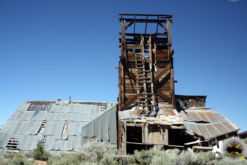
Potosi Nevada is the oldest lode mine in Nevada and the town site is located just off highway 160 between Las Vegas and Pahrump, Nevada.  The site was started in 1856 by some Mormon prospectors who were lead to the location with the help of a Piute guide.  The Mormons found the site in April 1856 and a month latter it was named Potosi after the boyhood home of Nathaniel Jones.  They did not begin mining until August after a return trip to Utah for supplies.  

Potosi mine, south center of sec. 12, T. 23 S., R. 57 E., the mine workings explore a zone at the base of the Yellowpine limestone. Clark County, Nevada. Circa 1921. Plate 33-B in U.S. Geological Survey. Professional paper 162. 1931.

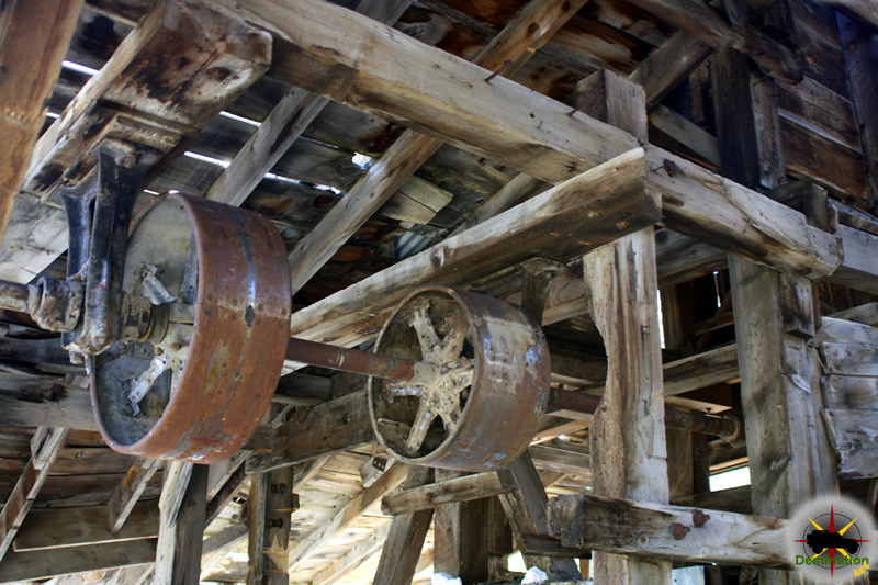
By September, the first wagon of ore sent back to Utah for trading and three months later three wagons returned with supplies including bellows, furnace, and hearths among other things.  On Christmas day 1856, an crude adobe furnace was used to smelt ore.

In the spring of 1861, a larger smelter was setup by the Colorado Mining Company at the Potosi Spring.  News of new silver mine spread all over the west in no time.  The town of Potosi was setup 700 feet below of the Potosi Mine or the Las Vegas Silver Mines as they were called and was soon home to 100 miners.

Carol Lombard was killed on a Douglas DC-3, Jan 16, 1942 on Mt Potosi

The site continued to slowly grow and develop until 1906.  In 1913 the Empire Zinc Company purchased the rights and was soon Potosi was Nevada’s largest producer of Zinc.  After nearly 100 years of production Potosi produced about 4.5 million in lead, silver and zinc.

Potosi is a designated at Nevada State Historic Marker no. 115.

Town Summary

NamePotosi
LocationClark County, Nevada
GNIS849366
Latitude, Longitude35.9708, -115.5408
Elevation5705
Population100

Potosi Trailmap

References

Anniversary Mine and Narrows

The narrows near the Anniversary Mine are a fun place to hike and keep cool.  Lake Mead National Recreation Area, Nevada
The narrows near the Anniversary Mine are a fun place to hike and keep cool. Lake Mead National Recreation Area, Nevada

The Anniversary Mine and Narrows trail is truly a fun place to go and the location has a little bit of everything. This is a very short side trail found off the northern shore of Lake Mead and suitable for almost any vehicle.

Located in the Muddy Mountain Wilderness of the Lake Mead National Recreation Area, the Anniversary Mine was founded in 1921.  The colomanite mine operated at seven years until 1928 and produced an estimation 200,000 tons of ore.  The mine is located a short ways off North Shore Road (167).  There exist some foundations, and tunnels along with some minor infrastructure of the operation.

The narrows near the Anniversary Mine are a fun place to hike and keep cool.  Lake Mead National Recreation Area, Nevada
The narrows near the Anniversary Mine are a fun place to hike and keep cool. Lake Mead National Recreation Area, Nevada

Should you drive down into the wash you have the opportunity to continue on to the left, or you can turn right and drive towards the mine narrows located at the end of the canyon.  The only obstacle is right at the beginning and and easy to get past with some clearance. Once past the trail is just a wash, but do yourself a favor.  Park the 4×4 and take the time to walk it. Just past the beginning obstacle, there are some tunnels about 20 feet up on the side of the canyon wall, which are fun hike up to and explore.

Leaving the side trail from the Anniversary Mine, Lake Mead National Recreation Area.

There are things to explore all along the route to the narrows and it is a great excuse the get out of the truck.  The slot canyon is about 1/4 of a mile in length and a bit tight in the few places. This is a nice place to hike on a hot day.

Anniversary Mine 4×4 Trail and Destination

Ubehebe Lead Mine

The Ubehebe Lead Mine is located just west of the Racetrack Playa Road off of the Bonnie Claire Road.  Discovered in 1906, the mine is located on the west side of the Racetrack valley just south of Teakettle junction.    The site was started as a copper mine and during to coarse of its operation would produce lead, copper, gold and zinc.

Ubehebe Lead Mine Trail sign located just off of the Racetrack, Death Valley, CA
Ubehebe Trail sign located just off of the Racetrack, Death Valley, CA

In February, 1908 a large eight foot thick vein of lead ore which was perceived to run through the mountain changed the mines name and destiny.  In order to prepare, the site hauled in 26,000 lbs of provisions to feed and supply a crew of eight men for the duration of the summer.   When processed the order produced significantly lower than expected.  The lack of water, remote location and less than desirable returns caused production of the Ubehebe Lead Mine to be sporadic.

Ubehebe Mine with tramway visible at the top of the hill, Death Valley, CA

The site currently has a main adit which is blocked off about 10 feet inside of the entrance.  Several other adits are located up the hillside and all are blocked to entry at this time.  There are a few collapsed buildings of light construction that have given their all against the harsh environment and several foundations are also evident.  An aerial tramway was built to the northern works and a single tramway cable is still suspended and connected to tramway on the ridge above.

Exploring the Ubehebe Mine tails pile, Death Valley, CA

The entire area has undergone extensive washing: bits of rail and pipe sections lie about near the mine, as do crockery fragments, pieces of glass, and tin cans that have worked down from the camp site. The several dumps nearby contain nothing of historical significance.

Looking back at the jeep, Death Valley National Park, CA
Continue Reading →

Chemung Mine

Located off the Masonic Road between Bridgeport, CA and the Masonic town site, are the remains of the Chemung gold mine.  The Chemung gold mine operated from from 1909 to 1938 and produced over one million dollars in gold.  In the 1920s, the Chemung mine was producing low grade and high grade ore.  The ore was processed onsite, and then shipped to near by Bodie for smelting.

The Chemung Mine located just outside of Bridgeport, CA. Photograph by James L Rathbun

Along with the increase cost of mining supplies which reduced growth, a poor gold market and the cost of hauling the ore to Bodie over the poor roads for smelting and little mine was doomed and closed its doors in 1938.

The Chemung mine history is not a mining failure, but a failure of management and litigation.  During its time of production, the mine built and tore down three mills.  During the last year of operation in 1938, 20 men worked the site and less than one year later the mine was closed.  The mine itself produced well, however endless litigation for various reasons doomed the mine.

The Chemung gold mine over looking the Bridgeport Valley.. Photograph by James L Rathbun

Throughout the 1950s and 1960s new life was found in the mine with the efforts of Elton “Heinie” Heinemeyer.  Heinemeyer mined for years but never struck it big.  Well liked by the town of Bridgeport, CA Heinemeters well being was the source of concern for the people of Bridgeport and it is reported that he would always find time to visit and entertain those who traveled to check up on him.

Currently, the mill building structure is intact but the years of harsh weather have taken its toll.  A mild wind will cause some of the walls to shake or shudder, and the lower outer wall is leaning outward.  In June 2016, bars restricted access to the mines themselves although the mines do offer a cold breeze on a warm day to cool you down.

The Chemung mine still maintains and impressive structure. Photograph by James L Rathbun

There are stories that the site is haunted by a spirit or ghost, but only on Saturday nights, which seems a bit odd to me.

The Chemung Mine working still seem ready to go. Photograph by James L Rathbun

On a personal note, the Chemung mine surprised me.  I have been to Aurora three times, Masonic at least three times, and Bodie… at least ten.  My last visit to Bodie was in 2013. Afterwards this last trip, I was looking in Google Earth when I “discovered” the Chemung gold mine.  How had this mine, such an impressive structure, evaded my radar for so many years?  It took me three years from that day to make my first visit to Chemung, and this place is definately on my list for a repeat visit.

Time, weather and gravity have taken its toll on the structure of the Chemung Mine.. Photograph by James L Rathbun
Time, weather and gravity have taken its toll on the structure of the Chemung Mine. Photograph by James L Rathbun

Chemung Mine Trailmap

Resources

Silver Star Mine

The Silver Star Mine is a small mine site located off of the Zinc Mountain Road in San Bernardino County, California. The site rests at 4931 feet above sea level in the Ivanpah montains. The lonely site features a small humble cabin the miners used to survive and beat the heat. There is also a wrecked automobile near at the site, which has long since given up the battle against rust.

Silver Star Mine Cabin

There is not much information available for this location on the Internet and hopefully I will be able to find some eventually. The mine site is also know as the Lucky Lode deposits. The route into the area is reasonably passable and should be suitable for most cars, provided the driver is used to operating on the back roads of the desert.

Silver Star Mine
Silver Star Mine rusted out auto

Some places claim that this mine produced lead, copper and zinc. The fact that this mine is found just off of Zinc Mountain Road offers some credence to a zinc mine. Other online sources claim this is a tungsten mine. A shallow mine shaft is located near the cabin. The shaft contains an old wooden ladder used by the miners and appears to be filled in, collapsed, or suspended after about 20 feet of workings.

Silver Star Mine Shaft
Silver Star Mine Shaft with ladder.

This stark hole in the ground reminds us what a challenges the life of a miner must endure. Hot, dry deserts, narrow, dark tunnels in a hostile landscape.

Silver Star Mine Trail Map

Resources