Charles Milles Maddox AKA Charlie Manson was a serial killer and most of the bad parts of the Old Testament sort of criminal. He briefly lived in the Panamint Mountains on the western edge of Death Valley National Park.

Introduction
As a preface, I would like to say that I have been extremely reluctant to include Maddox on my website. I do not wish to glorify him in anyway. Growing up in the 1970s, just a few miles from the La Bianca house, I can not remember when I first heard of Manson. Our family loved the 395 highway and knew some law enforcement officers in Lone Pine, Inyo County.
Long Story Short
Most books and movies of Manson tend correctly focas on the Tate-La Bianca murders. In summary, Manson, a career criminal, is release from prison. He meets young women and uses the girls to attack young men with sex a drugs. Over the coarse of about two years, he forms them in a cult of followers who live at Spahn movie ranch.. On August 9th and 10th, 1969, Manson orders these followers to slaughter 7 people in their homes.
After the murders, the family cult moves to Barker Ranch in Goler Wash, in Death Valley. It is here that he is captured for vandalizing some earth moving equipment and auto theft. Once captured, he is connected to the murders in Los Angles, tried and convicted by Vincent Bug
Panamint Charlie

Mansons original destination is the Myers Ranch in the Panamint Range. In October, 1968, he started to look for a desert location to move his “brood”. He choose the desert because “Out there, things aren’t so crazy”. (Ironic) One of his followers is Cathy (Cappy) Gilles is a grand daughter of Bill and Barbara Myers. “Cappy” obtained permission from the family matriarch for her and some girls to come up and stay at the ranch. One can not help to wonder if the true purpose of moving them to the Panamint mountains is to further isolate his followers from society.
Additionally, Manson supposedly discussed operating out of Barker Ranch with the owner Arlene. He convinced her he was a musician working on a record and would maintain the property for her. He gave her a Beach Boys gold album in payment, which would undoubtably prove his claims of being a musician. Between 40 acres at Myers Ranch and 5 acres at Barker, he had control over 45 acres of property in the sparsely populated Panamint Mountains.
The family stayed in Goler Wash from October 1968 to about January 1969. The family of nineteen people travelled using a school bus to the mouth of Goler wash, and would hike in with supplies up the ranch house. During this time, they made regular trips back down to Los Angeles or over to Las Vegas. The family would regularly shop for supplies in Ballarat which still had a small population and general store.
In the winter months of 1969, Manson and his followers returned to Los Angeles. They stayed at several other locations beside the infamous Spahn movie ranch. During this time, they continued to steal cars, deal drugs, probably prostitution and all in all anything to make money and “acquire” supplies.
Desert Deterioration

After the Tate-La Bianca murder in August of 1969, Charles Milles Maddox and his cult travelled back up to Goler Wash. This time he setup operations around Barker Ranch. Paul Watkins was a former follower who left the family before the murders. His book is fascinating.
Prior to Charlies arrival, Watkins and some prospectors where living at Barker Ranch. Watkins received guidance from a prospector named Crockett who helped Watkins leave the family. Manson knew of Crockett’s influence over Watkins and recognize an adversary. Upon his arrival, Manson asked permission to enter the area. As Watkins et al where living in Barker Ranch, the Manson Cult moved into the Myers Ranch.
Over the next few weeks, Charlie Manson continued his mental downward spiral. At the time, the neighbors at Barker Ranch knew Charlie was dangerous, however did not know about his guilt in the Los Angeles Murders. Crockett would have philosophical conversations and push the boundaries of Manson. This prompted the unstable Manson to come visiting the occupants at Barker ranch in the middle of the night. On at least two attempts he was caught trying to sneak into the ranch house while the occupants slept. He was greeted with the muzzle of a shotgun and left into the night.
Manson is said to have driven around the area of the Panamint mountains and Death Valley looking for a hole in the earth. These excursions opened the door into the capture of the psychopath. During this time he continued to prepare for a racial war he thought was coming.
Investigation

The beginning of the end for Manson started with a report of a fire on a Michigan front loader out at Racetrack valley. The front loader was moved to the playa in Race Track Valley to repair damage to the playa surface by off-roaders. On September 19th, 1969, Manson ordered the some family members to burn the machine because he construed it to be the device of environmental damage. Oddly enough, it was there to repair environmental damage…. This decision by Manson set in place a series of events which led to his capture and a life time in jail.
Inyo County officials were extremely upset about the loss of their newly acquired $35,000 earth moving equipment. They quickly dispatch officers and launched an investigation.
Park Rangers arrived at the scene of the fire sometime later. They noted several tire tracks leading away from the fire. One set of tire tracks belonged to a Toyota Land Cruiser. Follow up investigation included reports of a Red Toyota Land Cruiser driving around in the area. It was reported this Red Land Cruiser is driven by some hippies who lived up at Barker Ranch.
October 9th, 1969
On October 9th, CHP Officer Jim Pursell and Park Ranger Dick Powell drove up to Barker Ranch approaching from Mengel Pass. They ran into two of Mason’s girls and lacking evidence moved on down Goler Wash. In doing so, the came across Brooks Poston and Paul Crocket. When questioned why he was hauling supplies for the groupd Crocket replied, ‘‘I think my life might depend on it.’
The two men are instructed to return to Barker Ranch. On questioning about Manson, Brooks and Crocket told the two men about the families activity. According to Paul Watkins, Crocket left the ranch for fear of Manson was going to attract law enforcement. This event s probably because Crockett told law enforcement. Pursell noted that a VW was hidden beneath a purple nylon parachute beneath a trash heap. nd recorded the VIN number.
The two men left the ranch again and travelled down Goler Wash they stopped at a draw. Dick Powell started up the draw and was soon within a group of naked young women, one of who is Squeaky Fromme. Fromme claimed to be part of a girl scout troup from San Francisco and with no other evidence, the two officers continued down the valley.
A Series of Raids
Enroute to Trona, the two law enforcement officers found out over the radio that the car was stolen and a predawn raid is slated for the following morning. Looking forward to a long night, the two men hand dinner in Ballarat before parking at the mouth of Goler Wash.
October 10th
The first raid took place on October 10th, 1969. Just before dawn, a small task force made up of officers from the California Highway Patrol, Inyo County Sheriff’s Department, and the National Parks Service maneuvered into position around Barker Ranch. The cult members had pilled rocks up along the road, which necessitated the officers travel on foot.
At first, it seemed the operation was a success. The task forced found several stolen cars and dune buggies. Weapons suchs a pistol, knives, food, gasoline, and other survivalist supplies confirmed that the cult was building a stronghold in the desert for the long haul. They arrested three men, ten girls, and two babies, one of them just a few weeks old. A count of the number of sleeping bags informed the task force they had not captured everyone involved.
October 12th
On the evening of October 12, the small force of park rangers headed back to Barker Ranch. From an observation point, the witnessed four people walking towards the cabin and entering the building. One of the people is covered head to tow in a buck skin outfit and obviously the leader.
The task forced stormed the ranch with guns drawn. The ordered the occupants inside to raise their hands. They met no resistance. The man dressed buckskin is nowhere to be found.
Charles Milles Maddox Capture

Following the raid, Jim Pursell search for the buckskin man. He enters the bathroom where is sees a very small cabinet. The door is slightly open and he notices a few long hairs sticking out. In the failing evening light, armed with a candle and a .357 revolver, Pursell noticed some fingers wiggling inside.
Pursell later recounted “I put the candle way down, and this figure starts unwinding and coming out. How he got into that cupboard, I’ll never know. He’s not big. I’ve had a lot of people ask me, ‘Why didn’t you shoot the son of a bitch?’ But again, we really didn’t know what we had, and you can’t just shoot somebody that climbs out of a little cupboard, and says [cheerily], ‘Hi! I was pointing the gun at him and told him exactly what I wanted him to do, and what not to do. ‘Make one wrong move and I’ll blow your head off.’ I ask his name, and he said, simply, ‘Charlie Manson.’ Right off. I led him out to the guys outside”
The raid of October 12th lead to arrest of six males and three more females. All in all the bravery of the CHP, INYO Sheriffs and Park Rangers led to the apprehension, conviction and sentencing of one of the worlds most notorious people, Charles Milles Maddox. The cult or family that Manson started literally killed many and ruined the lives of hundreds of people. The story of Mansons life in the Panamint Mountains of Death Valley is more fascinating that the typical most people will understand and his activities in Death Valley are far larger than “Barker Ranch.”
Manson’s Locations in and around Death Valley
 Ballarat California – Inyo County Ghost TownBallarat, California Located in Inyo County, Ballarat California is a ghost town which supposedly has a few residents living their dream within the town. Ballarat… |
 Barker RanchThomason/Barker Ranch is a five-acre property within Death Valley National Park. This historic site is located off of Goler Wash in the southern Panamint Range… |
 Myers RanchMyers Ranch is a privately owned ranch located in Goler Wash in the Panamint Mountains of Death Valley National Park, California. The forty acre ranch… |
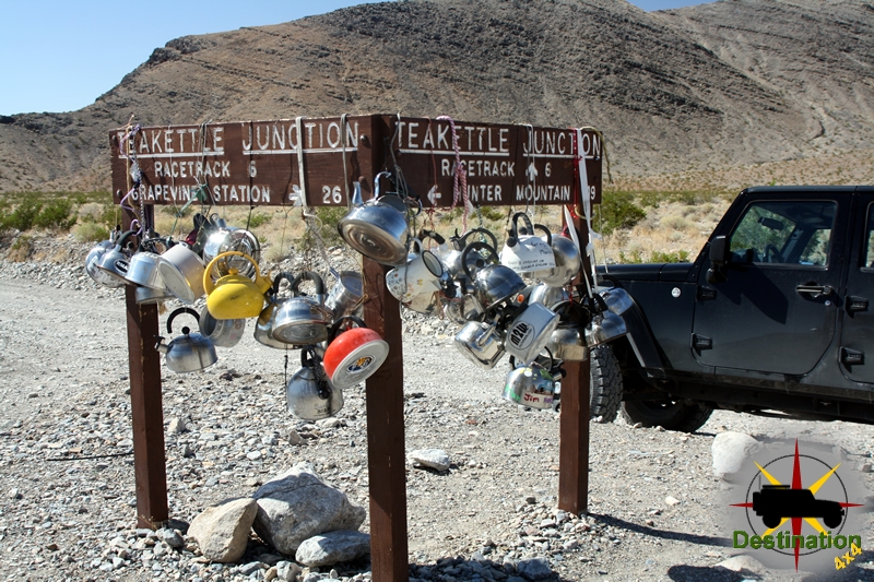
 Racetrack ValleyTeaKettle Junction lets you know you are starting to get close to the Racetrack. Racetrack valley is a rough graded road which departs the Ubehebe… |
 Warm Springs RoadA short side trip from the Saline Valley Road to the Saline Valley Warm Springs in Death Valley National Park, California. The road is used… |