Homestake Dry Camp

Homestake Dry Camp - A primative campsite at Racetrack Valley
Homestake Dry Camp – A primative campsite at Racetrack Valley

The Homestake Dry camp is a primitive campground located in Racetrack valley inside Death Valley National Park.  It contains four very large and reasonably flat campsites which could accommodate multiple vehicles for larger groups.

The mine site as no amenities beyond a single chemical toilet at the North end of the location and a few wide spots in the road denote the camp sites. The toilet is in reasonable condition, but it does have some rodent damage and the odd spider web.  

There are fire rings, but no fires or wood gather is not allowed. There is no trash bins, no water, no tables.

The setting sun and mountains offer some great view and shadows.

Homestake Dry Camp is however the only camping near the Racetrack playa and is arguably some of the most remote camping in the national park.  The campground was very clean during out last visit and the night sky on a moonless night was second to none.

This is certainly well worth a stop over if you are so inclined and the campground offers a great point to explore the Lippincott Mine Road, the Lippincott Mine, Ubehebe Lead mine and of coarse the racetrack.

The Homestake primitive campground offers from amazing dark skies.

On our trip, we were offered the best of remote primitive camping. While we stayed dry, the night boomed with thunder from Saline Valley. The moonless night sky gave us an opportunity to see the Milky Way. There was a constant breeze which did not offer us a sound sleep, however, we will return which is the best endorsement one can provide.

Directions

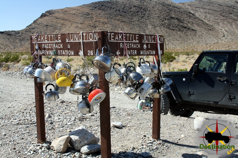
The campground is located at the southern end of the Race Track Valley Road.

Campground Summary

Camp Ground NameHomestake Dry Camp
Latitude, Longitude36.6372892,-117.5745213
Sites4
Elevation3780
AmenitiesNo Water, No Fires, No tables

Homestake Dry Camp Trail Map

Mesquite Springs Campground

Mesquite Springs Campground located near Scotty's Castle in Death Valley
Mesquite Springs Campground located near Scotty’s Castle in Death Valley

Mesquite Springs is a campground in Death Valley National Park, Located just a few short miles from Scottys castle. Mesquite springs offers a nice refuge for the traveler. Not far from the main north – south highway running the length of Death valley.

Airing up the tires from our trip to the Racetrack

The campground is typically open all year round and cooler than Furnace Creek. There is a small fee to stay here, but well worth it to stay in this little oasis. There may be a campground host, but you should not count on this for your planning with regards to firewood. There is little undergrowth, so you do feel a little exposed to your neighbor.

Typically a quiet little outpost used by campers who want access to the northern section of the national park. Mesquite Springs offers a great launching point for the northern dunes, racetrack valley, Ubehebe Crater and parts beyond.

A typical campsite at Mesquite Springs, Death Valley National Park

This is a great place to enjoy your beer and smores in the evenings while the Kangaroo Rats play around your feet. The remote area and dark skies allow for great star viewing.

Never let anyone tell you it does not rain in Death Valley.
Campground NameMesquite Springs Campground
Latitude, Longitude36.96303, -117.36840
AddressP.O. Box 579
Death Valley, CA
92328
Number of Sites40
Elevation1800
ReservationsNo
AmenitiesFlush Toilets, Fire Rings, Tables
Websitehttps://www.nps.gov/deva/planyourvisit/mesquite-spring-campground.htm

Mesquite Springs Campground Map

Old Mojave Road Trip Report

After our recent trip to the center section of the Old Mojave Road, my wife Heather was really excited to run the western section and complete the entire length of the trail. Her idea was to drive the western section on our way to our annual trip to Big Bear, CA over the Memorial Day holiday. I worried that such a trip during this time of year could be a rough trip due to high temperatures in the desert. In late April we finished the center section in Baker, CA and the air temperature was only 107 degrees. Despite my concerns, we gladly planned our trip and embraced her good idea.

Afton Canyon in the Mojave National Preserve.

As we prepared for our trip, gathered our gear, food, and checked out the mechanics of the jeep, I decide to check the local weather report. To my surprise, weather.com predicted the temps in the mid 80s with clear sky’s and light wind. The weather could not be any better.


Another interesting development, is that Heather kept offering to drive in the event I got tired of driving. She didn’t just offer once, but several times per day for several days before our departure. Being the good husband that I am, after about twenty or thirty offers, I started to get the idea that, subconsciously, Heather might want to drive this run. So after some arm twisting and bartering, I finally convinced her and Heather agreed to take the wheel. This of course, would be a great source of confusion for me during the trip, however I am certain I can persevere this new dynamic. This is not to imply that Heather is not one of the finest drivers I know, far from it.

An old trail leads off through the lava and into the great unknown.
All packed up, we left the Las Vegas area at 7:00 am on Saturday morning, and headed towards Baker. A quick stop in Baker, we topped off the fuel tank and took our respective bathroom breaks. Once Heather reminded me that she was driving this trip, I took my seat on the right had side of the jeep and we headed down Kelbaker Road.

It took me a few miles, but soon I became used to having my coffee cup on the wrong side, no pedals, eta… This must be what it is like in England. The map and guide-book took some getting used to as well, but somehow I managed to get us to the trail head. It certainly didn’t hurt that we were here just a few weeks before. A quick turn on to the trail, and we stopped to air down the tires for some ride comfort.


After dreaming of this trip for the past few weeks we are finally on our way. We followed the trail around 17 mile point and then turned southwest into the Mojave. The road steadily looses elevation as it cross a fallout zone of lava and start to head down into the valley.

Continue Reading →

Old Mojave Road Trip Report West

After our recent trip to the center section of the Old Mojave Road, my wife Heather was really excited to run the western section and complete the entire length of the trail. Her idea was to drive the western section on our way to our annual trip to Big Bear, CA over the Memorial Day holiday. I worried that such a trip during this time of year could be a rough trip due to high temperatures in the desert. In late April we finished the center section in Baker, CA and the air temperature was only 107 degrees. Despite my concerns, we gladly planned our trip and embraced her good idea.
As we prepared for our trip, gathered our gear, food, and checked out the mechanics of the jeep, I decide to check the local weather report. To my surprise, weather.com predicted the temps in the mid 80s with clear sky’s and light wind. The weather could not be any better.

The dry soda lake located in the Mojave National Preserve and found next to Zzyzx Road offers a surreal view of the area. Photograph by James L Rathbun

Another interesting development, is that Heather kept offering to drive in the event I got tired of driving. She didn’t just offer once, but several times per day for several days before our departure. Being the good husband that I am, after about twenty or thirty offers, I started to get the idea that, subconsciously, Heather might want to drive this run. So after some arm twisting and bartering, I finally convinced her and Heather agreed to take the wheel. This of course, would be a great source of confusion for me during the trip, however I am certain I can persevere this new dynamic. This is not to imply that Heather is not one of the finest drivers I know, far from it.

All packed up, we left the Las Vegas area at 7:00 am on Saturday morning, and headed towards Baker. A quick stop in Baker, we topped off the fuel tank and took our respective bathroom breaks. Once Heather reminded me that she was driving this trip, I took my seat on the right had side of the jeep and we headed down Kelbaker Road. It took me a few miles, but soon I became used to having my coffee cup on the wrong side, no pedals, eta… This must be what it is like in England. The map and guide-book took some getting used to as well, but somehow I managed to get us to the trail head. It certainly didn’t hurt that we were here just a few weeks before. A quick turn on to the trail, and we stopped to air down the tires for some ride comfort.

After dreaming of this trip for the past few weeks we are finally on our way. We followed the trail around 17 mile point and then turned southwest into the Mojave. The road steadily looses elevation as it cross a fallout zone of lava and start to head down into the valley.

After a few more miles, we “discovered” the Little Cow Hole Mountain Mill Site just north of the road. The short drive over to the site was well worth it and provided you are at all interested in locations such as these. There is a large concrete foundation which appears to be the footings for the mill itself, along with several retaining walls. There is a very minor uphill section of to the foundation level of the mill. Heather did a great job on this minor obstruction. I am still amazed that she easy handled the slope despite my exaggerated gesturing and attempts to apply the brake or depress the gas from the passenger seat.

Heading towards the Travelers Monument on the other side of the dry soda lake.

The next stage of the Old Mojave Road, drops the remaining elevation down to the Soda Dry Lake. For those who drive the I-15 highway between Barstow and Primm, this is the large desolate dry lake bed just off the highway as you drop into Baker from the South. The Soda Dry Lake is a flat expanse, that when dry is easily passable. However, judging from the troughs through the dried mud, it seems to be very rough terrain to traverse unless you have significantly more horsepower and larger tires. Most definitely bad form in my opinion and I certainly would never put my Jeep to this test.

Driving across the soda lake is an awesome experience. Either you appreciate terrain such as this, or you don’t. The flat dry desolation along with the white color of the soda lake combines perfectly with the crunch below your feet and the wind blowing. Oddly enough, the higher the temperature and wind speed, the more I appreciate this environment. There is a tranquility in this place and really gives on the feeling that you are alone and out in the middle of no where.

Ryan climbed to the top of Travelers Monument

We did make the prerequisite stop at the “Travelers” monument. My son Ryan added to the pile and we let Ryan and our Labrador Retriever, Rooger AKA the boys, run around and stretch their legs. The boys played while I explored the area photographically.

Again we loaded up the boys and continued our travels. Once we left the dry lake, we found ourselves in a deep sandy road after a quick right and then left turns at the “Granites” rock formation. There was no danger of getting stuck in the sand for us, but Heather was naturally concerned. She gained experience and confidence as we crossed over Shaw Pass and followed the rocky road down the backside. This was soon shattered when a high-pitched voice from the back seat sang out, “Mom, can you let dad drive?”

Once we crossed the rather nondescript pass, we dropped into the Mojave River Wash. This section of the trail is just sandy river bed and marked with either Cairns or railroad ties. During the Mojave River wash section, both Heather and I had to really keep an eye open for the markers. In many locations I noticed several parallel trails and multiple markers. For the most part you just travel in a western direction and keep to the left side of Cave Mountain.
Sandy conditions aside, this section of the trip was a lot of fun. There are an abundance of birds, and we jumped several large jack rabbits. As the terrain is sandy and with intermittent bushes, when we did see a rabbit, it was easy to follow them when they ran into the distance. Although we are in middle of the Mojave desert, an extremely harsh and arid place you would not know that considering the size and number of these rabbits.

Towards the end of the Mojave River Wash at the intersection with Basin Road, there is a large mining complex. We stopped for lunch and a hike. ’The boys’ were very exciting to hike an old track line which had rail road ties embedded into the rocky soil. One a future trip we will have to return and explore this area further as there are trails and roads all over this site. I don’t know much of the history of this spot, what was mined, etc… but this is a very interesting place and will be the subject of future adventures.

Back on the trail we headed towards and under the infamous railroad bridge. The bridge itself glistened in the sun and shined like a beacon in the distance. The bridge moaned as a train crossed over head on its way to drop off its cargo. I got out of the car to take some photos of the jeep and the bridge. Thankfully, Heather in an act of kindness did turn around and picked me up.

We continued to follow the river bed down and through Afton canyon. Afton Canyon is a gem of the Mojave desert. On the trail, we found a buried rail road car and soon crossed paths with the only other traffic on this forty mile side trip.
The rail road car is a great example of why the Mojave desert is such a wonderful place. Scattered across the landscape is the history of this country. Old rail cars, mines, camps, watering holes and even crashed jet airplanes can still be found lying around. You just need to learn to look.

Afton Canyon is just an amazing spot and the trail follows the riverbed through the water and wind-swept canyon. The colors and geology are amazing and photographically offer a lot of opportunities. A fence clocks the trail from following the river further for environmental rehabilitation purposes and the trail jumps up next to the train tracks for a while.

After two short water crossings this section of the Old Mojave Road dumps out into the Afton Canyon Campground. Once again Heather’s jeep confidence grew as I asked her to back up into the water crossing again to take some photographs of some cat tails growing in the river. The Afton Canyon Campground isn’t much to look at, and personally I would rather camp in the back country.

Once past the campground, we drove up the road towards the I-15. A quick stop to add some air pressure back into the tires and make us safe for high-speed travel. Once we aired up, Heather announced that she was tired and decided that I should drive. A bit over an hour later, we arrived at the house in Big Bear and unpacked. Following a quick dinner, the boys quickly crashed out.

This was the first time the Heather did significant driving on the back roads. She did a great job, and I am thrilled that she is taking to our trips with such a wonderful attitude and sense of adventure. This weekend, she drove 75 of the 110 miles of back road driving. I am very proud of her.

Back country ethics

Back country ethics came to the forefront recently. Over the last weekend, my wife and I decided to take a camping trip into the back country of Death Valley National Park.  We were inspired to return to Racetrack Valley, and over night at the Homestake Dry campground.  Upon our return, we were greeted with the grim news that another hiker had died in Zion National Park.  Zion is a personal favorite location and I know it well, and every time someone has an accident in the area I can’t help of think of the small little details that allow these tragedy’s to occur.  I would later recall that an actor died in Death Valley National Park this year.  There is, in fact, a book series written by Michael P. Ghiglieri that emphasizes death in various National Parks and the locations of each, are places which I frequent.

Back country ethics forced me to help a girl not drive this road in a acura.
Looking down at the Lippincott Mine Road from the Lippincott Mine, with Saline Valley in the distance.

To be sure, although stories like these grab attention and headlines I am sure that they are overblown in their publicity and for the most park the National Parks are safe.  The drama in each example is that we all visit there locations and with rare exception we all return with photo graphs and memories to last a life.  Many of this accidents are preventable, with the understanding the hindsight is always clear, I still can’t help but wonder what would happen should I ever find myself in a one of these situation?

Prior to any trip, I check and double checked my gear list.  The list changes depending upon time of year, destination, etc… but known the less I try to anticipate potential issues while I am loading the jeep.  The jeep is always packed with a first add kit, tools, 2 meter ham and CB radio, area maps, cell phone, extra water, fuel and food.  This is standard operating procedure for us.

During our weekend in Racetrack Valley we ran into a total of four other vehicles over the course of 24 hours.  Of these autos, two were in need of some assistance and I was more than happy to provide help.  The first car was a new Jeep Grand Cherokee which appeared to be just off the lot.  The Grand Cherokee is a great car, and they just had a flat tire.  The racetrack playa road claims many tires each year, and the owner was able to get the tire changed in just a few minutes.  The flat tire was a minor issue and they were soon on their way, although there had to be careful because they did not have a true spare tire but rather one of those light weight little donuts tires.

After an overnight stay at the Homestake dry camp, we left for our day full of explorations.  After a brief stop at the Lippincott Mine we headed north towards Teakettle Junction.  Upon arrival, our plan was to head east towards Hunter Mountain, however before we could make the turn the driver of a parked white Infinity coupe flagged us down requesting help.  So, I stopped the jeep, got out and walked towards the Infinity.  Our of the car, a woman in her 20’s or early 30’s stepped out of the car.  She was dressed like she was going to a summer bar-be-queue, complete with perfume, tight shorts, stylish shoes and make up in place.  So, seventeen miles in the back country of Death Valley National park, she pulled out a cheap gas station map and asked for directions.

Lippencott Mine Road from Racetrack Valley, Death Valley National Park, CA

I took a minute for me to completely comprehend what was being asked of me.  So, she starts out, pointing to Teakettle Junction of the map and asks if she was in fact “there”.  I told her “Yes, this is Teakettle Junction” which is funny to me since Teakettle Junction has a huge sign which reads “Teakettle Junction”, which is turn, is covered with about 50 Teakettles.  To which she points in the area of Saline Valley and tells me she is meeting her friends and wanted to know if she should take “this road” and points to the Lippincott Mine Road.  For those how are not aware, the Lippincott Mine Road is a non-maintained steep 4×4 trail with a sheer cliff on one side.  This is not the sort of thing you should try in an Infinity coupe with no low range and street tires and I told her politely that she is foolish for thinking  of it.  She responded, “yeah, my friend told me that.”

TeaKettle Junction lets you know you are starting to get close to the Racetrack.

To summarize now, I ran into someone, clearly not prepared for her environment, who did not listen to the advice of her friend, and is now asking for directions, 17 miles down a wash-boarded road, from a complete stranger.  I suggest that she turn around, head back to the highway, and jump on the pavement and take the long way around.  To which, she asked about “this road” and she points to the “Hunter Mountain Road”.  I told her that I didn’t know about the condition of “that road”, and my guess is that the road was more of the same of what she had already done, but “I hasten to add, I am not sure.”  She thanked me, and just as I left I told her to “turn around”.  I jumped back in the Jeep and went on to my next destination, the Lost Burro Mine.

After some time at Lost Burro, lunch and some further exploration a front arrived in the area and rain began to fall.  We made our may make down to the Hunter Mountain Road.  Prior to ending our trip, I want to run down to some other mines as the rain fell harder.  At which point, I noticed that we were following fresh street tire tracks on the road.  The car in front of us lost traction as it struggle to climb out of a sandy 6 inch gully which would not been an issue for any small SUV, but a different story from an Infinity car.  Each turn we were surprised not to find this woman, stuck by the side of the road with a flat tire or something else.  Mile after mile we followed the tracks until we reached our final destination at the Quakenbush Mine, at this point the turned around and ended our trip.

On the drive home, my lovely wife Heather and I discussed her situation.  We both agree that she was stupid for putty herself in danger.  She did not listen to her friend.  She did not appear prepared for anything, yet alone the back country of Death Valley.  I potentially saved her life that day, but I can’t help but wonder if I should have been more firm or blunt in getting her to turn around.  But then again, would it have mattered?  She already ignored her friends advice.

Where does my obligation to help end? Or does it ever end?  Of coarse, if our paths crossed deep in the Hunter Mountain Road we would completely helped her out and ensure her safety.  However, if you have an dealing with an adult, presumably of sound mind, when is enough help, enough?  She wasn’t in danger sitting at Teakettle Junction.  She is probably made her destination and  is probably safe and sound.  She probably still does not realize the potential danger of her situation that day.  I believe I talked her out of the Lippincott Mine Road “shortcut”, but I don’t know.  Perhaps, a series of small seemingly unimportant events was already cascading to push her towards her destiny which can only be seen with hindsight.  Perhaps, I interrupted the series of unfortunate events and removed a chapter from Mr. Ghiglieri’s next book