Harrisburg, California, a now-abandoned ghost town in Inyo County, was a fleeting but significant mining camp in Death Valley’s history. Established in 1905 following a gold discovery, it briefly flourished as a tent camp named after prospector Frank “Shorty” Harris. Located at an elevation of 4,987 feet near Wildrose Canyon, Harrisburg’s story is intertwined with the broader gold rush narrative of the early 20th century American West. This report examines Harrisburg’s origins, brief prosperity, decline, and enduring legacy, drawing on historical accounts and contemporary observations.

Origins and Establishment
Harrisburg’s history began in July 1905, when prospectors Frank “Shorty” Harris and Pete Aguerreberry, traversing the Panamint Range en route to Ballarat, discovered gold-bearing ore on a hill above what would become the townsite. Harris, already a celebrated figure for sparking the Bullfrog rush near Rhyolite, Nevada, and Aguerreberry, a French immigrant who arrived in the U.S. in 1890, staked six claims each, naming their primary find the Eureka Mine. News of the discovery spread rapidly, and within ten days, several hundred prospectors descended on the area, forming the Wild Rose Mining District. The tent camp that emerged was initially called Harrisbury, honoring both discoverers, but newspapers soon adopted “Harrisburg,” a name that stuck despite occasional misspellings.
The townsite, situated on a flat adjacent to the Eureka Mine, consisted primarily of canvas tents, reflecting the transient nature of early mining camps. Its location, roughly 22 miles northeast of Trona and accessible today via the Harrisburg Flats trail off Wildrose Road, placed it in the rugged heart of Death Valley, where water scarcity and extreme conditions shaped daily life.

Brief Prosperity (1905–1909)
Harrisburg’s peak was short-lived but intense. By late 1905, the Wild Rose Mining District encompassed a vast area, with Harrisburg as its central hub. The tent camp housed several hundred prospectors, supported by basic amenities like the Emigrant Springs Restaurant, relocated from a nearby camp. The Eureka Mine, operated initially by Harris and Aguerreberry, drove the town’s economy. A 1906 Los Angeles Herald article reported a $15,000 investment in the mine, signaling early optimism about its potential.
The town’s social fabric was shaped by its diverse inhabitants. Shorty Harris, a charismatic storyteller, and Pete Aguerreberry, a determined loner who later worked the Eureka Mine for decades, embodied the era’s prospecting spirit. The camp’s population fluctuated as prospectors arrived hoping to stake claims, but its lack of permanent infrastructure limited growth. Unlike nearby Skidoo, which developed a water pipeline and milling plant, Harrisburg remained rudimentary, relying on scarce local springs and pack mules for supplies.
The discovery of gold at Skidoo in January 1906, just months after Harrisburg’s founding, drew many prospectors away, hastening the camp’s decline. By 1907, the Rhyolite Herald noted Harrisburg’s reduced activity, though the Eureka Mine continued to attract attention. Aguerreberry’s persistence kept the mine operational, and by 1908, the camp still supported a small community, as evidenced by photographs of the tent settlement.
Challenges and Decline
Harrisburg faced numerous challenges that curtailed its longevity. The lack of water, a perennial issue in Death Valley, hindered large-scale mining and settlement. The town’s reliance on tents rather than permanent buildings reflected its precarious existence, as did its vulnerability to the region’s harsh climate—scorching summers and freezing winters. The 1907 financial panic further strained mining ventures across the West, reducing investment in speculative sites like Harrisburg.
By 1909, the town’s population had dwindled significantly. The Los Angeles Mining Review made little mention of Harrisburg after 1908, focusing instead on more productive sites like Skidoo. Harris moved on to other prospects, while Aguerreberry stayed, working the Eureka Mine intermittently until the 1930s. The mine produced modest yields—estimated at a few thousand ounces of gold—but never rivaled the output of larger operations. The tent camp gradually emptied, and by the early 1910s, Harrisburg was effectively abandoned as a town, though Aguerreberry’s solitary presence kept the site alive in local lore.
Legacy and Modern Significance
Harrisburg’s legacy lies in its role as a microcosm of Death Valley’s gold rush era, characterized by fleeting optimism and relentless hardship. The Eureka Mine, adjacent to the former townsite, remains a focal point for visitors, often mistaken for the town itself due to its visible ruins. Scattered tin cans, the Cashier Mill ruins, and Aguerreberry’s later cabin—built in the 1920s—are among the few physical remnants, evoking the camp’s ephemeral nature. The site, now within Death Valley National Park, is accessible via a short trail and offers panoramic views of the Panamint Valley.
Pete Aguerreberry’s enduring connection to Harrisburg adds a personal dimension to its history. After Harris’s departure, Aguerreberry worked the Eureka Mine for nearly 40 years, living in relative isolation until his death in 1945. His cabin, preserved by the National Park Service, stands as a testament to his resilience and is a popular stop for tourists exploring Aguerreberry Point, a nearby scenic overlook named in his honor.
Modern visitors, as noted in Tripadvisor reviews, find Harrisburg’s ruins understated but evocative. The trail to the Eureka Mine and Aguerreberry’s cabin is praised for its historical intrigue, though some note the rough dirt road requires careful navigation. The site’s inclusion in Death Valley’s historical narrative, alongside towns like Skidoo and Rhyolite, underscores its value as a preserved relic of California’s mining past.
Conclusion
Harrisburg, California, was a transient outpost born of the 1905 gold rush, thriving briefly before fading into obscurity by the early 1910s. Named for Shorty Harris and defined by Pete Aguerreberry’s tenacity, it encapsulates the boom-and-bust cycle of desert mining camps. Though little remains of the tent town, its story—preserved through the Eureka Mine, Aguerreberry’s legacy, and Death Valley’s stark landscape—continues to captivate those who seek the echoes of California’s gold rush era.
Harrisburg Summary
| Town | Harrisburg |
| Location | Death Valley National Park, California |
| Also Known as | Harrisberry |
| Latitude, Longitude | 36.363889, -117.111389 |
| Elevation | 4,987 |
| Post Office | |
| Population | 300 |
Harrisburg Trail Map
Harrisburg Personalities
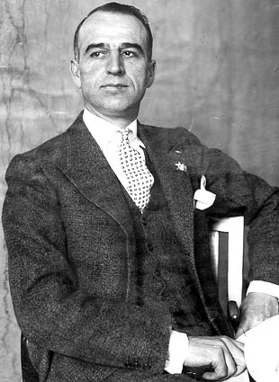
 Frank “Shorty” HarrisFrank Harris was a prospector, desert rat and perhaps the best known character in western mining history. He looked the part, often travelling the desert… |
 Pete Aguereberry – A Panamint Valley MinerPete Aguereberry was a prospector and miner who operated around Death Valley National Park, for whom Aguereberry is named. Born in the Basque Region of… |


![Photograph of an exterior view of the Leadfield Hotel in Death Valley's Titus Canyon, [s.d.]. The hotel is a simple wooden structure with a slanted roof and a rectangular façade. The upper left corner of the façade is missing, revealing the interior of the building. Three large rectangular windows and two doors alternate across the front of the building. There are three people standing on a caved-in porch in front of the hotel. A large rocky mountain rises up behind the hotel. The hotel was part of C. C. Julian's Leadfield boomtown, the hey day of which was in 1925. Photo Credit “University of Southern California. Libraries” and “California Historical Society” as the source. Digitally reproduced by the USC Digital Library.](https://i0.wp.com/www.destination4x4.com/wp-content/uploads/2022/03/CHS-13040.jpg?ssl=1)