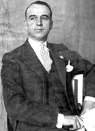
Goler Wash and Mengel Pass

Goler Wash and Mengel Pass over a route into Butte Valley from Panamint Valley. Although not technically in Death Valley, this trail is consider part of the area. Trail conditions vary from easy to difficult depending upon recent rainfall, with one section near Mengel pass being difficult.

The route twists and turns through a narrow valley, until it opens a bit into Goler wash itself. There is a short side trip to Baker Ranch and Meyer Ranch which was the one time, although short lived home of Charles Manson and his family prior to their arrest by Inyo County Sheriffs Department in October of 1969. Manson and others were responsible for the famous Tate – La Bianca murders in Los Angeles, California. Mason and his family drove a school bus up to Barker Ranch. The ranch was used as a mining and recreational property before Manson.

Barker Ranch - The building complex was heavily vegetated with trees, with a sparsely planted understory. Note the Manson bus in the left hand side of the image. View northwest, 1969 (DEVA collection). - NPS
Barker Ranch – The building complex was heavily vegetated with trees, with a sparsely planted understory. Note the Manson bus in the left hand side of the image. View northwest, 1969 (DEVA collection). – NPS

Barker Ranch

Barker Ranch is originally built in the 1930s by Bluth and Helen Thomason who were attempting mining operations at the site. They built a small stone building in the 1940’s and a windmill generated electricity. In 1955 the property was purchased by Jim and Arlene Barker. The Barkers expanded the original stone build for Barker family gatherings. In 1969, over the period of two days Charles Manson and his “family” are pursed and arrested. The arresting officer was CHP Officer Jim Jim Pursell.

In 2009, Barker Ranch is destroyed by a fire which tore though the dry wood of the buildings.

Asa Russell "Panamint Russ" in front of the Geologist cabin - Courtesy of Desert Magazine April 1955
Asa Russell “Panamint Russ” in front of the Geologist cabin – Courtesy of Desert Magazine April 1955

Follow the trail up to Megel pass, which offers the explorer access to Butte Valley, Megel’s Cabin, the Geologists Cabin and Russell’s camp.

Futher Reading

Goler Wash and Mengel Pass

Schwab California

Schwab is a gold mining camp and ghost town located in Echo-Lee Mining District of Death Valley National Park in California. The little townsite of Schwab was a short-lived mining camp run by three ambitious women: Gertrude Fesler, Mrs. F.W. Dunn, and Helen H. Black.

Schwab, California - “In the afternoon the townsite company drinks tea,” Death Valley Chuck-Walla magazine, Vol 2. No. 1, June 1907
Schwab, California – “In the afternoon the townsite company drinks tea,” Death Valley Chuck-Walla magazine, Vol 2. No. 1, June 1907

in December of 1906, as the Echo-Lee District is beginning its real boom stage. A new townsite is platted to serve the many mines in the area. The townsite was named Schwab, after the well-known steel and mining magnate, who helo interests in the Echo-Lee District. The townsite was promoted by the Schwab Townsite Company, which was incorporated in Nevada on December 31st, 1906. Thoe project is financed by S. H. Black, J. C. Houtz and J. E. Cram and $30,000 got the town up and running. The town being fully paid in advance by the three principles, made Schwab a closed corporation.

Ads in the Bll Frog Miner and the Rhyolite Herald and attempted to raise interest in the town. The owners claimed to have made arrangements for the town for the completion of a restaurant, a lodging house, a mercantile store, an assay house and a saloon. They also stated that roads were being built and stage service would be establised.

Gertrude Fesler was a young stockbroker out of Chicago who moved to Rhyolite and ended up purchasing a one-third interest in Schwab, located in the Funeral Range. After meeting her business partners, Fesler soon bonded with their wives and it wasn’t long before Mr. F.W. Dunn put his wife in charge and Helen Black purchased her husband’s share in Schwab!

Schwab was a popular town for local gold prospectors in early 1907, but the town did not survive the Financial Panic of 1907. Little remains of the town today besides one fuzzy black and white image from the Death Valley Chuck-Walla magazine, showing the three women and one unidentified person sitting at a tent, and small historic artifacts such as broken glass.

The town of Schwab is situated just below the Inyo and Skibo camps at the junction of the wagon roads leading up the east arm of Echo canyon and to Death Valley on the south. In other words, Schwab is located in the north or upper branch of Echo Canyon, astride the main Echo-Lee wagon road, across a small ridge from the present Inyo ruins, and about 1-1/2 miles from those ruins. At this location, evidence of the old townsite may be found.

The remains consist of seven leveled tent sites, some with ow and crude stone retaining walls remaining. More tent sites were once present, but have been erased by high water in the adjacent wash during Death Valley’s infrequent but violent flash floods. Two of the tent sites have eroded cellars behind them, about ten feet square and five feet deep. Since an immense pile of broken 1900 to 1910-dated beer bottles is located directly behind one of these tent-cellar sites, it is safe to say that this was the tent saloon, where once twenty-nine men were counted drinking at one time. The townsite covers several hundred feet along the-shallow wash which marks the northern branch of Echo Canyon, and remains are mostly restricted to the west side of that wash On the east side, however, is another tent location, and a shallow, unmarked grave, a lonely monument to one prospector who ended his days during the brief life of Schwab. About 300 yards to the west of the townsite is a crude derrick, the remains of Schwab’s well. The well site is dry and completely filled in, but numerous five gallon cans are scattered along the trail from the well to the townsite.

Rhyolite Herald of 22 February 1907.

Town Summary

NameSchwab, California
LocationDeath Valley National Park, California
Latitude, Longitude36.505, -116.7236
Elevation3,340 feet
Population200
Post Office

Schwab Map

References

Myers Ranch

Myers Ranch is a privately owned ranch located in Goler Wash in the Panamint Mountains of Death Valley National Park, California. The forty acre ranch is privately owned ranch and located about .5 miles from Barker Ranch.

 Myers Ranch, Panamint Mountain
Myers Ranch, Panamint Mountain

A Family Affair

Bill and Barbara Myers settled in Goler Wash in 1932, building themselves a comfortable house complete with such amenities as flush toilets, a swimming pool, an orchard, and of course, a garden. They raised three children there: Charles, Pat and Corky. The Myers family reluctantly moved to Fresno in 1960, so that their children could have a better education.

The ranch is built from wood ties used by the Searles Lake epsom salt monorail, it burned in 1999. The Myers ran a gas and food stop called Wildrose Station, which was demolished by the National Park Service.

Manson Family

Myers Ranch was the original destination for Charles Mason and his “family”. In 1968 he started to look for a desert location to move his “brood”. He choose the desert because “Out there, things aren’t so crazy”. One of his followers is Cathy (Cappy) Gilles is a grand daughter of Bill and Barbara Myers. “Cappy” obtained permission from the family matriarch for her and some girls to come up and stay at the ranch. He later received permission and based his activities at Barker Ranch.

From October 1968 to January 1969, Manson lived / camped in the area. In October 1969, CHP Officer Jim Pursell and a task force raided Goler Wash. Over the course of two days, they arrested seventeen people in the area. Charles Manson was arrested while hiding in a cabinet in the bathroom of Barker Ranch.

Myers Ranch Map

Myers Ranch Summary

NameMyers Ranch
LocationGoler Wash, Panamint Mountains, Death Valley, California
Elevation3700 Feet
Latitude, Longitude35.86162,-117.08227

References

Barker Ranch

Thomason/Barker Ranch is a five-acre property within Death Valley National Park. This historic site is located off of Goler Wash in the southern Panamint Range in the southwestern portion of the park. Barker Ranch is commonly referenced as being the location that mass murderer Charles Manson was arrested after the Tate – La Bianca killings in 1969.

This image, taken circa 1940, shows the main residence, workshop, retaining walls, and ornamental vegetation. Note the windmill located behind the workshop. View north (DEVA collection) - NPS
This image, taken circa 1940, shows the main residence, workshop, retaining walls, and ornamental vegetation. Note the windmill located behind the workshop. View north (DEVA collection) – NPS

Thomason Era (1937 – 1956)

In 1937, Blouch Thomason, a retired Los Angeles County detective, recorded three quartz lode mining claims named
“Tommy Group,” “Tommy Group No. 2,” and “Tommy Group No. 3” and a mill site located. The original structures consisting of three tent shelters is built in 1939.

In 1940, major improvements are made to the land. Thomason built the main ranch house, windmill, workshop, chicken coop, corral, fences, entry road, fences, water conveyance system, and planted ornamental and fruit-bearing vegetation. He also built a single rock building for “shop and storage” at the ranch. Later, a guestroom and garage are added to the shop. The Thomas ranch is inhabited full time by Blouch and Helen Thomason. They ceased mining operations due to poor yield

In 1950, Blouch passes away while visiting relatives in the Trinity Alps. Following his death, Helen moves away from the ranch, but still maintained the property as a vacation retreat.

Barker Era ( 1956 – 1971 )

James and Arlene Barker, from Oklahoma, purchased the Thomason Ranch, in 1955. In 1956, the Barkers recorded the “Chespa Mill Site” with the Inyo County Recorder’s Office. The Barkers built a 5,000 gallon water reservoir ( swimming pool ) and a 14 foot by 20 foot bunkhouse, sometime during 1957.

In 1968, Arlene Barker gave Charles Manson permission to occupy the Ranch in exchange for a Beach Boys Gold Album. After Manson’s arrest, the Barkers continued to maintain the property. In 1971, the Barkers ceased filing mining reports with the Bureau of Land Management (BLM) on the family’s mining activity. The land (and improvements) then reverted to government control. In 1976, the ranch became part of the California Desert Conservation Area.

In 1994, Barker Ranch is incorporated into Death Valley National Park.

Manson Era ( 1968 – 1969 )

Barker Ranch - The building complex was heavily vegetated with trees, with a sparsely planted understory. Note the Manson bus in the left hand side of the image. View northwest, 1969 (DEVA collection). - NPS
Barker Ranch – The building complex was heavily vegetated with trees, with a sparsely planted understory. Note the Manson bus in the left hand side of the image. View northwest, 1969 (DEVA collection). – NPS

The Thomason / Barker Ranch history was stained forever, in October 1968, when Charles Manson obtained permission from Arlene Barker to occupy the ranch. Paul Watkins, a Manson Family Member, stated the Mason agreed to watch over the place in exchange for maintenance and work on the Ranch. Manson and his band of opted to stay and Barker Ranch over the Myers Ranch which is located about .5 miles away. A total of 19 Manson followers performed a phased relocation to the property over time. Manson family members are known to drive to Los Angeles or Las Vegas to bring in supplies.

On October 10 and 12, 1969, CHP officer Jim Pursell and the INYO Sheriffs Department along with California Highway Patrol and NPS Rangers raided Barker Ranch. Actually, they raided the area around Barker Ranch. A raid is executed in search of vandals of earth moving equipment which repaired damage to the playa in Racetrack Valley. Over the coarse to several days, the task forced hunted down Family members who were scattered about the area. The diminutive Manson is arrested when found hiding under the sink in the bathroom at Barker Ranch.

To this day, Barker Ranch is the subject of investigation into the crimes of Charles Manson.

Barker Ranch Map

NPS

Barker Ranch was built by “recreational ranchers” who moved to the desert to enjoy the solitude and simplicity of living far from civilization. Bluch and Helen Thomason moved into the area the the late 1930s to try their hand at gold mining. Around 1940, the constructed a small stone cabin and outbuilding, with electricity. provided by a wind mill and generator, and drinking water from a nearby spring

In 1955, the ranch was sold to Jim and Arlene Barker, who moved to the desert from Oklahoma. To accommodate their family gatherings, the Barkers enlarged the house and constructed more building.

The ranch became infamous when Charles Manson and members of the “Manson Family” were captured at the site. Family members attracted the attention of local law enforcement when they were suspected to burning a piece of road maintenance equipment. Detectives later discovered that the vandalism suspects were responsible for a series of murders in the Los Angeles Area.

Barker Ranch became part of Death Valley National Park in 1994. Tragically, the main house and workshop were destroyed by an accidental fire in May 2009.

National Park Service – Barker Ranch

Sources

Asa Merton Russell “Panamint Russ” 

Asa Russell, also known as “Panamint Russ”, was a prospector and mine owner is the Butte Valley Area of Death Valley National Park, California.

Asa Merton Russell "Panamint Russ" in front of the Geologist cabin - Courtesy of Desert Magazine April 1955
Asa Russell “Panamint Russ” in front of the Geologist cabin – Courtesy of Desert Magazine April 1955

Russell started his mining career in the 1930 working in the Butte Valley area of the Panamint Mountains. The miner found gold high up the side of old Manly and began mining operation. Asa Merton Russell first established a camp, known as “Russell’s Camp” for his mining operations and registered several claims in the area from 1933 to 1947. Russell developed the springs nearby into a water source to supply the camp with drinking water, irrigation for trees and even vines of Concord Grapes. A five hundred gallon water tank is added to the system in the late 1950’s or 1960’s

The concord grapes are doing well, too. Twenty-five years ago coming through Riverside, California, I stopped at a nursery and bought a half dozen bare-root size, wrapped them in a newspaper, laid them on the running board with a wet gunny sack and today they are 20 feet of beauty.

Life on the Desert – by Panamint Russ – Desert Magazine, April, 1955

Asa Merton Russell retired from the Los Angeles Department of Water and Power in May of 1960. This event probably coincided with the previously mentioned 500-gallon water tank and water system expansion. Upon his retirement, Russ moved full time to his “Russell’s Camp” located on the site of the Ten Spot Mill. The miner operated his “Lucky Strike” mine from 1930 to 1974.

References