Leadfield California is a ghost town located in Inyo County and Death Valley National Park and found on the Titus Canyon Trail. The town boom in 1925 and 1926, however, Leadfield is a town that was started on fraud and deceit.

According to Legend and an article in Desert Magazine, and shameless promoter C. C. Julian wandered into Titus Canyon and started blasting tunnels. He then discovered lead ore which he purchased and brought down from Tonopah, Nevada. Julian then produced maps and other promotional materials and found investors from the East coast. The town of Leadfield was born and died on the imagination of this one man.
![Photograph of an exterior view of the Leadfield Hotel in Death Valley's Titus Canyon, [s.d.]. The hotel is a simple wooden structure with a slanted roof and a rectangular façade. The upper left corner of the façade is missing, revealing the interior of the building. Three large rectangular windows and two doors alternate across the front of the building. There are three people standing on a caved-in porch in front of the hotel. A large rocky mountain rises up behind the hotel. The hotel was part of C. C. Julian's Leadfield boomtown, the hey day of which was in 1925. Photo Credit “University of Southern California. Libraries” and “California Historical Society” as the source. Digitally reproduced by the USC Digital Library.](https://i0.wp.com/www.destination4x4.com/wp-content/uploads/2022/03/CHS-13040.jpg?ssl=1)
The truth of the tale is not quite as interesting or spectacular. According the the National Park Service, Leadfield ore was first worked in 1905. During the Bullfrog boom, which took place outside of Beatty, prospectors worked the land looking for the next big hit. In the fall of 1905, nine mine sights were identified and claimed by W. H. Seaman and Curtis Durnford. The ore from these sites was assayed in Rhyolite at $40 per ton. The men bought out a local consortium and the Death Valley Consolidated Mining Company was incorporated which released promotional material and sold shares for 2.5 cents each.
The mine and its ore did produce, however the Death Valley Consolidated Mining Company soon discovered that the expense of hauling the ore to Rhyolite and then the frieght costs to ship the material to smelters further off caused the ore to be not profitable. After six months of operation the Death Valley Colisidated Mining Company disappeared.


Despite early failures, in March of 1924 three prospectors wandered into the canyon and staked several claims. Ben Chambers, L. Christensen and Frank Metts worked their claims of lead ore for over one year before selling the claims to John Salsberry. Mr. Salsberry saw enough promise to form the Western Lead Mines Company and started to raise capital via stock sales at $0.10 per share. By the end of 1925, the Western Lead Mines Company was working 50 claims in the valley and soon began in invest in infastructure in the form of a compressor plant. A long steep road was constructed for LeadField to the Beatty Highway.
In early 1926, the Western Lead Mines Company build a boarding house and piped in water from a nearby spring. The town of Leadfield was named officially January 30th, 1926. Stock from the Western Lead Mines Company went on sale in January and within a 24 hour period, 40,000 share of stock were sold at $1.57 per share.
In February 1926 it became known to the public that C. C. Julian purchase shares and was now President of Western Lead Mines Company. Almost immediately the California State Corporation Commission began an investigation into the stock sale because a permit was not granted for the stock sale. The promoter went to work, along with several other mine operations, raise interest and money for the town. City plans were filed with Inyo County, however the spectre of investigation loomed.

Despite the arrival of a post office, investment into the location, and hundreds of feet of tunnel, C. C. Julian was ordered to cease sale of stock by the California State Corporation Commission. Around the same time, the primary tunnel of the Western Lead Mines Company penetrated to the ledge which experts predicted the highest quality ore. This ore was assayed at 2% and far too low for profit considered freight costs.

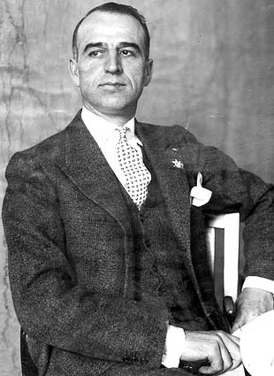
Leadfield and the surrounding mines where gone months later. Mr. Julian was blamed despite the facts that he did not start the venture, there was ore at the location, and he invested money and time towards the venture. Once his Leadfield venture faltered, he moved onto to Oklahoma and was caught up in yet another scam. Julian later fled the country for Shanghai in March of 1933 m where he committed suicide in 1923 after several more failed schemes. Julian was buried in a beggers coffin and his funeral was attended by nine people.
Mr. Julian is responsible for the road through Titus Canyon, which many is a favorite route of visitors every year.

For a detailed history, the NPS offers a great article.
Leadfield Town Summary
| Name | Leadfield |
| Location | Inyo County, Death Valley, California |
| Latitude, Longitude | 36.8466107,-117.0592307 |
| GNIS | 1658952 |
| Elevation | 4000 feet |
| Newspaper | Leadfield Chronicle ( 192?-19?? ) |
| National Register of Historic Places | 75000221 |
Further Reading
- Ghostotwns.com
- Digital Desert
- NPS.gov
- https://homesteadmuseum.blog/2019/07/20/drilling-for-black-gold-the-strange-saga-of-c-c-julian-part-one/


