Knickerbocker Road – 2N08 is a steep and beautiful drive from near the town of Big Bear, California to Skyline Drive. The route is a popular destination and common for hikers, bikes and vehicles alike. The route winds up the mountain from the village in Big Bear up to the top of the mountain offering some spectacular vistas and the valley below.

Knickerbocker Road – 2N08 is accessed from Highway 18 in Big Bear, about two blocks east of the village. The trail head is located 3/4 of a mile from the highway off of Knickerbocker Road. The trail begins with a tight left turn and steeply gains alititude. from the valley floor on its journey up to Skyline Drive.

Along the route, you journey deep into a lush pine forest with a few seasonal streams to nourish the lush green plant life. Manzanita Bushes fill the landscape, along with a variety of seasonal wild flowers as you continue to climb to the ridge of the mountain. Don’t forget to admire the views of Big Bear lake as you make the journey.
Once the trail terminates at the Grand View Vista at Skyline drive, there is a very small parking area to relax, picnic and enjoy the alpine view of Barton Flats and valley below. From here, you can return as you came, or pick any of several trails from the South Shore Trail Network including Skyline Drive,
Knickerbocker Road Trail Summary
| Name | Knickerbocker Road – 2N08 |
| Location | Big Bear, San Bernardino County, California |
| Latitude, Longitude | 34.2162, -116.9192 |
| Length | 4 Miles |
| Elevation Gain | 890 feet |
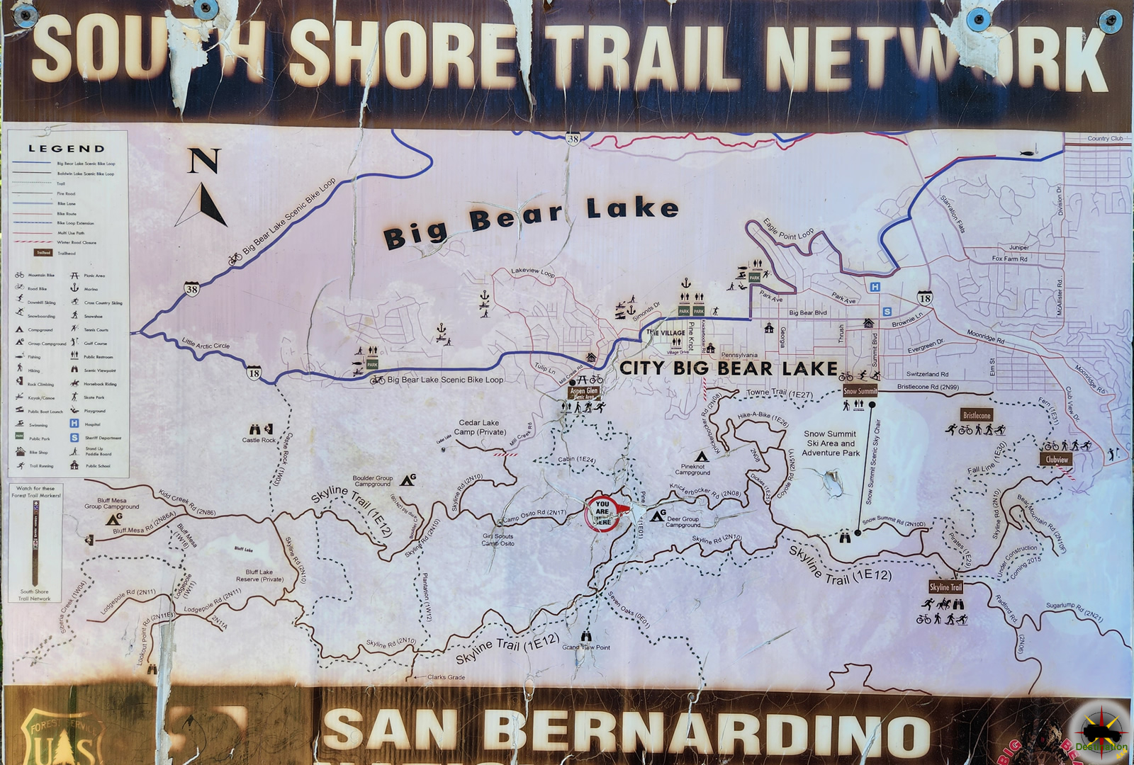
Trail Map
Knickenbocker Road is part of the South Shore Trail Network.
 Camp Osito Road – 2N17Camp Osito Road is a back country 4x4 trail which connects Knickerbocker Road to Skyline Drive in Big Bear, California. The seldom travelled road is… |
 Clarks Grade 1N54Clarks Grade 1N54 Trail Head dropping down into Barton Flats from Skyline Drive. Clarks Grade 1N54 is a steep and scenic descent from the top… |
 Knickerbocker Road – 2N08Knickerbocker Road - 2N08 is a steep and beautiful drive from near the town of Big Bear, California to Skyline Drive. The route is a… |
 Skyline Drive 2N10Skyline Drive 2N10 offers higher elevation views of Big Bear, California Skyline Drive 2N10 is the unofficial name for USFS Road 2N10 that begins just… |


