Ophir Canyon Nevada – Nye County Ghost Town
Ophir Canyon is a ghost town from the 1880s and located about 3.5 miles west of State Route 8A north of State Route 92, in Nye County, Nevada. The town began life as Toiyabe City when silver is discovered by a French prospector Boulrand in 1863. Boulrand managed to keeps his find quiet for a year, secreting provisions into the site by night. His secret is finally exposed when he confided his good fortune to countryman on a trip to Austin.
In 1864, R. B. Canfield purchased the principal ledge, also known as the Murphy ledge. Canfield utilized the Twin River Mining Company to secure financing. A wagon road is constructed, in 1865, to the site from the Big Smokey Valley for a cost of $8,000 for the two and a half mile road. The steep route suffered from grades of 10 degrees and nine creek crossings are made with wooden bridges.
A Growing Town
The newly founded Toiyabe City has a population of 400 citizens and a tri-weekly stage from Austin brought in people and supplies for the mines. In 1886, a twenty stamp mill is constructed at great costs, from the natural granite and shale sourced in the area. The mill produced over $750,000 in silver in the next two years. Despite this seemingly high rate of production, the mines did not produce a profit, due to the unusually dense rock which slowed operations considerably.
During its heyday, Ophir Canyon boasted saloons, stores and hotels. A post office operated at the site from June 18, 1867 to December 5, 1893.
Ophir NSHM #62 Text
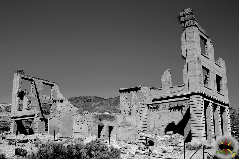
Well up into the canyon out yonder, one can still see the massive stone foundations of a costly and splendid stamp mill, as well as the stone walls of an elegant office and mansion. Here was the scene of a once busy place, now a ghost town.
Ore was discovered there in 1865 by S. Boulerond and his compatriots. In 1864, the Murphy mine was discovered and became the leading producer; a mining district was organized. During 1865, a 20-stamp mill was completed costing over $200,000. Connected with it was the first experimental Stetefeldt furnace ever built. When the Murphy mill was built, a town was started and it grew to a population of 400, but work in the mines declined in the 1870’s, and Ophir became almost deserted. In the 1880’s, the mines were reactivated, and Ophir had another period of prosperity. By the 1890’s the town was deserted, but some mining activity at the Murphy mine continued sporadically into the 20th century.
Over $2 million worth of gold and silver were mined from the Murphy vein and from surrounding properties. Iron, copper and arsenic were also found in the area.
Ophir managed to have all the accouterments of a large community–school, church, various lodges and, of course, several saloons.
Nevada Historic Marker
Town Summary
| Name | Ophir Nevada |
| Also Known As | Twin River, Toiyabe City |
| Location | Nye County, Nevada |
| Latitude, Longitude | 38.944444, -117.276667 |
| Elevation | 2,479 meters / 8,134 feet |
| GNIS | 860839 |
| Population | 400 |
| Post Office | June 18, 1867 – December 5, 1893 |
Town Map
Resources
Fort Ruby
Fort Ruby, also known as Camp Ruby is an old U. S. Army post which was built in 1862 during the American Civil War, The post is located in the “wilderness of eastern Nevada.” and protected the overland mail coaches and Pony Express, in order to maintain links and communication between residents of California and the Union states to the East.

The fort operated from 1862 to 1869 and was a small outpost in the land of the Western Shoshone tribes. The outpost is built prior to the signing of the Treaty of Ruby Valley in which the United States and the Western Shoshone agreed to allow access and mineral rights to the land in exchange for $5,000 a year for twenty years. These payments was supposed to be delivered in goods and livestock for the tribe. Sadly, only the first payment is delivered.
“Ruby Valley is a bleak, inhospitable place — no forage, nor lumber to build with, and as far as the Indians are concerned, entirely unnecessary to keep troops there,”
Col. Patrick E. Conner
Col. Patrick E. Conner lead the expedition to the site in 1862 and along with 600 men from the 3rd Regiment of California Volunteers, built the fort from stone and wood from the nearby mountains. Fort Ruby was comprised of fourteen buildings including living quarters, stables, corrals and store houses. Water is supplied by the Fort Ruby Spring located close to the fort. Just one month after initial construction of the fort, the men prepared the fort for winter. Upon doing so, the majority of the soldiers packed up and left for Salt Lake City to establish Fort Douglas. In 1864, the California troops were replaced by the Nevada Volunteers, Company B, 1st Nevada Infantry.
The outpost is located in a vast remote location about halfway between Carson City, Nevada and Salt Lake City Utah. The main threat to the men after the treaty is boredom. Aside from a brief action known as the Goshute War with the local natives, there is nothing for the Troops to keep busy after the treaty is signed.
The camp is decommissioned on September 20th, 1869. As the troops left the outpost, ranch families waved goodbye. Fort Ruby and its soldiers had become a welcome part of the valley. the closing of the fort was a social and economic blow to the local ranchers.
Fort Ruby was salvaged by local ranchers and today, no much remains at the site aside from several graves and a historic marker.
Fort Ruby Summary
| Name | Fort Ruby |
| Location | White Pine County, Nevada |
| Also Known As | Camp Ruby, Old Camp Ruby, Old Fort Ruby |
| Latitude, Longitude | 40.0677778, -115.5294444 |
| GNIS | 1681469 |
| Elevation | 1826 meters / 5991 feet |
| National Historic Landmark | 66000460 |
Fort Ruby Map
Resources
Calico California – San Bernardino Count Ghost Town
Calico California is a ghost town located just outside of Barstow in Mojave desert of San Bernardino, California. The town began its like in 1881 when four miners from Grapevine Station (present day Barstow) began prospecting the “Calico Colored” mountains to the north east. The prospectors soon found the Silver King Mine, which was the largest producer of Silver in California in the 1880’s.
The prospectors were grubstaked by John C. King for whom the the Silver King Mine was named. John King also served as the San Bernardino County Sherriff from 1879 to 1882. The post office is added to the town in 1882 along with the publishing on the newspaper the Calico Print which is published weekly. A typical assortment of business are started to support the mining efforts including three hotels, bars, brothels, boarding hoses, restaurants and a Wells Fargo office.
During the heyday, Calico boasted 500 mines, 3,500 townspeople, two constables, a deputy sheriff, two attorneys, two doctors and a boot hill cemetery. In 1890, the Silver Purchase Act drove down the price of silver and the decrease in profits made the town no longer economically viable. Future attempts at a rebirth and revival failed.

The town was purchase from Zenda Mining Company in 1951 by Walter Knot. It so happened, that Walter Knott was the nephew of John C. King and the founder of Knott’s Berry Farm. Mr. Knott invested over $700,000 restoring Calico in an attempt the create a road side attraction. Some of the original buildings are removed and replaced with facades similar in construction to a Hollywood set. Despite this fact, Calico played an important role and holds a special place in California history.
Calico Trail Map
Town Summary
| Name | Calico, California |
| Location | San Bernardino County, California |
| Latitude, Longitude | 34.948889, -116.864167 |
| GNIS | 1660414 |
| Elevation | 2,285 feet |
| Population | 3,500 |
| Post Office | 1882 – 1898 |
| Newspaper | Calico Print |
References
Metropolis Nevada – Elko County Ghost Town
Metropolis Nevada is a ghost town about 14 miles north west of Wells, Nevada and located in Elko County Nevada. The town was the brainchild of the Pacific Reclamation Company, which is based in New York. In 1909, the company envisioned build a city to host up to 7,500 people, which was surrounded by 40,000 acres of farm land.

Pacific Reclamation Company opened an office in Salt Lake City beginning in 1910 to promotion the future site of Metropolis in the Nevadan desert. In 1911, streets, lots and even two public parks were staked out for development and the newspaper, the Metropolis Chronicle began publication in 1911. All of this promotion and interested boosted the cost of land from as low as $10 an acre to $75. Town lots ranged from $100 to $300 per lot.
The towns infrastructure was second to none in Nevada. There streets were graded and line with fire hydrants and street lights and a four block commercial district is established. Railroad tracked is connected to the townsite by the Southern Pacific, from Tulasco about eight miles away. A train depot is built to welcome new visitors who are greeted with a small tree lined park built by the railroad.
In 1912, a one hundred foot tall damn is built along with canals to distribute the water. As the reservoir filled, the town of Metropolis grew. Over 700 citizens called the town home, the majority being Mormon. To serve the population a Post Office is opened along with several business including a brick hotel, saloons and a wagon factory.
1912 also witnessed the demise of the town of Metropolis. Lovelock Valley filed suit with Pacific Reclamation Co. seeking an injunction from water utilization from the headwaters of Humboldt. The court ruled against the Pacific Reclamation Co, only allowing them to supply water to support 4,000 of the 40,000 planned acres of farmland. Following this ruling, the reclamation company went into receivership and the newspaper is closed in 1913.
The town continued but languished. By 1925, the town was in steady decline and the railroad abandoned its footprint in Metropolis. In 1936, the hotel is a victim of fire. In 1942 the post office is closed and in 1947 the school is closed.
Metropolis Trail Map
Town Summary
| Name | Metropolis Nevada |
| Location | Elko County, Nevada |
| Latitude, Longitude | 41.228056, -115.056111 |
| Elevation | 5675 Feet |
| Population | 700 |
| Post Office | 1912 – 1942 |
| Newspaper | Metropolis Chronicle Sept 15, 1911 – Apr 15, 1913 |
References
Dinner Station Nevada – Elko County Stage Stop
Dinner Station is a ghost town and stage station located in Elko County, Nevada. The station started with a wood building in the 1860s or 1870s. The station served as a station and meal stop for passengers on the Tuscarora and Mountain City Stages Lines. This building was destroyed by a fire in 1884 and was replaced by a two story stone building and corral. Stage service picked up travelers from Elko destined for Tuscarora and stop for dinner, which was happily provided for fifty cents. The station was one of the more popular inns of the era.
By 1900 the station had a population of 40 inhabitants. The budding automobile industry caused the station to loose some of its importance and necessity. This fact spelled the end of Dinner as city and it became just a private residence.
A fire in 1991 destroyed the sole building, however the structure is rebuilt in 1996.
Dinner Station Trail Map
Site Summary
| Name | Dinner Station |
| Also Known As | Weiland Station, Oldham’s Station |
| Location | Elko County, Nevada |
| Latitude, Longitude | 41.0999142, -115.8661870 |
| GNIS | 845151 |
| Elevation | 1817 meters / 5962 feet |


