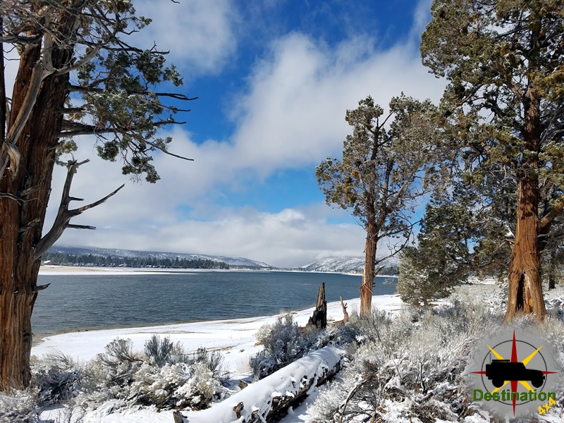
Big Bear, CA
I quiet mountain community full of back country adventure.
The Journey is the destination
The waterfalls of Darwin are located on the western edge of Death Valley National Park near the settlement of Panamint Springs, California. Although there exists a similarly named Darwin Falls Wilderness adjacent to the waterfall, the waterfalls themselves are located in and administered by Death Valley National Park and the National Park Service.

There are several falls, but they are mainly divided into the upper and lower with a small grotto in between. At a combined 80 feet (24 m), it is the highest waterfall in the park.
The hike into Darwin falls is rather short and easy terrain to reach the shallow pools which form under the water fall. There are, however, multiple creek The narrow canyon does contain Cottonwood trees and willows and offers some shade from the sun as you approach the waterfalls. The creek and pools in the area, like almost every other water source in the desert form an oasis of life in the desert. Birds and amphibians are common.
My trip on the early spring found no other hikers on the trail and a serene place to visit. It is easy to image that even this rather easy hike could be quite rough when the summer sun scorches the landscape and temperatures climb.
There is no swimming at Darwin Falls and the creek is a source of drinking water.
Owls Clover (Castilleja exserta) is a small flowering plant which can grow about 1 foot tall. The Owl’s Clover is a native plant to California, Arizona, New Mexico and the Northwestern areas of Mexico. Like other Castilleja plants, which also includes the Indian Paintbrushes, the Owl’s Clover is hemiparasitic which means that it obtains its nutrients from the roots of other plants.

The Owls Cover blooms from March to May and may be found at elevations from 2000 ft to 3000 ft. The plant ranges in height from 4 to 18 inches in height. The underdeveloped, hairy stemmed leaves are threaded in appearance because they are not needed for nutrients or photosynthesis. Rather, the roots of this plant will growth into the root structures of other plants around it, stealing the nutrients from it.
The thin, erect bracts are usually tipped in the same color. This will give the flower a dual tone color and the appearance a paintbrush dipped in paint. This is the source of the the paintbrush common name of other plants in this genus.
The seeds of the Owl’s clover were harvested and utilized as a food source by the indigenous peoples of California.
Lower Antelope Canyon one of two slot canyons located off the highway 98 just outside of Page, Arizona near the Utah border.

Slot Canyons are formed in usually arid regions, where a little bit of rain falls, and fulls the dry rivers of the desert southwest. The water can flash flood, which picks up speed and debris and scours the landscape. Overtime, the water forces itself into cracks in the rock and widens the deepens the crack into a deep narrow canyon. Lower Antelope is a commonly overlooked when compared the Upper Antelope Canyon, although does seem to be gaining in popularity.
Hasdestwazi, or “spiral rock arches ” as it is known to the LeChee Chapter of the Navajo Nation, Lower Antelope slowly exposes itself to you as a small crack in the rock which grows slightly in width, and dramatically in depth as you climb down into the slot canyon.
Unlike Upper Antelope Canyon which is an easy walk, Lower Antelope Canyon is a steep and deep trail as the passage plunges deeper into the rock. The Navajo Nation is kind enough to maintain metal stairs to aid the trek, however on my last visit the stars where covered in mud, silt and debris from a recent storm which further sculpts the rock. Upper Antelope pulls you eyes up into the colorful light above, however there is no real sense of depth. Lower Antelope Canyon constantly reminds you how deep you really are beneath the surface.

Just like Upper Antelope Canyon, a narrow opening at the top of the canyon only allows a little light the enter the canyon. This light bounces off the canyon walls, and throughout the day, a light show of glowing rock, shadows and textured water sculpted rock offer a wonderful visuals to the visitors.
The sculpted rock and light offer beauty, texture and scenic photographic opportunities, however this beauty hides a danger. An August 12, 1997 a group of eleven tourists where killed inside the canyon when a flash flood filled the canyon in seconds. A sole tour guide survived the tragedy.
As I follow the canyon down towards Lake Powell in the distance, I would constantly find my self touching the smooth canyon rock walls, all the while knowing that a summer monsoon miles aware could end my time on this planet. However, although always a bit uneasy, it is an amazing place and well worth the trip and the remote risk.
Growing up in the 70’s I learned and spent a lot of time camping, hiking, being outdoors and active. Every spring summer and fall, my parents and I would load up the truck, and later the trailer and head out. Typically preparations would start the week before departure, and the loading process would start on Thursday afternoon with my brother and I hauling all the gear into the yard, while my mom packed the vehicles. Friday could not come soon enough and when it did, my dad would come home from work, change is clothes, wrangle up two kids, maybe a dog, adjust the mirrors, and exclaim “We’re off” as we drove out of the driveway in The Green Gopher. For the most part, for my family nothing much has changed much from my dad. It is however the details that matter.
In 1972, I was one year old and to celebrate my dad bought a new truck. Details of the vehicle back then are scarce. From my point of view, my dad previously owned a 1964 International Scout. He drive this car for years all over the desert south west in the late 1960s. When my dad married my mom, my mom made him sell the Scout because the breaks were horrible, and at least three times they failed completely. It was a wise decision considering the stakes for the family at the time, but the loss of his beloved Scout was difficult and for decades despite its faults the Scout cast a long shadow in our family.
Returning to 1972, my dad decided to purchase his truck. He chose a Sea Foam Green 1972 Ford F-100 pickup sporting a 302 inch V-8 sporting with a 3.2:1 gear ratio, two fuel tanks, and a four speed manual transmission which included a “Granny Gear”. The extra costs of a four wheel drive were not an option for my dad at that time. So, the truck became the “ultimate compromise”. He opted for 2 wheel drive, but to offer improved traction he chose a four speed with granny gear. The differential was geared up to offer improve gas mileage, but the little 200 HP V-8 could not pull a grade at any sort of highway speeds. A camper shell, home built bed, pass-through rear window and the “green gopher” was complete for the initial incarnation.
Continue Reading →Located south of Baker, CA on the edge of a large soda dry lake bed in the Mojave, Zzyzx Road is a short road which leads from the I-15 highway to a soda spring with an eclectic history. The springs were the site of a prehistoric quarry and early human activity undoubtedly taking shelter from the heat in the Oasis which is the spring site.

During the 1860s, the springs and surrounding areas host a U.S. Army camp which serviced the Mojave Road as Fort Soda Springs and a local train depot for the Tomopah and Tidewater Railroad.
In 1944, a radio evangelist, self proclaimed medical doctor and methodist minister Curtis Howe Springer filed a mining claim for 12,800 acres of land south of Baker, CA and along the coast of the large dry soda lake. The 8 miles by 3 miles track of land included the old army fort and the train depot. Mr. Springers goal was to establish a “Health Spa” for anyone who felt the need to improve their Health. The cost of a visit was free of charge, but undoubtedly he pressured his visitors to make “donations” to his organization.
The area was developed over time, and Springer named the site after his own invented word Zzyzx, as to be the last word in the dictionary, and the phrase the “last word in” was used as part of his marketing campaigns for all his endeavors. The location was built up over a period of 30 years (1944 – 1974) starting with a 20 tent camp which soon turned into a primitive concrete settlement built using laborers recruited from Los Angeles “Skid Row”. The warm soda springs were of his own manufacture which used boilers and man made pools for this natural healing site.
Years of development Zzyzx Mineral springs featured 60 room lodging, a radio station, mineral spa, a private airport dubbed the “Zyport” and or coarse a church. In addition, Curtis Springer would peddle his cures using his national and international radio broadcasts which promised cures for almost every disease. In the late 1960’s, Mr Springer gained the attention of the Federal Government for building homes for large doners to his “Ministry”. Since the original Mine claim never transfer ownership of the land to him, but rather gives him mineral rights, and he had not produce any profit from mining he was not entitled to development the land, because he did not own the land.

After loosing in court, he was evicted from the site in 1974, and in 1976 the California State University system incorporate the site into their field studies and research programs which, I am sure, has provided a far better use of the property. The property continues to operative within the Mojave National Preserve as the Desert Studies Center by the California State University. Visitors are welcome to tour the area, there are picnic tables and a self guided tour around Lake Tuendae.
