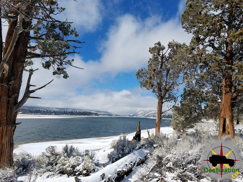
Big Bear, CA
I quiet mountain community full of back country adventure.
The Journey is the destination
When you travel the back country roads, you can not help but the search your own history for the thread of fact to help bind you to the location. Since I can remember, my dad would take me out into the sierra, desert, mountains, etc… looking for history, looking for mines, ghost towns, or just a place of nature. Being a son of western settler’s who reached California in the 1880s, I was well aware that my family was part of a vast wave of people who settled the country. Later, I discovered that my dad kept my grandfathers gold pan, he, like many others spent his time searching for opportunity in the ground.
However, this does have its draw backs. Many of the places I visit were simply not there when my family started to arrive, unless you count Ontario, CA which is now part of the urban sprawl which is Southern California.

During my earlier explorations of the Lucy Grey goldmine, my great grandfather was an investor in the mine, and like many other people did not fare well on his investment. However, on the other side of my family there was another interested in gold mines.
Like many who are fortunate enough to known their grandparents, I didn’t know my grandfather until late in his life, by then his course in life was settled. He had graduated from Berkeley, retired as a chemical engineer, raced sail boats, raised a family and retired and even had time to teach me to fish. I knew that he did some gold prospecting but I assumed his attempts were similar to my dads attempt.

In the 1980’s my family was driving in the back country of Arizona, neat Prescott. At some time during the trip, we were hiking up a stream bed and discovered some black sand. My father related the fact that gold is supposed to be found. We then loaded up about fifty pounds of the precious black sand and took our prize home. I hasten to add that we panned all the material and didn’t get a single flake of gold and were the proud owners of two bad backs.

In contrast, my grandfathers attempt was considerably more successful. During the depression, while studying chemistry, he decided that during the summer months he would mine for gold. So, while on break he headed off to the American River in California and spent the summer gold mining. In his descriptions of this time, his success was limited but “It kept me in beans”.
I look at his gold pan now, and like the ghost towns and mine sites all across the desert, it reminds me of tough men, struggling to full fill their version of the American Dream. One of those men was my grandfather, and I wish I knew this man.
Over Presidents day weekend, my wife and I were travelling back from Big Bear, CA to our house after a visit with family towards our home in Las Vegas. Frequently, my wife will point out an old road or mine and comment that we need to take that trail someday. During out drive home, we were talking about the mining district in Mountain Pass and the Evening Star mine. On this journey, we chanced upon the ultra rare Mojave Goldfish.
This is one of the great reasons for owning a 4×4 and the Mojave Desert is a prime location to explore.

So, we exited the I-15 travelling north on Baily road near the Kokoweef mine. Typically, I have a route mapped out ahead of time, but a spur of the moment decision left our route to happenstance. We drove straight off the off ramp and headed up the hill. Immediately I sensed the I took the wrong route, but since we were exploring I just drove on, you never know what you will find. Soon, we found a private property sign, and opt towards a road to the left. I found 4×4 low in the transfer case and we climbed a short hill. Upon cresting the hill, I noticed something metal down the the left. I road the gears down in low until we reached the small canyon where I made a tight left towards the metallic object I saw from the top of the hill.
Within a quarter of a mile, I found an juniper tree with a metal water trough. These are not uncommon in the mojave and can be found throughout the dessert. I parked the jeep to investigate and was shocked…

We stumbled upon Goldfish, in the Mojave Desert and these things were pretty big. I mean, I have eaten trout smaller than some of these. Goldfish are used to keep the algae in check inside the water trough. An elegant solution to a problem I didn’t think existed, but that makes sense. The water trough was plumbed with a PVC pipe to bring the spring water to the trough. The overflow, did just that and the rocks on either wide of the trough edge allow for animals to escape the tank. An endless supply of fresh water would keep the urea concentrations down, so the fish grow into their environment.
My biggest question is that in a remote area with a lot of preditors, why are these fish alive? I thought that an oportunistic coyote, fox or raven would make quick work of this exposed tank, but these large fish prove they have been here for time. Regardless a very fun find and a true 4×4 destination.
Recognized on the National Register of Historic Places, the Hole in the Rock trail is an old Mormon trail in Utah that was used to establish colonies on the east side of the Colorado River in 1879. The Hole in the Rock from which the trail is named, is a narrow canyon from the rim of the canyon down into the Colorado River Valley. This canyon provided access to the Colorado River and the much needed water require to survive in these remote locations. Months were spent widening the narrow canyon to allow “safe” passage of all the wagons and cattle.

The original trail was bisected when the Glen Canyon damn bottled the Colorado River and started to fill up Lake Powell in 1966. However, thE road continues to exist and allows access to the Escalante Canyon system, along with access to the Devils Garden, numerous slot canyons and lots of back country hiking and camping opportunities.

The road passes between the Kaiparowits Plateau and the Escalante River. This area is a labyrinth of roads and trails. The trail leaves the small town of Escalante and travels 44 miles south along a sandy road.

Do not underestimate how cool this area is to visit. The rock formations, remote locations and sunsets are beyond comprehension. One can get the feeling of isolation on just a short visit.

The Shafer Trail, located in the Island in the Sky district of Canyonlands National Park near Moab, Utah, is a renowned backcountry road celebrated for its dramatic scenery and challenging terrain. Spanning approximately 19 miles, the trail descends 1,500 feet through a massive sandstone cliff via a series of tight switchbacks, connecting the mesa top to the canyon floor and linking with the White Rim Road and Potash Road. Its history reflects a rich tapestry of human activity, evolving from ancient pathways to a modern recreational route.

Long before modern roads, the Shafer Trail began as a route used by Native Americans to access resources on the mesa top and travel to the Colorado River below. These early inhabitants of the region navigated the rugged terrain to gather materials and move between seasonal locations, establishing a path that would later be adapted for other purposes. The trail’s origins as a Native American route highlight its significance as a corridor through the challenging canyon landscape.
In the early 20th century, the trail was adapted by Mormon pioneer settlers, particularly the Shafer family, for whom it is named. Starting in 1916, John “Sog” Shafer used the trail to move cattle between summer pastures on the mesa top and winter grazing grounds on the White Rim sandstone below. Shafer and other ranchers improved the trail, widening and stabilizing it to make it safer for livestock, though it remained narrow and perilous, with animals occasionally slipping to their deaths. These improvements laid the groundwork for later developments, and many trails in the Island in the Sky district bear the names of families who worked them.
The 1950s marked a significant transformation for the Shafer Trail during the uranium boom in the American Southwest. The Atomic Energy Commission widened and extended the trail to accommodate trucks transporting uranium-bearing ore from mines in the Triassic Chinle Formation to processing facilities in Moab. This period saw many backcountry roads in the Moab area, including the Shafer Trail, upgraded to support the mining industry, leaving visible scars across the desert landscape. The trail’s role in uranium transport underscores its importance to the region’s industrial history.
With the establishment of Canyonlands National Park in 1964, the Shafer Trail’s function shifted from ranching and mining to recreation. Ranchers were granted a ten-year extension to continue operations, but by the mid-1970s, the trail was primarily used by visitors seeking adventure. The National Park Service improved the road to make it safer for recreational use, though it remains unpaved and challenging, requiring high-clearance 4WD vehicles with low-range gear (4LO). Today, the trail attracts hundreds of visitors annually for its thrilling switchbacks and breathtaking views of Canyonlands’ sculpted pinnacles, buttes, and the Colorado River.
The Shafer Trail is now an iconic backcountry drive, celebrated for its scenic beauty and historical significance. It offers access to notable sites like the Shafer Canyon Overlook, where visitors can view the trail’s switchbacks and the surrounding canyon landscape, and Thelma and Louise Point, famous for its appearance in the 1991 film’s final scene. The trail also connects to other recreational routes like the White Rim Road and is popular among hikers, mountain bikers, and photographers for its wildflowers, petroglyphs, and dinosaur tracks. Its challenging conditions, including steep drops and sharp rocks, require careful preparation, and it can become impassable during wet or snowy weather.
From a Native American pathway to a cattle trail, a uranium transport route, and now a premier recreational destination, the Shafer Trail encapsulates the evolving human relationship with Canyonlands’ rugged landscape. Named after the Shafer family and shaped by centuries of use, it remains a testament to the region’s cultural, industrial, and natural history, offering visitors an unforgettable journey through one of America’s most striking national parks.
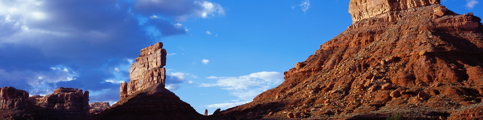
Valley of the Gods is a beautiful sandstone valley and located in the South East corner of Utah near Mexican Hat. alley of the Gods is the lesser known northern extension of Monument Valley and is frequently confused with Monument Valley. The valley is carved out from a layer of eroded sandstone, and features two large table top mesa with are long and narrow in shape. These mesas appear like ship sails again a sea of clear blue skies.
The seventeen mile trail loops north from highway 163 and then travels back the the south west to connect to highway 261 and recommended for high clearance vehicles.

Down towards to the of the valley, two beautiful spires reminded me of sailing ships in the desert. The road winds between them to provide for an amazing drive.
Unlike Monument Valley which is controlled by the Navajo Nation, the valley is managed by the Bureau of Land Management and does not contain any services or campgrounds, or tribal restrictions. There are several small camping spots on the loop and when I visited in October the number of people seems to be quite low.
The striking landscape of Valley of the Gods is the result of sedimentary deposition, tectonic uplift, and prolonged differential erosion over hundreds of millions of years. The primary rock unit is the Cedar Mesa Sandstone, part of the Permian-age Cutler Group (approximately 250–270 million years old). This formation reaches thicknesses of up to 1,200 feet and was deposited in a coastal environment near the shores of an ancient shallow sea that once covered much of the region during the Permian Period.
The valley’s geology also preserves Late Paleozoic fossils (vertebrates, plants, and invertebrates) in the Halgaito Shale and related units, offering a window into ancient coastal plain and riparian environments.
In essence, Valley of the Gods is a textbook example of Colorado Plateau geology: ancient Permian coastal sediments uplifted and exquisitely sculpted by arid-climate erosion into one of the American Southwest’s most iconic badlands.
While the rocks themselves predate humanity by hundreds of millions of years, the valley holds deep cultural meaning for Native American tribes and has seen limited Euro-American activity.
Today, Valley of the Gods stands as a pristine, uncrowded gem of the Colorado Plateau—offering solitude, stunning geology, and a living connection to Native American heritage. Its formations continue to erode slowly, ensuring that future generations will witness an ever-changing landscape shaped by the same forces that created it over 250 million years ago. For visitors, a drive or hike through the valley provides both geological wonder and cultural reverence in one of Utah’s most underrated desert treasures.