
Big Bear, CA
I quiet mountain community full of back country adventure.
The Journey is the destination


The True Fissure newspaper was a weekly newspaper published in Candelaria, Nevada, a mining town in Esmeralda County that thrived during the silver boom of the late 19th century. Operating from June 5, 1880, to December 4, 1886, the newspaper served as a vital source of information for the local mining community, reflecting the economic, political, and social dynamics of a bustling yet transient mining town. This report explores the historical context, content, ownership, and legacy of the True Fissure, drawing on available records to provide a comprehensive overview.
Candelaria emerged as a significant mining town in the 1860s and 1870s following the discovery of silver deposits. By the early 1880s, it was a hub of mining activity, with a peak population of around 1,500 residents, several saloons, general stores, and a post office. The town’s economy was heavily tied to silver mining, particularly the Northern Belle Mine, which drove local prosperity. However, like many Nevada mining towns, Candelaria’s fortunes were volatile, subject to the boom-and-bust cycles of the mining industry.
Newspapers played a critical role in such communities, serving as a medium for local news, mining updates, political discourse, and advertisements. The True Fissure, named after a mining term referring to a genuine vein of ore, embodied the spirit of Candelaria’s mining culture and its Republican political leanings. Its establishment coincided with a period of relative stability in Candelaria, though the town’s decline in the mid-1880s would ultimately lead to the newspaper’s closure.
The True Fissure began publication on June 5, 1880, as a weekly newspaper, with its final issue published on December 4, 1886. According to historical records, the newspaper was published every Saturday, providing regular updates to the community. It was housed in Candelaria, a town strategically located to serve miners, merchants, and residents of the surrounding region.
The newspaper’s owner and editor, John Dormer, was a prominent figure in Nevada’s political landscape. Dormer leveraged the True Fissure to promote Republican ideals, which resonated with many in the mining community. His editorial influence helped him secure election as Nevada’s Secretary of State in 1882, a position he held through reelection in 1886, coinciding with the newspaper’s final year. The True Fissure’s Republican stance made it a platform for political advocacy, likely featuring editorials and articles that supported Republican candidates and policies during state and local elections.
As a mining-town newspaper, the True Fissure likely covered a range of topics relevant to Candelaria’s residents, including:
The True Fissure served as a booster for Candelaria, promoting the town’s economic prospects and encouraging investment in its mining industry, a common practice among Nevada newspapers of the era. Its role as a community anchor would have been particularly important in a remote mining town, where access to timely information was limited.
Historical issues of the True Fissure are preserved on microfilm at institutions such as the University of Nevada, Las Vegas (UNLV) Libraries, which hold copies from January 1, 1881, to December 4, 1886. The Nevada State Library, Archives and Public Records also maintains a microfilm collection of historical newspapers, including the True Fissure, available for viewing during library hours. Researchers can access these microfilms on-site and save images to a flash drive. Some issues may also be available through electronic databases, such as those accessible with a Nevada State Library card.
Additionally, the Library of Congress’s Chronicling America project includes bibliographic information on the True Fissure, confirming its publication run and providing context alongside other Nevada newspapers. Researchers interested in specific articles or issues can consult these archives or contact the Nevada Historical Society, which houses extensive newspaper collections.
The True Fissure ceased publication on December 4, 1886, as Candelaria’s economic fortunes waned. The decline of silver mining in the region, coupled with falling silver prices and the exhaustion of easily accessible ore, led to a population exodus. By the late 1880s, Candelaria was transitioning into a ghost town, unable to sustain businesses or institutions like the True Fissure. The newspaper’s closure reflects the broader challenges faced by mining-town newspapers, which were heavily dependent on local economic stability.
The True Fissure is a valuable historical artifact for understanding life in Nevada’s mining towns during the late 19th century. Its coverage offers insights into the economic aspirations, political dynamics, and social fabric of Candelaria. The newspaper’s association with John Dormer highlights the role of editors in shaping local and state politics, a common phenomenon in frontier journalism. Furthermore, its preservation on microfilm ensures that researchers and genealogists can access its content to study Nevada’s mining history, local governance, and community life.
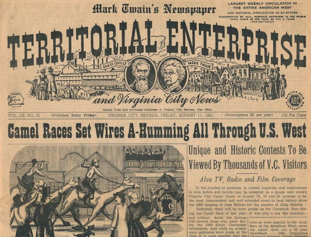
The True Fissure also exemplifies the transient nature of mining-town newspapers, many of which folded as their communities declined. Its story is part of Nevada’s broader journalistic tradition, characterized by colorful and influential publications like the Territorial Enterprise and the Reese River Reveille, which similarly documented the rise and fall of mining towns.
The True Fissure was more than a local newspaper; it was a reflection of Candelaria’s brief but vibrant existence as a silver-mining hub. Under John Dormer’s editorship, it played a significant role in promoting Republican politics and boosting the town’s image. Though its publication run was short, its preserved issues remain a critical resource for historians and genealogists. The True Fissure stands as a testament to the resilience and ambition of Nevada’s mining communities, capturing a fleeting moment in the state’s history before fading with the town it served.
Carrara is a historic ghost town located in southern Nye County, Nevada, within the Amargosa Desert. Situated approximately 8.5 to 10 miles southeast of Beatty and adjacent to U.S. Route 95, the townsite lies on the valley floor at an elevation of about 2,881 feet. It is named after the renowned marble-producing city of Carrara in Italy, reflecting ambitious hopes that its local deposits would rival the famous Italian quarries. To the northeast, a former railroad grade (now a dirt road) ascends about 3 miles up Carrara Canyon on the southeast flank of the Bare Mountains to the old marble quarry, which sits roughly 1,400 feet higher in elevation. The site was once served by spurs from the Las Vegas & Tonopah Railroad and later the Tonopah & Tidewater Railroad.
Unlike the gold and silver boomtowns that dotted early 20th-century Nevada, Carrara was uniquely founded on marble quarrying — a rare commodity in the region’s mining history. Its story exemplifies the classic boom-and-bust cycle of the American West, driven by optimism, geological challenges, and economic realities in a harsh desert environment.

Marble deposits in the area were first identified as early as 1904, but initial attempts to quarry them yielded poor results due to highly fractured stone that produced only small, unusable pieces. Prospectors persisted, and in 1911, a more promising vein was located, leading to the formation of the American Carrara Marble Company under president P.V. Perkins, with Eastern investors providing capital.
The company platted a townsite on the flat desert floor below the quarry, strategically positioned along the Las Vegas & Tonopah Railroad for shipping. Infrastructure developed rapidly: a 9-mile pipeline brought water from Gold Center across the valley (a rarity in the arid region), electricity was supplied, and a 3-mile inclined cable railway (using a Lidgerwood counterbalance system) transported marble blocks downhill from the quarry to the finishing mill and rail spur.
On May 8, 1913, Carrara was officially dedicated with great fanfare — a grand celebration featuring a ball, live music from a Goldfield band, a baseball game, and swimming in the new town pool. That same day, the town’s newspaper, the Carrara Obelisk, published its first issue, and a post office opened shortly after (operating until 1924). Amenities included a hotel, store, restaurant, saloon, dance hall, telephones, electric lights, and even a public park with a flowing fountain fed by the pipeline — luxurious features that made Carrara stand out in the desolate Nevada landscape.
At its peak around 1915–1916, Carrara boasted about 150 residents and roughly 40 buildings. The quarry produced a variety of marble types, including pure white, blue, black, yellow, and striped varieties, which promoters claimed were chemically superior to Italian Carrara or Colorado Yule marble. Blocks were partially finished at the townsite mill before shipment via railroad, primarily southward on the Tonopah & Tidewater line after a spur was added.
The American Carrara Marble Company invested heavily, completing the cable railway in 1914 and shipping the first slabs that year. The town fostered a sense of community, with the Obelisk chronicling local events and aspirations. For a brief moment, Carrara represented a diversified industrial future beyond precious metals, capitalizing on proximity to West Coast markets.
Despite the hype, geological issues doomed the venture. Much of the marble was too fractured and impure for large-scale commercial blocks, competing poorly with higher-quality sources from Vermont and abroad. Production costs soared, and by late 1916, the Nevada-California Power Company deemed the operation unprofitable and cut electricity to the quarry.
Operations halted in 1917, the Obelisk ceased publication that year, and the railroad discontinued service to Carrara in 1918. Residents departed quickly, leaving the town abandoned by the early 1920s. A brief gold rush in 1929 sparked minor excitement, including the short-lived Carrara Miner newspaper promoting the Gold Ace Mining Company, but it failed to revive the site.
Later attempts, such as a 1940s proposal for a white cement plant using crushed marble (and nearby unrelated Elizalde cement ruins from the 1930s), also collapsed without success.
Carrara remains a classic Nevada ghost town — uninhabited, with no active population or commercial activity. The desert has largely reclaimed the site, leaving minimal physical remnants visible from U.S. 95. Key surviving features include:
The townsite is easily accessible via a short, bumpy dirt road east from Highway 95 (near mile marker 51), making it a popular stop for ghost town enthusiasts, historians, and off-road explorers. The quarry road is rougher and leads to the Bare Mountains base. No modern development has occurred, and the area falls under public land management, preserving its desolate, historic character. Nearby ruins (e.g., the 1930s cement plant) are sometimes confused with Carrara but are distinct.
Carrara’s legacy endures as a poignant reminder of Nevada’s transient mining era: grand dreams dashed by nature’s unforgiving realities, yet offering quiet ruins that whisper of a fleeting marble empire in the desert.
| Name | Carrara Nevada |
| Location | Nye County, Nevada |
| Population | 150 |
| Post Office | May 5, 1913 – September 15, 2914 |
| Newspapers | Carrara Obelisk Feb 7, 1914 – Sept 9, 1916 Carrara Miner July 21, 1929 |
Carrara Miner NewspaperThe Carrara Miner was a brief newspaper published in Carrara, Nevada, a small ghost town in Nye County located approximately nine miles south of Beatty.… |
Carrara ObeliskThe Carrara Obelisk was a short-lived but significant weekly newspaper published in the early 20th century in Carrara, Nevada, a small marble quarrying town located… |

The Goldome Mill is an abandoned modern mill site in the New York mountains of San Bernardino, California just off of the Ivanpah Road. The site was abandoned in the 1998 following the formation of the Mojave National Preserve by the California Desert Protection Act in 1994 and has slowly fallen into a state of decay. The mill site is currently classified as a Superfund Site by the Environmental Protection Agency which means that the site is known to contain hazardous waste which is improperly contained.

The mill was named Goldome, meaning “an abnormal growth of gold” out of an optimism as to the fortunes of those who invested in this venture. The construction of the site is very modern and industrial in appearance. All of the buildings are of metal construction and probably built during the late 1970s or early 1980s. All of the milling equipment, such as the trommel and sluice boxes appear to silently rest in state. This site was likely the mill site of choice for near by mines of its era, such as the Morning Start Mine
The Goldome Mill was constructed in the late 1970s or early 1980s, during a period of renewed interest in gold mining driven by economic factors and technological advancements. The mill’s modern, industrial design featured metal buildings, a stark contrast to the wooden stamp mills of earlier eras, such as the Lost Horse Gold Mill in Twentynine Palms. The facility was equipped with advanced processing equipment, including an ore dump and grizzly, a long conveyor to a giant ball mill, froth flotation cells, filters, and large cyanidation tanks for gold extraction. A control panel with a mimic board in the mill office allowed operators to oversee the entire operation.
The milling process began with ore being fed into the grizzly, transported via conveyor to the ball mill for grinding, and then processed through froth flotation to separate gold-bearing minerals. The resulting slurry was treated in cyanidation tanks, where cyanide leached gold from the ore, a common method in modern gold mining despite its environmental risks. The mill’s capacity was significant, making it one of the largest and most advanced milling operations in the region, capable of processing large volumes of ore. However, specific production figures for the Goldome Mill are not well-documented, likely due to its short operational period.
The mill was operated by a company, likely a corporate entity such as those common in San Bernardino County’s mining landscape (e.g., Castle Mountain Venture or PAN American Minerals Inc.), though exact ownership details are scarce. The name “Goldome,” meaning “an abnormal growth of gold,” reflected the optimism of investors hoping to capitalize on the region’s mineral wealth. The mill processed ore from nearby gold claims in the New York Mountains, an area with a history of small-scale prospecting but limited large-scale success.
The Goldome Mill’s operations were curtailed by environmental and regulatory factors. The establishment of the Mojave National Preserve in 1994 restricted mining activities, as new claims were prohibited, and existing operations faced increased scrutiny. By 1998, the mill was abandoned, likely due to a combination of declining ore quality, rising operational costs, and regulatory pressures. The site’s designation as a Superfund Site by the Environmental Protection Agency (EPA) indicates that it contains hazardous waste, likely from cyanide used in gold extraction, which was improperly contained. The presence of half-full cyanidation tanks and other hazardous materials has made the site a concern for environmental cleanup efforts.
The harsh Mojave Desert environment has also contributed to the site’s deterioration. While the metal structures remain intact, the mill has been heavily vandalized and looted, with graffiti and scattered debris marking the site. Explorers have noted hazards such as a large beehive in the main building, which has deterred some from fully investigating the interior. Despite these challenges, the mill’s open layout and intact equipment make it a compelling site for historians and urban explorers.
The Goldome Mill ceased operations by 1998, a mere two decades after its construction, reflecting the transient nature of modern mining ventures in the region. Several factors contributed to its closure. First, the quality of gold ore in the New York Mountains may have been insufficient to sustain large-scale milling, as many San Bernardino County mines struggled with low-grade deposits. Second, the economic viability of the operation was likely undermined by fluctuating gold prices and high maintenance costs for the sophisticated equipment. Finally, the creation of the Mojave National Preserve imposed strict regulations, limiting access to new claims and increasing environmental compliance costs.
After abandonment, the mill fell into disrepair, with its tunnels sealed but the milling operation left accessible. The site’s isolation and lack of fencing have made it vulnerable to vandalism, yet its robust construction has preserved much of the infrastructure, including the ball mill, flotation cells, and cyanidation tanks. The absence of gates or fences along the access road has allowed explorers to visit, though the EPA’s Superfund designation underscores the need for caution due to hazardous materials.

In 2017, political vandals posing as “street artists” decided on their own to deface the site as part of their environmental message and forever changed the face of this site. The mill at Goldmine is heavily vandalized and at the time of our visit during the riots following the murder of George Floyd gave the site an uneasy felling. It is not too far a reach to understand that they vandals who defaced this site could be burning our cities down.

During our visit to the site, a large swam of bees built a hive in the main building. This prevented me from entering and exploring further, however, I will return to do so, at some point.
Recently, I discovered that a youtube channel called Jessie’s Drone Adventures referenced our site in the video 10 ABANDONED Places in California….You should NEVER Explore! in Jessie video, Golddoom is referenced as number four on this list.
The Carrara Miner was a brief newspaper published in Carrara, Nevada, a small ghost town in Nye County located approximately nine miles south of Beatty. Published on July 11, 1929, the Carrara Miner emerged during a short-lived revival of mining activity in the area, specifically tied to the Gold Ace mine, following the decline of Carrara’s original marble quarrying industry. This report examines the historical context, establishment, purpose, and legacy of the Carrara Miner, highlighting its role as a fleeting effort to document and promote a renewed mining venture in a nearly abandoned town.
Carrara, Nevada, was established in 1913 by the American Carrara Marble Company to exploit marble deposits discovered in Carrara Canyon, named after the renowned marble-producing city in Italy. The town initially thrived, boasting a population of around 100–150 residents, a post office (May 24, 1913–September 15, 1924), a hotel, a store, a restaurant, and a newspaper called the Carrara Obelisk (published May 8, 1913–September 1916). The town’s economy centered on a large marble quarry, supported by a three-mile cable railway connecting the quarry to the Las Vegas & Tonopah Railroad and later a spur to the Tonopah & Tidewater Railroad. However, by 1916, the quarry’s marble was found to be too fractured for large-scale use, leading to the cessation of operations. The Nevada-California Power Company cut off electricity in 1917, and the railroad discontinued service in 1918, leaving Carrara a ghost town with only remnants like concrete foundations and the town fountain.
In the late 1920s, a brief resurgence of interest in the Carrara area occurred due to gold discoveries at the nearby Gold Ace mine, northwest of the original townsite. This small gold rush attracted a few miners to the region, prompting the establishment of the Carrara Miner newspaper in 1929. Unlike the earlier Carrara Obelisk, which focused on the marble industry and community life, the Carrara Miner was tied to this new mining venture, aiming to promote the gold prospects and sustain interest in the area.
The Carrara Miner is documented as having at least one issue published on July 11, 1929, though its full publication run is unclear due to limited archival records. Given the short-lived nature of the gold rush at the Gold Ace mine, it is likely that the newspaper ceased publication within a year or two. The Carrara Miner was likely a small-scale operation, typical of mining camp newspapers, produced with minimal resources and distributed locally to miners, prospectors, and nearby communities such as Beatty. Archival records at the University of Nevada, Las Vegas (UNLV) Libraries confirm the existence of at least this single issue, suggesting a limited circulation.
The newspaper was probably printed using a basic press, possibly in Carrara or a nearby town like Beatty, and relied on local advertisements and subscriptions for funding. Its editorial content likely focused on promoting the Gold Ace mine, reporting on mining activities, and encouraging investment in the region. The Carrara Miner emerged during a period when most of Carrara’s original infrastructure, including the Carrara Obelisk newspaper, had already shut down, indicating it was a distinct effort to capitalize on the renewed mining activity rather than a continuation of the earlier publication.
The Carrara Miner served as a promotional tool for the Gold Ace mine and the surrounding mining efforts. Its content likely included reports on gold discoveries, updates on mining operations, and advertisements for mining-related services or local businesses. Given the transient nature of the 1929 gold rush, the newspaper may have also covered news from nearby mining camps, such as Arista, where most miners relocated during this period. The Carrara Miner aimed to foster optimism about the region’s economic revival, much like the Carrara Obelisk had done for the marble industry a decade earlier.
As a community newspaper, the Carrara Miner would have addressed the needs of a small, temporary population of miners and prospectors. Unlike the Carrara Obelisk, which documented a more established town with social events and infrastructure developments, the Carrara Miner operated in a context of decline, with Carrara largely abandoned and its population significantly reduced. The newspaper’s role was likely limited to boosting morale among the remaining miners and attracting external interest in the gold prospects, though its reach was constrained by the area’s isolation and economic challenges.
The Carrara Miner ceased publication shortly after its inception, likely within a year or two, as the gold rush at the Gold Ace mine failed to sustain long-term economic activity. The brief revival of mining in the late 1920s did not produce significant yields, and most miners moved to the nearby camp of Arista, further diminishing Carrara’s relevance. By the early 1930s, the area saw little activity, and the Carrara Miner could not survive without a stable community or consistent mining success. The failure of a proposed cement plant in the 1940s, intended to use crushed Carrara marble for white cement, further underscored the region’s inability to support industrial ventures, cementing Carrara’s status as a ghost town.
Archival evidence suggests that only one issue of the Carrara Miner (July 11, 1929) is preserved, indicating its limited run and impact. The newspaper’s closure reflects the broader economic and environmental challenges of sustaining mining operations in the remote Nye County desert, where fractured marble and inconsistent mineral deposits thwarted repeated attempts at development.
The Carrara Miner represents a fleeting chapter in Carrara’s history, capturing a brief moment of renewed hope during the late 1920s gold rush. Unlike the Carrara Obelisk, which documented a more vibrant community, the Carrara Miner was a modest endeavor tied to a short-lived mining venture. Its single documented issue, preserved at UNLV Libraries, serves as a historical artifact of the transient gold rush and the challenges of reviving a ghost town. The newspaper’s legacy lies in its reflection of the cyclical boom-and-bust nature of Nevada’s mining towns, where optimism often gave way to economic realities.
Today, Carrara remains a ghost town, with only concrete foundations, the town fountain, and railroad grades as reminders of its past. The Carrara Miner, though obscure, contributes to the historical record of Nye County’s mining heritage, illustrating the persistent allure of mineral wealth in the American West, even in the face of repeated failures. Researchers interested in the Carrara Miner can consult microfilm collections at institutions like the Nevada State Library, Archives, and Public Records or UNLV Libraries, where historical Nevada newspapers are preserved.
The Carrara Miner newspaper, published on July 11, 1929, was a short-lived attempt to document and promote a gold rush at the Gold Ace mine in Carrara, Nevada. Emerging over a decade after the collapse of the town’s marble industry and the closure of the Carrara Obelisk, the Carrara Miner sought to revive interest in a nearly abandoned community. Its limited run reflects the transient nature of the 1929 gold rush and the broader challenges of sustaining economic activity in Nye County’s remote desert. Though little remains of the Carrara Miner beyond a single archived issue, it serves as a testament to the fleeting optimism of Nevada’s mining history and the enduring struggle to transform mineral discoveries into lasting prosperity.
The Carrara Obelisk was a short-lived but significant weekly newspaper published in the early 20th century in Carrara, Nevada, a small marble quarrying town located approximately nine miles south of Beatty in Nye County. Active from May 8, 1913, to September 1916, the newspaper served as a vital communication hub for the burgeoning community, reflecting the aspirations and challenges of a town built on the promise of marble extraction. This report explores the historical context, establishment, content, and eventual decline of the Carrara Obelisk, highlighting its role in documenting the brief but ambitious history of Carrara.
Carrara, Nevada, was founded in 1913, named after the famous marble-producing city in Italy, with the goal of becoming a major marble quarrying hub in the United States. The town was established by the American Carrara Marble Company, formed in 1911 after the discovery of higher-quality marble deposits in Carrara Canyon. The company laid out the townsite on the valley floor below the quarry, strategically positioned near the Las Vegas & Tonopah Railroad, with a spur line later built to the nearby Tonopah & Tidewater Railroad for marble transport. By 1913, Carrara boasted a population of around 100 residents, a post office, a hotel with modern amenities, a store, a restaurant, a town swimming pool, and a school district. The town’s official dedication on May 8, 1913, was marked by a grand celebration featuring a ball, music from a Goldfield band, a baseball game, and swimming, signaling high hopes for its future.
The Carrara Obelisk emerged as part of this optimistic vision, serving as the town’s primary news outlet and a tool to promote the marble industry and community growth. Named to evoke the grandeur of monumental stone structures, the newspaper reflected the town’s ambition to rival its Italian namesake.
The Carrara Obelisk began publication on May 8, 1913, coinciding with the town’s dedication day, a symbolic launch that underscored its role as a cornerstone of community identity. Published weekly, the newspaper was likely a modest operation, typical of small-town papers in early 20th-century America, relying on local subscriptions and advertisements from businesses such as the American Carrara Marble Company, the Hotel Carrara, and local merchants. While specific details about its editorial staff or printing facilities are scarce, it is reasonable to infer that the paper was produced locally, possibly using a small press, and distributed to the town’s residents and nearby communities.
The newspaper’s primary function was to report on local events, promote the marble industry, and foster a sense of community among Carrara’s residents. It likely covered topics such as quarry operations, railroad developments, social events, and local governance. For example, it would have reported on significant milestones like the completion of a three-mile unpowered railway in 1914, which used a Lidgerwood cable system to transport marble blocks from the quarry to the townsite for shipment to Los Angeles. The Obelisk also served as a promotional tool, boosting the town’s image as a thriving center for high-quality marble production, often referred to as “the world’s best marble” despite later discoveries of its fractured nature.
As a community newspaper, the Carrara Obelisk played a central role in documenting the daily life and aspirations of Carrara’s residents. Its pages likely featured stories about the town’s growth, such as the opening of the Hotel Carrara in 1914, which boasted electric lights, running water, and telephones—modern amenities for a desert town. Social events, like the dedication day’s festivities, would have been prominently covered, fostering a sense of pride and unity among residents. The newspaper also likely reported on challenges, such as the initial failure of marble deposits discovered in 1904, which were too fractured for large-scale use, and the subsequent success of higher-quality deposits found in 1911.
Beyond local news, the Obelisk may have included advertisements, editorials, and regional news, connecting Carrara to broader developments in Nevada and the marble industry. It served as a platform for the American Carrara Marble Company to communicate progress, such as the first major shipment of six large marble blocks to Los Angeles on April 7, 1914. By highlighting these achievements, the newspaper aimed to attract investors and settlers to sustain the town’s economy.
The Carrara Obelisk ceased publication in September 1916, mirroring the rapid decline of the town itself. The primary reason for the newspaper’s closure was the failure of the marble quarry to produce consistently high-quality, unfractured marble. Despite early optimism, the marble deposits proved too fractured to yield profitable quantities, undermining the town’s economic foundation. By 1916, the Nevada-California Power Company cut off electricity to the quarry, halting operations and triggering an exodus of residents. The Obelisk, reliant on local support and the quarry’s success, could not sustain itself as the population dwindled. By 1917, the newspaper had shut down, and by 1924, the post office closed, marking Carrara’s transition to a ghost town.
A brief revival attempt occurred in 1929 with the publication of The Carrara Miner, a newspaper aimed at promoting the nearby Gold Ace Mining Company during a short-lived gold rush. However, this publication also folded within a couple of years, reflecting the region’s ongoing economic challenges. The failure of a proposed cement plant in the 1940s, intended to produce white cement from crushed Carrara marble, further underscored the area’s inability to sustain industrial activity.
The Carrara Obelisk newspaper, though short-lived, remains a historical artifact of Carrara’s ambitious but ultimately unsuccessful attempt to become a major marble-producing center. Its pages chronicled the town’s brief moment of optimism, capturing the dreams of a community that sought to emulate the grandeur of its Italian namesake. Today, Carrara is a ghost town, with only concrete foundations and scattered ruins remaining, but the Obelisk serves as a testament to the town’s brief vitality. Archival records of the newspaper, if preserved, would offer valuable insights into early 20th-century Nevada mining communities and the challenges of sustaining remote industrial towns.
The Carrara Obelisk newspaper was more than a local publication; it was a reflection of Carrara, Nevada’s, hopes and struggles during its brief existence from 1913 to 1916. Emerging during a period of optimism driven by the marble industry, the newspaper documented the town’s development, promoted its economic prospects, and fostered community spirit. However, the quarry’s failure and the town’s rapid decline led to the Obelisk‘s closure, marking the end of an era. The newspaper’s history underscores the fragility of boomtowns reliant on single industries and serves as a poignant reminder of the challenges faced by early 20th-century mining communities in the American West.