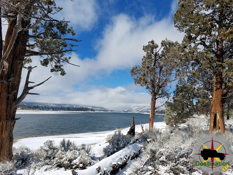
Big Bear, CA
I quiet mountain community full of back country adventure.
The Journey is the destination
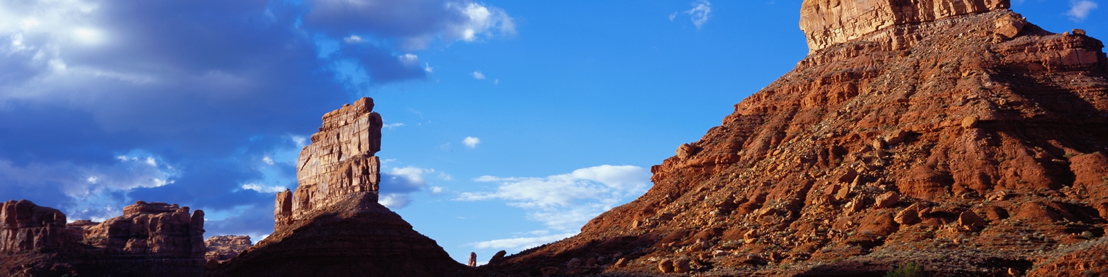
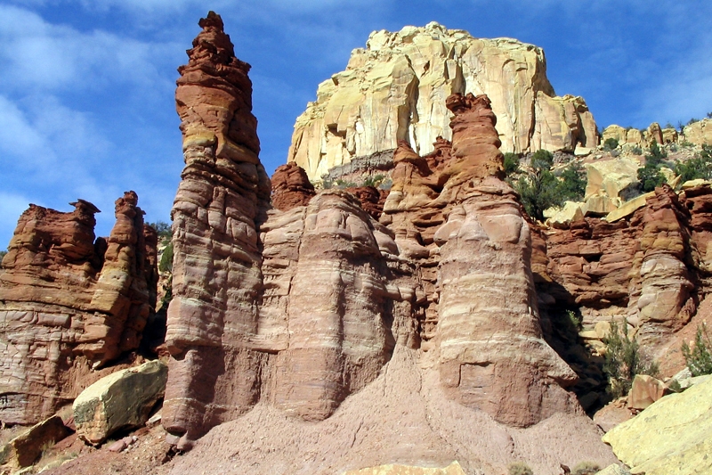

Klondike Bluffs Road is a rugged, off-the-beaten-path trail in the northwestern corner of Arches National Park, offering a remote adventure through a dramatic desert landscape. This 7-mile one-way dirt and gravel road (14 miles round-trip) connects Salt Valley Road to the Klondike Bluffs Trailhead, where a 1.6-mile hiking trail leads to the secluded Tower Arch. Best suited for high-clearance 4WD vehicles and experienced mountain bikers, the road is also navigable by determined hikers, though its length and exposure make hiking less common. The trail winds through a stark terrain of sandstone fins, rolling hills, and sandy washes, with expansive views of the Salt Valley, distant La Sal Mountains, and unique formations like the Marching Men—a cluster of eroded spires. Rated as moderate for 4WD vehicles and bikes, the road features sandy sections, rocky ledges, and washboard stretches, with an elevation gain of about 600 feet (ranging from 4,800 to 5,400 feet). The journey takes approximately 30-45 minutes by vehicle, 2-3 hours by bike, or 4-6 hours hiking round-trip, depending on pace and stops.
The trail begins at a junction with Salt Valley Road, about 15 miles from the park’s main entrance off Arches Scenic Drive (near 38.7675, -109.5847). From there, it heads northwest, passing through open desert before climbing gently into the Klondike Bluffs area. A highlight is the access to Tower Arch, a 92-foot-wide, secluded sandstone arch reachable via a 1.6-mile round-trip hike from the trailhead. The road’s remoteness offers solitude, with fewer visitors than popular park areas like the Windows Section. Spring (March–May) and fall (September–November) are ideal due to milder temperatures, as summer heat often exceeds 100°F, and winter may bring snow or muddy conditions. Weather can affect road conditions, with flash flooding possible in washes, so checking with the Arches Visitor Center is recommended.
Hiking Klondike Bluffs Road is rare due to its 14-mile round-trip length, lack of shade, and repetitive gravelly terrain, which some find tedious for foot travel. The road’s sandy and rocky surface makes for a strenuous trek, best attempted in cooler months with ample water and navigation tools (GPS or map). Mountain biking is more popular, offering a challenging yet rewarding ride through varied terrain. Cyclists must navigate deep sand and rocky ledges, often dismounting in tougher sections, and stay on designated roads to protect the fragile desert ecosystem, including cryptobiotic soil. The trail’s highlight is the 1.6-mile round-trip hike to Tower Arch from the Klondike Bluffs Trailhead, a moderately strenuous trek with slickrock scrambles and stunning views of the 92-foot arch framed by sandstone fins. Bikers and hikers should carry sun protection and expect minimal trail markers, with the open landscape potentially disorienting. The solitude and panoramic vistas, including the Marching Men formations, make the effort worthwhile.
Klondike Bluffs Road derives its name from the Klondike Bluffs, a series of eroded sandstone ridges and spires in the park’s northwestern region, shaped by geologic forces tied to the underlying Paradox Formation. This 300-million-year-old salt bed, deposited in an ancient evaporative basin, shifted and dissolved over time, causing the overlying Entrada Sandstone (formed 165 million years ago from Jurassic dune fields) to fracture and collapse. These processes created the park’s iconic arches and fins, including Tower Arch, accessible via the road. The trail’s path through this geologically dynamic area underscores its significance as a gateway to some of Arches’ most secluded features.
Historically, the Salt Valley region, which Klondike Bluffs Road traverses, was part of the broader Moab landscape inhabited by the Fremont and Ancestral Puebloan peoples until about 700 years ago. Nearby rock art sites, such as petroglyphs along Potash Road, suggest their cultural presence. Spanish missionaries encountered Ute and Paiute tribes in the region in 1775, and Mormon settlers attempted to establish the Elk Mountain Mission in 1855, abandoning it due to harsh conditions. Klondike Bluffs Road likely evolved from early ranching and exploration routes used by settlers and prospectors navigating the rugged terrain. Its integration into Arches National Park, established as a national monument in 1929 and a national park in 1971, highlights its role in providing access to remote geologic wonders like Tower Arch and the Marching Men.
The road’s proximity to paleontological sites, such as dinosaur tracks on nearby Willow Springs Road, reflects the region’s Jurassic heritage, when the area was a muddy floodplain roamed by dinosaurs. While no tracks are specifically documented on Klondike Bluffs Road, its connection to this fossil-rich area adds to its significance. Today, the road is valued by off-road enthusiasts and cyclists for its challenging terrain and serene isolation, offering a stark contrast to the park’s busier trails. National Park Service regulations emphasize responsible use to protect the delicate desert ecosystem, including cryptobiotic soil and rare plant species, ensuring the road remains a vital link to the park’s wild and storied landscape.

Salt Valley Road is a rugged, scenic backcountry route in Arches National Park, offering an adventurous journey through the park’s northern reaches. Stretching approximately 11.7 miles from the park’s main paved road (Arches Scenic Drive) to its intersection with Willow Springs Road near the park’s western boundary, this dirt and gravel trail is best suited for high-clearance 4WD vehicles and experienced mountain bikers, with hiking possible but rare due to its length and exposure. The road winds through the expansive Salt Valley, a broad basin framed by sandstone fins, distant buttes, and views of the La Sal Mountains, providing access to remote park features like Tower Arch and the Eye of the Whale Arch via connecting trails. Rated as moderate for 4WD vehicles and bikes, the trail features sandy washes, gravelly stretches, and occasional rocky sections, with an elevation change of about 600 feet (mostly gradual). The journey takes roughly 45-60 minutes by vehicle or 3-4 hours by bike, with hiking times varying based on pace.
The trail begins at a signed junction off Arches Scenic Drive, about 16 miles from the park’s entrance (near the Sand Dune Arch trailhead at 38.7675, -109.5847). It descends into the Salt Valley, passing through a landscape of sparse desert vegetation, including yucca and sagebrush, and offers panoramic vistas of formations like the Fiery Furnace and Klondike Bluffs. Key highlights include access to the Tower Arch Trail (a 2.4-mile round-trip hike from the road’s western end) and connections to West Valley Jeep Road and Willow Springs Road, which lead to additional backcountry features. The road’s condition varies with weather, with deep sand and washboard sections challenging drivers and cyclists, and flash flooding possible in washes after rain. Spring (March–May) and fall (September–November) are ideal, as summer heat exceeds 100°F, and winter may bring snow or mud.
Hiking Salt Valley Road is uncommon due to its 11.7-mile length, lack of shade, and repetitive gravelly terrain, which some describe as monotonous for foot travel. For hikers, the route is a long, exposed trek best suited for cooler months, following the road’s dirt and gravel path with no dedicated trail. Mountain bikers find it more appealing, navigating sandy washes and rocky sections, though deep sand may require dismounting. The road’s solitude and expansive views reward cyclists, but they must yield to vehicles and stay on designated routes to protect the fragile desert ecosystem, including cryptobiotic soil. A highlight is the detour to Tower Arch, accessible via a 1-mile spur road and a 1.2-mile hike from the road’s western end, offering stunning views of a secluded arch. Hikers and bikers should carry ample water, navigation tools (GPS or map), and sun protection, as trail markers are minimal, and the open valley can be disorienting.
Salt Valley Road derives its name from the underlying Paradox Formation, a 300-million-year-old salt bed that profoundly shaped Arches National Park’s geology. This salt layer, deposited in an ancient evaporative basin, shifted and dissolved over millions of years, causing the overlying Entrada Sandstone (formed 165 million years ago from Jurassic dune fields) to fracture and collapse. These processes created the park’s iconic arches, fins, and valleys, including the Salt Valley itself, a collapsed salt dome where the road now runs. The road’s path through this geologic wonderland highlights its significance as a corridor to the park’s remote northwestern features, offering access to formations rarely seen by casual visitors.
Historically, the Salt Valley area was part of the broader Moab region, inhabited by the Fremont and Ancestral Puebloan peoples until about 700 years ago, with nearby rock art sites (e.g., along Potash Road) attesting to their presence. Spanish missionaries encountered Ute and Paiute tribes in the region in 1775, and Mormon settlers attempted to establish the Elk Mountain Mission in 1855, abandoning it due to harsh conditions. Salt Valley Road likely evolved from early ranching and exploration routes, used by settlers and prospectors navigating the rugged terrain. Its integration into Arches National Park, established as a national monument in 1929 and a national park in 1971, cemented its role as a backcountry access route for adventurers seeking solitude and geologic marvels like Tower Arch.
The road’s significance also lies in its paleontological context, as the surrounding region, including nearby Willow Springs Road, hosts Jurassic-era dinosaur tracks, reflecting the area’s ancient history as a muddy floodplain. While no tracks are specifically documented on Salt Valley Road, its proximity to these sites underscores its place in a landscape rich with prehistoric evidence. Today, Salt Valley Road is cherished by off-road enthusiasts and cyclists for its challenging terrain and serene isolation, with National Park Service regulations emphasizing responsible use to protect the delicate desert ecosystem, including cryptobiotic soil and rare plant species. The road remains a vital link to the park’s wild heart, offering a glimpse into its geologic and cultural legacy.

In the red rocks and canyons of Arches National Park, where the desert’s heart beats in hues of fire and stone, Park Avenue stands as a grand corridor of towering sandstone monoliths, a natural boulevard sculpted by the hands of time. This dramatic landscape, one of the park’s most iconic vistas, stretches as a mile-long canyon flanked by colossal fins, spires, and buttes, their sheer faces rising like the skyscrapers of a primordial city. The formations, bathed in the golden blaze of dawn or the crimson glow of dusk, shimmer with shades of rust, ochre, and amber, their surfaces etched with the intricate scars of wind and fleeting rains. Among the towering giants, the Courthouse Towers loom at the southern end, their massive silhouettes evoking ancient sentinels guarding secrets of the desert. The scene is both humbling and majestic, a cathedral of stone where the silence of the desert hums with reverence, punctuated only by the whisper of wind or the distant cry of a raven.
Park Avenue’s monoliths, with their smooth, vertical faces and jagged crests, stand as a testament to nature’s artistry, their forms both resolute and transient. From the trail, the corridor feels alive, the towering walls seeming to lean inward, framing the sky as a ribbon of blue above a sea of red rock. Each formation, from the imposing Queen Nefertiti to the distant Three Gossips, carries its own character, yet together they form a cohesive gallery of geologic splendor, inviting awe and introspection.
Park Avenue’s dramatic landscape is carved primarily from the Entrada Sandstone, deposited approximately 165 million years ago during the Jurassic period, with contributions from the underlying Carmel Formation. The Entrada Sandstone, composed of fine quartz grains cemented by calcium carbonate and iron oxides, owes its vibrant red and orange hues to the iron’s oxidation, giving the rock its fiery desert palette. The formation of Park Avenue is a geologic epic of deposition, uplift, and erosion, shaped over millions of years by relentless natural forces.
During the Jurassic, vast dune fields and intermittent shallow seas blanketed the region, compacting into the Entrada Sandstone. Around 70 million years ago, the uplift of the Colorado Plateau elevated these sedimentary layers, exposing them to wind, water, and temperature fluctuations. Beneath the surface, the Paradox Formation—a thick layer of salt deposited 300 million years ago—played a critical role. As the salt shifted and dissolved, it caused fracturing and collapse in the overlying sandstone, creating joints and fins. Erosion, driven by water and wind, sculpted these fins into the towering monoliths and spires of Park Avenue. Differential erosion, where softer layers eroded faster than more resistant ones, carved the deep, linear corridor, leaving behind the vertical walls and isolated formations like the Courthouse Towers. This ongoing process continues to shape Park Avenue, a fleeting chapter in the geologic saga of Arches National Park.

The journey through Park Avenue is an accessible and awe-inspiring trek, inviting visitors to walk among giants. The Park Avenue Trail begins at the Park Avenue parking area, just 2 miles from the park’s entrance, and stretches 1 mile one-way to the Courthouse Towers parking lot, with a round-trip distance of 2 miles if you return to the starting point. Rated as easy, the trail features a gentle descent of about 320 feet, making it suitable for most hikers, including families, and typically takes 1-2 hours to complete. A shuttle or second vehicle is recommended for a one-way hike, though many choose to retrace their steps for different perspectives.
The trail begins with a paved path that transitions to packed dirt and slickrock, winding through a dramatic canyon flanked by towering sandstone fins and monoliths. As you descend, the formations rise higher, their sheer faces creating a corridor that feels both grand and intimate. Notable landmarks, like the Queen Nefertiti rock formation, resemble their namesakes from certain angles, while the distant Three Gossips and Courthouse Towers loom majestically. The trail is exposed, with minimal shade, so hikers should bring water, sunscreen, and sturdy shoes, especially in the desert’s intense summer heat. Winter may bring icy patches, but the trail remains accessible year-round. Sunrise or sunset hikes are particularly enchanting, when the monoliths glow with ethereal light, casting long shadows across the desert floor. Interpretive signs along the path offer insights into the geology and ecology, enriching the experience of walking through this natural skyscraper alley.
In Indiana Jones and the Last Crusade (1989), Park Avenue serves as a striking backdrop in the film’s opening sequence, set in 1912, which introduces a young Indiana Jones (River Phoenix) as a Boy Scout exploring the Utah desert. The Park Avenue area, with its towering monoliths and dramatic canyon, appears during scenes where Indy’s scout troop rides on horseback through the park. The corridor’s iconic formations, including the Courthouse Towers and nearby Three Gossips, are visible as Indy discovers grave robbers in a fictional cave and steals the Cross of Coronado, sparking a chase sequence. While the film does not linger on specific formations, Park Avenue’s grandeur enhances the adventurous tone, grounding Indy’s early exploits in a landscape of monumental beauty. The area’s rugged, open terrain and towering spires provide a cinematic stage for the high-energy chase, cementing Park Avenue’s role as a visual cornerstone of the film’s prologue.
In the heart of Arches National Park, where the desert stretches like a canvas painted in shades of fire and stone, the Double Arch rises as a monumental embrace of sandstone, a sculpture of nature’s boundless imagination. Two majestic arches, entwined like lovers frozen in a timeless waltz, emerge from a shared foundation of crimson rock, their graceful curves framing the endless sky. The larger arch sweeps boldly, its wide span a window to the vast desert beyond, while the smaller arch nestles intimately beside it, a delicate crescent whispering secrets to the stars. Bathed in the golden blaze of sunrise or the soft lavender of dusk, their surfaces glow with hues of rust, amber, and coral, etched with the intricate patterns of wind and time. Shadows dance across their smooth, sculpted faces, accentuating their contours and lending them an almost living presence—a silent symphony of stone that hums with the desert’s ancient heartbeat.

The Double Arch is a paradox of strength and fragility, its towering forms defying gravity yet bearing the delicate scars of erosion’s patient touch. From one angle, the arches blend into a singular, harmonious silhouette; from another, their distinct identities emerge, each arc a testament to the desert’s artistry. Surrounded by a rugged landscape of scattered boulders and resilient desert shrubs, the arches stand as a natural cathedral, inviting reverence and wonder in the quiet vastness of the park.
The Double Arch is carved from the Entrada Sandstone, a formation laid down roughly 165 million years ago during the Jurassic period. Composed of fine quartz grains cemented by calcium carbonate and iron oxides, this sandstone glows with the desert’s signature reds and oranges, its vibrant colors a gift of mineral alchemy. The arches’ creation is a geologic epic, shaped by deposition, uplift, and relentless erosion over millions of years.
In the Jurassic, vast dune fields blanketed the region, their sands compacting into the Entrada Sandstone. About 70 million years ago, the uplift of the Colorado Plateau thrust these layers skyward, exposing them to the elements. Beneath the surface, the Paradox Formation—a thick layer of salt deposited 300 million years ago—played a pivotal role. As the salt shifted and dissolved, it fractured the overlying sandstone, creating joints and fissures. Water, seeping into these cracks, eroded softer material, sculpting thin fins of resistant sandstone. The Double Arch formed as erosion hollowed out two parallel fins, eventually breaking through to create the twin spans we see today. The larger arch, with its expansive reach, and the smaller, more delicate arc reflect subtle variations in the sandstone’s composition, where harder layers resisted erosion while softer ones yielded. This ongoing dance of erosion continues to refine the arches, a fleeting chapter in the geologic story of Arches National Park.

The journey to Double Arch is a short, accessible pilgrimage, inviting visitors to step into the desert’s embrace. The trailhead begins at the Double Arch parking area in the Windows Section of Arches National Park, just a few miles from the park’s main entrance. This easy, 0.5-mile round-trip hike, rated as family-friendly, requires only about 15-30 minutes to complete, with minimal elevation gain (less than 40 feet). The path is a well-trodden, flat trail of packed dirt and sand, winding through a landscape dotted with sagebrush and twisted junipers, with the towering sandstone formations of the Windows Section looming in the distance.

As you approach, the Double Arch reveals itself gradually, its massive form emerging from behind rocky outcrops, a breathtaking crescendo that feels both intimate and grand. The trail leads directly to the base of the arches, where visitors can stand beneath their soaring spans, dwarfed by their scale. For those seeking a closer encounter, a gentle scramble over slickrock allows exploration beneath the arches, though caution is advised as the sandstone can be slippery. No technical gear is needed, but sturdy shoes and water are recommended, especially under the desert’s unrelenting sun. The trail offers no shade, but its brevity and the reward of standing in the arches’ shadow make it a must for any park visitor.
Along the way, interpretive signs provide insights into the geology and ecology, enriching the experience. The hike is most magical at sunrise or sunset, when the arches glow with ethereal light, casting long shadows across the desert floor. Accessible year-round, the trail may be dusty in summer or icy in winter, but its simplicity ensures that all can witness the Double Arch’s majesty, a fleeting yet eternal monument to the desert’s enduring artistry.
In Indiana Jones and the Last Crusade (1989), the Double Arch in Arches National Park, Utah, plays a brief but visually striking role in the film’s opening sequence, set in 1912. This scene introduces a young Indiana Jones (played by River Phoenix) as a Boy Scout exploring the desert with his troop. The Double Arch serves as a dramatic backdrop when the troop dismounts from their horses near this iconic formation in the Windows Section of the park. The arches’ towering, intertwined spans frame the rugged Utah landscape, emphasizing the adventurous spirit of young Indy’s early exploits.
The sequence centers on Indy’s discovery of grave robbers in a nearby cave (a fictional addition, as no such cave exists beneath Double Arch). After stealing the Cross of Coronado from them, believing it belongs in a museum, Indy flees, and the area around Double Arch is visible as he runs down a hill, pursued by the thieves. The arches’ majestic presence enhances the scene’s sense of grandeur and sets the tone for Indy’s lifelong quest for archaeological treasures. While the Double Arch itself is not a central plot element, its inclusion leverages the park’s iconic scenery to ground the film’s adventurous tone, making it a memorable part of the prologue’s high-desert setting.
In the sun-drenched heart of Arches National Park, where the desert’s pulse beats in shades of fire and stone, the North and South Window arches stand as twin sentinels of time, their majestic forms framing the infinite. Rising from the rust-red landscape of the Windows Section, these sandstone portals evoke the eyes of the desert, gazing out across a sea of sculpted rock and sagebrush.

The North Window, broad and commanding, stretches wide like an open embrace, its smooth, curved edges softened by eons of wind and rare rains. Its sibling, the South Window, mirrors it with a gentler arc, its slightly smaller span exuding quiet grace. Together, they form a pair of celestial frames, capturing slivers of sky—cerulean by day, ablaze with stars by night. Bathed in the golden fire of sunrise or the crimson glow of dusk, their surfaces shimmer with hues of ochre, coral, and amber, etched with the delicate scars of time’s patient hand.
The Windows stand as a study in harmony and contrast, their massive forms both grounded and ethereal. The North Window’s bold silhouette invites exploration, its cavernous opening a gateway to the vastness beyond, while the South Window, nestled nearby, offers a softer perspective, its frame cradling the horizon with tender intimacy. Surrounded by rugged fins and scattered boulders, they create a natural amphitheater, where the desert’s silence hums with reverence, broken only by the whisper of wind or the distant call of a canyon wren.
The North and South Window arches are carved from the Entrada Sandstone, a formation deposited approximately 165 million years ago during the Jurassic period. This sandstone, composed of fine quartz grains cemented by calcium carbonate and iron oxides, owes its vibrant red and orange palette to the iron’s oxidation, painting the rock with the desert’s fiery signature. The arches’ creation is a geologic saga of deposition, uplift, and erosion, shaped over millions of years by the relentless forces of nature.
During the Jurassic, vast dune fields blanketed the region, their sands compacting into the Entrada Sandstone. Around 70 million years ago, the uplift of the Colorado Plateau elevated these sedimentary layers, exposing them to wind, water, and temperature fluctuations. Beneath the surface, the Paradox Formation—a thick layer of salt laid down 300 million years ago—played a crucial role. As the salt shifted and dissolved, it caused fracturing and collapse in the overlying sandstone, creating joints and fins. Water and wind exploited these weaknesses, eroding softer material to sculpt the thin, vertical fins that would become the Windows. The North and South Window arches formed as erosion widened cavities within these fins, eventually breaking through to create their iconic openings. Differential erosion, driven by variations in the sandstone’s composition, shaped their distinct forms—the North Window’s broader, bolder span contrasting with the South Window’s more delicate arc. This ongoing process of erosion continues to refine the arches, a fleeting moment in the geologic tapestry of Arches National Park.

The journey to the North and South Window arches is an accessible adventure, inviting visitors to step into the desert’s timeless embrace. The trail begins at the Windows Section parking lot, located about 9 miles from the park’s entrance in the Windows Section of Arches National Park. The Windows Loop Trail, a 1-mile round-trip hike, is rated as easy to moderate, with a gentle elevation gain of about 150 feet, making it suitable for most visitors, including families. The hike typically takes 30-60 minutes, depending on pace and time spent marveling at the arches.
The trail, a mix of packed dirt, sand, and slickrock, winds through a starkly beautiful landscape of junipers, pinyon pines, and scattered sandstone boulders. As you approach, the Windows emerge dramatically, their towering forms rising against the horizon like ancient portals. The path splits, offering two options: a direct route to the base of the North Window, where hikers can scramble up slickrock for a closer view beneath its massive span, or a loop that circles around to the South Window, offering stunning perspectives of both arches and nearby Turret Arch. The North Window’s cavernous opening is particularly striking up close, its scale humbling, while the South Window, viewed from a slight distance, frames the desert landscape with serene elegance.

For a quieter experience, the primitive trail behind the arches provides a less-traveled loop, offering panoramic views of the Windows Section and a chance to appreciate the arches’ silhouettes against the sky. The trail is exposed, with little shade, so hikers should bring water, sunscreen, and sturdy shoes, especially in the desert’s intense summer heat. Winter may bring icy patches, but the trail remains accessible year-round. Sunrise or sunset hikes are particularly magical, when the arches glow with ethereal light, casting long shadows across the desert floor. Interpretive signs along the path provide insights into the geology and ecology, enriching the journey to these iconic monuments, where the desert’s artistry invites awe and contemplation.