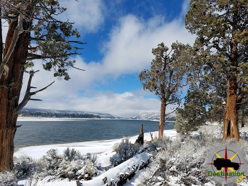
Applewhite Campground – San Bernardino National Forest
Peaceful Creekside Escape in San Bernardino National Forest

Applewhite Campground is a charming, no-frills forested campground nestled in Lytle Creek Canyon within California’s San Bernardino National Forest. Located about three miles north of the Lytle Creek Ranger Station (roughly 487-490 Lytle Creek Road, Lytle Creek, CA 92358), it’s an easy getaway for Southern Californians—especially those in the LA/Inland Empire area—offering a refreshing mountain escape just an hour or two from the city bustle.
Setting and Atmosphere
The campground sits in a scenic canyon with Lytle Creek flowing right across the street at the adjacent Applewhite Picnic Area (note: the picnic area has faced closures due to storm damage or seasonal issues). Towering trees provide good shade for many sites, and the surrounding hills create a tranquil, natural vibe. Sites are spread out with generous spacing, giving a sense of privacy uncommon in many popular campgrounds. There are two loops: the Upper Loop often praised for better canyon views, and the Lower Loop offering more shade and spacious sites.
Each of the 44 single-family sites (plus a few double sites) includes:
- A paved parking spur (suitable for tents, trailers, and smaller RVs, though narrow in spots)
- Picnic table
- Fire ring with grill
Maximum occupancy is typically 8 people and 2 vehicles per site. Quiet hours run from 10 PM to 6 AM.
Amenities
Applewhite keeps things basic but functional:
- Restrooms: Accessible flush toilets (highly praised for cleanliness when operational).
- Water: Potable water spigots (subject to occasional outages—always check current conditions and bring extra water).
- Trash collection and dumpsters.
- No showers, no electric hookups, and no sewer/dump station on site.
- Campfire allowed (check fire restrictions, especially in dry seasons).
- Pets allowed.
- Campground hosts are usually present.
Recent reviews mention that during water outages, portable toilets are provided. Conditions can vary, so it’s wise to verify via Recreation.gov before heading out.
Activities in the Area
Applewhite is ideal for relaxed outdoor recreation rather than high-adrenaline thrills:
- Creek Play: Wade, splash, and relax in the shallow waters of Lytle Creek (great for kids and cooling off).
- Hiking & Nature Walks: Short day hikes in the Lytle Creek area. Nearby Bonita Falls is a popular, relatively easy hike with rewarding views.
- Picnicking: The picnic area across the road offers BBQ grills when open.
- Wildlife Viewing, Bird Watching, Photography, and Stargazing: Excellent due to the forested setting.
- OHV/Off-Roading: Opportunities in the nearby Cajon Pass area (about 20 minutes away). Maps available at the ranger station.
- Other options: Backpacking, mountain biking, horseback riding, and exploring historic sites in the broader national forest.
It’s a family-friendly spot perfect for beginners, with a low-stress atmosphere and plenty of space for kids to roam safely.
Pros and Cons
Pros:
- Close to major cities yet feels remote.
- Spacious, shaded sites with good privacy.
- Beautiful natural setting with easy creek access.
- Clean facilities (when maintained).
- Affordable and straightforward reservation system through Recreation.gov.
Cons:
- No hookups or showers — true “roughing it” for RVers.
- Water outages have been reported recently.
- Narrow roads and parking spurs may challenge larger RVs.
- Can get busy on weekends; fire restrictions or seasonal closures apply.
- Limited cell service in spots.
Overall Verdict
Applewhite Campground earns solid marks as a convenient, scenic basecamp for anyone seeking an accessible mountain getaway. It’s not luxury glamping, but that’s part of its charm—simple, affordable, and surrounded by nature. Whether you’re looking for a quick weekend tent trip, family bonding by the creek, or a launching pad for day hikes and OHV adventures, it delivers. Just come prepared with water, check conditions, and embrace the unplug-and-relax vibe. Highly recommended for Southern California campers wanting quality time outdoors without a long drive.
Reservations are strongly advised, especially in peak seasons. Check the latest alerts on Recreation.gov or the San Bernardino National Forest site. Enjoy your stay!
Borate and Daggett Railroad

The Borate and Daggett Railroad, a 3-foot narrow-gauge railway operational from 1898 to 1907 in California’s Mojave Desert, was a critical infrastructure project for the borax industry. Stretching 11 miles from Daggett to the Borate mining camp, it replaced inefficient mule teams, significantly reducing transportation costs for colemanite borax. Built by the Pacific Coast Borax Company under Francis Marion Smith, the railroad featured innovative engineering, including Heisler locomotives and a roasting mill for on-site ore processing. Despite its success, declining ore quality and the discovery of richer deposits elsewhere led to its abandonment in 1907.
Background

The borax industry gained prominence in the late 19th century due to the mineral’s applications in detergents, glass, and metallurgy. In 1883, colemanite deposits were discovered in the Calico Mountains, acquired by William Tell Coleman, who relied on twenty-mule teams to transport borax to railheads. After Coleman’s bankruptcy in 1890, Francis Marion Smith, the “Borax King,” took over, forming the Pacific Coast Borax Company. By 1899, the renamed Borate mine was the world’s largest, producing 22,000 short tons annually. The high cost and slow pace of mule teams necessitated a more efficient transport solution, leading to the railroad’s construction.
Construction and Design
Completed in 1898, the Borate and Daggett Railroad was a 3-foot narrow-gauge line designed to navigate the Calico Mountains’ 7% grades. The 11-mile route connected the Borate mine to Daggett, a Santa Fe mainline hub. Two Heisler steam locomotives, “Marion” and “Francis,” powered the line, leveraging geared drive systems for steep terrain. A roasting mill at the midpoint, named Marion, processed ore into burlap bags, and a third rail facilitated transfers to standard-gauge boxcars. The narrow gauge design and Heisler technology minimized costs while ensuring reliability in the harsh desert environment.
Operations and Economic Contributions
![Borate & Daggett Heisler locomotive #2 "Francis" (s/n 1026), at Daggett, California in 1910. The locomotive helped to construct the Death Valley Railroad in 1913, before being sold to the Nevada Short Line Railway in 1916 where it retained its number #2.[4] It ended its days working for the Terry Lumber Company (later Red River) at Round Mountain, California until about 1925.](https://i0.wp.com/www.destination4x4.com/wp-content/uploads/2025/05/Borate__Daggett_No._2_Francis_stored_at_Daggett_CA.png?resize=796%2C370&ssl=1)
From 1898 to 1904, the railroad was integral to the Pacific Coast Borax Company’s operations, transporting large colemanite volumes at lower costs than mule teams. The Marion mill enhanced efficiency by processing ore on-site. The railroad bolstered
Daggett’s role as a regional hub, supporting jobs and infrastructure. However, narrow gauge limitations, such as small train capacities, occasionally constrained output. At its peak, the railroad underpinned Borate’s status as the world’s leading borax mine, driving economic growth in the Mojave Desert.
Decline and Abandonment

By 1904, Borate’s colemanite quality declined, prompting Smith to focus on richer deposits at the Lila C. Mine in Death Valley. The Tonopah and Tidewater Railroad, completed in 1907, served the new mine, rendering the Borate and Daggett Railroad
obsolete. Mining at Borate ceased in 1907, and the railroad was abandoned. Rails were scrapped, and equipment was left in Daggett or repurposed for the Death Valley Railroad. The Heisler locomotives were later sold to the Forest Lumber Company in Oregon until they closed in 1939.
Legacy
The Borate and Daggett Railroad demonstrated the efficacy of narrow-gauge systems for mineral transport, influencing projects like the Death Valley Railroad. Its equipment reuse and documented history, including photographs and railbeds, preserve its legacy . The railroad exemplifies the interplay of technology and economics in the borax industry, highlighting the transient nature of resource-driven infrastructure in the American West.
Borate and Daggett Railroad Summary
| Name | Borate and Daggett Railroad |
| Location | Mojave Desert, San Bernardino, California |
| Length | 11 miles |
| Gage | Narrow Gauge – 3 feet (914 mm) |
| Operational |
Borate and Daggett Railroad Map
The Needles Campground

Needles Campground, also known as Squaw Flat Campground, is the primary developed camping area within the Needles District of Canyonlands National Park in southeastern Utah. Situated about 3 miles west of the Needles Visitor Center along the main park road (UT-211), it provides a convenient base for exploring the district’s iconic sandstone spires, hiking trails, and backcountry routes. The campground is open year-round and offers a rustic desert camping experience amid red rock formations, piñon-juniper woodlands, and expansive views of the surrounding canyons. It’s ideal for tent campers, small RVs (up to 28 feet in length due to tight turns and limited maneuvering space), and groups seeking immersion in the park’s remote beauty, though it lacks modern conveniences like hookups or showers to preserve the natural environment.
The campground features 26 individual sites divided into two loops (A and B), plus three group sites for larger parties. Loop A operates on a first-come, first-served basis year-round, while Loop B allows reservations during peak seasons (March 15–June 30 and September 1–October 31) up to six months in advance via Recreation.gov. Group sites accommodate 11–50 people and are also reservable. Each individual site includes a picnic table, fire ring with grill, and space for up to 10 people and 2 vehicles. Amenities are basic: vault toilets are available, but there is no potable water on-site (visitors must fill up at the visitor center), no electricity, no dump station, and no showers. Trash and recycling collection is provided, and firewood gathering is prohibited—bring your own or purchase it locally. Generator use is restricted to specific hours (typically 8 a.m.–10 a.m. and 4 p.m.–8 p.m.) to minimize noise.
Fees are $20 per night for individual sites and range from $90 (11–20 campers) to $135 (21–30 campers) for group sites, with a $10 discount for holders of Interagency Senior or Access passes. Check-in is after 8:30 a.m., and check-out is by 10 a.m., with a 7-day camping limit during peak seasons. Reservations can fill quickly, especially in spring and fall when temperatures are mild (daytime highs 60–80°F), so booking early is recommended; otherwise, arrive early for first-come sites. Regulations emphasize low-impact practices: pets must be leashed (and are not allowed on trails), quiet hours are 8 p.m.–8 a.m., and all food must be stored properly to avoid attracting wildlife like ravens or rodents. Visitors should prepare for extreme weather—hot summers (over 100°F with no shade), cold winters (below freezing), and potential flash floods—and carry ample water (at least 1 gallon per person per day). The campground’s proximity to trails like Chesler Park and Elephant Hill makes it a hub for day hikes, but its remote location (75miles from Moab) means no nearby services; stock up on supplies in Monticello or Moab..
Campground Map
Description and History of the Needles Region of Canyonlands National Park
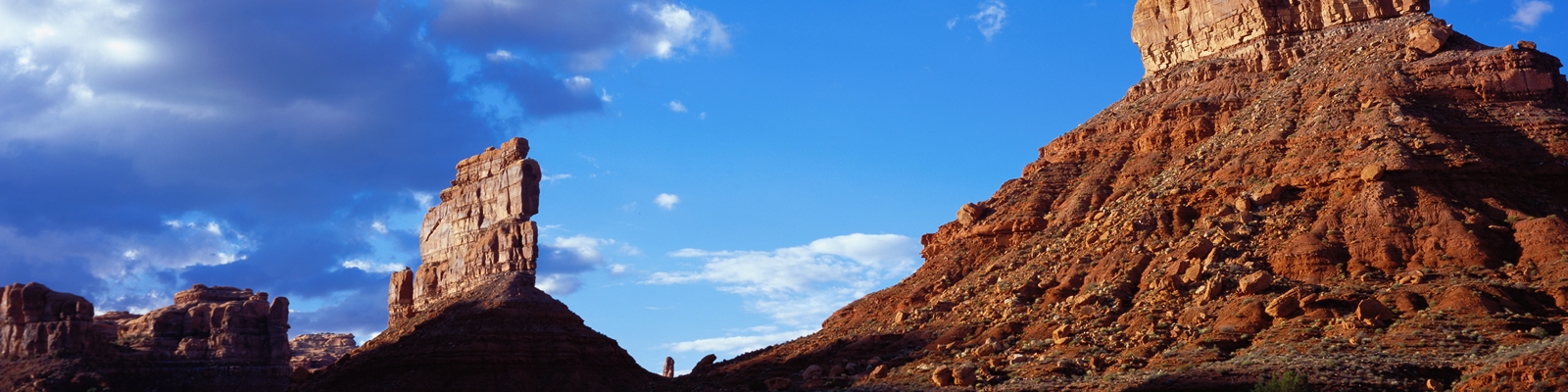
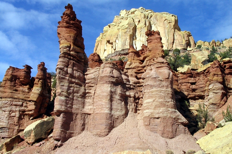
The Needles District, encompassing the southeastern portion of Canyonlands National Park, is renowned for its striking landscape of multicolored sandstone spires, towers, and fins formed from Cedar Mesa Sandstone, creating a maze-like terrain of red-and-white banded rock formations that resemble needles piercing the sky. Covering about 74 square miles, it’s the most accessible yet least crowded district of the park, located roughly 40 miles south of Moab or 14 miles north of Monticello via US-191, then 35 miles west on the paved UT-211 (which dead-ends in the park). The area features dramatic canyons, grassy meadows like Chesler Park, ancient ruins, and panoramic overlooks such as Confluence Overlook, where the Green and Colorado Rivers meet. Elevation ranges from 4,500 to 6,000 feet, supporting sparse desert vegetation including yucca, prickly pear cactus, and piñon pines, with wildlife like bighorn sheep, coyotes, and golden eagles commonly spotted.
Activities center on exploration: over 60 miles of hiking trails (from short loops like Slickrock Foot Trail to multi-day backpacks into Salt Creek), 50 miles of challenging four-wheel-drive roads (e.g., Elephant Hill, one of the toughest in Utah with steep switchbacks and rock ledges), and rock climbing on the sandstone features. Backcountry permits are required for overnight stays outside developed areas, and ranger-led programs (evening talks at the campground April–June and September–November) educate on geology, ecology, and history. The Needles Visitor Center, open spring through fall, provides exhibits, maps, permits, and a year-round water filling station. The district’s remoteness fosters solitude, but visitors must prepare for limited cell service, no fuel or food in the park, and variable weather—flash floods in monsoon season (July–September) or snow in winter.
Human history in the Needles spans over 10,000 years, beginning with Paleoindians who hunted big game and gathered plants in the post-Ice Age era. By 2,000 years ago, Ancestral Puebloans (formerly called Anasazi) thrived here, farming corn, beans, and squash in the fertile canyons, constructing granaries, dwellings, and rock art panels (petroglyphs and pictographs) that remain visible today, such as at Tower Ruin or Newspaper Rock nearby. These peoples left around 1300 CE due to drought or resource depletion, with later Ute, Paiute, and Navajo groups using the area seasonally. European exploration began in the 19th century, notably with John Wesley Powell’s 1869 and 1871 expeditions down the Green and Colorado Rivers, which mapped the canyons but bypassed much of the Needles interior.
In the early 20th century, cowboys grazed cattle in the grassy parks, and the 1950s uranium boom brought prospectors who built primitive roads (now used for 4WD trails) while searching for ore, inadvertently opening the area to outsiders. The park’s creation stemmed from the 1950s advocacy of Bates Wilson, superintendent of nearby Arches National Monument, who explored the Needles in 1959 and pushed for protection amid growing interest in desert preservation under President Kennedy’s administration. Canyonlands National Park was established on September 12, 1964, by President Lyndon B. Johnson, encompassing the Needles as one of its three districts (along with Island in the Sky and The Maze). Early controversies in the 1960s–1970s centered on development: initial plans for extensive roads (e.g., to Chesler Park) clashed with wilderness advocates, leading to limited access and a focus on backcountry preservation. Today, the Needles embodies this balance, protecting cultural sites under the Antiquities Act while offering low-impact recreation, with ongoing efforts to collaborate with Tribal nations on heritage management.
Bullfrog Miner

The Bullfrog Miner was a weekly newspaper that served the burgeoning mining communities of the Bullfrog Mining District in Nye County, Nevada, during the early 20th century. Published between 1905 and 1909, the newspaper chronicled the rapid rise and eventual decline of the region’s gold and silver mining boom, providing a vital source of local news, mining updates, and community developments. This report explores the historical context, publication details, content, and significance of The Bullfrog Miner, drawing on available archival information.
Historical Context
The Bullfrog Mining District, located in the Bullfrog Hills of southern Nevada, emerged as a significant mining hub following the discovery of gold in 1904. The initial strike sparked a rush that led to the establishment of settlements such as Bullfrog, Rhyolite, and Beatty. By 1905, the region was bustling with activity, with an estimated 3,000 residents, numerous mining companies, and infrastructure developments like railroads and telegraph lines. The economic prosperity, however, was short-lived, as the San Francisco earthquake of 1906 and subsequent financial challenges led to a decline in mining activity by 1909.
The Bullfrog Miner was launched at the peak of this boom to serve the informational needs of the district’s residents, miners, and investors. It competed with other local newspapers, such as the Rhyolite Herald and the Beatty Bullfrog Miner, in a region where media played a critical role in promoting optimism and attracting investment.
Publication Details
- Publication Period: March 31, 1905, to September 25, 1909.
- Frequency: Weekly.
- Locations:
- Initially published in Bullfrog, Nye County, Nevada, by the Bullfrog Miner Print Company.
- Later moved to Rhyolite, Nevada, by March 1906, reflecting the shift of economic activity to the larger town.
- Publisher: F.P. Mannix is noted as a key publisher during its run.
- Volume and Issues: The newspaper began with Volume 1, Number 1, on March 31, 1905, and ceased with Volume 5, Number 27, on September 25, 1909.
- Availability: Microfilm copies are available from Bay Microfilm, and some issues may be held by libraries, as noted in the Library of Congress records.
A notable error in the newspaper’s publication occurred in the January 12, 1906, issue, which was misdated as January 12, 1905, likely due to a typesetting mistake.
Content and Role
The Bullfrog Miner covered a wide range of topics relevant to the mining district:
- Mining News: Reports on mine developments, such as the West Extension Mine’s progress and ore discoveries, were central to the newspaper’s content. For example, it documented the West Extension’s shift to large-scale development in 1906 and its later financial troubles in 1909.
- Local Events: The newspaper reported on community activities, including the establishment of post offices, banks, and businesses, as well as social events like the formation of the Rhyolite Symphony Orchestra.
- Infrastructure Developments: It highlighted significant projects, such as the completion of telephone lines to Bullfrog and Rhyolite in 1906 and the Bullfrog-Goldfield Railroad’s operations.
- Economic Optimism: Like many boomtown newspapers, The Bullfrog Miner maintained a positive tone to sustain investor confidence, rarely reporting discouraging news even as the district’s fortunes waned.
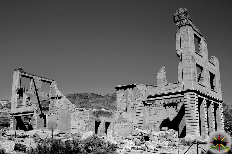
The newspaper also reflected the competitive dynamics of the region. As Rhyolite emerged as the district’s metropolis, The Bullfrog Miner relocated there, and its coverage increasingly focused on Rhyolite’s growth, including the construction of major buildings like the Overbury building and the establishment of a miners’ union hospital.
Significance
The Bullfrog Miner was more than a local news outlet; it was a cultural and economic artifact of the Bullfrog Mining District’s brief but intense boom. Its significance lies in several areas:
- Historical Record: The newspaper provides a primary source for understanding the daily life, economic activities, and social dynamics of the Bullfrog Mining District. It captures the optimism of the 1905–1906 boom and the challenges faced during the decline.
- Community Identity: By reporting on local achievements and developments, The Bullfrog Miner fostered a sense of community among the district’s diverse population of miners, promoters, and settlers.
- Economic Promotion: The newspaper played a role in attracting investment by highlighting the district’s potential, even as financial difficulties mounted after the 1906 San Francisco earthquake.
- Archival Value: Despite its short run, the newspaper’s surviving issues offer valuable insights for historians studying Nevada’s mining history, particularly the boom-and-bust cycle that characterized the state’s economy.
Decline and Closure
The Bullfrog Miner’s closure in September 1909 was emblematic of the broader decline of the Bullfrog Mining District. Several factors contributed to its demise:
- Economic Downturn: The San Francisco earthquake and fire of 1906 disrupted financial markets, weakening investor confidence in mining ventures. By 1909, many mines, including the West Extension, were idle or facing lawsuits.
- Population Decline: As mining operations slowed, residents left the district. The 1909 tax rolls revealed that 28% of property owners abandoned their holdings, followed by 44% in 1910.
- Competition: The Rhyolite Herald and other local publications outlasted The Bullfrog Miner, which struggled to maintain relevance as Rhyolite’s dominance grew.
- Closure of Local Institutions: The failure of two Rhyolite banks and the closure of the Rhyolite Daily Bulletin in May 1909 signaled the district’s economic collapse, leaving The Bullfrog Miner with a dwindling readership.
Conclusion
The Bullfrog Miner was a vital voice of the Bullfrog Mining District during its brief but vibrant existence. From its first issue in 1905 to its final publication in 1909, it documented the hopes, achievements, and challenges of a community driven by the promise of gold and silver. While its optimistic reporting could not forestall the district’s decline, the newspaper remains a valuable historical resource, offering a window into Nevada’s mining frontier. Researchers can access its microfilm archives to explore the stories of a boomtown era that shaped the region’s identity.
References
- Library of Congress, Chronicling America: The Bullfrog Miner (Bullfrog, Nye County, Nev.) 1905–1909.
- Legends of America: Bullfrog Mining District, Nevada.
- Rhyolite.org: The Bullfrog and Its Associated Mining Districts.
- Mindat.org: Bullfrog Mining District, Bullfrog Hills, Nye County, Nevada, USA.
Bishop Park Campground – Inyo National Forest

Bishop Park Campground is a scenic, high-elevation campground in Inyo National Forest along the Middle Fork of Bishop Creek, just west of the town of Bishop, California. Situated at approximately 8,400 feet in the beautiful Bishop Creek Canyon of the Eastern Sierra Nevada, it offers a serene alpine setting with grassy lawns, direct creek access, and many walk-in tent sites right along the water.
The campground is popular with families, anglers, and outdoor enthusiasts due to its peaceful creekside location, proximity to trailheads into the John Muir Wilderness, and easy access to nearby lakes and attractions. It features a mix of sites, though it is best suited for tents and smaller RVs (large rigs and trailers are generally not recommended). Many sites have beautiful views of the surrounding mountains and aspen groves, which turn vibrant in the fall.
Amenities
Bishop Park Campground typically includes the following facilities:
- 21 single-family campsites (many walk-in tent sites; a few suitable for smaller vehicles/RVs).
- Picnic tables, fire rings with grills, and tent pads at each site.
- Bear-proof food storage lockers (essential, as this is an active bear area).
- Flush toilets.
- Potable drinking water.
- Trash collection.
- Grassy areas and creekside access.
- Group camping options are available nearby at the Bishop Park Group site.
No hookups, showers, or dump stations are available. Reservations are strongly recommended (often required) through Recreation.gov, especially during peak summer months. Firewood may be available for purchase, and camp hosts are usually on site.
Activities
The campground and surrounding area support a wide range of outdoor recreation:
- Fishing: Excellent creek fishing right from many campsites for rainbow, brown, brook, and Alpers trout. Intake Lake II is just upstream for additional opportunities. Nearby Lake Sabrina is also popular.
- Hiking: Direct access to trails into the John Muir Wilderness, with routes leading to alpine lakes, glaciers, and backcountry terrain. Popular nearby trails include those toward Bishop Pass and other high Sierra destinations.
- Horseback riding: Available via local pack stations; trails are suitable for riders.
- Wildlife viewing: Prime location for observing animals in their natural habitat.
- Other activities: Picnicking, photography (especially fall colors), stargazing (dark skies at elevation), relaxing by the creek, and exploring nearby lakes and aspens. The area also serves as a great base for day trips to Mammoth Lakes, Ancient Bristlecone Pine Forest, or Mono Lake.
Wildlife in the Area
The Eastern Sierra around Bishop Park is rich in biodiversity. Common and notable wildlife includes:
- Mammals: Mule deer (very common), black bears (frequent visitors—proper food storage is mandatory), coyotes, bobcats, mountain lions (less commonly seen), marmots, jackrabbits, and occasionally bighorn sheep (Sierra and Desert varieties in the broader region).
- Birds: Various songbirds, raptors like golden eagles, and waterfowl near lakes and streams.
- Other: Wild mustangs (in certain nearby areas), and smaller rodents/reptiles typical of the alpine and high-desert transition zones.
Note: Always practice bear safety—keep a clean camp and use provided bear boxes. Pets must be leashed, and feeding wildlife is prohibited.
Bishop Park Campground makes an ideal base for exploring the Eastern Sierra’s natural wonders, combining convenient amenities with immersive wilderness access. It’s especially lovely in summer for escaping valley heat and in autumn for fall foliage. Always check current conditions, fire restrictions, and availability on Recreation.gov or the Inyo National Forest website before planning your trip.