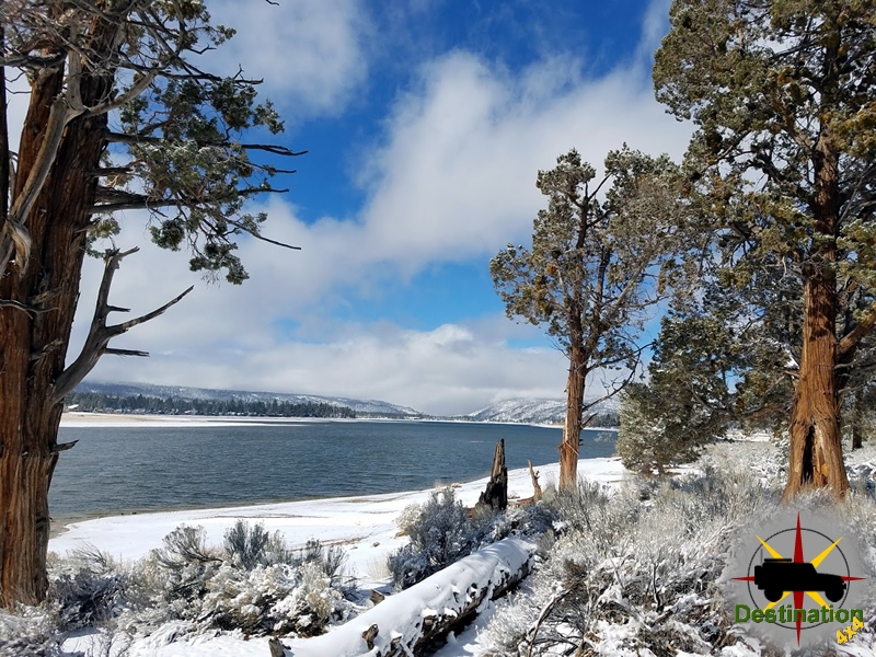
Big Bear, CA
I quiet mountain community full of back country adventure.
The Journey is the destination
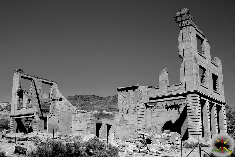
Panamint City, California, was a fleeting silver mining boomtown in the rugged Panamint Valley, established in 1873 following the discovery of silver in Surprise Canyon. At its peak in 1874–1875, the town housed approximately 2,000 residents and boasted saloons, stores, a post office, and a newspaper, the Panamint News. This report examines the history, purpose, and significance of the Panamint News within the context of Panamint City’s brief existence, relying on limited historical records and secondary sources.
Panamint City emerged during a wave of mining excitement in the American West, spurred by silver discoveries in the Panamint Mountains. Founded by prospectors, including Richard C. Jacobs and William L. Kennedy, the town grew rapidly after the formation of the Panamint Mining District in 1873. By 1874, the town featured a mile-long main street, a Wells Fargo office, and several mills to process silver ore. The boom was driven by speculative investment, notably from Nevada senators John P. Jones and William M. Stewart, who promoted the region’s potential.
However, Panamint City’s prosperity was short-lived. The remote location, coupled with declining ore quality and a devastating flash flood in 1876, led to the town’s rapid decline. By 1877, most residents had abandoned Panamint City, leaving it a ghost town. In this transient environment, the Panamint News served as a critical tool for communication and community cohesion.
The Panamint News was established in November 1874, during Panamint City’s peak. Published by T.S. Harris and edited by E.M. Boyle, the newspaper operated as a weekly or semi-weekly publication, though exact publication frequency is unclear due to scarce records. Its office was located in Panamint City’s bustling commercial district, likely near the main street where businesses like the Oriental Saloon thrived.
As a frontier newspaper, the Panamint News was likely printed on a small, hand-operated press, a common setup for mining town publications. The newspaper’s staff probably consisted of a small team, with Harris and Boyle handling writing, editing, and printing. No complete surviving copies of the Panamint News are known to exist in major archives, such as the California Digital Newspaper Collection or Chronicling America, but references to the paper appear in historical accounts of Panamint City and contemporary newspapers like the Inyo Independent.
Drawing on the conventions of 19th-century mining town newspapers, the Panamint News likely included:
The Panamint News aimed to foster a sense of community among Panamint City’s diverse population, which included miners, merchants, and speculators. It also served as a promotional tool, boosting the town’s image to attract investment and settlers. Editorials may have reflected the optimistic tone of the boom years, downplaying challenges like the town’s isolation or the volatility of silver mining.
Operating a newspaper in a remote desert town posed significant challenges. The Panamint News faced high costs for printing supplies, which had to be transported over rugged terrain from coastal cities like Los Angeles or San Francisco. Distribution was limited to Panamint City and nearby mining camps, constraining subscription and advertising revenue. The town’s transient population further complicated efforts to maintain a stable readership.
The Panamint News ceased publication by late 1875 or early 1876, as Panamint City’s economy collapsed. The flash flood of July 1876, which destroyed much of the town’s infrastructure, likely marked the final blow. The newspaper’s short lifespan reflects the broader instability of boomtowns, where media outlets depended on the fleeting prosperity of mining.
The Panamint News played a vital role in Panamint City’s brief history. It documented the town’s aspirations, promoted economic activity, and provided a platform for local discourse. In a lawless and isolated community, the newspaper likely helped establish a sense of order and identity, even if only temporarily. Its existence underscores the ambition of Panamint City’s residents to build a lasting settlement, despite the harsh realities of the desert environment.
The Panamint News also reflects the broader role of newspapers in the American West, where print media served as both a record of frontier life and a tool for speculative boosterism. While the newspaper’s content is largely lost, its presence in historical accounts highlights its importance to Panamint City’s social fabric.
This report relies on secondary sources, including historical accounts of Panamint City from websites like DesertUSA and the Death Valley National Park archives, as well as books like Mines of the Mojave by Ronald Dean Miller. References to the Panamint News appear in passing in regional histories and contemporary newspapers, such as the Inyo Independent, which noted the paper’s launch in 1874. No primary sources, such as original issues of the Panamint News, were located in digital archives or regional collections.
The lack of surviving copies poses significant limitations. Details about the newspaper’s content, circulation, and staff are speculative, based on patterns observed in similar mining town publications. Future research could involve exploring archives at the Inyo County Historical Society or the Bancroft Library at UC Berkeley for potential fragments or references to the Panamint News. Physical surveys of Panamint City’s ruins, though unlikely to yield intact newspapers, might uncover related artifacts.
The Panamint News was a short-lived but significant institution in Panamint City, California, operating during the town’s silver mining boom of 1874–1875. As a source of news, promotion, and community identity, it reflected the optimism and challenges of a frontier boomtown. Its disappearance, likely by 1876, mirrors the rapid decline of Panamint City itself, a casualty of economic and environmental hardships. While the Panamint News remains an obscure chapter in California’s media history, its story illuminates the fleeting vitality of the American West’s mining frontier. Further archival research is needed to uncover additional details about this elusive publication.
Vanderbilt, California, was a fleeting gold mining town in the Mojave Desert, established in 1891 following the discovery of gold in the New York Mountains. At its height in 1893–1894, the town boasted a population of several hundred, with amenities including saloons, a post office, a school, and various businesses. Among these was The Shaft, a local newspaper that served the community during its brief existence.
Vanderbilt emerged during a period of intense mining activity in Southern California, spurred by gold discoveries in the 1890s. The town was named after Cornelius Vanderbilt, reflecting the era’s fascination with industrial magnates. Key mines, such as the Boomerang and Gold Bronze, drove the local economy, attracting prospectors, merchants, and families. By 1893, Vanderbilt had a post office, a Wells Fargo station, and a chamber of commerce, indicating a structured community despite its remote location. However, the town’s prosperity was short-lived; declining ore quality and economic shifts led to its abandonment by the early 1900s.
Newspapers in mining towns like Vanderbilt were critical for disseminating local news, mining updates, and advertisements, while also fostering community identity. The Shaft, as Vanderbilt’s primary newspaper, likely played a similar role, though specific details about its operations are scarce due to the town’s rapid decline and the loss of archival records.
The Shaft is believed to have been established around 1892 or 1893, coinciding with Vanderbilt’s peak. While no surviving copies of the newspaper have been identified in major archives, such as the California Digital Newspaper Collection or Chronicling America, references to The Shaft appear in secondary sources discussing Vanderbilt’s history. The newspaper’s name, a playful nod to mining terminology, suggests it catered to the town’s mining-centric culture.
As a typical small-town newspaper of the era, The Shaft likely operated on a weekly or biweekly schedule, produced using a modest printing press. It would have included local news, mining reports, advertisements for businesses (e.g., saloons, general stores, and assay offices), and possibly regional or national news reprinted from larger publications. The editor and staff were likely local residents, possibly including figures prominent in Vanderbilt’s civic life, such as merchants or mine owners.
Based on the conventions of 19th-century mining town newspapers, The Shaft probably covered:
The newspaper would have served as a unifying force, connecting Vanderbilt’s diverse residents—miners, families, and entrepreneurs—while promoting economic activity. It may also have reported on challenges, such as the town’s isolation or the fluctuating profitability of the mines.
Operating a newspaper in a remote mining town presented significant challenges. The cost of printing equipment, paper, and ink, combined with the logistical difficulties of distribution in the Mojave Desert, would have strained The Shaft’s finances. The newspaper likely relied on subscriptions and advertising revenue, but Vanderbilt’s small population limited its market. As the town’s economy faltered in the late 1890s due to declining gold yields, The Shaft would have faced dwindling readership and revenue.
By 1900, Vanderbilt was nearly deserted, with most residents moving to nearby towns like Searchlight, Nevada, or Barnwell, California. The Shaft ceased publication around this time, leaving no known surviving issues. The lack of preserved copies may be attributed to the town’s rapid abandonment, the perishable nature of newsprint, and the absence of local institutions to archive records.
Despite its brief existence, The Shaft was a vital part of Vanderbilt’s community. It provided a platform for local discourse, documented the town’s aspirations, and reflected the optimism of the gold rush era. The newspaper’s role in fostering civic engagement and economic activity underscores the importance of print media in 19th-century frontier towns.
The absence of surviving issues limits our understanding of The Shaft’s content and impact. However, its existence highlights the ambition of Vanderbilt’s residents to establish a lasting community, even in the face of environmental and economic challenges. The newspaper’s story parallels that of Vanderbilt itself: a brief moment of vitality followed by obscurity.
This report draws on secondary sources, including historical accounts of Vanderbilt available through websites like Destination4x4 and MojaveDesert.net, which mention The Shaft in passing. No primary sources, such as original copies of the newspaper, were located in digital archives like Chronicling America or the California Newspaper Project. The Bureau of Land Management’s records on Southern California mining provide context but do not reference The Shaft specifically.
The scarcity of primary sources poses significant limitations. Future research could involve exploring regional archives, such as those at the San Bernardino County Historical Society or the University of California, Riverside, for potential microfilm or references to The Shaft. Oral histories from descendants of Vanderbilt residents, if available, might also yield insights.
The Shaft newspaper was a short-lived but significant institution in Vanderbilt, California, reflecting the town’s brief prominence as a gold mining hub in the 1890s. While details about its operations and content are limited, it likely served as a vital source of news and community cohesion. Its disappearance mirrors the fate of Vanderbilt itself, a ghost town lost to the shifting fortunes of the mining frontier. Further archival research is needed to uncover additional details about The Shaft and its role in this forgotten chapter of California’s history.

The Manzanar Free Press was a newspaper published by Japanese American internees at the Manzanar Relocation Center in California during World War II. As the first newspaper published in a U.S. internment camp, it served as a critical record of the internees’ lives, capturing their resilience, challenges, and efforts to maintain a sense of community under difficult circumstances. Operating from April 11, 1942, to October 19, 1945, the Free Press evolved from a mimeographed bulletin to a full-fledged tri-weekly newspaper, reflecting the internees’ determination to assert their voices despite confinement and censorship. This report explores the newspaper’s origins, development, content, and historical significance, drawing on primary and secondary sources to provide a comprehensive overview.
The Manzanar Free Press began publication on April 11, 1942, during the “assembly center” period, when Manzanar was still under the control of the Wartime Civil Control Administration (WCCA). It was the first newspaper published in any of the assembly centers or War Relocation Authority (WRA) camps, marking a significant milestone in the internees’ efforts to document their experiences. The newspaper was initially produced on a mimeograph press, reflecting the limited resources available at the time. The first issue reported a camp population of 3,302 residents, highlighting the rapid influx of Japanese Americans forcibly relocated from their homes following Executive Order 9066.
The Free Press was established by internees under the supervision of the WRA, which maintained editorial control to ensure content aligned with government policies. Despite this oversight, the newspaper’s staff, composed of Nisei (second-generation Japanese Americans) and Issei (first-generation immigrants), worked to create an independent record of camp life. Early editors, such as James Oda and Roy Takeno, played key roles in shaping the paper’s tone and mission, striving to balance WRA directives with the internees’ need for self-expression.
Over its three-and-a-half-year run, the Manzanar Free Press grew from a simple bulletin to a sophisticated tri-weekly publication. By July 1942, it had a circulation of 2,500 copies within the camp, serving a population that peaked at over 10,000. The newspaper’s staff expanded to include reporters, editors, and translators, who produced both English and Japanese-language editions to cater to the diverse linguistic needs of the internees. The Japanese section was particularly important for Issei readers, who often faced language barriers in accessing camp news.
The Free Press was printed in a dedicated newsroom within Manzanar, using equipment provided by the WRA. Despite resource constraints, the staff maintained a regular publishing schedule, transitioning from mimeograph to offset printing as the camp’s infrastructure improved. The newspaper’s operations were a testament to the internees’ ingenuity and organizational skills, as they navigated censorship, limited supplies, and the emotional toll of internment to produce a consistent and professional publication.
The Manzanar Free Press covered a wide range of topics, serving as both a news outlet and a community bulletin. Its content included:
The newspaper’s title, Free Press, was ironic given the WRA’s control over its content. While the staff sought to report objectively, they faced pressure to promote pro-American sentiment and avoid inflammatory topics. Despite these constraints, the Free Press provided a platform for internees to share their perspectives, fostering a sense of agency and community cohesion.
The Manzanar Free Press operated in a complex and often contentious environment. One major challenge was the tension between editorial independence and WRA censorship. The WRA’s Reports Officer closely monitored the newspaper, ensuring that content did not undermine camp authority or incite unrest. This oversight led to accusations that the Free Press served as a government mouthpiece, particularly when it published editorials urging loyalty or downplaying camp hardships.
Internal divisions within the camp also posed challenges. The December 1942 Manzanar Riot, sparked by tensions between pro-American and pro-Japanese factions, highlighted the polarized atmosphere. The Free Press reported on the aftermath, including threats against pro-American internees, but its coverage was carefully worded to avoid escalating conflicts. Some internees viewed the newspaper with skepticism, believing it prioritized WRA interests over their own.
Staff turnover was another issue, as skilled writers and editors often left the camp for resettlement or military service. Despite these obstacles, the Free Press maintained its publication schedule, demonstrating the staff’s commitment to their craft and their community.
The Manzanar Free Press holds enduring significance as a primary source for understanding the Japanese American internment experience. Its pages offer a window into the daily lives, struggles, and aspirations of Manzanar’s residents, preserving their voices for future generations. The newspaper’s role as the first camp publication set a precedent for other internment camp newspapers, such as those at Tule Lake and Poston, which similarly documented internee experiences.
The Free Press also reflects the broader dynamics of internment, including the tension between oppression and resilience. While constrained by censorship, the newspaper provided a space for internees to assert their identity, maintain cultural traditions, and advocate for their rights. Its coverage of legal battles, community achievements, and war developments underscores the complexity of the internment experience, challenging simplistic narratives of victimhood or compliance.
Today, the Free Press is preserved in archives such as the Library of Congress and the University of Illinois, with digital collections making its issues accessible to researchers and the public. Scholars have used the newspaper to study topics ranging from Japanese American identity to media censorship, as seen in works like the corpus analysis by PDXScholar. The Free Press remains a powerful testament to the internees’ determination to tell their own stories, even in the face of injustice.
The Manzanar Free Press was more than a camp newspaper; it was a lifeline for the Manzanar community and a bold assertion of agency in the face of adversity. From its humble beginnings as a mimeographed bulletin to its final issue in October 1945, the Free Press chronicled the lives of Japanese American internees with dignity and purpose. Despite the constraints of censorship and the challenges of camp life, its staff created a lasting record of resilience, community, and hope. As a historical artifact, the Manzanar Free Press continues to educate and inspire, reminding us of the power of the press to give voice to the silenced and to document truth in even the darkest times.

Big Pine Creek Campground is a scenic, family-friendly campground located in the Inyo National Forest, about 11 miles west of the small town of Big Pine, California, via Glacier Lodge Road. It sits at approximately 7,700 feet elevation in the beautiful Big Pine Canyon of the Eastern Sierra Nevada.
The campground is nestled among towering Jeffrey pines, aspen, cottonwood trees, sagebrush, and sprawling meadows, directly adjacent to the cool, fish-filled waters of Big Pine Creek. It offers a peaceful, shaded setting with many sites providing creek-front access and stunning views toward the Palisade Crest, which includes the southernmost (and some of the largest) glaciers in the Sierra Nevada.
This is a classic high-country basecamp ideal for those seeking access to the John Muir Wilderness. The campground typically operates from late April/May through mid-to-late October, depending on snow conditions.
Big Pine Creek Campground has about 30 single-family campsites (some sources note 29), suitable for tents, small trailers, and RVs (best suited for rigs under ~25 feet). Most sites offer good shade.
Key amenities per site include:
Campground-wide facilities:
The campground is pet-friendly and family-friendly, with a maximum of 6 people per site. Reservations are available through Recreation.gov, with some first-come, first-served sites. A 14-day stay limit applies.
Nearby Glacier Lodge offers a small store, cabins, and pay showers for additional convenience.
The Eastern Sierra location supports diverse wildlife:
Visitors should practice proper bear safety, keep a clean camp, and not feed wildlife.
Overall, Big Pine Creek Campground is prized for its beautiful setting, reliable access to world-class hiking and fishing, and tranquil high-elevation atmosphere. It serves as an excellent gateway to some of the Eastern Sierra’s most spectacular alpine scenery. Always check current conditions on Recreation.gov or the Inyo National Forest website before visiting, as weather, fire restrictions, and road access can change.
The Courtland-Gleeson Mining District (also known as the Turquoise Mining District), located in Cochise County, southeastern Arizona, about 14-15 miles east of Tombstone on the east flank of the Dragoon Mountains, has a rich history tied to copper, turquoise, lead, silver, and gold mining.
Indigenous peoples, particularly Native American groups, mined turquoise in the area long before European-American settlement. The district derives its alternative name, Turquoise Mining District, from these early operations, especially on the west side of Turquoise Hill northwest of Courtland.
Prospecting and small-scale mining in the broader region began in the late 19th century. The area was initially known as Turquoise, with early activity in the 1870s–1880s.
In the 1880s, mines near what became Gleeson (such as the Gleeson and Tejon) produced oxidized ores carrying gold, silver, lead, and copper from Carboniferous limestone deposits east of the site. Production declined by around 1902 as higher-grade oxidized ores were depleted.
In 1896 (or around 1900 according to some accounts), Irish prospector/miner John Gleeson from nearby Pearce discovered and developed significant copper deposits. He opened the Copper Belle Mine (his namesake claim) and others. The town of Gleeson was established downhill from the older Turquoise site for better access to water. A post office opened on October 15, 1900, and the population reached about 500.
John Gleeson sold the Copper Belle to the Shannon Copper Company around 1901 for a substantial sum (reported as $100,000 in one account). The extension of railroads (branches of the El Paso & Southwestern) later enabled profitable mining of lower-grade ores.
Courtland was founded in 1909 by the Young brothers (from Clinton, Iowa), owners of the Great Western Copper Company, and named after Courtland Young. It grew rapidly as a mining camp along the road from Gleeson to Pearce, divided into multiple sections or “townsites” (including Great Western, McFate, and others farther north known for saloons and the “tenderloin” district due to alcohol restrictions in mining areas).
At its peak, Courtland had a population of around 2,000, supporting two newspapers, stores, a Wells Fargo office, an assay office, a jail (built 1909 of reinforced concrete—the only such building, which still stands), a power plant, and other businesses. Unlike typical company towns, it was not fully controlled by mining companies, with independent merchants and operations.
Major companies active in the district included:
Key mines included the Mary, Germania, Mame, Humbot, Copper Belle, and various turquoise operations. Production involved oxidized copper ores, pyritic ores, and some replacement deposits in limestone and along fault zones. The geology is highly complex due to faulting, overthrusts, and igneous intrusions (quartz monzonite porphyry).
In 1907–1908, there was intense activity and prospecting. By 1911, operations like the Mary Mine were shipping significant ore (e.g., nine 50-ton cars per week). Turquoise mines were productive but later idled.
The boom was relatively short-lived. Courtland’s peak faded by around 1920, and the town was largely abandoned by the 1940s, though a few residents remained (the last, Eugene Yoakem, died in 1974). Gleeson persisted longer with ongoing production, especially during World War I when copper demand was high, but it too declined into a semi-ghost town.
Minor gold placers were worked in the 1930s. Later exploration continued intermittently into the mid-20th century and beyond, with drilling programs in the 1950s onward. The Arizona Geological Survey has digitized extensive drill core data from the area.
Today, both Gleeson and Courtland are ghost towns or semi-ghosts with scattered ruins, including the Courtland jail. The area attracts historians, rockhounds (turquoise collecting at pay-dig sites), and off-road enthusiasts. Some private land and mining claims remain.
The Courtland-Gleeson District exemplifies the boom-and-bust cycle of Arizona’s mining towns in the early 20th century. It contributed to regional copper production during a time of expanding railroads and industrialization, while its turquoise heritage links back to prehistoric activity. The structural complexity of the geology (faults, intrusions, thrust sheets) has made it a subject of geological study.
The district highlights the interplay of prospectors like John Gleeson, corporate investment, and the harsh realities of desert mining life. Remains of mines, foundations, and the enduring jail serve as tangible links to this history.