
Big Bear, CA
I quiet mountain community full of back country adventure.
The Journey is the destination


Junction House, located in what is now Reno, Nevada, holds a significant place in the state’s history as one of the earliest permanent settlements in the Truckee Meadows area. Established in the mid-19th century, it served as a critical crossroads for emigrants, miners, and travelers traversing major toll roads during Nevada’s formative years. This report explores the history, significance, and legacy of Junction House, drawing on historical records and accounts to provide a comprehensive overview.
By 1853, the intersection of several key routes in the Truckee Meadows was known as Junction House, marking it as the first permanent settlement in the region. The site was a natural convergence point for emigrants traveling westward from the eastern United States, particularly during the California Gold Rush and subsequent migrations. The Truckee Meadows, a fertile valley along the Truckee River, provided a vital resting point for travelers before they continued over the Sierra Nevada or toward other destinations.
Junction House emerged as a critical hub due to its strategic location at the crossroads of several major toll roads in the 1860s. These included:
These routes connected burgeoning mining communities, agricultural regions, and trade networks, making Junction House a bustling stopover for thousands of travelers, including emigrants, miners, and merchants.
Initially known as Junction House, the settlement was later referred to as Andersons, likely after a prominent local figure or property owner. It functioned as a stage station and rest stop, offering lodging, supplies, and services to travelers. The station was integral to the toll road system, which facilitated commerce and communication across Nevada and into California during the 1860s. The presence of Junction House supported the region’s growth as a transportation and economic hub, contributing to the development of nearby Reno.
The site’s importance was further underscored by its role in supporting the mining boom in nearby Virginia City, where the Comstock Lode attracted thousands of prospectors. The Geiger Road, in particular, linked Junction House to Virginia City, enabling the flow of goods and people to one of the richest silver mining districts in the United States. Similarly, the Henness Pass route connected Nevada to California, facilitating trade and migration.
In the late 1890s, Junction House came under the ownership of Governor John Sparks, a prominent Nevada politician and rancher who served as the state’s governor from 1903 to 1908. Sparks’ acquisition of the property reflects its continued relevance as a valuable piece of land in the growing region. More recently, the site was owned by cattleman William Moffat, indicating its transition from a transportation hub to a property used for agricultural purposes.
As transportation methods evolved and new infrastructure, such as railroads and modern highways, emerged, the importance of Junction House as a stage station diminished. By the 20th century, the settlement’s role as a crossroads faded, and its physical structures largely disappeared. Today, the historical significance of Junction House is commemorated by a Nevada Centennial Marker (No. 4), located on South Virginia Street near the main entrance to the Atlantis Casino Resort Spa in Reno.
It is important to distinguish the Junction House in Reno from other locations with the same name in Nevada. For example, another Junction House is noted in Nevada County, California, at an elevation of 4,363 feet, near the Washington USGS quad map. This site is unrelated to the Reno Junction House and is associated with different historical contexts, such as the Gold Rush-era roads in California. Additionally, a Junction House in Placer County, California, served as a hotel and stage station and was associated with notable figures like Mary Eulalie Shannon, California’s first woman poet, and the outlaw “Rattlesnake Dick.” These distinctions ensure clarity when discussing the Reno-based Junction House.
Junction House’s legacy lies in its role as a foundational settlement in the Truckee Meadows, contributing to the growth of Reno as a major city in Nevada. Its function as a crossroads facilitated the movement of people and goods during a transformative period in the American West, particularly during the mining booms of the 1860s. The site’s historical marker serves as a reminder of its importance, though its modern surroundings—large buildings and parking lots near the Atlantis Casino—make it less prominent to casual visitors.
The Nevada Historical Society and other regional organizations, such as the Nevada County Historical Society, continue to preserve and document the history of sites like Junction House through digitized records, photographs, and maps. These efforts ensure that the stories of early Nevada settlements remain accessible to future generations.
Junction House, Nevada, represents a pivotal chapter in the state’s history, serving as a vital crossroads for emigrants and miners in the 19th century. Its strategic location, role in supporting major toll roads, and later ownership by notable figures like Governor Sparks highlight its significance. While the physical remnants of Junction House have largely vanished, its story endures through historical markers and preservation efforts, offering insight into the rugged, dynamic history of Nevada’s Truckee Meadows.
Nevada State Historical Markers identify significant places of interest in Nevada’s history. The Nevada State Legislature started the program in 1967 to bring the state’s heritage to the public’s attention with on-site markers. These roadside markers bring attention to the places, people, and events that make up Nevada’s heritage. They are as diverse as the counties they are located within and range from the typical mining boom and bust town to the largest and most accessible petroglyph sites in Northern Nevada Budget cuts to the program caused the program to become dormant in 2009. Many of the markers are lost or damaged.
One of the busiest crossroads of pioneer Nevada converged at this point, serving many major toll roads of the area. The earliest emigrants from the east crossed through Truckee Meadows at this point, and by 1853, the intersection was known as Junction House, was the first permanent settlement in this valley and a stopping place for thousands.
Junction House, later called Andersons, was a station for toll roads of the 1860s including the turnpike to Washoe City, the Myron Lake Road to Oregon, the Geiger Road to Virginia City and the important Henness Pass route to California.
Governor Sparks bought the property in the late 1890s, and most recently it belonged to cattleman William Moffat.
CENTENNIAL MARKER No. 4
STATE HISTORIC PRESERVATION OFFICE
| Name | Junction House – The First Settlement |
| Location | Washoe County, Nevada |
| Latitiude, Longitude | 39.4884, -119.7943 |
| Nevada State Historic Marker No | 4 |
Founded in 1876, Tip Top Arizona is a old Silver Mining town and ghost town located in Yavapai County, Arizona. The town site is located west of Black Canyon City, in the southern foothills of the Bradshaw Mountains.

In the late 1870s, gold and silver were discovered in the Bradshaw Mountains, attracting prospectors and miners seeking their fortune. In 1876, the Tip Top Mining District was established by two men, Jack Moore and Bill Corning, and the town of Tip Top sprung up around it. Initially, nearby Gillett served as the milling town.
The district quickly gained a reputation for its rich ore deposits and attracted significant investment and development. The first mining claims were staked, and a stamp mill was constructed to process the ores. With the arrival of the railroad in nearby Phoenix, Tip Top saw an influx of miners, merchants, and entrepreneurs, leading to its rapid growth. A Post Office is established on August 12, 1880
During the boom times, Tip Top boasted six saloons, a brewery, two restaurants, a Chinese laundry, a feed yard, a blacksmith shop, a shoe store, and many residences. The Post Office is closed February 14, 1895.

During is heyday, the silver mines of Tip Top produced over $4,000,000 from its ore deposits.
| Name | Tip Top, Arizona |
| Location | Yavapai County, Arizona |
| Latitude, Longitude | 34.0508662, -112.2468296 |
| Elevation | 765 meters / 2510 feet |
| GNIS | 1669455 |
| Population | 1200 |
| Post Office | August 12, 1880 – February 14, 1895 |
According to Dangerous Roads the trail into Tip Top Arizona is closed and and the area is undergoing land changes. Other resources state that the road was closed in 2009.
The “Forging the Link” historical marker in Ely, Nevada, encapsulates the story of a town that became a vital hub in the American West due to its strategic location and economic contributions. The marker, part of Nevada’s historical marker program overseen by the State Historic Preservation Office (SHPO), commemorates Ely’s role in connecting the region through mining, transportation, and community development.


The story of Ely begins with its placement on the map by James H. Simpson during his 1859 exploration of the Great Basin. As a U.S. Army officer, Simpson conducted surveys to identify potential routes for communication and travel across the vast, arid region. His work highlighted Ely’s strategic position, laying the groundwork for its future development as a regional center. This initial mapping was critical, as it introduced Ely to the broader narrative of westward expansion and connectivity in the United States.
In the 1860s, the discovery of silver and gold deposits in the nearby Robinson Mining District spurred interest in the area. These discoveries attracted prospectors and settlers, transforming Ely into a burgeoning hub. By 1887, Ely had grown sufficiently to become the county seat of White Pine County, solidifying its administrative importance. The real economic surge came in the early 1890s with the discovery of significant copper deposits. Copper mining became the backbone of Ely’s economy, drawing investment and labor to the region and necessitating infrastructure to support the industry.
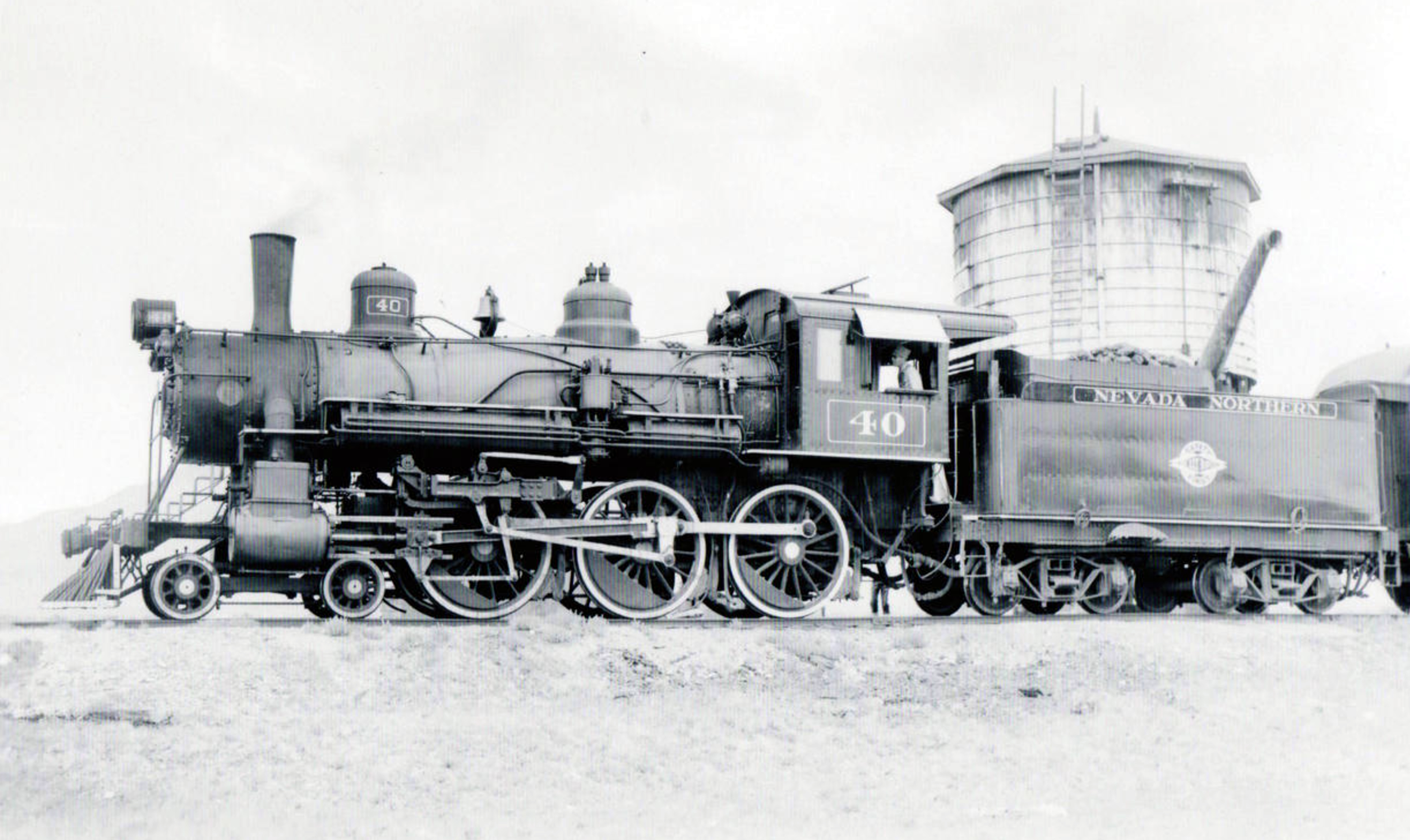
A pivotal development in Ely’s history was the establishment of the Nevada Northern Railway, headquartered in East Ely. Completed in the early 20th century, this 150-mile railway connected Ely’s mines in Ruth to a smelter in McGill and linked the town to the transcontinental railroad to the north. The railway was instrumental in transporting copper ore and other goods, effectively “forging the link” between Ely and national markets. This connectivity not only boosted Ely’s economy but also positioned it as a critical node in the supply chain of the American West, facilitating trade and communication across vast distances.

Ely’s role as a transportation hub was further cemented in 1913 when the transcontinental Lincoln Highway, one of America’s first coast-to-coast automobile routes, was routed through the town. Although the road was not paved until 1922, its inclusion of Ely underscored the town’s importance as a stopping point for travelers crossing the Great Basin. By the late 19th century, Ely was already connected by a network of wagon roads, but the Lincoln Highway elevated its status. Additionally, two other major roadways—U.S. Route 6 (designated in 1937, formerly the Midland Trail) and U.S. Route 93—converged at Ely, making it a crossroads for travelers moving between Canada, southern California, and beyond. With over 2,000 residents by the early 20th century, Ely offered essential services, making it an ideal stop for weary travelers.
The “Forging the Link” marker, erected by the Nevada State Historic Preservation Office, was designed to capture Ely’s multifaceted role in connecting the Great Basin through exploration, mining, and transportation. While the exact date of the marker’s installation is not specified in available records, it is part of a broader initiative to document Nevada’s history through physical markers. The marker’s title, “Forging the Link,” reflects Ely’s historical significance as a connector—geographically, economically, and socially—in a region characterized by its isolation.
The marker likely emerged from a collaborative effort involving local historians, community members, and the SHPO, which oversees Nevada’s historical marker program. Such markers are typically proposed by local groups or agencies, such as the Bureau of Land Management’s Ely District, to highlight significant historical narratives. The content of the marker emphasizes Simpson’s exploration, the mining boom, the Nevada Northern Railway, and the Lincoln Highway, weaving together the threads of Ely’s development into a cohesive story of regional importance.
The “Forging the Link” marker serves as both an educational tool and a point of pride for Ely’s residents. It highlights the town’s resilience and adaptability, from its origins as a mapped point in the Great Basin to its growth into a mining and transportation hub. The marker also underscores Ely’s enduring role as a service center for travelers, a legacy that continues with its position at the intersection of major highways. For visitors, the marker offers a glimpse into the challenges and triumphs of life in the American West, particularly in a region as remote as White Pine County.
Today, the marker stands as a testament to Ely’s historical contributions and its ongoing relevance. It invites reflection on how infrastructure and economic activity can transform a small town into a vital link in a larger network, a theme that resonates with Nevada’s broader history of connectivity and development.
James H. Simpson put the future site of Ely on the map during his 1859 exploration through the Great Basin. In the 1860s, silver and gold deposits were discovered nearby in what became the Robinson Mining District. Ely developed as a regional center, becoming the White Pine County seat in 1887. The area grew dramatically in the early 1890s with major copper discoveries. The Nevada Northern Railway, headquartered in East Ely, carried ore from the mines in Ruth to the McGill smelter, as well as connecting Ely to the world on its 150 mile route north to the transcontinental railroad.
The towns of eastern Nevada were joined during the late nineteenth century by a network of wagon roads. In 1913, the road through Ely was incorporated into the transcontinental Lincoln Highway, though it was not paved until 1922. Ely had over 2,000 residents and offered many services, making it an excellent stopping place on the long road across the Great Basin. When the copper industry declined after World War I, the struggling town turned to travelers for income.
The Lincoln Highway was designated U.S. 50 in 1926. By mid-century the popularity of the Victory Highway, now Interstate 80, reduced U.S. 50 to the status of “The Loneliest Road in America.”
In addition to the Lincoln Highway, two other major national roadways converge at Ely. The Midland trail, designated Route 6 in 1937, was an early coast to coast automobile road that also connected Ely to Tonopah and southern California. U.S 93, which passes north-south through Ely takes travelers from Canada almost to the Mexican border.
STATE OF NEVADA HISTORIC PRESERVATION OFFICE
AT&T
Land Services, Inc.
MACTEC Engineering and Consulting, Inc.
Ely Renaissance Society
Bureau of Land Management, Ely District
| Name | Ely Forging The Link |
| Location | Ely, White Pine County, Nevada |
| Latitude, Longitude | 39.2488, -114.8902 |
| Nevada State Historic Marker | 269 |
Fort Mohave is a historic settlement located in the southwestern region of Mohave county, Arizona, United States. Nestled along the banks of the Colorado River near Beale’s Crossing, it has played a significant role in the development and growth of the American West. Over the centuries, this area has witnessed the presence of various indigenous tribes, Spanish explorers, American pioneers, and military forces, each leaving their mark on the region’s rich history.

The history of Fort Mohave dates back thousands of years, with evidence of human habitation found in archaeological sites within the surrounding area. The Mojave people, from whom the fort derived its name, were one of the prominent Native American tribes in the region. They lived along the Colorado River, engaging in agriculture, hunting, and trade with other indigenous groups.
The first recorded European contact in the area occurred in the 16th century when Spanish explorers, including Melchor Díaz and Francisco Garcés, ventured into present-day Arizona. They encountered the Mojave people and established a limited presence in the region through the establishment of missions and trade routes. However, it wasn’t until the early 19th century that significant European-American exploration and settlement occurred.
In 1826, trapper and explorer Jedediah Smith traversed the Colorado River, reaching the vicinity of Fort Mohave. His expedition paved the way for subsequent fur trappers and traders who ventured into the area in search of beaver pelts and new trade opportunities. This influx of fur trappers and mountain men led to increased interaction between Native American tribes and Euro-Americans, often resulting in conflicts and tensions.

The establishment of Fort Mohave came about as a direct response to these conflicts. In 1858, the U.S. Army constructed the fort on the east bank of the Colorado River, near the confluence of the Mohave and Hardy rivers. Initially known as Camp Colorado, its primary purpose was to protect American settlers and travelers on their journey to the California gold fields during the height of the Gold Rush.
Fort Mohave was strategically positioned along the major transportation route that linked the Atlantic and Pacific coasts, known as the Mojave Road. It served as a critical outpost for the U.S. Army during the American Civil War, as troops were deployed to protect the mail and telegraph lines and maintain control over the region.

The fort played a significant role in the military campaigns against Native American tribes, particularly the Mojave, Chemehuevi, and Navajo people, who were resisting the encroachment of settlers on their traditional lands. Numerous skirmishes and battles occurred in the area as tensions escalated between Native Americans and the expanding American population.
Following the conclusion of the Civil War, the fort gradually lost its military significance. In 1890, it was officially decommissioned, and the remaining structures were abandoned. However, the establishment of the Mohave Valley Irrigation Project in the early 20th century sparked a renewed interest in the region.
The irrigation project brought water to the arid lands surrounding Fort Mohave, facilitating the cultivation of crops and the establishment of farming communities. This development, coupled with the construction of the Davis Dam in the 1950s, which created Lake Mohave, transformed the economy and landscape of the area. The lake provided recreational opportunities, attracting tourists and supporting the growth of the local tourism industry.
The region continues to be influenced by its proximity to the Colorado River, offering a range of water-based activities such as boating, fishing, and water sports. The Fort Mojave Indian Reservation, located nearby, serves as a reminder of the area’s rich Native American heritage and provides a cultural center for the Mojave, Chemehuevi, and Navajo tribes.
John Wesley Powell, a remarkable American explorer, geologist, and ethnologist, was born on March 24, 1834, in Mount Morris, New York. His expeditions through the uncharted territories of the American West not only added to scientific knowledge but also provided invaluable insights into the land’s geological and cultural diversity. Powell’s legacy as a pioneer of exploration and his tireless efforts in promoting conservation measures have left an indelible mark on American history.

Powell grew up in rural New York, where his love for nature and the outdoors was nurtured from an early age. Although he lost his right arm in a childhood accident, Powell’s determination and thirst for adventure were undeterred. He developed a keen interest in natural sciences and geography and pursued higher education at Illinois College and later at Oberlin College, where he focused on geology.
Powell’s most famous and daring expedition was his 1869 journey down the Colorado River, known as the Powell Geographic Expedition. With a team of nine men, Powell set out to explore the largely uncharted canyons and rapids of the Colorado River and gather valuable scientific data. The expedition faced numerous hardships, including treacherous rapids, scarce food supplies, and hostile encounters with Native American tribes. Miraculously, Powell and his crew successfully navigated the treacherous river and completed the journey, providing unprecedented knowledge of the Grand Canyon and its geological formations.

Powell’s subsequent expeditions further solidified his reputation as a fearless explorer. He embarked on multiple journeys across the American West, including explorations of the Green and Colorado Rivers, the Rocky Mountains, and the Uinta Mountains. Powell’s meticulous record-keeping and scientific observations greatly expanded the understanding of the region’s geology, hydrology, and ethnography.
Powell’s expeditions were not merely adventurous endeavors but also scientific ventures aimed at advancing knowledge in various fields. He published numerous papers and reports detailing his findings, including “Exploration of the Colorado River of the West and its Tributaries” and “Canons of the Colorado.” These works significantly contributed to the geological understanding of the American West, shaping subsequent research and studies in the region.
Additionally, Powell’s expertise in ethnology led him to conduct extensive research on Native American tribes. He documented their cultures, languages, and customs, recognizing the importance of preserving their heritage. His ethnographic studies formed a crucial foundation for future anthropological research in the United States.

John Wesley Powell was not only a scientist and explorer but also an early advocate for conservation. Recognizing the fragile nature of the American West’s ecosystems, he became a vocal proponent of sustainable land use practices and preservation efforts. Powell believed that the arid region’s limited water resources necessitated careful management and planning.
In 1879, Powell presented his influential “Report on the Lands of the Arid Region of the United States” to Congress. This groundbreaking report emphasized the need for responsible irrigation and land development strategies, urging policymakers to consider the long-term consequences of uncontrolled resource exploitation. Powell’s report laid the groundwork for the eventual establishment of the U.S. Forest Service and the Bureau of Reclamation, both crucial agencies in land and water management.
John Wesley Powell’s contributions to exploration, science, and conservation continue to resonate today. His expeditions not only unveiled the wonders of the American West but also inspired future generations of explorers and scientists. Powell’s emphasis on interdisciplinary research and his understanding of the intricate relationships between humans and their environment remain
