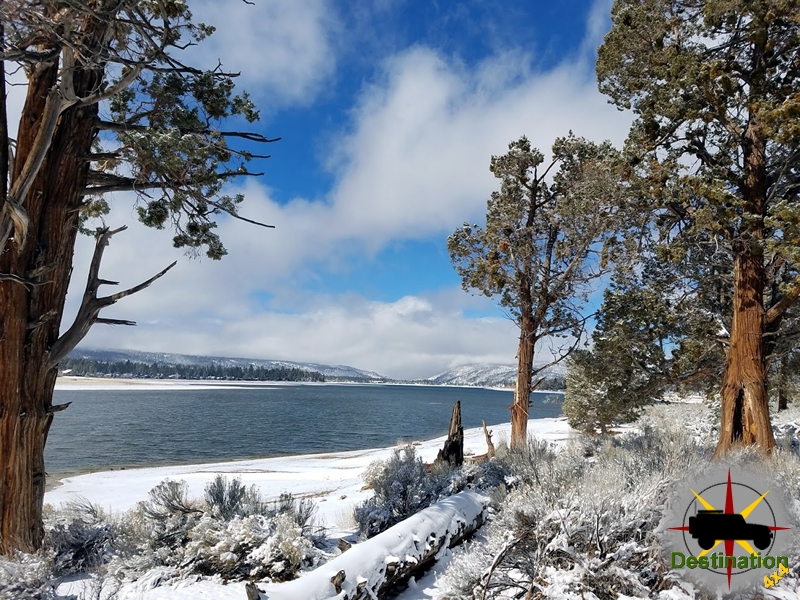
Big Bear, CA
I quiet mountain community full of back country adventure.
The Journey is the destination
The Bodie Hydroelectric Substation, a key component of the town’s power infrastructure, is a brick building attached to the Wheaton and Hollis Hotel on Main Street, originally part of the 1892-1893 electrification project. Constructed during the “Leggett’s Folly” initiative, it housed transformers that stepped down incoming high-voltage AC for safe distribution to the Standard Mill and eventually the town, symbolizing Bodie’s entry into the 20th century. The building’s brick construction contrasted with Bodie’s typical wooden structures, providing durability against fires and weather. Remnants of white paint on its walls remain visible today, evoking its operational era.

Initially focused on mill power, the substation received 3,100 volts from Green Creek, reducing it to 100 volts for lighting and machinery. It played a pivotal role in the 1893 activation, where delayed startup briefly fueled doubts before success. After the 1911 avalanche, the substation integrated with the new Jordan Canyon plant, handling higher voltages (up to 33,000) for expanded town use, including James S. Cain’s operations after he consolidated mines in 1915. By 1910, it also served as an office for the Hydro-Electric Power Company.
The substation’s significance lies in enabling cost-effective power, prolonging Bodie’s viability amid decline—reducing wood dependency and supporting cyanide-based revival. Figures like Leggett (innovator) and Cain (investor) were central, with the building embodying technological optimism. Today, preserved in the state park, it stands as a testament to early electrification, attracting visitors to peer at its artifacts and underscoring Bodie’s role in power transmission history.
Power generation in Bodie mirrored the technological evolution of remote mining towns in the American West, transitioning from labor-intensive steam power to pioneering hydroelectric systems amid economic pressures and resource scarcity. Early operations relied on steam engines fueled by cordwood, hauled from distant forests like the Mono Basin or Aurora Canyon, costing mills like the Standard Consolidated up to $22,000 annually by the early 1890s—a burden exacerbated by “wood famines” as local supplies depleted. Steam powered stamp mills for crushing ore, hoists for mining shafts, and compressors for drills, but high fuel costs and transportation challenges hindered profitability as gold yields declined post-1880s boom.
By the early 1890s, Bodie faced economic stagnation, prompting innovations like the cyanide process for extracting gold from low-grade tailings. Standard Mill Superintendent Thomas H. Leggett proposed replacing steam with hydroelectric power, harnessing distant Sierra streams to drive electric motors—a radical idea amid the “War of the Currents” between DC (direct current) and AC (alternating current) systems. Leggett, convinced by Westinghouse’s AC technology (which allowed voltage step-up for efficient long-distance transmission via transformers), persuaded banker and mine owner James S. Cain to fund the project in November 1892. Dubbed “Leggett’s Folly” by skeptics due to its $100,000 cost and unproven nature, it targeted Green Creek, 12.5 miles south, with a reliable flow of 400 miner’s inches of water (expandable to tenfold).
Construction spanned August to October 1892: enlarging an abandoned ditch for 4,570 feet of water diversion, building a penstock, gates, weirs, and a powerhouse from repurposed Bulwer-Standard mill materials. Dynamo Pond was dammed for storage. In November, a 120-kilowatt Westinghouse AC generator and four Pelton waterwheels arrived from San Francisco. Water plunged 1,571 feet (355 vertically) through an 18-inch pipe, striking nozzles on the wheels to generate 3,530 volts AC at up to 130 horsepower. Power transmitted 12.46 miles via straight copper wires on wooden poles (to avoid “jumping out” at curves, per folklore), entering Bodie above the cemetery and reaching the mill at 3,100 volts. A parallel telephone line aided operations.
After winter delays, full operation began in July 1893 following a 30-day test. On activation day, a crowd at the mill witnessed initial silence after the Green Creek signal, sparking mockery, but motors soon hummed, powering the 20-stamp mill and lighting—heralding Bodie as possibly the first site worldwide for an AC-powered electric stamp mill over long distance. Celebrations ensued, and the system slashed costs, enabling a revival through cyanide processing.
The Green Creek plant operated until an avalanche destroyed it in February 1911. By then, regional power expanded: in 1910, the Hydro-Electric Power Company (later Southern Sierras Power Company) built a new plant in Jordan Canyon (Lundy Canyon), 1,000 feet from Copper Mountain’s base, using reinforced concrete and transmitting 33,000 volts to Bodie via a 30-mile line. This supplied broader needs, including mines and residences, until mining ceased in 1942. Bodie’s innovations influenced Western mining, demonstrating AC’s viability for remote sites and reducing reliance on finite fuels.

The Bodie Schoolhouse, located on Green Street, stands as a poignant symbol of community resilience and family life amid the chaos of a gold rush boomtown. This large two-story wooden building, topped with a prominent belfry, was not Bodie’s first educational facility but represents the town’s evolving commitment to education during its peak years. The original school opened in March 1878 on Main Street, taught by Belle Moore, the wife of local saloon owner Ben Butler. A subsequent school, located about two blocks higher on Green Street, was destroyed in a catastrophic fire reportedly started by a mischievous 2.5-year-old boy known as “Bodie Bill.” Sent home from school for bad behavior, he played with matches behind the Old Sawdust Corner saloon, igniting a blaze that consumed 70% of the town.
The current schoolhouse was originally constructed in 1879 as the Bon Ton Lodging House, operated by Mrs. C.A. Ratjohn, and was later converted and relocated to its present site to serve as the town’s primary school. Architecturally, it features a simple yet sturdy wooden frame typical of frontier buildings, with a gabled roof and the distinctive belfry used to signal the start of classes. The structure’s design accommodated multiple functions: the ground floor housed one class, an addition at the back served another, and the second floor was reserved for older students. Early teachers included Mr. Cook and Mr. McCarty, who managed a multi-grade curriculum in this one-room (or effectively multi-room) setup.
At its height during Bodie’s boom, the school enrolled up to 615 students, ranging from young children to teenagers as old as 16 or 17, though it never offered a formal high school program. It played a vital role in the community, providing basic education in reading, writing, arithmetic, and history to the children of miners, merchants, and families who sought stability in the transient mining environment. The school fostered a sense of normalcy and community cohesion, counterbalancing the town’s reputation for violence and vice. Classes emphasized discipline and practical skills, reflecting the era’s educational norms, and the building occasionally served broader social functions, such as community gatherings.
The school operated intermittently as Bodie’s population dwindled, closing permanently in 1942 or 1943, shortly after mining ceased in 1942. When residents abandoned Bodie, they left behind artifacts too cumbersome to transport, preserving the schoolhouse in a time capsule-like state. Today, as part of Bodie State Historic Park, the interior remains untouched: desks, chalkboards, books, and globes are scattered as if the students had just stepped out for recess. Visitors can peer through the windows to see these relics, evoking the daily life of frontier education. The park’s “arrested decay” policy ensures the building’s structural integrity without modern alterations, making it a key attraction for those exploring Bodie’s history. Notable discrepancies exist in historical accounts, such as exact dates or fire details, but the schoolhouse endures as a testament to Bodie’s brief but vibrant community life.

Schoolhouses in the historic American Southwest—encompassing regions like California, Nevada, Arizona, New Mexico, and parts of Texas and Utah—were foundational to frontier settlement, particularly in mining towns and rural outposts shaped by the 19th-century gold and silver rushes. Often one-room structures, these buildings emerged as symbols of progress and community amid the rugged landscapes of deserts, mountains, and canyons, where Native American influences, Spanish colonial legacies, and Anglo-American expansion intersected. From the early 1800s to the mid-20th century, they provided the primary means of education in isolated areas, evolving from makeshift cabins to more permanent wooden or adobe buildings.
Physically, Southwestern schoolhouses were modest: typically single-room log, sod, or frame structures with potbelly stoves for heat, blackboards, and rows of desks facing the teacher’s platform. In mining towns like Bodie or Calico, California, they might feature belfries to call students from scattered homes or camps, and some, like the Calico Schoolhouse built in 1870 and relocated multiple times, were constructed from local materials for durability against harsh weather. Teachers, often young women, handled all grades simultaneously, teaching basics like the “three Rs” (reading, writing, arithmetic) alongside geography, history, and moral lessons, using McGuffey Readers or similar texts. Strict rules governed educators, including prohibitions on marriage or public socializing, emphasizing their role as moral exemplars.

Their roles extended far beyond academics. In mining boomtowns, schoolhouses stabilized transient populations by attracting families, signaling a shift from rough prospector camps to settled communities. They served as social hubs for town meetings, religious services, elections, and holiday events, fostering camaraderie and cultural exchange among diverse groups—Anglo settlers, Mexican ranchers, Chinese laborers, and Native Americans. In places like historic Florissant, Colorado (part of the extended Southwestern mining frontier), schools like the 1887-built one-room structure educated all 12 grades until 1959, embodying community determination. Economically, they prepared children for local industries, teaching practical skills while promoting American values and assimilation.
Challenges were abundant: funding shortages, teacher turnover, and environmental hazards like fires or isolation often led to intermittent operations. In coal mining communities of the Southwest, early one-room schools were rudimentary, described as “better suited for barns,” yet they laid the groundwork for public education systems. The legacy persists in preserved sites like Bodie or Montana’s rural schools (the state with the most surviving one-room structures), highlighting their enduring impact on regional development. As railroads and urbanization advanced, these schoolhouses declined, but they remain icons of frontier perseverance, community building, and the democratization of education in the American Southwest.

The Boone Store and Warehouse stands as one of Bodie’s most iconic and intact structures, exemplifying the commercial backbone of this remote mining outpost. Constructed in 1879 at the corner of Main and Green Streets, the building was erected during Bodie’s peak prosperity, when the town was a hub for gold and silver mining operations. It served dual purposes as a general store on the main floor and a warehouse for storage, reflecting the practical needs of a frontier town where supplies had to be stockpiled against harsh winters and unreliable transportation routes from larger cities like Carson City or Hawthorne.
The store was owned and operated by Harvey Boone, a prominent Bodie businessman and a direct descendant of the legendary frontiersman Daniel Boone. Harvey Boone was deeply embedded in Bodie’s economic fabric; he also owned the Boone Stable and Livery business, catering to the town’s reliance on horses for mining and travel. In 1879, he partnered with J.W. Wright, and together they expanded operations, including the purchase of Gilson and Barber’s Store. Boone’s entrepreneurial spirit extended to civic improvements—he was one of five founders of the Bodie Water Company in October 1879, which aimed to supply water for fire suppression, a critical need in a town prone to blazes due to wooden construction and mining explosives. By 1881, Boone and Wright paid Mono County real estate taxes on property valued at $25,313, underscoring their substantial holdings. Boone is believed to have been Bodie’s longest-operating single business owner, outlasting many competitors in a volatile economy.
The building itself is a two-story wooden structure with a false front typical of Western frontier architecture, designed to appear more imposing from the street. Its rear extension features unconventional siding made from repurposed five-gallon cans originally used to transport kerosene and gasoline, later replaced in parts with corrugated iron—a testament to the resourceful improvisation common in isolated mining camps. The store narrowly escaped destruction in July 1884 when a fire ravaged much of the Green Street block, from Boone’s establishment to Kingsley’s stables, highlighting the constant fire risks in Bodie.
Today, the Boone Store and Warehouse is preserved as part of Bodie State Historic Park, filled with hundreds of authentic artifacts that provide a vivid snapshot of late 19th-century commerce. Visitors can peer through the windows to see shelves stocked with period goods, including familiar brands that have endured into the modern era: Kellogg’s Tasteless Castor Oil, St. Joseph’s Aspirin, Trojan condoms, and Colgate medicated powder. Notably, several original Edison light bulbs in the front-right window have been continuously burning for years, symbolizing the town’s transition into the electrical age. These items, left as they were when the town was abandoned, include dry goods, tools, clothing, and household essentials, evoking the store’s role in sustaining Bodie’s diverse population of miners, families, and transients.

The structure’s significance is documented in the Historic American Buildings Survey (HABS CA-1932), part of the National Register of Historic Places (NRIS Number: 66000213), which classifies it under themes of commerce, general stores, and ghost towns. It represents Bodie’s commercial history, illustrating how entrepreneurs like Harvey Boone supported the mining economy by importing goods via wagon trains over treacherous Sierra passes. As one of several general stores in town (others included the Wheaton & Luhrs store, which later became a U.S. Land Office), it competed in a market where supply chains were fragile, and prices fluctuated with gold strikes. In Bodie’s heyday, the Boone Store was not just a retail outlet but a vital lifeline, stocking everything from mining tools to canned foods, and serving as a social gathering point amid the town’s isolation.
General stores were indispensable institutions in the historic American Southwest, a region encompassing California, Nevada, Arizona, New Mexico, and parts of Texas and Utah, shaped by Spanish colonial influences, Native American trade networks, and the 19th-century influx of Anglo-American settlers during the Gold Rush and frontier expansion. Emerging in the early 1800s as successors to colonial trading posts, these stores evolved into multifaceted hubs that went far beyond mere commerce, embodying the self-sufficiency and community spirit of isolated settlements in arid, rugged terrains.
Physically, general stores were often simple wooden buildings with broad counters, shelves lining the walls, and barrels or crates for bulk items. They stocked an eclectic array of goods to meet diverse needs: dry goods like flour, sugar, and coffee; hardware such as nails, shovels, and lanterns; clothing, boots, and fabrics; medicines, tobacco, and even luxury items like candy or books when available. In mining boomtowns like Bodie or Tombstone, Arizona, they carried specialized supplies for prospectors, including picks, dynamite, and assay kits, often obtained through special orders from urban warehouses in San Francisco or Denver. Prices were high due to transportation challenges—goods arrived via stagecoach, freight wagons, or later railroads—leading to bartering systems where miners traded gold dust or pelts for essentials.
Beyond retail, general stores played pivotal social and economic roles. They functioned as community centers where locals gathered to exchange news, gossip, and political opinions, fostering social bonds in otherwise lonely frontiers. Many doubled as post offices, with storekeepers acting as postmasters, handling mail that connected remote areas to the outside world. In the Southwest, they facilitated cultural exchanges among Anglo settlers, Mexican ranchers, and Native American tribes, sometimes serving as trading posts for hides, wool, or turquoise. Economically, they symbolized American enterprise, enabling credit systems for cash-strapped farmers and miners, and often influencing local politics as store owners like Harvey Boone invested in infrastructure.
In mining-heavy regions of the Southwest, general stores were lifelines during booms, stocking provisions against supply disruptions caused by weather or banditry, and they adapted to bust cycles by diversifying into services like banking or assaying. Their decline in the early 20th century came with the rise of railroads, automobiles, and chain stores, but remnants like the Boone Store preserve their legacy as cornerstones of Southwestern frontier life, blending commerce, community, and resilience.
Bodie, California, is a preserved ghost town and state historic park located in Mono County, east of the Sierra Nevada mountains. Once a bustling gold-mining boomtown that peaked in the late 1870s with a population of 7,000 to 10,000 residents, Bodie epitomized the Wild West with its saloons, mines, and lawless reputation. Amid this chaotic environment stood the Methodist Church, a symbol of moral and communal stability. Built in 1882, it remains one of the few intact structures in the town, preserved in a state of “arrested decay” as part of Bodie State Historic Park since 1962.

The Methodist Church’s in Bodie, CA origins trace back to Bodie’s early religious efforts, which began without dedicated buildings. In the town’s formative years, Methodist services were led by preachers like Reverend Hinkle and later Reverend Warrington, often held in private homes, the Independent Order of Odd Fellows (I.O.O.F.) Building, or the Miner’s Union Hall. By 1881, Bodie’s population had declined to around 3,000 as the initial mining boom waned, but community leaders sought to foster a more settled, family-oriented atmosphere. Reverend Warrington purchased the lot at the corner of Green and Fuller Streets, and construction of the church was completed in 1882—the same year the Roman Catholic Church (which later burned in 1928) was dedicated on September 10.
The first gathering in the Methodist Church took place on September 15, 1882, just five days after the Catholic Church’s dedication. Its bell was first rung on Christmas Day that year, marking a milestone in the town’s religious life. Services continued through Bodie’s decline, with the last regular service held in 1932, as most families had departed by then amid economic hardship and fires that ravaged the town (including major blazes in 1892 and 1932, which destroyed up to 90% of Bodie’s original 2,000 buildings). In the mid-20th century, the church suffered vandalism, including the theft of an original oilcloth inscribed with the Ten Commandments. Today, it stands as a key attraction in the park, where free history talks are sometimes held at 10:00 AM.
The Methodist Church exemplifies the simple, functional architecture of late-19th-century frontier boomtowns in the Southwestern United States. Constructed primarily of wood—a readily available material in the region—it is a large, rectangular structure with a gabled roof and a prominent front entrance facing Green Street. A wood shed was later added to the front-right side of the entrance for practical storage. The exterior, weathered by over a century of harsh desert winds, heavy snows, and Sierra Nevada elements, features unpainted wooden siding that has aged to a gray patina, contributing to Bodie’s eerie, abandoned aesthetic.
Inside, the church retains a modest layout suited to a mining community’s needs: wooden pews, an altar area, and an old wood-burning stove to combat the area’s frigid winters, where temperatures can plummet below freezing. The interior is visible to visitors through a wire-mesh fence at the entrance, installed for protection, allowing glimpses of its historical furnishings without entry. This design reflects the utilitarian style of the era, prioritizing durability and community gathering over ornate decoration, in stark contrast to the town’s more elaborate saloons.


In a rough-and-tumble mining town notorious for its 65 saloons, gunfights, and transient population, the Methodist Church played a crucial role as a beacon of morality, family values, and social cohesion. Established during Bodie’s shift from a lawless camp to a more stable community, it provided spiritual guidance and a venue for worship, weddings, funerals, and gatherings that helped anchor family life amid the chaos of gold rushes and economic booms and busts. Alongside the Catholic Church, it represented the town’s religious diversity and efforts to civilize the frontier, offering an alternative to the vice-ridden saloons and brothels that dominated daily life.
The church also symbolized resilience; while mining operations ceased by 1942 and the town emptied, its survival through fires and abandonment underscores Bodie’s enduring historical narrative. Today, as part of the state park, it educates visitors on 19th-century frontier life, drawing tourists worldwide to explore this outdoor museum of California’s gold rush era

The J.S. Cain House, located at the corner of Green and Park Streets in Bodie, Mono County, California, is a significant structure within the Bodie State Historic Park, a Registered National Historic Landmark and California Historical Landmark #341. Constructed in 1879 for James Stuart Cain, one of Bodie’s wealthiest and most influential residents, the house exemplifies the architectural and cultural characteristics of a late 19th-century gold mining boomtown. This report details the historical context, architectural features, and preservation status of the J.S. Cain House, drawing on primary documentation from the Historic American Buildings Survey (HABS) and other historical records.
Bodie, California, emerged as a bustling mining town following the discovery of placer gold in July 1859 and a quartz vein in August of the same year. While early exploitation efforts were modest, the town’s potential became evident by 1874, leading to a peak in gold and silver production between 1879 and 1880, with an estimated total yield of $90–100 million. During this period, Bodie’s population swelled to 10,000–12,000, making it one of the largest mining towns in the American West.
James Stuart Cain arrived in Bodie in 1879 at the age of 25, quickly establishing himself as a prominent entrepreneur. He began by transporting timber across Mono Lake to supply Bodie’s mines and construction needs, later expanding into mining, banking, and real estate. Cain’s ventures included a lucrative 90-day lease of a Standard Consolidated Mining Company claim, yielding $90,000 in gold, and eventual ownership of the Standard Mine and Mill through legal action. By the early 20th century, Cain was Bodie’s principal property owner, and his family maintained the town’s structures until its designation as a state historic park in 1962.
The J.S. Cain House, built in 1879, served as the primary residence for Cain, his wife Martha, and their family. As one of the largest and most finely constructed homes in Bodie, it reflected Cain’s wealth and status. The house later housed park rangers and their families and has been a focal point for visitors to the ghost town, preserved in a state of “arrested decay” by the California State Park Service.

The J.S. Cain House is a two-story wood-frame structure, modest by urban standards but notably grand within the context of Bodie’s vernacular architecture. Its design incorporates elements of Victorian styling, adapted to the harsh environmental conditions and limited resources of a remote mining town. The following details are informed by HABS documentation, including photographs and measured drawings from 1933 and 1962.
The interior floor plan, documented by the Library of Congress, reveals a functional yet comfortable layout for a family of Cain’s stature.

The house was constructed using timber, much of which Cain himself supplied through his Mono Lake lumber barges. The wood-frame structure is supported by a simple foundation, likely stone or wooden piers, given Bodie’s rocky terrain. Interior finishes include wooden floors and plaster or wood-paneled walls, with minimal ornamentation. The fireplace, a central feature of the living room, is constructed of brick or local stone, providing essential heat in Bodie’s cold winters.
While modest compared to urban Victorian homes, the J.S. Cain House stands out in Bodie for its size, quality, and Victorian influences. Its large windows, porch, and two-story design contrast with the smaller, utilitarian homes of miners, reflecting Cain’s wealth and social standing. The house’s construction also demonstrates the logistical challenges of building in a remote location, where lumber and other materials were scarce and expensive.
The J.S. Cain House is maintained by the California State Park Service in a state of arrested decay, a preservation approach that stabilizes structures without restoring them to their original appearance. This method preserves the ghost town’s haunting aesthetic while protecting historical integrity. The house has been documented extensively by the HABS, with five photographs, ten measured drawings, and five data pages compiled since 1933.


The J.S. Cain House is a testament to Bodie’s brief but intense prosperity during the late 19th-century gold rush. Its architectural design, blending Victorian elements with frontier pragmatism, reflects the unique challenges and aspirations of a remote mining community. As one of the best-preserved structures in Bodie State Historic Park, the house offers valuable insights into the domestic life of a prominent mining family and the broader history of the American West. Continued preservation efforts ensure that the J.S. Cain House remains a tangible link to Bodie’s past, inviting visitors to explore its historical and architectural legacy.