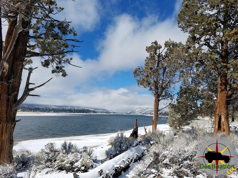
Big Bear, CA
I quiet mountain community full of back country adventure.
The Journey is the destination

Bodie, California, is a well-preserved ghost town located in Mono County, east of the Sierra Nevada mountains. It emerged as a booming mining camp following the discovery of placer gold in July 1859 and a quartz vein in August of that year. Although initial mining efforts were modest, the town experienced explosive growth in the late 1870s due to rich gold and silver deposits, particularly from the Standard Mine. By 1879–1880, Bodie’s population swelled to an estimated 7,000–12,000 residents, with around 2,000 buildings, including saloons, churches, a school, and a railroad. The town became notorious for its lawlessness, with frequent shootings, robberies, and a harsh climate that contributed to its “bad man from Bodie” reputation. Amid this chaotic environment, the Miners’ Union Hall stood as a cornerstone of organized labor and community life, symbolizing the miners’ efforts to improve working conditions and foster social cohesion.
The Bodie Miners’ Union was formally organized on December 22, 1877, as one of the earliest labor unions in California. It began with about 20 members but quickly grew as the town’s mining industry expanded. The union affiliated with the Western Federation of Miners in 1903, becoming Local 61. Recognizing the need for a dedicated space, union members constructed the Miners’ Union Hall on Main Street in 1878. Construction was completed on June 28, 1878, making it one of the key structures built during Bodie’s peak boom period. Architecturally, the hall was a simple wooden building with shiplap siding, ogee moldings, and wood plank footpaths, typical of frontier mining town construction. It served as a multifunctional space, including as a hall, auditorium, theater, and later a gallery or museum.
The union’s formation was driven by the dangerous and exploitative conditions in Bodie’s mines. Miners faced long hours, low wages, and high risks from cave-ins, explosions, and toxic fumes. The union advocated for better pay, safer working environments, and benefits like medical care for injured workers. By providing a venue for meetings, the hall became the epicenter for labor organizing, where members discussed strikes, negotiated with mine owners, and supported one another during disputes.
Beyond its labor functions, the Miners’ Union Hall played a pivotal role in Bodie’s social, cultural, and even spiritual fabric, earning it a reputation as the “center of social life” in the town. In a remote, isolated community plagued by violence and harsh winters, the hall offered a vital gathering place that fostered community bonds and provided respite from the rigors of mining life. It hosted a wide array of events, including dances, concerts, plays, school recitals, and holiday celebrations, transforming it into an entertainment hub. Annual highlights included the Fourth of July Grand Ball, an elegant masquerade ball on Washington’s Birthday (notably, it “invariably snowed” during these events), and Christmas parties for all ages. School performances and other family-oriented activities also took place there, underscoring its role in education and family life.
The hall’s significance extended to spiritual and civic matters. It was described as central to Bodie’s “social and spiritual life,” possibly hosting religious services or moral discussions in a town with limited churches. Politically, it supported labor rights during a time when unions were crucial for countering the power of mining companies. The hall also reflected Bodie’s diverse population, including immigrants from China, Mexico, and Europe, though union membership was likely dominated by white miners. Overall, in a town known for its saloons and brothels, the hall provided a more wholesome alternative, helping to maintain social order and community morale amid economic booms and busts.
One of the most infamous events associated with the Miners’ Union Hall occurred on January 15, 1881, during a dance at the venue. Joseph DeRoche (also known as Jules DeRoche), a local brick foundry owner romantically involved with the wife of miner Thomas Treloar, danced repeatedly with Treloar’s wife despite objections. Treloar confronted the pair, leading to an altercation outside the hall where DeRoche shot and killed Treloar. DeRoche was arrested and held in Bodie’s jail, but on January 24, 1881, the vigilante group known as the Bodie 601 (a secretive committee formed to combat crime, with “601” possibly standing for “6 feet under, 0 trials, 1 rope”) broke him out and lynched him near the murder site. This incident highlighted the hall’s role as a social flashpoint and Bodie’s reliance on vigilante justice due to inadequate law enforcement.
Other events included union-led funerals and parades, such as the burial procession for Treloar, attended by the Fire Department and Miners’ Union. The hall’s association with such dramatic episodes cemented its place in Bodie’s lore of Wild West violence.

Bodie’s decline began in the 1880s as ore deposits dwindled, exacerbated by major fires in 1892 and 1932 that destroyed much of the town. By the early 20th century, the population had dropped sharply, and mining operations largely ceased by the 1940s. The Miners’ Union Hall, however, survived these disasters and the town’s abandonment. In 1962, the state of California acquired Bodie, designating it as Bodie State Historic Park to preserve it in a state of “arrested decay.” Some restoration work on the hall occurred that year under the “Mission 66” program.
Today, the hall serves as the park’s museum and gift shop, displaying artifacts from Bodie’s past, including mining tools, photographs, and household items. Administered by the Bodie Foundation since 2024, it attracts about 200,000 visitors annually, offering a glimpse into the town’s mining heritage and the hall’s enduring legacy as a symbol of community resilience. The site is a National Historic Landmark, emphasizing its historical importance.

Bodie, California, emerged as a bustling gold mining town in the late 1870s, located in Mono County in the eastern Sierra Nevada mountains. Discovered in 1859 by William S. Bodey (often misspelled as “Body”), the town experienced a significant boom starting around 1876 with rich gold discoveries, particularly at the Standard Mine operated by the Standard Consolidated Mining Company. By 1879, Bodie’s population had swelled to approximately 7,000 to 10,000 residents, making it one of the largest and most notorious mining camps in California. The town was known for its rough-and-tumble atmosphere, with saloons, gambling halls, and frequent violence, but its economy revolved around gold extraction. Mines like the Standard relied heavily on explosives, including “giant powder” (a dynamite-like substance based on nitroglycerin), stored in magazines near the works for blasting operations. This set the stage for one of the town’s most tragic disasters: the explosion at the Standard Mine’s powder magazine.
The explosion occurred on Thursday, July 10, 1879, at approximately 4:00 PM (though some accounts place it closer to 8:00 PM). It was not an underground mine blast but rather the detonation of the powder magazine located on the hillside near the Standard Mine works, about a mile from the main town of Bodie. The magazine contained an estimated three to five tons of giant powder cartridges, used for blasting in the mine. A massive cloud of smoke rose from the site, followed by a deafening roar and a shockwave that resembled a violent earthquake. The blast was felt as far as 20-25 miles away in Bridgeport, California, and it vaporized the magazine, leaving a large crater in its place. Nearby structures, including the old Standard hoisting works and the Summit Mine building (about 400 feet away), were demolished or set ablaze. Fires broke out in the timbering of the old incline but were quickly extinguished by responders. The shockwave shattered windows, blew down houses, and extinguished lights throughout Bodie, causing widespread panic as residents rushed to the scene amid cries of alarm and searches for loved ones.
Miners working underground in the Standard Mine at the time—numbering around 100—escaped unharmed. They were initially unaware of the surface explosion due to the mine’s connecting drifts, which allowed smoke and gases to dissipate quickly, preventing suffocation. The new shaft and hoisting works, as well as the mill, remained operational, allowing mining activities to resume without major interruption.
The exact cause of the explosion remains a mystery, as the magazine was obliterated, and key witnesses were killed. Contemporary accounts speculated that it might have been accidental, possibly triggered by William O’Brien, the man in charge of the magazine, who was last seen heading there with Charles Malloy to retrieve fuse materials. One theory suggested O’Brien may have dropped a blasting cap, igniting the powder. No evidence of foul play or sabotage was reported, and miners in Bodie described it as an inexplicable accident. The use of giant powder, while effective for mining, was inherently dangerous due to its sensitivity to shock and friction. In the aftermath, the incident led to changes in powder storage practices in Bodie to improve safety, such as more isolated magazines and stricter handling protocols.
The explosion claimed between 6 and 10 lives, with discrepancies in counts likely due to unidentified remains and delayed reports of fatalities. Over 40 people were injured, many severely, though most were expected to recover. The victims were primarily surface workers, residents in nearby cabins, and passersby, including some women and children buried under debris. The Miners’ Union Hall in Bodie was hastily converted into a makeshift hospital, where fraternal organizations like the Masons and Odd Fellows assisted in caring for the wounded. The scene was described as heart-rending, with the hall crowded by the dead, dying, and grieving relatives.
Accounts vary slightly in names and spellings, but the following individuals were reported killed:
Injuries ranged from fractures and lacerations to lost limbs, eyes, and internal damage. Notable wounded individuals included:
A coroner’s jury was impaneled to investigate, but no definitive conclusions on causes or additional victims were detailed in surviving reports.
The explosion had immediate and lasting effects on Bodie, though the town’s resilience allowed it to rebound quickly. Physically, it destroyed the old Standard hoisting works, the Summit Mine building, and several nearby cabins, boarding houses, and restaurants (including those at the McClinton, Bodie, Dudley, Jupiter, Tioga, Bechtel, and old Bodie mines, which suffered broken doors and windows). Damage estimates were initially overestimated, but the blast shattered glass and structural integrity across the town, with boulders and debris raining down on structures up to 2,000 feet away. The new Standard shaft and mill escaped serious harm, enabling operations to continue and preventing a broader economic collapse.
Socially, the disaster heightened community bonds, as residents rallied to aid victims, and it underscored the perils of mining life in Bodie. It prompted safety reforms in explosive storage, reducing the risk of similar incidents. Economically, Bodie was at its peak in 1879-1880, with the Standard Mine producing richly, so the explosion did not halt the boom—production actually increased in subsequent years. However, it contributed to Bodie’s reputation as a dangerous place, alongside its infamous violence and later fires (such as those in 1886 and 1892). The event faded into local lore as Bodie declined in the 1880s due to depleting ore, eventually becoming a ghost town preserved as Bodie State Historic Park today.
In the desolate expanse of California’s Mojave Desert, a violent clash unfolded on May 11, 1943, that would echo through the history of Joshua Tree National Park. The incident, known as the Bill Keys shootout, pitted William F. “Bill” Keys, a rugged homesteader and miner, against his neighbor, Worth Bagley, in a deadly confrontation rooted in a bitter land dispute. This account draws from historical records and firsthand sources to recount the events leading to the shootout, the incident itself, and its lasting impact.

Bill Keys was a stoic figure, shaped by the harsh realities of desert life. Born in either Nebraska or Russia—accounts vary—he arrived in the Joshua Tree area around 1910. After working as a ranch hand for Walter Scott in the Mojave and later managing the Desert Queen Mine, Keys acquired land through the Homestead Act when the mine closed in 1917. He named his property the Desert Queen Ranch, where he built a life with his wife, Frances, raising seven children, three of whom tragically died in early childhood. Keys was a self-reliant man, constructing a stamp mill, digging wells, and cultivating orchards and livestock in an environment that demanded relentless perseverance. His life was one of grit, ingenuity, and survival in an unforgiving landscape.
Worth Bagley, a former Los Angeles deputy sheriff, entered the scene in 1938. Described in some accounts as erratic or possibly mentally unstable, Bagley settled near Keys’ ranch, and tensions soon arose. The core of their conflict centered on a dirt road—variously called Quail Wash or Quail Springs Historic Trail—that Keys had used for decades to access his Wall Street Mill. Bagley claimed the road crossed his property and demanded Keys stop using it, escalating their feud with a threatening cardboard sign planted in the road: “KEYS, THIS IS MY LAST WARNING. STAY OFF MY PROPERTY.”
The establishment of Joshua Tree National Monument in 1936 added further strain. The monument’s boundaries enveloped Keys’ ranch, restricting his cattle grazing and fueling his resentment toward federal oversight. Bagley, too, clashed with Keys over property rights, and their disputes—whether over the road, water, or grazing land—grew increasingly volatile. By 1943, the stage was set for a confrontation that reflected the lingering lawlessness of the Old West.

On the morning of May 11, 1943, Bill Keys drove along the familiar dirt road toward his Wall Street Mill. As he approached the sign erected by Bagley, he stopped his car, acutely aware of the threat’s gravity. Keys, a seasoned desert dweller whose survival had long depended on keen observation, surveyed the surrounding terrain. According to Keys’ account, Bagley ambushed him, emerging from cover and opening fire. Keys, armed and prepared, returned fire in self-defense, fatally shooting Bagley. The exchange was swift, a brutal culmination of years of animosity.
Keys maintained that he acted to protect his life, but the legal system viewed the incident differently. Arrested and charged with murder, Keys faced a trial that many considered unjust. The prosecution painted him as the aggressor, and a jury convicted him of manslaughter, sentencing him to ten years in San Quentin State Penitentiary. The trial was marred by controversy, with some accounts suggesting bias against Keys, a solitary desert figure, in favor of Bagley, a former lawman.
While incarcerated, Keys’ resilience and sharp mind—honed by years of navigating the desert’s challenges—kept him focused. His wife, Frances, sought help from Erle Stanley Gardner, a Ventura-based attorney and author of the Perry Mason novels, who was drawn to the desert and had befriended the Keys family during his visits to Joshua Tree. Gardner, through his Court of Last Resort, investigated Keys’ case, uncovering evidence of self-defense and procedural flaws in the trial. His advocacy, combined with growing public support, led to Keys’ parole after five years and a full pardon in 1956.
Upon his release, Keys returned to the Desert Queen Ranch, where he lived quietly until his death in 1969. In a defiant act of remembrance, he erected a stone marker at the site of the shootout, inscribed: “Here is where Worth Bagley bit the dust at the hand of W.F. Keys, May 11, 1943.” The original marker, vandalized in 2014, was replaced with a steel replica by the National Park Service, preserving the site’s historical significance along the Wall Street Mill Trail.
The Bill Keys shootout is a stark reminder of the rugged individualism and simmering tensions that defined life in the American West, even into the mid-20th century. It reflects not only a personal feud but also broader conflicts over land, resources, and autonomy in a region increasingly shaped by federal control. Keys’ story, as detailed in Art Kidwell’s Ambush: The Story of Bill Keys, challenges the romanticized narrative of the West, revealing a world where survival often hinged on quick decisions and deadly force.
Today, Joshua Tree National Park preserves the site as a tourist attraction, with rangers leading tours of the Desert Queen Ranch and recounting Keys’ tale. The shootout, though a footnote in the broader sweep of American history, remains a poignant chapter in the park’s cultural landscape, embodying the harsh realities and enduring spirit of those who carved out lives in the desert.
The Worth Bagley Stone is a historical marker located in Joshua Tree National Park, San Bernardino County, California, along the Wall Street Mill Trail, approximately 0.3 miles from the trailhead. The original marker was a granite stone, measuring approximately 78 cm high, 46 cm wide, and 12 cm thick, inscribed with the text: “Here is where Worth Bagly [sic] bit the dust at the hand of W.F. Keys, May 11, 1943.” The misspelling of “Bagley” as “Bagly” is notable on the marker. This stone was carved and erected by William F. (Bill) Keys to commemorate a deadly shootout between himself and Worth Bagley, a former Los Angeles deputy sheriff, over a land and water access dispute. Due to vandalism, including green paint defacement and the stone being broken off at its base in 2014, the original was removed by the National Park Service for safekeeping in the park’s museum. In February 2019, a replica made of ¾-inch steel was installed at the original site, crafted by artist Rebecca Lowry of JTLab in collaboration with park staff, Vagabond Welding, and Keys’ descendants. The replica closely mirrors the original’s design and lettering, ensuring the historical event remains marked for visitors.
The Worth Bagley Stone marks the site of a fatal confrontation on May 11, 1943, between Bill Keys, a rancher and miner who owned the Desert Queen Ranch and Wall Street Mill, and his neighbor, Worth Bagley. The two had a contentious relationship, primarily due to a dispute over access to a road leading to the Wall Street Mill, which Bagley claimed crossed his property. Bagley, known for his volatile temperament and history of conflict, had reportedly shot Keys’ cattle and posted a warning sign threatening Keys to stay off his land. On the day of the incident, Keys claimed Bagley ambushed him with a revolver along the road. Bagley fired and missed, and Keys returned fire with his rifle, killing Bagley. Keys turned himself in to authorities the same day.
In the subsequent trial, Keys was convicted of manslaughter and sentenced to ten years in San Quentin State Prison, despite his self-defense claim. Evidence tampering and questionable expert testimony may have influenced the verdict. While in prison, Keys educated himself in the library, and his case gained attention from Erle Stanley Gardner, the creator of Perry Mason, who advocated for his release. Keys was paroled in 1948 after serving five years and received a full pardon in 1956. Upon returning to his Desert Queen Ranch, Keys carved and placed the granite marker at the shootout site in the 1950s to memorialize the event.
The stone stood as a testament to the rugged, lawless spirit of the desert and Keys’ determination to defend his rights, as he once stated, “If the law won’t uphold me, I’ll uphold myself.” However, by 2014, vandalism had damaged the marker, prompting its removal for preservation. The National Park Service, recognizing its historical significance, commissioned the steel replica to maintain the site’s historical narrative. The Worth Bagley Stone remains a poignant reminder of the violent disputes that shaped the history of Joshua Tree National Park, then known as Joshua Tree National Monument, and is a point of interest for hikers and history enthusiasts on the Wall Street Mill Trail.
![The Battle of Wingate pass as reports by Los Angeles herald (Los Angeles [Calif.]), March 21, 1906](https://i0.wp.com/www.destination4x4.com/wp-content/uploads/2025/08/WinGatePass.png?resize=800%2C606&ssl=1)
The so-called “Battle” of Wingate Pass, which occurred on February 26, 1906, in the rugged terrain of Death Valley, California, was not a genuine conflict but a staged hoax orchestrated by the infamous con artist Walter Edward Perry Scott, better known as “Death Valley Scotty.” This incident stemmed from Scotty’s elaborate schemes to defraud investors by promoting nonexistent gold mines in the desert. What followed the event was a chaotic sequence of retreats, media scrutiny, arrests, lawsuits, and jurisdictional disputes that exposed the fraud and led to short-lived legal repercussions. Below is a detailed chronological account of the events leading up to the “battle,” the incident itself, and the immediate aftermath, with a focus on the court actions that unfolded in the weeks and months following.

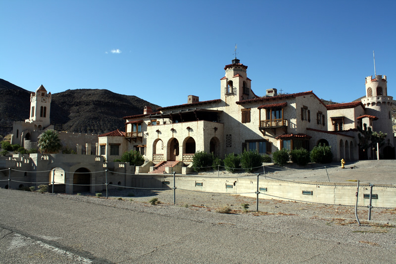
Walter Edward Perry Scott (1872–1954), famously dubbed “Death Valley Scotty,” was born in Cynthiana, Kentucky, and rose to prominence as one of the American West’s most colorful con artists. Scotty began his career as a performer in Buffalo Bill’s Wild West Show in the 1890s, where he honed his skills in showmanship and tall tales. By the early 1900s, he had relocated to California and began promoting himself as a wealthy gold prospector with secret mines in Death Valley, often flashing rolls of cash (later revealed to be “upholstered” with newspaper) to lure investors. His schemes involved “grubstakers”—investors who funded his expeditions in exchange for shares in supposed riches. Scotty’s charisma and exaggerated stories attracted figures like Chicago businessmen Albert M. Johnson and Edward A. Shedd, who invested $2,500 for a two-thirds stake in his fictional mine. However, as investors demanded proof, Scotty’s deceptions escalated, leading to elaborate hoaxes to maintain the illusion. His persona became synonymous with Death Valley, and he later lived at the opulent Scotty’s Castle (built by Johnson), perpetuating myths of hidden wealth until his death.

By early 1906, Scotty’s investors were growing suspicious. New England mining promoter A.Y. Pearl had introduced Scotty to Eastern bankers and businessmen eager to inspect his claimed gold properties in Death Valley. They insisted on an evaluation by Daniel E. Owen, a reputable Boston mining engineer based in Nevada. Fearing exposure—since Scotty had no real mine—he persuaded his associate Bill Keys (a prospector and half-Cherokee Indian) to allow the group to view Keys’ modest Desert Hound Mine as a stand-in. Still anxious that Owen would deem it unworthy, Scotty hatched a plan for a staged ambush to make the area seem too dangerous for further exploration.
On February 23, 1906, the party departed from Daggett, California, equipped with two wagons, mules, horses, provisions, and whiskey. The group included Scotty, Owen, Pearl, Albert M. Johnson (president of the National Life Insurance Company of Chicago), Scotty’s brothers Bill and Warner Scott, Bill Keys, A.W. DeLyle St. Clair (a Los Angeles miner), and Jack Brody (a local desert character). Keys and Brody were sent ahead to prepare the ambush, possibly with help from an Indian named Bob Belt. The party camped at Granite Wells on February 24 and proceeded toward Lone Willow Spring the next day, leaving Bill Scott behind to guard extra animals.
The hoax unfolded on February 25, 1906, as the group approached Wingate Pass near Dry Lake. Shots rang out from behind stone breastworks (five of which still exist today as historical remnants), simulating an attack by claim jumpers or bandits. An ex-deputy sheriff from Goldfield, Nevada, reported being ambushed earlier, causing his pack train to stampede, adding to the chaos. Scotty fired two warning shots, startling the mules and tipping Owen from his wagon. Then, a rifle shot from the hidden assailants struck Warner Scott in the groin, an accidental injury likely due to the ambushers’ drunkenness (possibly Bob Belt). Scotty galloped toward the “attackers,” yelling for them to stop, which inadvertently exposed the ruse to the suspicious Owen.
The “battle” was brief and one-sided, with no return fire from the party. Panic ensued, and the group retreated hastily to Daggett, abandoning provisions in the desert. Warner was rushed to Los Angeles for medical treatment, where he survived after surgery. The staged nature became evident through Scotty’s over-the-top reaction and the lack of pursuit by the “ambushers.” The event involved real bullets, turning a planned scare tactic into a near-tragedy due to poor execution.
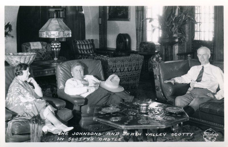
The group’s return to civilization sparked immediate chaos. Los Angeles newspapers sensationalized the story, with Pearl initially claiming it was a genuine fight against four outlaws who were “claim jumpers” guarding Scotty’s mine. However, Owen, suspecting foul play, reported the true details to the San Bernardino County sheriff and the press, asserting that Scotty had orchestrated the ambush in an attempt to kill him and cover up the fraud. This led to a public unraveling of the hoax, as investors like Johnson realized they had been duped—though Johnson would later reconcile with Scotty and fund the construction of Scotty’s Castle in Death Valley.
The sheriff’s investigation uncovered incriminating evidence: abandoned provisions at Scotty’s “Camp Holdout” and a witness statement from the Nevada lawman who spotted Keys fleeing the scene. Media coverage intensified, portraying Scotty as a swindler and the “battle” as a farce. Scotty, ever the showman, initially denied involvement but soon faced mounting pressure.
The legal fallout began swiftly. On March 14, 1906, just over two weeks after the incident, the San Bernardino County District Attorney issued arrest warrants for Scotty, Bill Keys, and Jack Brody on charges of assault with a deadly weapon. Scotty was arrested in Seattle on March 24 and released on $500 bail. He was rearrested two days later on March 26 but again released. On April 7, Scotty pleaded not guilty to two counts of assault in San Bernardino County Court and was freed on $2,000 bail.
Meanwhile, Warner Scott, seeking compensation for his injury, filed a civil lawsuit on or around April 1906 in Los Angeles County Court against Walter Scott, Bill Scott, Bill Keys, A.Y. Pearl, and a “John Doe” (likely Brody or another accomplice). The suit demanded $152,000 in damages for his wounds and related suffering.
Keys was apprehended on April 10 at Ballarat, a mining camp near Death Valley, and pleaded not guilty before being jailed in San Bernardino. On April 13, Scotty, Pearl, and Bill Scott were arrested once more and briefly jailed in San Bernardino. However, they were released the next day after a successful habeas corpus petition challenged their detention.
The cases collapsed on April 27, 1906, when all criminal charges were dismissed by the San Bernardino County Court due to a jurisdictional error: the “battle” had occurred in Inyo County, not San Bernardino County. Inyo County authorities declined to pursue the matter, possibly due to lack of evidence or interest. Scotty later boasted that he had moved a county boundary marker to create this confusion, though this claim remains unverified.
Warner eventually agreed to drop his damage suit on the condition that Scotty pay over $1,000 in medical bills owed to Dr. C.W. Lawton in Los Angeles. Scotty consented but never paid, leading to a default judgment against him—though he had no attachable assets at the time. This unresolved debt would resurface years later, culminating in Scotty’s 1912 contempt-of-court jailing and public confession to the hoax, but the immediate 1906 proceedings ended without convictions.
The “Battle” of Wingate Pass marked a turning point in Scotty’s career, exposing his deceptions to a wider audience and costing him most investors—except Johnson, who ironically became his lifelong patron. The event highlighted the lawlessness of the California desert frontier, where jurisdictional ambiguities often allowed scams to evade justice. While no one was ultimately prosecuted in 1906, the hoax cemented Scotty’s legend as a colorful charlatan, and Wingate Pass remains a footnote in Death Valley lore.
Participants of the Battle
 Albert Mussey Johnson – Death Valley Ranch OwnerAlbert Mussey Johnson Albert Mussey Johnson (1872 - 1948) was a businessman and investor who received notoriety as the millionaire, who built “Scotty's Castle” in… |
 Walter Edward Perry Scott – “Death Valley Scotty”Walter Edward Perry Scott (September 20, 1872 – January 5, 1954), also known as "Death Valley Scotty", was a miner, prospector and conman who operated… |
Warner Elmore ScottWarner Elmore Scott (1865–1950) was a Kentucky native from a horse farming family who became entangled in his brother Walter "Death Valley Scotty" Scott's infamous… |
 William Franklin KeysWilliam Franklin Keys (September 27, 1879–1969) was a rugged American frontiersman, rancher, and miner who became a notable figure in the history of the Mojave… |
Curtis Howe Springer was a charismatic radio evangelist and self-proclaimed doctor who founded the Zzyzx Mineral Springs and Health Resort in California’s Mojave Desert, operating it as a fraudulent health retreat from 1944 until his eviction in 1974.

Curtis Howe Springer was born on December 2, 1896, in Birmingham, Alabama, though verifiable details about his childhood remain scarce due to his propensity for fabricating personal history. Springer often embellished his background, claiming to have served as a boxing instructor during World War I, campaigned against alcohol alongside politician William Jennings Bryan, and worked at a school in Florida. He also asserted attendance at a college in Chicago and possession of multiple advanced degrees, including an M.D., Ph.D., and N.D., some purportedly from nonexistent institutions like the “Springer School of Humanism” or the fictitious “National Academy.” In reality, no records exist to confirm any formal education or medical training, marking the beginning of a lifelong pattern of deceit.
By the 1910s and 1920s, Springer had emerged as a prohibition crusader and self-proclaimed Methodist minister, despite lacking official ordination. He transitioned into roles as a radio evangelist and lecturer, blending Christian gospel with health and hygiene advice. During this period, he worked as an insurance salesman before fully embracing his persona as a “doctor” and promoter of dubious remedies.
In the 1930s, Springer traveled extensively through the Midwest, delivering sermons and selling homemade elixirs and cure-alls, often without disclosing ingredients or efficacy. He positioned himself as “the last of the old-time medicine men,” hawking products like homeopathic treatments for hair loss, hemorrhoids, and other ailments in exchange for “donations” to his ministry. His charisma propelled him onto the radio waves, following in the footsteps of figures like Aimee Semple McPherson and Father Charles Coughlin. By the mid-1930s, he was broadcasting from Chicago, falsely presenting himself as a licensed physician and promoting “miracle cures” that promised to make listeners “internally, externally, and eternally clean.”
These claims drew scrutiny; a 1936 paper by the American Medical Association, titled “Nostrums and Quackery and Pseudo-Medicine,” debunked his practices. Undeterred, Springer relocated to Pittsburgh and continued his radio empire, eventually syndicating shows to over 300 stations in the U.S. and abroad at its peak. He emphasized Christian doctrine intertwined with physical fitness, mental alertness, and spiritual soundness, while selling products such as Antediluvian Desert Herb Tea, Acidine, Hollywood Pep Cocktail, Manna, O-M-R, RE-HIB, Zy-Crystals (containing Epsom salts and salt from Soda Dry Lake), Mo-Hair, and F-W-O. In the early 1940s, he retired to Los Angeles, where he sought a permanent base for his operations.
In 1944, Springer discovered the remote site of Soda Springs (also known as Fort Soda Springs) in the Mojave Desert, about 200 miles east of Los Angeles. On September 13, 1944, he filed mining claims under the General Mining Act of 1872 for 12,800 acres of federal land, intending to “mine” salt crystals but with no genuine mining plans. He renamed the area Zzyzx (pronounced “zi-zex”), claiming it to be “the last word in health” to ensure it appeared last in alphabetical listings.
Springer transformed the barren desert into Zzyzx Mineral Springs and Health Resort, starting with tents and expanding through labor from homeless men recruited from Los Angeles’ Skid Row, whom he paid minimally with room, board, and promises of redemption. Facilities included a two-story hotel called “The Castle,” concrete cottages (“Zycott” housing), a dining hall, lecture room, chapel, library, office/recording studio, pool house, goat shed, diesel generator, subterranean rabbit chambers, an artificial lake named Lake Tuendae (falsely claimed to mean “where the waters come together” in Native American), and a private airstrip called “Zyport.” He installed diesel-powered boilers to heat the naturally cold mineral springs from the Mojave River, creating imitation hot springs for “healing” soaks.
The resort operated as a Christian health retreat for nearly 30 years (1944–1974), accommodating over 100 guests nightly. Visitors followed a regimen of detoxification, special diets (including on-site-grown rabbit meat, goat’s milk, fruits, and vegetables), abstention from alcohol, smoking, and quarreling, sunshine exposure, and daily sermons. Springer promoted it via his radio broadcasts, newspaper ads, a newsletter called The Elucidator, and a free shuttle service using buses and an eight-door Chevrolet from Los Angeles. Fees were on a sliding scale, with no one turned away for lack of funds, though large donors received land parcels—a practice that later proved illegal. He dubbed the main road “Boulevard of Dreams” and erected eye-catching signage along the highway. At its height in the 1950s and 1960s, Zzyzx was a bustling oasis, blending snake oil sales with salvation.
Springer’s empire unraveled in the late 1960s amid complaints from dissatisfied customers. In 1968, he was arrested by the California Department of Public Health on 65 counts of false advertising and misrepresentation, pleading guilty to eight counts of false advertisement and mislabeling. The American Medical Association condemned him as the “King of Quacks” in 1969, leading to a conviction, fine, and 60-day jail sentence.
Concurrently, the Bureau of Land Management (BLM) investigated his land use, suing in 1967 for $34,187 in damages and back rent, deeming him a squatter for failing to conduct actual mining. His sale of land parcels to donors violated federal terms. On April 11, 1974, U.S. District Judge Francis C. Whelan ordered his eviction, granting just 36 hours to vacate. Springer fought the decision but lost, marking the end of his 30-year desert venture.
Following eviction, Springer retired to Las Vegas, Nevada, where he continued advocating for Zzyzx through writings, including a 1984 editorial titled “The Legal Rape of Zzyzx” in the Baker Valley News. He died on August 19, 1985, at age 88, never regaining his desert domain. (Note: Some sources list his death as January 19, but August aligns with verified records.)
Zzyzx was nearly demolished but was repurposed in 1976 as the Desert Studies Center, a research outpost for California State University campuses, focusing on ecology, climate change, dune formation, endangered species like the Mohave tui chub, and even Mars rover testing by NASA’s Jet Propulsion Laboratory. Today, remnants of Springer’s era—abandoned buildings, signage, and the Boulevard of Dreams—serve as historical curiosities in this now-academic haven, underscoring his legacy as a masterful con artist who turned public land into a profitable mirage.