Dog Town, California

Dog Town holds a pivotal place in the history of California’s eastern Sierra Nevada as the site of the first major gold rush on the eastern slope of the mountains. Located in Mono County, near the modern Highway 395 (approximately 7 miles south of Bridgeport and close to the turnoff for the famous Bodie ghost town), Dog Town was a short-lived placer mining camp during the broader California Gold Rush era.

Founding and Early Development

The camp was established around 1857 by German prospector Carl (or Cord) Norst, who, along with his wife Mary (a Native American woman), set up a basic camp along what became known as Dog Town Creek (near the confluence with Virginia Creek). They built a dugout house with rock walls and began panning for placer gold—loose gold deposits in streambeds that could be extracted without deep mining.

Rumors of gold near Mono Lake spread quickly, drawing prospectors to the area. By 1859, a group of Mormon miners from Nevada arrived, staked claims, and helped establish a small mining camp and trading center. At its peak, the settlement reportedly housed around 100 miners, living in primitive huts, hovels, and dugouts—earning the name “Dog Town” from a miners’ slang term for rough, dog-like living conditions in makeshift camps.

This marked the beginning of organized gold prospecting on the eastern side of the Sierra Nevada, predating more famous boomtowns in the region.

Economic Role in the Area

Dog Town’s economy was almost entirely based on placer mining, with some later hydraulic methods mentioned in accounts. Miners panned and dug along the creeks, extracting gold from alluvial deposits. While never highly profitable overall, the camp produced notable finds, including reports of one of the largest gold nuggets discovered on the eastern Sierra slope.

Its production was modest compared to later strikes—exact figures are unknown, but combined with nearby areas like Monoville, several million dollars in gold may have been extracted from the broader region in the early years.

Dog Town played a crucial catalytic role in the regional economy:

  • It sparked the first significant influx of prospectors to the eastern Sierra, proving gold existed beyond the western slopes.
  • The initial rush drew attention eastward, leading miners to relocate quickly to richer discoveries.
  • In 1859, founder Norst (or others) found better deposits about 5-6 miles east, prompting most residents to abandon Dog Town for Monoville (overlooking Mono Lake), which briefly became a more substantial town and even a candidate for Mono County seat.
  • Subsequent richer strikes in Aurora (Nevada), Bodie (starting in the 1870s with massive gold and silver output), and Masonic built on the momentum Dog Town initiated.
  • The camp served as a primitive supply and trading hub in its brief heyday, supporting the flow of miners and goods into the isolated high-desert region.

Though Dog Town itself declined rapidly—abandoned within a couple of years as miners chased better prospects—it ignited the chain of discoveries that fueled the eastern Sierra’s mining economy for decades. Bodie, for example, grew into a major boomtown with up to 10,000 residents and tens of millions in gold/silver production by the 1880s, far outstripping Dog Town’s output but owing its origins indirectly to the earlier eastern slope rush.

Decline and Legacy

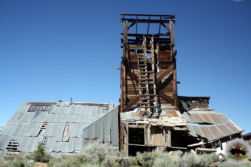
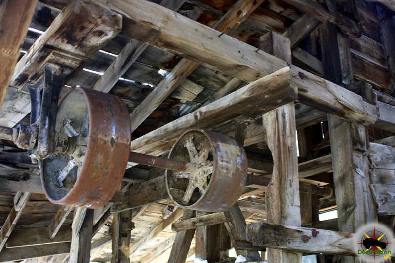
By the early 1860s, Dog Town was largely deserted, with residents moving to Monoville or other sites. There were minor reworkings of the diggings in the late 1870s–1880s during Bodie’s peak, but no sustained revival occurred. Today, only ruins remain—scattered remnants of rock walls and foundations near the creek, visible from Highway 395.

Designated California Historical Landmark No. 792 in 1964, the site is marked with plaques describing it as “the site of the first major gold rush to the eastern slope of California’s Sierra Nevada.” Ruins lie close to the cliff bordering Dog Town Creek.

In summary, while Dog Town was economically minor and fleeting, its role as the spark for the eastern Sierra gold rush was foundational. It drew prospectors across the mountains, set the stage for larger booms like Bodie, and contributed to the broader economic development of Mono County and the surrounding region during the late 1850s Gold Rush era.

Chemung Mine

Located off the Masonic Road between Bridgeport, CA and the Masonic town site, are the remains of the Chemung gold mine.  The Chemung gold mine operated from from 1909 to 1938 and produced over one million dollars in gold.  In the 1920s, the Chemung mine was producing low grade and high grade ore.  The ore was processed onsite, and then shipped to near by Bodie for smelting.

The Chemung Mine located just outside of Bridgeport, CA. Photograph by James L Rathbun

Along with the increase cost of mining supplies which reduced growth, a poor gold market and the cost of hauling the ore to Bodie over the poor roads for smelting and little mine was doomed and closed its doors in 1938.

The Chemung mine history is not a mining failure, but a failure of management and litigation.  During its time of production, the mine built and tore down three mills.  During the last year of operation in 1938, 20 men worked the site and less than one year later the mine was closed.  The mine itself produced well, however endless litigation for various reasons doomed the mine.

The Chemung gold mine over looking the Bridgeport Valley.. Photograph by James L Rathbun

Throughout the 1950s and 1960s new life was found in the mine with the efforts of Elton “Heinie” Heinemeyer.  Heinemeyer mined for years but never struck it big.  Well liked by the town of Bridgeport, CA Heinemeters well being was the source of concern for the people of Bridgeport and it is reported that he would always find time to visit and entertain those who traveled to check up on him.

Currently, the mill building structure is intact but the years of harsh weather have taken its toll.  A mild wind will cause some of the walls to shake or shudder, and the lower outer wall is leaning outward.  In June 2016, bars restricted access to the mines themselves although the mines do offer a cold breeze on a warm day to cool you down.

The Chemung mine still maintains and impressive structure. Photograph by James L Rathbun

There are stories that the site is haunted by a spirit or ghost, but only on Saturday nights, which seems a bit odd to me.

The Chemung Mine working still seem ready to go. Photograph by James L Rathbun

On a personal note, the Chemung mine surprised me.  I have been to Aurora three times, Masonic at least three times, and Bodie… at least ten.  My last visit to Bodie was in 2013. Afterwards this last trip, I was looking in Google Earth when I “discovered” the Chemung gold mine.  How had this mine, such an impressive structure, evaded my radar for so many years?  It took me three years from that day to make my first visit to Chemung, and this place is definately on my list for a repeat visit.

Time, weather and gravity have taken its toll on the structure of the Chemung Mine.. Photograph by James L Rathbun
Time, weather and gravity have taken its toll on the structure of the Chemung Mine. Photograph by James L Rathbun

Chemung Mine Trailmap

Resources

The Standard Mill – Bodie, CA

The Standard Mill, also known as the Standard Consolidated Mining Company Mill, was a pivotal element in the history of Bodie, California. The building is one of the most iconic images or Bodie, and dominates the landscape. Located in the Bodie Hills east of the Sierra Nevada mountain range, this mill played a crucial role in the processing of ore from one of the richest gold-mining areas in the American West.

The Standard Mill, Bodie, CA. Photograph by James L Rathbun

Formation of the Standard Company

The Standard Company was founded in 1877, quickly becoming one of the most prominent and productive mines in the Bodie District. The company consolidated several claims, thereby gaining control over a large portion of the mineral-rich land. The successful extraction and processing of gold ore by the Standard Company were instrumental in Bodie’s transformation from a small camp into a bustling mining town.

Construction and Operation of the Standard Mill

The Standard Mill was constructed in 1877 to process the ore extracted from the company’s mines. It employed the latest technology of the time, using a combination of steam power, gravity, and chemical processes to extract gold from the ore. The mill utilized the amalgamation process, which involved crushing the ore to a fine powder and then using mercury to separate the gold. This process was later supplemented with cyanidation, which allowed for the extraction of gold from low-grade ore, significantly improving recovery rates.

Looking up at the trestle bridge which is used to haul gold ore into the Standard Mill, Bodie, CA.  Two large mortar boxes are visible in the foreground. 
 Photograph by James L Rathbun
Looking up at the trestle bridge which is used to haul gold ore into the Standard Mill, Bodie, CA. Two large mortar boxes are visible in the foreground. Photograph by James L Rathbun

Technical Details

Originally, as built, the mill is powered by large steam boilers. There boilers are fed using wood brought up to Bodie on the Bodie and Benton Railroad. The mill initially featured a 20-stamp system, but as operations expanded, it was upgraded to a 30-stamp system. Later, the mill is converted to Hydroelectric power from a plant built approximately thirteen miles from the town at Dynamo Pond.

Ore is loaded into the mill using one of two trestles. The primary trestle connects to the backside of the mill, and used to haul ore from the mines deep inside mines inside of the mountain. The secondary trestle is sloped to the north and is used to haul ore up sevens stories above the the loading room. From there, the ore is sorted with grizzly bars before being dropped into the powerful stamps.

The now quiet stamps of the Standard Mill in Blodie, CA could be heard from four miles away.  Photograph by James L Rathbun
The now quiet stamps of the Standard Mill in Blodie, CA could be heard from four miles away. Photograph by James L Rathbun

The stamps, which were heavy iron rods, repeatedly crushed the ore into a fine powder. This powder was then passed over mercury-coated copper plates, where the gold particles would adhere to the mercury. The amalgam of gold and mercury was then collected and heated to separate the gold from the mercury.

Economic Impact and Contribution to Bodie’s Growth

The Standard Mill was the most significant factor in Bodie’s economic boom during the late 19th century. By 1879, Bodie’s population had swelled to approximately 10,000 people, with the Standard Company producing gold worth millions of dollars by today’s standards. The wealth generated by the mill attracted a diverse population, leading to the establishment of various businesses, schools, and a newspaper. During the height of operations, the stamps from the mill could be heard four miles away, and operated twenty-four hours per day, six days a week.

Ore entering into the the smelting room at the left in the form of 400lb ingots.  Standard Mill, Bodie,
Ore entering into the the smelting room at the left in the form of 400lb ingots. Standard Mill, Bodie,

Challenges and Decline

All the mining and milling activities of the Standard Mining Co., came to their conclusion with the pouring of a bullion bar in the smelting room.

Despite its success, the Standard Mill faced numerous challenges, including harsh weather conditions, fires, and fluctuating gold prices. The mill experienced several fires, the most devastating occurring in 1898, which necessitated extensive rebuilding. Additionally, as the richest veins of ore were exhausted, the profitability of the mill declined. The Standard Company ceased operations in 1913, marking the end of Bodie’s major gold production.

Preservation and Historical Significance

Today, the Standard Mill stands as a testament to Bodie’s rich mining history. It is one of the best-preserved examples of a 19th-century mill in California. The site is now part of Bodie State Historic Park, established in 1962, which aims to preserve the town and educate the public about its historical significance. The mill’s machinery, structures, and surrounding buildings offer valuable insights into the technological advancements and industrial processes of the time.

The Hoover House served as housing for the Director of Operations of the Standard Mill in Bodie.  Photography by James L Rathbun
The Hoover House served as housing for the Director of Operations of the Standard Mill in Bodie. Photography by James L Rathbun

Tours are available several times per day for a tickets price of $6 a person. The hour long takes you past the Hoover House up past the stream plant to the trestle, which fed ore up the the top of the mill. From there, the tour route enters the machinery room and power room before dropping into the slucing room and clean up rooms.

The Standard Mill was a cornerstone of the town’s mining industry and played a vital role in its economic development. Through its innovative use of technology and its contribution to gold production, the mill significantly influenced the growth and prosperity of Bodie during its peak years. Today, it remains an important historical site, providing a window into the challenges and achievements of the mining era in the American West.

The Standard Mill Map

More Standard Mill Photographs

Big Meadow Campground

Big Meadow Campground, located in the Inyo National Forest near Rock Creek and Tom’s Place, California, is a serene, high-altitude campground situated at approximately 8,600 feet elevation. Nestled along Rock Creek in the scenic Rock Creek Canyon of the Eastern Sierra Nevada, this small 11-site campground offers a peaceful retreat surrounded by Jeffrey pines, aspens, and towering granite peaks. Positioned about 5 miles west of Tom’s Place and a half-mile past Iris Meadow Campground, Big Meadow is known for its creekside location, offering stunning scenery, excellent trout fishing, and access to hiking trails in the nearby John Muir Wilderness. Its proximity to Rock Creek Lake and Tom’s Place makes it an ideal base for campers seeking a quiet, nature-immersed experience in the Eastern Sierra.

Big Meadow Campground located near Tom's Place in Mono County
Big Meadow Campground located near Tom’s Place in Mono County

Campsite Details

Big Meadow Campground features 11 single-family campsites, all available on a first-come, first-served basis with no reservations accepted. The sites are well-separated and suitable for tents, small RVs, and trailers up to 26 feet in length, though parking is limited, and larger vehicles may face challenges due to the narrow dirt spurs. Each campsite is equipped with a picnic table, a fire ring with grill, and a bear-proof food storage locker (typical size: 48″ x 30″ x 36″), essential due to active black bear activity in the area. Amenities include potable water and flush toilets, which are noted for being clean and well-maintained, though some campers report occasional upkeep issues. Many sites are located along Rock Creek, offering a soothing water backdrop, while others are set within a mature pine forest for added privacy and shade. The cost is $35 per night for a single site, with an additional $10 per night for extra vehicles. Holders of America the Beautiful Senior or Access Passes receive a 50% discount on single-site fees. Quiet hours are enforced from 10:00 PM to 6:00 AM, with a maximum stay of 7 days.

Recreation and Activities

Big Meadow Campground is a gateway to a variety of outdoor activities in the Rock Creek area:

  • Fishing: Rock Creek, flowing alongside the campground, is renowned for exceptional trout fishing, including rainbow, brown, and stocked Alpers trout. Nearby Rock Creek Lake, 4 miles up the road, offers additional fishing opportunities from the shore or small boats (electric motors only, 5 MPH limit).
  • Hiking and Backpacking: The Mosquito Flat Trailhead, approximately 6 miles up Rock Creek Road, provides access to the Little Lakes Valley in the John Muir Wilderness. This gentle trail leads to a series of glacially carved alpine lakes, such as Morgan Lakes and Gem Lakes, within a 2.5-mile hike, with stunning views of Bear Creek Spire, Mt. Dade, and Mt. Abbott. Other nearby trails cater to both day hikers and backpackers.
  • Boating: Kayaking, canoeing, and stand-up paddleboarding are popular at Rock Creek Lake, though the water remains cold even in summer.
  • Wildlife Viewing and Stargazing: The area is home to black bears, mountain lions, mule deer, pikas, and birds like Clark’s nutcrackers. The high elevation and minimal light pollution make Big Meadow ideal for stargazing.
  • Horseback Riding: Rock Creek Pack Station, located near Rock Creek Lake, offers guided trail rides and fishing pack trips into the backcountry.
  • Photography and More: The dramatic granite peaks, vibrant aspen groves (especially in fall), and summer wildflowers attract photographers. Mountain biking and rockhounding are also popular in the surrounding terrain.

Natural Setting

Situated at 8,600 feet in Rock Creek Canyon, Big Meadow Campground is enveloped by a mature forest of Jeffrey pines and aspens, which turn vibrant gold in the fall, creating a spectacular display comparable to New England autumns. Rock Creek runs adjacent to the campground, its clear, cold waters cascading over boulders, providing a tranquil soundscape. The surrounding landscape features steep granite cliffs and towering peaks, characteristic of the Eastern Sierra Nevada’s rugged beauty. Summer daytime temperatures typically range from the 60s to 70s°F, with nights dropping to the 30s or 40s°F due to the high elevation. Visitors should be prepared for strong UV exposure and potential altitude sickness, as acclimatization may take a day or two.

Logistics and Access

To reach Big Meadow Campground, take US Highway 395 to Tom’s Place, approximately 23 miles north of Bishop or 10 miles south of Mammoth Lakes. Turn west onto Rock Creek Lake Road and drive about 5 miles; the campground is on the right, a half-mile past Iris Meadow Campground. The road is paved but narrows as it climbs, and the campground’s dirt parking areas require careful navigation for larger vehicles. The campground operates seasonally, typically from early June to late September (June 6 to September 28, 2025, weather permitting), with exact dates subject to snow conditions. For updates, contact the White Mountain Ranger District at (760) 873-2500. Cell service is unreliable, with most carriers reporting no reception, enhancing the campground’s remote, off-the-grid atmosphere. Parking is limited, and campers should consult the camp host or bulletin board for instructions on additional vehicle parking.

Nearby Amenities

Rock Creek Lakes Resort, approximately 4 miles up the road, offers a general store, a café serving breakfast and lunch, and cabin rentals, providing convenient access to supplies and meals. Tom’s Place, 5 miles down the road, features a rustic lodge with a market, café, and bar for additional provisions. Nearby campgrounds, such as Iris Meadow (0.5 miles away), Upper Pine Grove, Lower Pine Grove, East Fork, and Rock Creek Lake, offer alternative camping options if Big Meadow is full.

Visitor Considerations

  • Bear Safety: Black bears are active in the area, so all food, scented items, and trash must be stored in bear-proof lockers when not in use. Keeping a clean campsite is critical to avoid wildlife encounters.
  • High Altitude: At 8,600 feet, campers should stay hydrated, use sunscreen, and monitor for altitude sickness symptoms, particularly during the first day or two.
  • Fire Regulations: Campfires are permitted in fire rings, but check for seasonal fire restrictions (Stage 1 Fire Restrictions may be in effect starting June 16, 2025). Firewood is available for purchase locally to prevent the spread of invasive pests. Generators are allowed only during non-quiet hours (6:00 AM to 10:00 PM) with a three-hour maximum run time and must be attended.
  • Pets: Dogs are welcome but must be leashed and attended at all times, with a limit of two per site.
  • Site Selection: With only 11 sites, Big Meadow fills quickly, especially in mid-summer. Arrive early to secure a spot, particularly for creek-side sites (e.g., sites 4, 6, 7, 8, 9, and 10), which offer scenic views and the sound of flowing water. Forested sites provide more shade and seclusion.
  • Accessibility: The flush toilets are accessible, but some sites may have uneven terrain, so check conditions for mobility needs.

Visitor Feedback

Campers praise Big Meadow Campground for its peaceful setting, scenic beauty, and proximity to Rock Creek and hiking trails. Reviews highlight the well-separated sites, clean flush toilets, and the relaxing ambiance of the creek, with one camper noting, “This is a gem for California where so many campgrounds have over a hundred sites. This is away from the crowds with only 11 sites.” The lack of cell service is often appreciated for its disconnect-from-technology vibe, though some mention the challenge of securing a site due to the small size and first-come, first-served policy. Occasional complaints include less-than-pristine bathroom maintenance, but overall, the campground is highly regarded for its serene environment and recreational opportunities.

Clarification Note

There is potential confusion with another Big Meadows Campground in the Sequoia National Forest, located 75 miles east of Fresno at 7,500 feet elevation. That campground is distinct, with 43 sites, no potable water, and a different setting near Kings Canyon. This description pertains specifically to Big Meadow Campground in the Inyo National Forest near Rock Creek and Tom’s Place.

Conclusion

Big Meadow Campground is a small, idyllic retreat in the heart of Rock Creek Canyon, offering a perfect blend of rustic camping and access to the Eastern Sierra’s stunning landscapes. With its creekside sites, shaded pine forest, and proximity to world-class fishing and hiking in the John Muir Wilderness, it’s an ideal destination for tent campers and small RV users seeking solitude and adventure. Whether casting a line in Rock Creek, hiking to alpine lakes, or stargazing under a pristine Sierra sky, Big Meadow Campground delivers an unforgettable outdoor experience in one of California’s most scenic regions.

The Hoover House

The Hoover House, located in Bodie, California, is a significant part of the town’s rich history. Bodie itself is a well-preserved ghost town that exemplifies the late 19th-century gold rush era in the United States. The town, named after Waterman S. Body (later spelled Bodie), experienced its peak during the late 1800s after gold was discovered in 1859.

The Hoover House served as housing for the Director of Operations of the Standard Mill in Bodie. Photography by James L Rathbun

The Hoover House was built during Bodie’s boom period in the late 19th century. The home served as a residence for the While specific records about the construction date of the Hoover House are scarce, it is believed to have been built around the 1880s, when Bodie was thriving with a population that peaked at around 10,000 people. The house is a representative example of the residential architecture of that time, featuring wood-frame construction and a design typical of the homes built for the town’s middle and upper-class citizens.

The Hoover Family

Theodore Hoover in Bodie, Calif., 1904

The Hoover House is named after the Hoover family, who were among the prominent residents of Bodie. Theodore Hoover, and his wife Mildred, lived in the house, while he served as the head of mining operations for the Standard Mill. It is said that Theodores brother, Herbert Hoover, visited the town during his tenure with the Standard Mill.

The house features a large veranda which overlooks the town and was one of the nicer structures in the town. However, this peace the site now must not compare with the sound of the stamp mills located just a few hundred feet from the front door. The stamps of the Standard mill of the operated 24 hours a day, six days a week and the sounds from the stamps could be heard four miles from the town.

The family was involved in various local businesses, contributing to the economic development of the town. Like many other families, the Hoovers moved to Bodie in search of prosperity brought about by the gold mining industry.

Life in Bodie

Life in Bodie during its peak was rough and often dangerous. The town was notorious for its lawlessness, with frequent gunfights and a high crime rate. Despite this, families like the Hoovers established homes and contributed to the community’s social fabric. The Hoover House would have been a comfortable residence compared to the more modest dwellings of the working-class miners.

The Hoover House Today

Today, the Hoover House stands as a testament to Bodie’s vibrant, albeit short-lived, history. Visitors to Bodie State Historic Park can view the house and get a sense of what life was like during the town’s heyday. The house, like many others in Bodie, offers a glimpse into the past, with its weathered wooden walls and remnants of a bygone era. The home is physically located near the Standard Mill.

The Hoover House, along with the rest of Bodie, serves as a historical treasure, providing valuable insights into the lives of those who lived during one of America’s most famous gold rushes.

Hoover House Summary

NameHoover House
LocationBodie, Mono County, California
Latitude, Longitude38.2121, -119.0101
Elevation8,425 ft

Hoover House Map

References