Old Spanish Trail

The Old Spanish Trail BLM Sign

Introduction

The Old Spanish Trail, a significant trade and travel route in the American Southwest, connected Spanish colonial settlements in present-day New Mexico to California during the late 18th and early 19th centuries. Spanning approximately 2,700 miles, the trail facilitated cultural exchange, commerce, and exploration across rugged terrains, linking diverse peoples and shaping the region’s history. This report examines the trail’s origins, development, key figures, economic and cultural impacts, and eventual decline, drawing on historical records and archaeological evidence.

Origins and Development

The Old Spanish Trail emerged from earlier Native American trade networks, which Spanish explorers adapted for their purposes. By the late 1700s, Spanish colonial authorities in Santa Fe sought reliable routes to connect their New Mexico settlements with California’s missions and presidios. The trail’s development was incremental, with early expeditions laying the groundwork.

  • Early Exploration (1776): The Dominguez-Escalante expedition, led by Franciscan priests Francisco Atanasio Dominguez and Silvestre Vélez de Escalante, aimed to find a route from Santa Fe to Monterey, California. Although the expedition failed to reach California, it mapped parts of the Southwest, including areas later incorporated into the trail.
  • Formalization (1820s): By the 1820s, Mexican independence from Spain (1821) opened the region to increased trade. Merchants and traders, particularly from Taos and Santa Fe, began using the trail to transport goods to Los Angeles. The route combined segments of earlier paths, including the Northern Route, Armijo Route, and Main Route, each varying slightly in path and difficulty.

The trail stretched from Santa Fe, New Mexico, through present-day Colorado, Utah, Arizona, Nevada, and California, terminating in Los Angeles. Its path traversed deserts, mountains, and canyons, including the Mojave Desert and the Grand Canyon region, making it one of the most arduous trade routes in North America.

Key Figures

Several individuals played pivotal roles in the trail’s history:

  • Antonio Armijo (1829-1830): A Mexican merchant, Armijo led the first successful commercial expedition from Santa Fe to Los Angeles, establishing the Armijo Route. His journey solidified the trail as a viable trade corridor, with pack mules carrying woolen goods west and returning with horses and mules.
  • John C. Frémont (1840s): The American explorer and military officer documented parts of the trail during his expeditions, increasing U.S. interest in the region. His maps and reports helped popularize the trail among American settlers.
  • Kit Carson and Other Guides: Mountain men and guides like Kit Carson facilitated travel along the trail, bridging cultural and linguistic gaps between Spanish, Mexican, Native American, and Anglo-American travelers.

Economic and Cultural Impacts

The Old Spanish Trail was a vital artery for economic and cultural exchange in the Southwest.

  • Economic Significance:
    • Trade Goods: New Mexican traders exported woolen textiles, blankets, and hides to California, where they were exchanged for horses, mules, and luxury goods like silk and wine. This trade bolstered local economies, particularly in Santa Fe and Los Angeles.
    • Livestock Drives: The trail became a major corridor for driving horses and mules eastward, with California’s abundant livestock fetching high prices in New Mexico and beyond.
    • Illicit Trade: The trail also facilitated illegal activities, including the trade of enslaved Native Americans, particularly Paiute and Ute individuals, who were captured and sold in New Mexico or California markets.
  • Cultural Exchange:
    • Native American Interactions: The trail crossed territories of numerous tribes, including the Ute, Paiute, Mojave, and Navajo. While some tribes engaged in trade, others faced exploitation or violence, leading to tensions.
    • Hispanic Influence: Spanish and Mexican cultural practices, including language, religion, and ranching techniques, spread to California, leaving a lasting imprint on the region’s identity.
    • Diverse Travelers: The trail attracted a mix of Spanish, Mexican, Native American, and later Anglo-American traders, fostering a multicultural exchange of ideas, technologies, and traditions.

Challenges and Decline

Travel along the Old Spanish Trail was fraught with challenges. Harsh environmental conditions, including water scarcity in the Mojave Desert and treacherous mountain passes, tested travelers’ endurance. Hostile encounters with Native American groups, particularly in response to slave raiding, posed additional risks. The trail’s reliance on pack mules limited the volume of goods transported, making it less efficient than later wagon-based routes.

The trail’s prominence waned by the mid-19th century due to several factors:

  • U.S. Annexation (1848): The Treaty of Guadalupe Hidalgo, ending the Mexican-American War, transferred the Southwest to the United States. New American roads and railroads, such as the Santa Fe Trail and transcontinental railway, offered faster and safer alternatives.
  • Gold Rush (1849): The California Gold Rush shifted attention to northern routes, as prospectors sought quicker paths to goldfields.
  • Changing Trade Patterns: The rise of coastal shipping and overland wagon routes diminished the trail’s economic viability.

By the 1850s, the Old Spanish Trail had largely fallen into disuse as a major trade route, though segments remained in use for local travel.

Legacy and Preservation

The Old Spanish Trail left an enduring legacy in the American Southwest. It contributed to the region’s economic development, cultural diversity, and eventual integration into the United States. Place names, such as Las Vegas (originally a watering stop on the trail), and archaeological sites, including campsites and trade posts, reflect its historical significance.

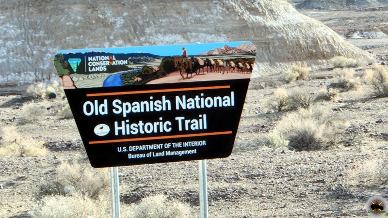
In 2002, the U.S. Congress designated the Old Spanish Trail as a National Historic Trail, recognizing its role in American history. The National Park Service, in collaboration with state agencies and preservation groups, maintains interpretive sites and protects trail remnants. Modern efforts focus on public education, trail mapping, and archaeological research to preserve this vital piece of Southwestern heritage.

Conclusion

The Old Spanish Trail was more than a trade route; it was a conduit for economic, cultural, and social exchange in the American Southwest. From its origins in Spanish colonial ambitions to its role in Mexican and early American trade, the trail shaped the region’s history despite its challenges. Its legacy endures in the cultural diversity of the Southwest and the preserved remnants that continue to tell its story. Understanding the trail’s history offers valuable insights into the complex interplay of peoples and economies that defined the American frontier.

Further Reading

The Needles Campground

Needles Campground, also known as Squaw Flat Campground, is the primary developed camping area within the Needles District of Canyonlands National Park in southeastern Utah. Situated about 3 miles west of the Needles Visitor Center along the main park road (UT-211), it provides a convenient base for exploring the district’s iconic sandstone spires, hiking trails, and backcountry routes. The campground is open year-round and offers a rustic desert camping experience amid red rock formations, piñon-juniper woodlands, and expansive views of the surrounding canyons. It’s ideal for tent campers, small RVs (up to 28 feet in length due to tight turns and limited maneuvering space), and groups seeking immersion in the park’s remote beauty, though it lacks modern conveniences like hookups or showers to preserve the natural environment.

The campground features 26 individual sites divided into two loops (A and B), plus three group sites for larger parties. Loop A operates on a first-come, first-served basis year-round, while Loop B allows reservations during peak seasons (March 15–June 30 and September 1–October 31) up to six months in advance via Recreation.gov. Group sites accommodate 11–50 people and are also reservable. Each individual site includes a picnic table, fire ring with grill, and space for up to 10 people and 2 vehicles. Amenities are basic: vault toilets are available, but there is no potable water on-site (visitors must fill up at the visitor center), no electricity, no dump station, and no showers. Trash and recycling collection is provided, and firewood gathering is prohibited—bring your own or purchase it locally. Generator use is restricted to specific hours (typically 8 a.m.–10 a.m. and 4 p.m.–8 p.m.) to minimize noise.

Fees are $20 per night for individual sites and range from $90 (11–20 campers) to $135 (21–30 campers) for group sites, with a $10 discount for holders of Interagency Senior or Access passes. Check-in is after 8:30 a.m., and check-out is by 10 a.m., with a 7-day camping limit during peak seasons. Reservations can fill quickly, especially in spring and fall when temperatures are mild (daytime highs 60–80°F), so booking early is recommended; otherwise, arrive early for first-come sites. Regulations emphasize low-impact practices: pets must be leashed (and are not allowed on trails), quiet hours are 8 p.m.–8 a.m., and all food must be stored properly to avoid attracting wildlife like ravens or rodents. Visitors should prepare for extreme weather—hot summers (over 100°F with no shade), cold winters (below freezing), and potential flash floods—and carry ample water (at least 1 gallon per person per day). The campground’s proximity to trails like Chesler Park and Elephant Hill makes it a hub for day hikes, but its remote location (75miles from Moab) means no nearby services; stock up on supplies in Monticello or Moab..

Campground Map

Description and History of the Needles Region of Canyonlands National Park

The Needles District, encompassing the southeastern portion of Canyonlands National Park, is renowned for its striking landscape of multicolored sandstone spires, towers, and fins formed from Cedar Mesa Sandstone, creating a maze-like terrain of red-and-white banded rock formations that resemble needles piercing the sky. Covering about 74 square miles, it’s the most accessible yet least crowded district of the park, located roughly 40 miles south of Moab or 14 miles north of Monticello via US-191, then 35 miles west on the paved UT-211 (which dead-ends in the park). The area features dramatic canyons, grassy meadows like Chesler Park, ancient ruins, and panoramic overlooks such as Confluence Overlook, where the Green and Colorado Rivers meet. Elevation ranges from 4,500 to 6,000 feet, supporting sparse desert vegetation including yucca, prickly pear cactus, and piñon pines, with wildlife like bighorn sheep, coyotes, and golden eagles commonly spotted.

Activities center on exploration: over 60 miles of hiking trails (from short loops like Slickrock Foot Trail to multi-day backpacks into Salt Creek), 50 miles of challenging four-wheel-drive roads (e.g., Elephant Hill, one of the toughest in Utah with steep switchbacks and rock ledges), and rock climbing on the sandstone features. Backcountry permits are required for overnight stays outside developed areas, and ranger-led programs (evening talks at the campground April–June and September–November) educate on geology, ecology, and history. The Needles Visitor Center, open spring through fall, provides exhibits, maps, permits, and a year-round water filling station. The district’s remoteness fosters solitude, but visitors must prepare for limited cell service, no fuel or food in the park, and variable weather—flash floods in monsoon season (July–September) or snow in winter.

Human history in the Needles spans over 10,000 years, beginning with Paleoindians who hunted big game and gathered plants in the post-Ice Age era. By 2,000 years ago, Ancestral Puebloans (formerly called Anasazi) thrived here, farming corn, beans, and squash in the fertile canyons, constructing granaries, dwellings, and rock art panels (petroglyphs and pictographs) that remain visible today, such as at Tower Ruin or Newspaper Rock nearby. These peoples left around 1300 CE due to drought or resource depletion, with later Ute, Paiute, and Navajo groups using the area seasonally. European exploration began in the 19th century, notably with John Wesley Powell’s 1869 and 1871 expeditions down the Green and Colorado Rivers, which mapped the canyons but bypassed much of the Needles interior.

In the early 20th century, cowboys grazed cattle in the grassy parks, and the 1950s uranium boom brought prospectors who built primitive roads (now used for 4WD trails) while searching for ore, inadvertently opening the area to outsiders. The park’s creation stemmed from the 1950s advocacy of Bates Wilson, superintendent of nearby Arches National Monument, who explored the Needles in 1959 and pushed for protection amid growing interest in desert preservation under President Kennedy’s administration. Canyonlands National Park was established on September 12, 1964, by President Lyndon B. Johnson, encompassing the Needles as one of its three districts (along with Island in the Sky and The Maze). Early controversies in the 1960s–1970s centered on development: initial plans for extensive roads (e.g., to Chesler Park) clashed with wilderness advocates, leading to limited access and a focus on backcountry preservation. Today, the Needles embodies this balance, protecting cultural sites under the Antiquities Act while offering low-impact recreation, with ongoing efforts to collaborate with Tribal nations on heritage management.

Wells Spicer

Wells Spicer (1831–1885 or 1887) was an American journalist, lawyer and judge whose over saw the trial after the gunfight at the O.K. Corral in Tombstone Arizona.

Historical photo of Wells Spicer, 1875. Cropped from group photo of John D. Lee's defense team for Lee's second murder trial.
Historical photo of Wells Spicer, 1875. Cropped from group photo of John D. Lee’s defense team for Lee’s second murder trial.

Early Life and Education

Wells Spicer was born in 1831 in Chemung, Tioga County, New York, to William and Seba Spicer, Presbyterian farmers. He had two siblings: an older brother, George, and a younger sister, also named Seba. Around 1840, when Wells was nine, the family relocated to Tipton, Cedar County, Iowa. As a young man, Spicer clerked for respected lawyer, banker, and merchant William H. Tuthill, under whose guidance he was admitted to the Iowa bar in 1853. That same year, Spicer, with associates, launched the Cedar County Advertiser, becoming its sole publisher and editor by 1854. He sold the successful newspaper four years later.

Early Career and Family

Spicer’s early career was multifaceted. In 1854, he ran unsuccessfully as a Democrat for county prosecutor but switched to the Republican Party and won election as county judge in 1856. That July, he married Abbie Gilbert, and they welcomed a son, Earnest, in 1857. The couple faced marital difficulties, separating in 1876, though Spicer considered himself married years later. After a brief stint in Onandaeg City, Colorado, Spicer moved to the Utah Territory in 1869 with former publishing colleague Charles Swetland, settling in Corinne City, a non-Mormon enclave. Admitted to the Utah bar, Spicer specialized in mining suits and claims and opened a hotel. Abbie and Earnest joined him around this time.

Utah Ventures and the Mountain Meadows Massacre Trial

In 1871, Wells Spicer and his family moved to Ophir City, Utah, where he continued legal work, prospected, and founded a tunneling company. He contributed to the Salt Lake Daily Tribune and Utah Mining Gazette. By 1872, the family settled in Salt Lake City, where Spicer was appointed U.S. Commissioner by the Supreme Court, handling cases primarily in Bingham. In 1874, he leased the Rollins Mine in the Lincoln Mining District near Minersville, striking a profitable lead and gold vein that revitalized the area.

Through his Beaver connections, Spicer became entangled in the infamous Mountain Meadows Massacre trial. In November 1874, Sheriff William Stokes arrested John D. Lee for his role in the 1857 massacre, where a Mormon militia killed approximately 120 emigrants in southern Utah. Spicer defended Lee in two trials. The first, in 1875, ended in a hung jury—eight Mormons voted for acquittal, four non-Mormons for conviction. Spicer faced backlash: non-Mormons labeled him a “jack Mormon” for defending Lee, while Mormons criticized his defense tactics. The second trial in 1876, with a Mormon-heavy jury, convicted Lee, who was executed by firing squad on March 22, 1877. Spicer’s reputation suffered, with both sides vilifying him in the press, often referring to him derisively as “One Spicer.”

Move to Tombstone and the O.K. Corral Hearing

In 1878, Spicer relocated to Tombstone, Arizona, where he worked as an attorney, mining broker, and U.S. Commissioner for Deeds. He was appointed Justice of the First District Court in June 1880, overseeing customs, internal revenue, and U.S. criminal cases. Related to the Earp brothers, Spicer’s most notable role came after the Gunfight at the O.K. Corral on October 26, 1881. The 30-second shootout pitted Marshal Virgil Earp, his brothers Wyatt and Morgan, and Doc Holliday against outlaws Billy Claiborne, Ike and Billy Clanton, and Tom and Frank McLaury. Billy Clanton and the McLaury brothers were killed.

As Justice of the Peace, Spicer presided over the preliminary hearing to determine if the Earps and Holliday should face murder charges, following complaints filed by Ike Clanton. The month-long “Spicer Hearing,” held in a building near the Tombstone Epitaph office, generated intense debate. Spicer’s rulings, including allowing Kate Holliday’s testimony despite her allegations against Doc Holliday, sparked accusations of bias, especially given his business ties with Wyatt Earp in liquor and tobacco sales. On November 29, 1881, Spicer ruled that the evidence would not support a murder conviction, citing the defendants’ actions as justified in their official duties. He noted the lawlessness of the frontier and the Earps’ role in maintaining order, though he acknowledged the Grand Jury could revisit the case. The Grand Jury upheld his decision, and the Earps and Holliday were released.

The bodies of Tom & Frank McLaury and Bill Clanton after the shoot-out in Tombstone

The ruling was polarizing. The Tombstone Epitaph praised Spicer, while the Tombstone Nugget and the Cowboy faction condemned him. In December 1881, Spicer received a threatening letter from “A Miner,” warning him to leave or face violence. Unintimidated, he remained in Tombstone but faced ongoing scrutiny for alleged partisanship.

Later Years and Mysterious Disappearance

The O.K. Corral decision effectively ended Spicer’s legal career in Tombstone. He shifted focus to prospecting, first in Pima County, Arizona, then in Ures, Sonora, Mexico. In the mid-1880s, he invested heavily in a silver mine in the Quijotoa Mountains near Tucson, but the shallow veins led to financial ruin. Destitute and reportedly despondent, Spicer’s final days are shrouded in mystery. In January 1887, while en route to Covered Wells, he visited Bill Haynes and attempted suicide twice. He then wandered into the Arizona desert and vanished. Some believe he died of exposure, while others speculate he faked his death to escape creditors and fled to Mexico, possibly Ures. A report suggests his body was found in Ajo, Arizona, in 1885, but no definitive evidence confirms his fate.

Legacy

Wells Spicer’s life encapsulates the complexities of the American frontier. A lawyer, journalist, prospector, and judge, he navigated the volatile worlds of mining, politics, and justice. His involvement in the Mountain Meadows Massacre trials and the O.K. Corral hearing placed him at the heart of two defining frontier events, earning him both fame and infamy. Criticized for bias yet praised for his legal reasoning, Spicer’s decisions reflected the blurred lines between law and lawlessness in the Wild West. His mysterious disappearance only adds to his enigmatic legacy, leaving historians to debate whether he met a tragic end or slipped away to a new life.

Fay Nevada – Lincoln County Ghost Town

Fay, Nevada, is a ghost town located in Lincoln County, approximately 10 miles northeast of Alamo. Once a small but active mining community, Fay has faded into obscurity, leaving behind only traces of its brief existence. This report explores the history of Fay, its establishment, economic activities, population, and eventual decline, drawing on available historical records to provide a comprehensive overview.

Fay Nevada - 1910 - The horseshoe mine  is visible on the hill
Fay Nevada – 1910 – The horseshoe mine is visible on the hill

Establishment and Early Development

Fay was established in the late 19th century during a period of intense mining activity in Nevada. The discovery of mineral deposits, likely silver or gold, spurred prospectors to settle in the area. The town was officially recognized with the opening of the Fay post office in September 1900, which served as a critical link for communication and supply in the remote region. The post office remained operational until July 1924, marking a 24-year period of activity.

The town’s name, “Fay,” may have been inspired by a person or a term common in mining communities, though specific origins are unclear due to limited records. Like many Nevada mining towns, Fay’s early development was tied to the boom-and-bust cycles of the mining industry, with its fortunes dependent on the productivity of local mines.

Economic Activity

The primary economic driver of Fay was mining. Lincoln County, rich in mineral resources, saw numerous small mining camps like Fay emerge during the late 19th and early 20th centuries. Miners in Fay likely extracted silver, gold, or other metals, though specific details about the mines or their output are scarce. The town’s remote location meant that supplies had to be transported over long distances, making the post office a vital hub for receiving goods and sending out ore or correspondence.

In addition to mining, some residents may have engaged in ancillary activities such as small-scale farming or ranching to support the community. However, the arid climate and rugged terrain of Lincoln County limited agricultural potential, reinforcing mining as the economic backbone.

Fay Nevada - 1910
Fay Nevada – 1910

Population and Community

Fay was never a large settlement. According to the 1910 U.S. Census, the Fay precinct had a population of 99 residents. This small population reflects the transient nature of mining towns, where communities often consisted of miners, their families, and a few service providers such as merchants or postmasters. The demographic likely included a mix of Euro-American settlers and possibly some Native American or immigrant laborers, though specific records are unavailable.

One notable figure associated with Fay is Darr H. Alkire, a United States Air Force general born in Fay during its active years. Alkire’s birth in the town highlights its role as a small but functioning community capable of supporting families, at least temporarily.

The community would have centered around essential services like the post office and perhaps a general store or saloon. Social life in Fay likely revolved around mining activities, with residents sharing the challenges of living in a remote, harsh environment. However, no records of schools, churches, or other institutions have been found, suggesting that Fay remained a rudimentary settlement.

Decline and Abandonment

Fay’s decline began in the early 20th century as the local mines became less productive. By the time the post office closed in July 1924, the town was likely already in decline. The exhaustion of mineral resources, combined with the high costs of sustaining a remote community, drove residents to seek opportunities elsewhere. Many moved to larger towns like Alamo or Caliente, or left Lincoln County entirely.

By the mid-20th century, Fay had become a ghost town, with its buildings abandoned and left to deteriorate. Today, little remains of Fay beyond scattered ruins, possibly including foundations or mining debris. The site is rarely visited, and its obscurity is compounded by the lack of detailed historical documentation.

Historical Significance

Fay’s history is emblematic of the many short-lived mining towns that dotted Nevada during the late 19th and early 20th centuries. These communities played a critical role in the state’s economic development, contributing to Nevada’s reputation as a hub of mineral wealth. Fay’s small size and brief existence underscore the challenges of sustaining remote settlements in an arid, resource-scarce environment.

The town’s story also reflects broader themes in Nevada’s history, including the transient nature of mining booms, the resilience of early settlers, and the impact of geographic isolation. While Fay itself left little mark on the historical record, its existence adds to the tapestry of Nevada’s mining heritage.

Conclusion

Fay, Nevada, was a fleeting chapter in the state’s history, born from the promise of mineral wealth and extinguished by the realities of an unforgiving landscape. Its 24 years of activity, centered around a small mining community, offer a glimpse into the lives of those who sought fortune in Nevada’s rugged interior. Though now a ghost town, Fay remains a testament to the ambition and impermanence of the mining frontier.

Town Summary

TownFay Nevada
Latitude, Longitude37.9080190,-114.0699775
Elevation6926 Feet
Postoffice1901 – 1924
Population99 (1910 Census)

Fay Trail Map

Resources

Taylor Campground

Taylor Campground is a remote, single-site backcountry campsite located along a spur road off the White Rim Road/Trail in the Island in the Sky District of Canyonlands National Park, Utah. Situated approximately 77 miles from the Island in the Sky Visitor Center (about 11 hours estimated driving time clockwise), it lies roughly 6 miles down the sandy Taylor Canyon Road from the main White Rim loop.

This site offers a more isolated experience compared to the campsites directly on the White Rim Road, with stunning panoramic views of the surrounding canyon landscape, including dramatic red rock formations, towering spires like Moses and Zeus, and expansive desert vistas. The area feels especially serene and exposed, making it ideal for those seeking solitude amid the park’s rugged beauty. Access involves sandy driving conditions, and the site is best suited for high-clearance 4WD vehicles. It accommodates up to 15 people and 3 vehicles (motorbikes and trailers count toward vehicle limits).

Amenities at Taylor Campground

As a primitive backcountry site in Canyonlands National Park, amenities are minimal and consistent with other White Rim campsites:

  • Vault toilet (pit toilet) — typically stocked with toilet paper, though visitors should be prepared and always pack out all trash (do not dispose of trash in the toilet).
  • Designated camping area for tents and vehicles.
  • No running water, electricity, cell service, picnic tables, fire rings, or trash collection. Campfires are not permitted anywhere in the park’s backcountry.
  • Stunning natural setting with panoramic canyon views.

All visitors must pack in all water, food, and supplies, and pack out everything (including human waste if required in certain zones, though vault toilets are available here). A backcountry camping permit is required and highly recommended to reserve well in advance, as White Rim sites book up quickly (often months ahead).

White Rim Trail History

The White Rim Trail (also known as White Rim Road) is a roughly 100-mile unpaved 4WD loop that traverses the top of the White Rim Sandstone formation below the Island in the Sky mesa. It provides dramatic views of the Colorado and Green Rivers, deep canyons, and iconic landmarks like Musselman Arch and Murphy Hogback.

The road was constructed in the 1950s by the U.S. Atomic Energy Commission during the Uranium Boom to provide access for prospectors seeking uranium deposits for Cold War-era nuclear weapons production. Although large uranium finds occurred in similar nearby regions, mines along the White Rim produced very little, and operations were soon abandoned. Prior to that, the area saw use by Ancestral Puebloan peoples (with rock art and dwellings still visible), followed by white settlers who grazed cattle in the region during winter. Canyonlands National Park was established in 1964, preserving the landscape and transforming the old mining road into one of the park’s premier backcountry routes for 4WD vehicles, mountain bikers, and adventurers. Today, it attracts thousands of visitors annually for its challenging terrain, stunning scenery, and sense of remote wilderness.

Note: Always check current conditions, road status, and permit requirements on the official NPS Canyonlands website before your trip, as flash floods, weather, and high water on the Green River can affect sections of the route. High-clearance 4WD is essential, and self-sufficiency is key due to the remote environment.