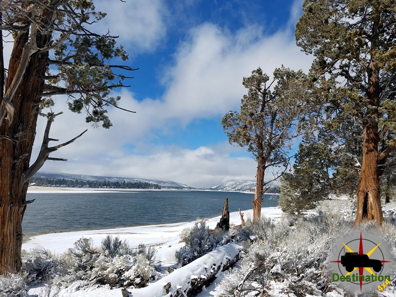
Big Bear, CA
I quiet mountain community full of back country adventure.
The Journey is the destination
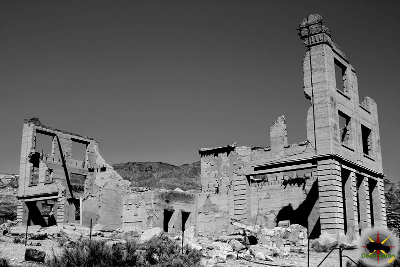
Bullionville, Nevada, is a ghost town in Lincoln County, located approximately one-quarter mile east of U.S. Route 93, one mile north of Panaca, and ten miles south of Pioche. This report explores the history of Bullionville, a short-lived but significant milling town that thrived from 1870 to 1882, driven by its strategic water resources and proximity to the silver mines of Pioche. Drawing from historical records, this account details its establishment, growth, decline, and lasting remnants.

Bullionville was founded in February 1870 when John H. Ely and W.H. Raymond relocated a five-stamp mill from Hiko to a site selected for its reliable water supply from Meadow Valley Creek, a northern tributary of the Colorado River. Initially named Ely City, the settlement was renamed Bullionville later that year. The availability of water made it an ideal location for milling operations, prompting the construction of additional mills to process ore from nearby Pioche mines. Between 1870 and 1872, most of Pioche’s mills were established in Bullionville due to this advantage. The 1870 Federal Census recorded 96 residents, indicating early growth.
In 1872, construction began on the Pioche and Bullionville Railroad, a 21-mile narrow-gauge line costing $255,000, designed to transport ore from Pioche mines to Bullionville’s mills. Completed in 1873, the railroad facilitated efficient ore processing and spurred further development.
Bullionville experienced rapid growth between 1872 and 1875, reaching a population of approximately 500 by 1875. The town boasted five mills with a total of 110 stamps, making it a regional hub for ore processing. It also housed the first iron foundry in eastern Nevada, reflecting its industrial significance. The community supported a range of businesses, including hotels, stores, multiple saloons, blacksmith shops, and a daily stage service to Pioche. A post office opened in April 1874, further solidifying its status as a burgeoning settlement.
The Panaca Summit Charcoal Kilns, built in the mid-1870s, supported Bullionville’s mills by producing charcoal, a critical fuel for smelting silver ore. Constructed by skilled stone masons using rhyolitic tuff and operated by Swiss and Italian woodcutters known as “Carbonari,” these kilns processed up to 50 cords of wood per cycle, yielding enough charcoal to smelt one ton of ore per 30 bushels. The kilns, located near Panaca, operated until the late 1890s, outlasting Bullionville’s peak.
The construction of a water system connecting Bullionville to Pioche in 1875 marked the beginning of the town’s decline. This system enabled Pioche to support its own milling operations, reducing the need for Bullionville’s facilities. Between 1875 and 1877, most mills were relocated to Pioche, and the Pioche and Bullionville Railroad ceased operations by 1880. The 1880 Federal Census reported only 68 residents, a sharp decline from the town’s peak.
In 1880, an attempt was made to sustain Bullionville by erecting a plant to process tailings left by the former mills. However, this effort failed to reverse the town’s fortunes. The post office closed in November 1886, briefly reopened from October 1892 to July 1898, and closed permanently thereafter. By 1900, the Federal Census recorded only two families, the Morgans (3 members) and the Clarks (10 members), residing in Bullionville. The town was effectively abandoned by the early 20th century.
Today, Bullionville is a ghost town with few physical remnants. The Bullionville Cemetery, accessible via a short trail at Cathedral Gorge State Park, is one of the primary surviving features, documented in the 1980s as part of the Civic Historical Research Project led by Paul Vance. The cemetery offers insight into the lives of early residents, though no original buildings remain. The Nevada State Historical Marker No. 203, located along U.S. Route 93 one mile north of Panaca, commemorates Bullionville’s history.
Photographic evidence from the Nevada Historical Society, including images of mining operations circa 1910–1912, provides visual documentation of Bullionville’s industrial past. The Panaca Summit Charcoal Kilns, still standing, serve as a testament to the region’s mining heritage.
Bullionville, Nevada, was a fleeting but vital component of Lincoln County’s mining economy in the 1870s. Its strategic location and water resources fueled a brief period of prosperity, marked by industrial innovation and community growth. However, the development of infrastructure in Pioche led to its rapid decline, leaving Bullionville as a ghost town by the late 19th century. Its cemetery, historical marker, and nearby charcoal kilns preserve its legacy, offering a glimpse into Nevada’s boom-and-bust mining history.
Buillionville is located about 10 miles south of Pioche, near the intersection of the 319 and 93, Great Basin Highway. The Bullionville cemetary is located after a short hike in the Cathedral Gorge State Park.
| Town | Bullionville |
| Latitude, Longitude | 37.803333, -114.406944 |
| Elevation | 5220 |
| Post Office | April 1874 – November 1886 October 1892 – July 1898 |
| Nevada State Historic Marker | 203 |
| Population | 500 |
Bullionville began early in 1870 when John H. Ely and W.H. Raymond removed their five-stamp mill at Hiko and placed it at this point. The enterprise prospered and during the next two years most of nearby Pioche’s mills were located here because of the proximity to water. A twenty-one mile narrow gauge railroad, the Pioche and Bullionville, was completed in 1873 at a cost of $255,000 to haul ore from the Pioche mines to the reduction mills. Bullionville grew rapidly and by 1875 it had five mills, a population of 500 and the first iron foundry in eastern Nevada. During the same year a water works was constructed at Pioche which eventually led to the relocation of the mills. Although a plant was erected here in 1880 to work the tailings deposited by the former mills, this failed to prevent the decline of Bullionville.
Nevada State Historic Marker
Hole in the Wall campground is found deep in the Mojave National Preserve in San Bernardino County, California. The Campground is a popular location for hikers, star gazers and explorers of the Old Mojave Road.

The campground is nestled up against a small hillside and offers access to the Ring Trail which is a short and very fun hike around a mesa of sharp sculpted volcanic rock. The Hole-in-the-Wall Information Center is located nearby and offers a book store, bathrooms and ranger programs. The campsites are suitable for RV’s, trailer and tent camping and does have 2 sites dedicated for walk in camping.
The campground is at a reasonable higher elevation, which offers mild weather in the spring and falls months. Winter will be cold and obviously the summer months will allow a visitor to experience the harsh, hot, arid Mojave.
From I-40: Exit Essex Road and drive north 10 miles to the junction with Black Canyon Road. Hole-in-the-Wall is 10 miles north on Black Canyon Road.
| Campground Name | Hole in the Wall Campground |
| Latitude, Longitude | 35.0484172,-115.3963526 |
| Sites | 35 |
| Elevation | 4,400 ft |
| Amenities | Pit toilets, trash receptacles, fire rings, picnic tables; no utility hookups. Firewood is not available in the park. |
The Lippincott Mine Road is a one way trail from Death Valley’s Racetrack Playa to Saline Valley. It is a steep trail which is not for the novice or the feint of heart. Greeting you at the trail head is a sign which reads:
“Lippincott Pass, 4×4 High Clearance, No Tow Service, Caution”
Experienced drivers using 4×4 high clearance vehicles only. What traveler in their right mind could resist a challenge like this? Provided you are equipped to do so.


The top of Lippincott Mine road starts at the end of the Racetrack Valley road and descends into the west towards Saline Valley. The road is steep and narrow but is not too technical. At the top of the route is the Lippencott Mine site which gives the trail it’s name. The Lippincott Mine offers great views of both Saline and RaceTrack Valley.

There are several structures, and mines to explore and a lot of time could be spent exploring the site on foot. The Homestake dry camp offers a great spot of overnight in the area for those of us who are so inclined and look forward to being really away from it all. The best night sky I have seen in the last 35 year was at the Homestake Dry Camp.

The Afton Canyon Campground offer amazing access and camping for the Old Mojave Road, surroundings areas of the Mojave. The dry, desert campground is found in the heart of the Mojave desert at 1640 feet in elevation and is a great place for birding and wildlife due to close proximity to the Mojave River which is briefly above ground in this area.

Afton Canyon Campgrounds features 22 large sites which all include tables with sun shades, BBQ and fire pits. The campground does offer pit toilets and no RV Facilities. The camp sites are dispersed nicely, so you are not going to be too crowded when staying here.
Afton Canyon is commonly referred to as the “The Grand Canyon of the Mojave” due to its diverse geology and impressive rock formations. There are a view slot canyons to explore and even a buried rail road car. Afton Canyon is one of the few places in the Mojave where surface water can be found. Like many deserts, this water offers an oasis which supports the local wild life and plant populations.
Due to the location severe weather, poisonous snakes and flash floods are all possible here.
This campsite is an nice spot for astronomers to view the dark night skys.
Campsites are provided first come first serve.
Afton Canyon is managed by the BLM.
| Campground Name | Afton Canyon Campground |
| Latitude, Longitude | 35.038306, -116.383813 |
| Address | Afton Rd, Baker, CA 92309 |
| Number of Sites | 19 |
| Elevation | 3800 |
| Reservations | No |
| Amenities | Campsite Tables, Drinking Water, Fire Pit, Fire Rings Grills, Group Camping, Pets OK, Picnic Tables, Vault Toilets |
| Webiste | https://www.blm.gov/visit/afton-canyon |
Bodie, California is the ghost town by which all others are judged. Located at 8300 in the Bodie Hills above Mono Lake, Bodie is the largest and perhaps best preserved ghost town in America. Established as a ghost town and state park in 1962, the town site is now administered by the Bodie Foundation.
Currently preserved in “Arrested Decay” a condition and phrase coined by the State of California for the Bodie, the town site is preserved as it was found in 1962. This essentially maintains the structures as the were at that time, and work may be done to keep them to that standard. Some buildings get new roofs, windows sealed and foundation rebuilt to preserve the state of degradation. It is because of this forward thinking policy that the town remains in the state of decline that it does.

I remember my first visit to Bodie was probably in the the late 1970’s. My father drove our old Ford truck into the town, and as I jumped out my eyes found the old Standard Mill. The Standard Mill still dominates the valley with its grayish-blue siding, multiple smoke stakes and extreme size. The Standard Mill is the most intact mill in California and processed over $14 million dollars in gold during its 25 years of service.

Formed in 1859, the town under went several mining booms, busts and fires. At it’s peak in 1879, Bodie hosted 5000 – 7000 souls, 65 saloons, a “Redlight” district, a china town, four volunteer fire stations, several newspapers, churches and of coarse, a Jail. Bodie maintain a rough reputation over the years and suffers from murders, shoot outs, stage robberies and the odd bar room brawl.
They say you were wild and woolly, Bodie
And fast on the draw as them make ’em;
That you lived at ease with the bad and the bold,
Who thought nothing of shooting a man down cold,
And defying the law to take ’em
Lillian Ninnis
By 1910 the population settled at about 700 people, mostly families, as the miners and those who service the miners moved on to more prosperous areas. The last printed paper was in 1912, and signaled the beginning of the end for the scrappy little town. Although labelled a ghost town in 1915, Bodie continued to linger and dwindle is size until 1940 when the Post Office closed.

Under threat and vandalism the state of California took over the town site, and currently hosts some 200,000 visitors per year.
Remote locations, harsh weather and rustic builds make Bodie is a popular site for photographers.
The road into Bodie is accessible to almost any vehicle, but can server as a launch point the many back roads and trails. Nearby attractions are Masonic, Chemung and Aurora who like to get off the beaten path.


Gold was first discovered in the Mono Lake region in 1352 and placer gold was then discovered at the future site of Bodie in July, 1859* by William S. Body. On July 10, 1860, the Bodie Mining District was organized. In August, 1859 quarts veins were also discovered in the area, but the lack of -water and the extreme difficulties of transporting supplies and equipment over the mountains and desert tended to severely restrict mining activities at Bodie for some time. From 1860 to 1877, Bodie polled only some 20 votes a year, and in 1865 the town still had only SOP 14 small frame and adobe houses.
NATIONAL SURVEY OF HISTORIC SITES AND BUILDINGS
In 1876-77, however, new quartz discoveries were made at the Bodie and Standard mines, touching off a great gold rush to Bodie in 1878. From a few shacks, a term of some 250 wooden buildings rapidly appeared in the desert and the population leaped to 10,000 or 12,000 persons, with the usual assortment of gambling dens, breweries, saloons, and the nightly shootings, stabbings and brawls. Bodie soon merited the title of “Shooters Town,” and a “Bad Man from Bodie” was then universally recognized to be a particularly unpleasant individual. In 1879, when Bodie reached its pinnacle, its main street was over a-mile long and built solidly with one and two-story frame buildings. In 1881 a 32- mile narrow gauge railroad was constructed from Mono Lake to Bodie to carry in fuel and lumber. % 1883, however, the boom was over and all but the Bodie and Standard mines closed down; these two mines finally consolidated in 1887. In 1895 Bodie had a small revival when the cyanide process of recovering gold was put in use, Mining continued intermittently up to World War II, when Bodie finally became a true ghost town.


| Name | Bodie |
| Location | Mono County, California |
| Latitude, Longitute | 38.2121, -119.0120 |
| GNIS | 1658094 |
| Newspaper | Bodie Standard 1878 – ? Bodie Morning News |
| National Historic Landmark | 66000213 |


 Bodie Fire June 23, 1932The Fire of June 23, 1932, stands as one of the most devastating events in the history of Bodie, California, the once-thriving gold-mining boomtown in… |
 Standard Mine Magazine Explosion – July 14, 1879A vintage photo of the Standard Mill in Bodie as it appeared sometime during the 1980s. Photo by Paul Wight Bodie, California, emerged as a… |
 Treloar Murder January 14, 1881Bodie, California, was a booming gold mining town in Mono County during the late 1870s and early 1880s, with a population peaking around 8,000-10,000 residents.… |
 Bodie and Aurora rivalry continues to this dayTwo towns located in the hills above Mono Lake maintain, the Bodie and Aurora rivalry continues even now, long past their demise. Bodie, CA and… |
 Bodie and Benton RailroadThe Bodie and Benton Railway operated for about thirty eights years, supplying the town of Bodie, California. The narrow gauge railroad travelled north, from the… |
 Bodie CemeteryNestled on a sagebrush-covered ridge overlooking the remnants of Bodie State Historic Park in Mono County, California, the Bodie Cemetery stands as a poignant testament… |
 Boone Store and Warehouse – Bodie CaliforniaThe Boone store and warehouse located on the corner of Green Street & Main Stree in Bodie, CA. Photo James L Rathbun The Boone Store… |
 DeChambeau Hotel – Bodie CaliforniaThe DeChambeau Hotel is a historic brick building located in Bodie, California, a once-thriving gold-mining boomtown that has since become one of the most well-preserved… |
 Firehouse – Bodie CaliforniaThe firehouse in Bodie stands as a poignant symbol of the town's efforts to combat these threats, reflecting both the ambition of its heyday and… |
 IOOF Building – Bodie CaliforniaThe Independent Order of Odd Fellows (IOOF) Building, also known as the I.O.O.F. Hall, is a prominent wooden structure located on Main Street in Bodie,… |
 J. S. Cain House – Bodie CaliforniaJ. S. Cain House i Bodie, California. Photo by James Rathbun The J.S. Cain House, located at the corner of Green and Park Streets in… |
 Methodist Church – Bodie CaliforniaBodie, California, is a preserved ghost town and state historic park located in Mono County, east of the Sierra Nevada mountains. Once a bustling gold-mining… |
 Miners Union Hall – Bodie, CaliforniaExterior View of the miners hall in Bodie, CA Photo by James Rathbun Bodie, California, is a well-preserved ghost town located in Mono County, east… |
 Sawmill – Bodie, CaliforniaThe sawmill in Bodie, California, is a preserved structure within Bodie State Historic Park, a ghost town in Mono County that once thrived as a… |
 The Hoover HouseThe Hoover House, located in Bodie, California, is a significant part of the town's rich history. Bodie itself is a well-preserved ghost town that exemplifies… |
 The Standard Mill – Bodie, CAThe Standard Mill, also known as the Standard Consolidated Mining Company Mill, was a pivotal element in the history of Bodie, California. The building is… |
 Wheaton and Hollis Hotel – Bodie, CaliforniaThe Wheaton and Hollis Hotel, a weathered wooden structure on Main Street in the ghost town of Bodie, California, exemplifies the transient and multifaceted nature… |
 Eleanora DumontEleanora Dumont Eleanora Dumont, born around 1829, likely in New Orleans or of French Creole descent, was a famed American gambler known as Madame Mustache.… |
James Stuart CainJames Stuart Cain (April 17, 1853 - October 28, 1938) was a business man and entrepreneur who lived and worked in the mining town of… |
 Rosa MayRosa May, Born Rosa Elizabeth White in January 1855 Rosa May was a prostitute and madam in Bodie, California, during the late 19th and early… |
 Theodore Jesse HooverTheodore Hoover in Bodie, Calif., 1904 Early Life and Education Theodore Jesse Hoover was born on January 28, 1871, in West Branch, Iowa. He was… |
Waterman S BodeyWaterman S Bodey (14 May 1814 - 9 Dec 1859 ) was a prospector whose name became immortalized in the annals of American mining history through… |
Bodie Fire June 23, 1932The Fire of June 23, 1932, stands as one of the most devastating events in the history of Bodie, California, the once-thriving gold-mining boomtown in… |
Standard Mine Magazine Explosion – July 14, 1879A vintage photo of the Standard Mill in Bodie as it appeared sometime during the 1980s. Photo by Paul Wight Bodie, California, emerged as a… |
Treloar Murder January 14, 1881Bodie, California, was a booming gold mining town in Mono County during the late 1870s and early 1880s, with a population peaking around 8,000-10,000 residents.… |
Bodie Evening Miner NewspaperThe Bodie Evening Miner was a key newspaper in Bodie, California, a bustling gold-mining town in Mono County that reached its zenith in the late… |
 Bodie Standard NewsBodie Standard News, Bodie, Mono County, California The Bodie Standard News, originally known as the Standard and later as the Bodie Standard, was a cornerstone… |
 Daily Free PressDaily Free Press - Bodie, California The Daily Free Press was a prominent newspaper in Bodie, California, a gold-mining boomtown in Mono County that flourished… |
 The Bodie Chronicle NewspaperThe Bodie Chronicle, Bodie, Mono County Newspaper The Bodie Chronicle was a short-lived but notable newspaper in Bodie, California, a gold-mining boomtown in Mono County… |
 The Bodie Morning NewsThe Bodie Morning News Newspaper The Bodie Morning News was a short-lived but significant publication in the bustling mining town of Bodie, California, during the… |
 A Pathway Through ParksPathway Through Parks written by Carl S Chavez "Bodie, the very sound of that name conjures up images of "The Bad Man From Bodie", a… |
 Bodie: 1859-1962 (Images of America)Bodie: 1859-1962 (Images of America) - Author Terri Lynn Geissinger Nestled amongst the sage-covered, windswept hills of California’s Eastern Sierra is the site of one… |
 Bodie: Good Times & BadBodie, Good Time and Bad - Author Nicholas Clapp Author Nicholas Clapp and photographer Will Furman portray Bodie in both vivid words and stunning photography—a… |