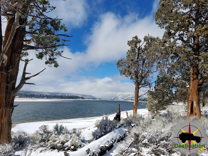
Big Bear, CA
I quiet mountain community full of back country adventure.
The Journey is the destination
In the past few weeks, the Destination4x4.com website was overhauled to better comport itself to a higher standard. At its core, Destination4x4.com is a list of places that I have been, researched and / or places I want to go. These places are places that interest me, for whatever reason. I have found many of them from family, browsing the web or searching google earth.
The website is going over an overhaul at the moment and work is happening in the following ways.

Recently, I was on a fellow explorers website researching a site and he / she was lamenting that they were tired of people copying from their website. They made the statement something along the lines of quit “copying my content” and “do what I did and google it”.
At first I felt rather guilty. I was on another website and learning about a site with the intention of writing my own article. Then, I became annoyed as I was simply doing what they did and I found their website. This person is complaining about something that he/she never did. Give Credit where Credit is due.
In an effort to be as honest and informative as I can, I then and there decided that I was going to “do it better”. I am currently in process of adding resource links back to the source material for every page I publish were it is referenced. For example, the definitive research tome in Nevada for ghost towns is “Nevada Ghost Towns and Mining Camps” by Stanley W. Paher. Much of his work serves as the backbone to Wikipedia and all of those who ghost town in Nevada owe him a lot.
Overtime I will add more book reviews, resources, useful websites, research,etc… to the website from my library. It will take a while.

When I first considered Destination4x4 as a website, it was based around the concept of interactive trail maps. At the time, Google offered their mapping API essentially for free for smaller websites. At first, this allowed me to build maps with Google Earth and then save a KML file which I could then use to produce an online map.
About two years ago, Google decided to charge for this service and started watermarking my maps with “For developer use only”. To date, Destination4x4 is a loss and does not make any money, so it is difficult to justify spending anything on Google.
Over the past two years, I have search for various plugins for WordPress which allowed for free mapping. They all would do somethings well, but not others. I finally stumpled upon WordPress OpenStreetMap Plugin. This is a free open source wordpress plugin which allows me to publish KML file maps. Thank you!
Additionally, I have done some polishing and clean up my lists on the website. Prior to this update, a list of locations would just contain a title and link to the page. Now, the lists will contain a featured image thumbnail, the title and a description. Essentially this is a little tweak which makes the site look and feel nicer.
Destination4x4 runs on a Dell poweredge server installed next to my desk. It runs on Ubuntu 18.04 LTS Linux and features an 8 core processes, 32 GB of RAM and 3.2 Terabytes of Storage on a RAID 5 drive.
WordPress was complaining about running on an older version of PHP 5 and really wanted to run on PHP 7. So about two weeks ago, I made that happen and supposedly the site is supposed to be faster.
Additionally, the server is minifying and caching better, so hopefully the web server and web site are faster for all.
Goodsprings is an unincorporated community and census-designated place (CDP) in Clark County, southern Nevada, located in Goodsprings Valley at the southeastern foothills of the Spring Mountains. Situated along Nevada State Route 161, about five miles northeast of Jean and Interstate 15 (roughly 30-45 minutes southwest of Las Vegas), it sits at an elevation of 3,717 feet in an arid desert environment. Once the heart of one of Clark County’s most productive mining districts, Goodsprings thrived as a boomtown in the early 20th century before declining into a small, semi-preserved settlement often described as a “living ghost town.” As of the 2020 census, its population was 162.

The area around Goodsprings has long been a rare water source in the Mojave Desert. Indigenous peoples, including the Ancient Puebloans and later the Paiute, used the natural springs seasonally. White settlers first documented the springs in 1830 along the Old Spanish Trail.
Mining in the broader region began in 1856 when Mormon miners established a lead operation at nearby Potosi Mountain—possibly Nevada’s oldest underground lode mine. Gold was discovered in the area in 1893. In the 1860s, cattleman Joseph Good discovered silver near the springs (sometimes dated to 1861 or 1868) and established a small store while using the water for his herd. The settlement was initially called “Good’s Springs” or “Goods Springs” in his honor. By 1868, additional silver and lead deposits attracted more prospectors, forming a rudimentary mining camp. The Yellow Pine Mining District (also known as the Goodsprings Mining District) was formally organized around 1882 following further gold discoveries.
Before 1900, the area consisted mainly of tent cabins and a small mill. A post office opened in 1899 (initially at the nearby Keystone Mine, later relocated), and Lincoln County established Goodsprings Township. In 1904, Salt Lake City mining interests platted the township. Early structures were limited until transportation improved.

The arrival of railroads transformed Goodsprings. The San Pedro, Los Angeles & Salt Lake Railroad (later Union Pacific) reached nearby Jean in 1905. In 1911, the narrow-gauge Yellow Pine Railroad connected the mines to Jean, drastically reducing ore transport costs and spurring construction of permanent buildings. The Yellow Pine Mining Company consolidated claims in 1909, operating a mill and focusing on oxidized zinc, lead, silver, copper, and gold.
World War I dramatically boosted the economy, as demand for lead (for ammunition) and zinc surged. By 1916–1918, the population peaked at around 800 (some accounts cite up to 1,000), supporting a developed downtown with a hospital, luxury hotel, post office, weekly newspaper (Goodsprings Gazette, 1918–1921), stores, churches, and multiple saloons. The district became Clark County’s most productive, yielding a total of approximately $25 million in minerals—primarily lead and zinc, with lesser amounts of gold, silver, copper, and rarer elements like molybdenum, vanadium, nickel, cobalt, platinum, palladium, and uranium. It represented the greatest variety of minerals in Nevada.
Key Infrastructure and Landmarks Built During the Boom
1916: The 20-room Fayle Hotel (considered one of Nevada’s finest at the time, with modern amenities; destroyed by fire in 1966).
1913: The Pioneer Saloon (built by Clark County Commissioner George Fayle using prefabricated stamped-tin construction), General Store, and Community Church. The saloon, Nevada’s oldest continuously operating bar in southern Nevada, featured an original cherry-wood bar and quickly became the social hub.
1913: Goodsprings Schoolhouse (the oldest school in Clark County built specifically as a school; still in use today and listed on the National Register of Historic Places).

Notable events include a 1915 saloon shooting during a card game (miner Paul Coski killed by Joe Armstrong; ruled self-defense, with bullet holes still visible) and the 1942 plane crash of actress Carole Lombard on nearby Mount Potosi. Her husband, Clark Gable, waited at the Fayle Hotel and Pioneer Saloon for news of the tragedy; a memorial to the victims remains in the saloon today.
Post-World War I, falling metal prices led to mine closures and population decline (down to about 400 by 1920). The Yellow Pine Railroad ceased operations around 1930 (tracks removed by the mid-1930s). A brief resurgence occurred during World War II due to renewed demand, but mining largely ended by the 1950s. The town contracted but never fully vanished, unlike many desert boomtowns. Fires destroyed several structures, and atomic testing occurred in the region during the 1950s. By the late 20th century, fewer than 100–200 residents remained, living among preserved and restored buildings, mobile homes, and newer structures.
Goodsprings endures as a quiet desert community with a focus on historic preservation. The Goodsprings Historical Society (established in the 1990s) works to educate the public, restore buildings (e.g., roof repairs), and maintain sites like the 1886 Campbell Stone Cabin (one of the oldest structures), the cemetery, and mill ruins. The Pioneer Saloon continues operating as a tourist draw, hosting events, filming locations (The Misfits, Fear and Loathing in Las Vegas), and even inspiring a recreation in the 2010 video game Fallout: New Vegas (which has boosted visitation through annual festivals since 2022).
In 2010, the Goodsprings Waste Heat Recovery Station (a 7.5 MW geothermal-style plant using pipeline waste heat) opened as Nevada’s first renewable energy facility of its kind. The town remains accessible for day trips from Las Vegas, with the saloon, schoolhouse, and surrounding desert landscape attracting history enthusiasts and off-roaders.
Goodsprings exemplifies the classic Nevada mining town arc: from obscure springs and prospector camps to wartime prosperity and eventual contraction, while retaining its historic character. Its $25+ million in mineral wealth, pioneering infrastructure, and resilient landmarks like the Pioneer Saloon underscore its significance in Clark County’s development. Today, it stands not as a fully abandoned ghost town but as a preserved chapter of the American West—tied to Indigenous heritage, railroad expansion, world wars, Hollywood tragedy, and modern tourism—offering a tangible link to Nevada’s rugged past amid the Mojave Desert.
Goodsprings Mines

Goodsprings Nevada Trailmap
Titus Canyon has it all, rugged mountains, colorful rock formations, a small ghost town, mines, petroglyphs, wildlife, rare plants and spectacular canyon narrows as a grand finale! Titus Canyon is the most popular back-country road in Death Valley National Park and just plain fun to run. The canyon is easily accessible from Stovepipe wells and Furnace Creek.

Although the Grapevine Mountains were uplifted relatively recently, most of the rocks that make up the range are over half a billion years old. The gray rocks lining the walls of the western end of the Canyon are Cambrian limestone. These ancient Paleozoic rocks formed at a time when the Death Valley area was submerged beneath tropical seas. By the end of the Precambrian, the continental edge of North America had been planed off by erosion to a gently rounded surface of low relief. The rise and fall of the Cambrian seas periodically shifted the shoreline eastward, flooding the continent, then regressed westward, exposing the limestone layers to erosion. The sediments have since been upturned, up folded (forming anticlines), down folded (forming synclines) and folded back onto themselves (forming recumbent folds).

Although some of the limestone exposed in the walls of the canyon originated from thick mats of algae (stromatolites) that thrived in the warm, shallow Death Valley seas, most of the gray limestone shows little structure. Thousands of feet (hundreds of meters) of this limey goo were deposited in the Death Valley region. Similar limestone layers may be seen at Lake Mead National Recreation Area and at the bottom of the Grand Canyon.
At one of the bends in the canyon, megabreccia can be seen.
Leadfield was an unincorporated community, and historic mining town found in Titus Canyon in Death Valley National Park.
The Old Mojave Road (Government Road) is an east-west route that enters the Mojave National Preserve off the highway 95 in Nevada, and Afton Canyon on the west side. Some sections are rough and sandy; 4 x 4 recommended. Roads can become slick, muddy and impassable after rains. Be sure to inquire about road conditions, especially if you plan to cross Soda Dry Lake.

The Mojave Road is party of the Old Spanish Trail, which is a 700 mile long historical trade route that connected the northern New Mexico settlements near Santa Fe, New Mexico with those of Los Angeles, California. The Old Spanish trail’s rugged terrain discouraged the use of wagons. It was always a pack route, mainly used by men and mules. Used by Indians to transport goods from the southwest to trade with the Chumash and other coastal tribes, this route later served the cause of westward expansion. Military forts were established along the route to protect key water sources and provide assistance for travelers.
The route at one time was for all intents and purposes lost until Dennis Casebier and Friends researched the route and reestablished the trail as if it know today and is a popular four-wheel drive road.
The eastern section of the Old Mojave Road leaves US 95 in Nevada near Laughlin moving westward. The eastern section climbs up to Fort Piute and continues past an old corral one a rocky climb. Once up on the plateau, the road continues to travel west to Nipton Road.

The central section starts at Nipton Road and continues west to Kelbaker road near Baker, CA. The road starts rather narrow with high brush offering the opportunity for some new desert pin-striping.

A short declination which offers the only real obstacle near Rock Spring. Burt Smiths cabin and the Government Holes water offer short hikes and distractions from the trail. Once you cross the Kelso Cima Road, about 5 miles of “whoop de doos” will rock you to sleep. The center section offers the most to see, and if you choose one section, this would be it in our opinion.
The western section leaves Kelbaker road and continues west into the dry soda lake south of Baker. The western section of the route can best be described as dry and sandy. A larger mine complex and Afton Canyon are the major sights.

In addition to over 100 miles of 4×4 trail, the Old Mojave road offers access to mines, old homesteads, and other 4×4 routes. The Old Mojave can be run either way and in a single long day, or in thirds with access being provided from Kelbaker road out of Baker or the Nipton Road in the the East. However, for the best experience, take your time and run the trail in Multiple days and overnight in one of many primitive or established Campgrounds.
Old Mojave Road Trail Map

Jail Canyon Road is a rugged, scenic 4WD trail in the western Panamint Mountains, branching east from Indian Ranch Road in Panamint Valley and leading into Death Valley National Park, offering vibrant canyon views, a perennial stream, and access to historic mining sites like the Corona Mine. This approximately 5.2-mile one-way route ascends from the valley floor at around 1,800 feet to about 3,200 feet at the mine, crossing rocky alluvial fans and narrow washes amid colorful rock formations, making it a popular day trip for off-road enthusiasts and history buffs. The trail lies mostly on BLM land for the first 1.5 miles before entering the national park, where dispersed camping is permitted but requires self-sufficiency due to no services, water, or cell coverage.
As of mid-2025, Jail Canyon Road appears navigable for high-clearance 4WD vehicles, though recent flash floods from 2023-2024 storms (including Hurricane Hilary remnants) have caused washouts and rock obstacles in similar nearby routes; no specific closures are reported for Jail Canyon, but conditions can change rapidly with monsoon rains or erosion, potentially making sections impassable. Expect extreme summer heat (over 100°F/38°C), dry and dusty terrain, and potential winter snow at higher elevations; always verify real-time status via the NPS website, Death Valley Road Conditions Facebook group, or apps like Gaia GPS before attempting, as self-rescue may be necessary. In 2021, monsoons washed out parts, requiring hiking the final 2 miles, and a large boulder was noted alongside the trail in recent reports—carry ample water, tools, and a Campfire Permit for any fires on BLM land. Nearby roads like Emigrant Canyon are undergoing repairs with closures through early 2025, which may indirectly affect access via connecting routes.
Access begins from Indian Ranch Road, reached via paved Trona-Wildrose Road from the south (28 miles north of Trona) or Panamint Valley Road from the north (13.9 miles south from SR-190); after 4.0 miles on graded Indian Ranch Road, turn left onto the rocky Jail Canyon spur. The trail starts as a slow, rocky climb across an alluvial fan with panoramic views of the Panamint Mountains and eroded Hall Canyon, transitioning into a narrow wash with boulder negotiations and stream crossings—rated moderate overall but requiring short-wheelbase, high-clearance 4×4 vehicles with low-range gearing for the final sections. Travel time is 1-2 hours one-way; beyond the vehicle endpoint (often a sheer drop or washout), hiking continues along a streamside path to the mine, adding steep, unshaded ascents suitable for experienced hikers—bring maps like National Geographic’s Death Valley edition for navigation, and adhere to Leave No Trace to protect the riparian habitat.
The Corona Mine, nestled in Jail Canyon, exemplifies the boom-and-bust mining era of the Panamint Mountains, with operations spanning over a century and contributing to the region’s silver, gold, lead, copper, and zinc production that fueled local economies during the late 19th and early 20th centuries. Gold was first discovered in 1899 by Jack Curran, who mined until 1901 when a flash flood destroyed his three-stamp mill, powered by a water wheel and local spring. Activity remained intermittent until 1930, when it was renamed the Gem Mine; by 1932, a 25-ton mill was built, featuring a jaw crusher, ball mill, flotation unit, and 50-horsepower diesel engine, boosting output until water infiltration forced closure in 1938. In the 1940s, A.F. Troster revived the site, selling it in 1949 to the Corona Mining Company, which re-timbered tunnels but abandoned operations by 1950 due to dwindling ore. Troster resided in the cabin into the 1950s, marking the end of active mining; the site’s ruins, including modern equipment left behind, highlight the technological adaptations and environmental challenges that defined Panamint mining, as detailed in resources like Michel Digonnet’s “Hiking Western Death Valley National Park.”