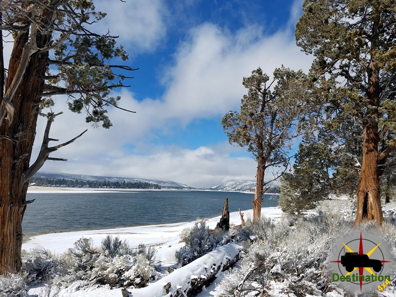
Big Bear, CA
I quiet mountain community full of back country adventure.
The Journey is the destination
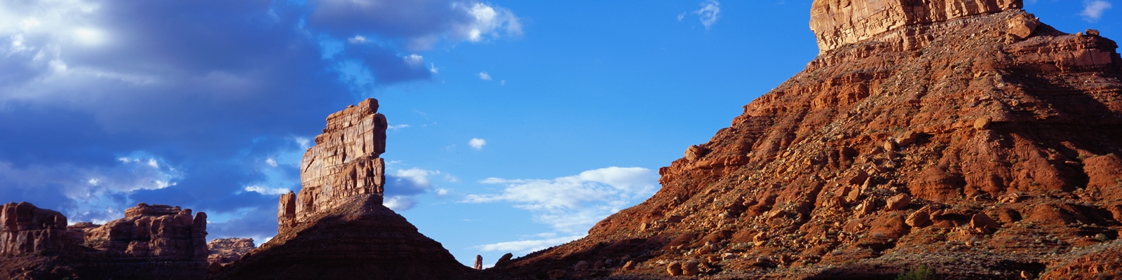
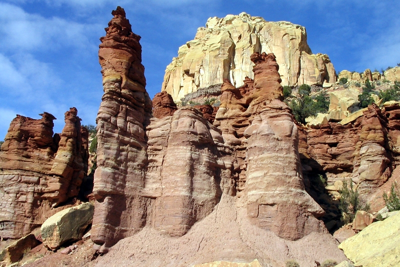
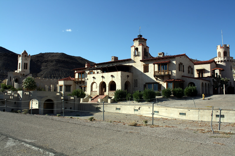
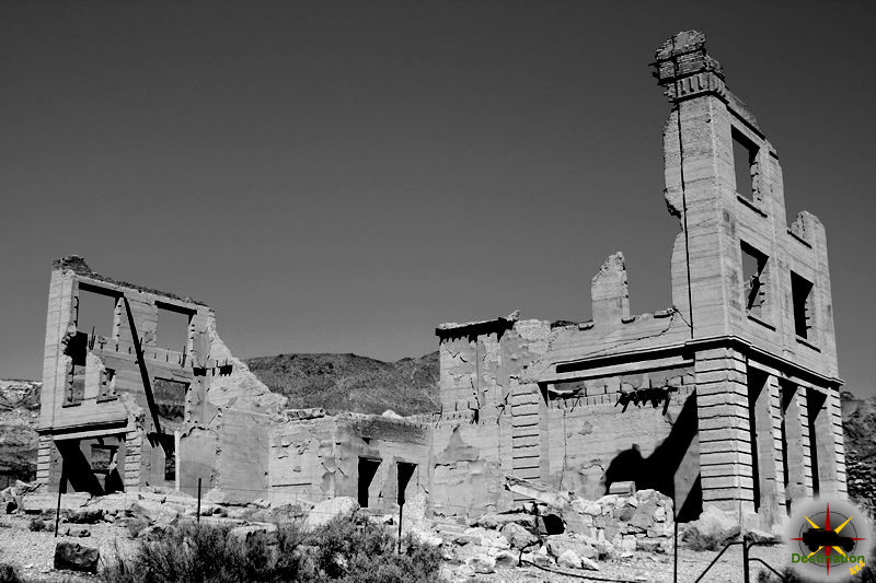

Hamblin (also known as Fort Hamblin) is a ghost town in western Washington County, Utah, located in Mountain Meadow (sometimes called Mountain Meadows) at an elevation of about 5,832 feet (1,778 m). It existed as a Mormon pioneer settlement primarily from 1856 to around 1905 and sat along the Mormon Road (also associated with the Old Spanish Trail / California Road). Today only the Hamblin Cemetery and scattered foundations remain.
In 1855 the Leach Cutoff of the Mormon Road was completed. This improved wagon route ran from Mountain Meadow through Leach Canyon to Pinto and on toward Cedar City, shortening the older path (via Iron Springs, Antelope Springs, and Pinto Creek near modern Newcastle) by about 15 miles.
In 1856, Jacob Vernon Hamblin (1819–1886)—a prominent Mormon pioneer, explorer, and missionary known for his work among Native American tribes—established a ranch and built a house for his family overlooking the meadow. Other settlers soon arrived to ranch and farm, including Hamblin’s brothers (Dudley and others), Leavitt family members, Jacob Mica Truman, Edwin Westover, Milo Andrus, David (or James) Canfield, John Day, and James Holt. The community became known as Fort Hamblin, later shortened to Hamblin.
Homes were built close together along a single street, with the church and school at the far (east) end. Drinking water came from Hamblin Spring (a clear spring near the village). Irrigation for farms and meadows came from lower springs in the valley. The location offered good ranching and farming potential in the spring-fed meadow, which explorer John C. Frémont had earlier described as a lush, roughly 16-mile-long oasis.
Hamblin functioned mainly as a supply and rest stop for travelers, drovers of livestock herds, immigrants, and teamsters using the wagon road toward California. Settlers produced butter, cheese, and other dairy products and food supplies, selling surplus to passing trains. The meadow provided essential grazing after long desert stretches.
The settlement was tied into broader southern Utah Mormon colonization efforts and Jacob Hamblin’s Indian mission work. He had been called to southern Utah in the mid-1850s and was known for diplomacy with Paiute and other tribes.
In September 1857 the Mountain Meadows Massacre occurred a short distance south in the same meadow area. Members of the Baker–Fancher emigrant party from Arkansas (and some from Missouri), traveling to California, were killed by a combination of local Mormon militia and Native American participants. Seventeen young children survived. They were brought to the Hamblin settlement (near Jacob Hamblin’s ranch/home) and cared for by local residents before eventually being returned to relatives in Arkansas.
Jacob Hamblin himself was not present during the massacre (accounts place him elsewhere at the time), though his ranch and family were nearby. The event remains one of the most tragic and controversial episodes in Utah pioneer history; the Hamblin site’s proximity made it part of the immediate aftermath.
Jacob Hamblin left the area in 1869 after receiving a call from Brigham Young to establish an Indian mission at Fort Kanab; he relocated there with his family.
The townsite was formally surveyed in 1873. Richard Gibbons served as the first presiding elder of the local branch of The Church of Jesus Christ of Latter-day Saints.
A contemporary account from 1892 noted that Hamblin still had about five families at that time (forming part of a branch with nearby Holt’s Ranch), indicating a small residual population into the early 1890s.
Several factors led to the town’s demise:
Residents gradually relocated, many moving to the nearby town of Enterprise. The site was mostly deserted by about 1890 and had essentially disappeared as a village by 1905.
All that remains of Hamblin are the Hamblin Cemetery (coordinates approximately 37°32′11″N 113°36′28″W) and a few foundations or cellar remains of homes. The actual townsite lies about a mile northeast of the cemetery. The area is known as the Hamblin Historical Site.
Access is via dirt roads (including FR010 and FR732) off Pinto Road, which heads east from Utah State Highway 18 near mile marker 34 (between St. George and Enterprise). Signs direct visitors to the cemetery. A historical marker erected in 2000 by the Sons of Utah Pioneers (Marker No. 95) stands near the cemetery and summarizes the settlement’s history.
Some headstones in the cemetery were carved using the Deseret Alphabet (a phonetic writing system briefly promoted by early Mormon leaders); many are now heavily weathered. Notable burials include members of the Canfield, Truman, and other pioneer families.
Hamblin exemplifies the challenges of mid-19th-century Mormon pioneer settlement in southern Utah’s high desert: strategic placement along key travel corridors, reliance on fragile water sources, economic dependence on transient traffic, and vulnerability to environmental degradation and shifting transportation technology. Its brief history is closely linked to Jacob Hamblin’s career and to the broader story of the Mountain Meadows region.
Harrisburg is a ghost town in Washington County, Utah (roughly 12–16 miles northeast of St. George, along what is now the I-15 corridor near Leeds and Quail Creek Reservoir). It was a short-lived Mormon pioneer agricultural settlement that flourished briefly in the 1860s before declining due to environmental hardships, water scarcity, and the rise of nearby communities.
In 1859, Moses Harris—a Mormon pioneer who had earlier helped establish a colony near San Bernardino, California—settled with his family near the confluence of Quail Creek (and associated Cottonwood Creek flows) and the Virgin River. This was part of broader Latter-day Saint efforts under Brigham Young to create self-sufficient agricultural colonies in southern Utah’s “Dixie” region. Other families soon joined, and the small community was initially known as Harrisville (or sometimes Cottonwood).
An accidental fire and irrigation difficulties disrupted the original site. In 1862, severe flooding by the Virgin River forced residents to relocate farther upstream along Quail Creek to higher ground. The new settlement was renamed Harrisburg in honor of Moses Harris. Apostles Orson Pratt and Erastus Snow helped organize it as a formal church branch. Early arrivals in the early 1860s included families headed by James Lewis, Hosea Stout, William Leany, Dr. Priddy Meeks, John Brimhall, Orson B. Adams, Elijah K. Fuller, Samuel Hamilton, William Robb, and others.
By 1864 the population stood at 128 people (about 16 families). It peaked around 200 residents (roughly 25 families and some 30 homes) by 1868. Buildings were largely constructed of local sandstone because rock was abundant; stone fences marked property lines. The schoolhouse was more rudimentary, built of cedar posts set in the ground with a roof of cedar logs, bark, and soil.
Residents dug irrigation ditches, including an ambitious roughly five-mile canal along what became known as Leeds Creek, to water fields. They grew corn, cotton, sorghum (for molasses), alfalfa, fruits, vegetables, orchards, and vineyards (including for wine production as a cash crop). The rocky soil and limited arable land constrained expansion. Harrisburg also served as a stop for freighters traveling between Salt Lake City and St. George. A post office operated from 1863 to around 1900.
Notable structures included homes built by stonemason Willard G. McMullin (from Maine, arrived 1862). The Orson B. Adams House (constructed 1864), a two-room stone dwelling, housed Adams, his wife, sons, and granddaughters. Prospector John Kemple stayed there en route to Nevada; he is credited with early silver discoveries that led to the nearby Silver Reef boom. The Adams property later passed through several owners and was farmed into the mid-20th century before BLM acquisition and restoration around 2001.
Silver was discovered in the sandstone reefs nearby (White Reef, later Silver Reef) in the mid-to-late 1860s. The Harrisburg (originally Union) Mining District was organized in the early 1870s, with the Harrisburg schoolhouse as a reference point for its boundaries. Between about 1875 and 1888, Silver Reef’s mining population created a cash market for Harrisburg’s agricultural produce.
Hardships mounted quickly. Recurring floods damaged fields and infrastructure. In 1869 a grasshopper plague devastated crops, and Navajo raiding parties added insecurity. Drought and, critically, water shortages worsened as upstream diversions for the new settlement of Leeds (organized 1867 as Bennington/Road Valley, later renamed Leeds after a town in England) reduced flow in Leeds Creek. Rocky soil and limited farmland further hindered viability. Many residents petitioned church leaders (including Erastus Snow) and relocated to Leeds or the booming mining town of Silver Reef, taking water rights with them.
By 1876 Harrisburg was already declining significantly. In 1892 only six families remained; by 1895 the town was essentially abandoned (some sources note a couple of holdouts into the early 20th century, with the last activity fading by the 1920s). Many houses were dismantled for building materials. The school and meetinghouse closed.
For decades the site stood in ruins. In 1958 it served as a movie set for They Came to Cordura (starring Gary Cooper); remnants of a constructed Mexican village set were visible for a time. Interstate 15 was later built through the old townsite. A mobile home/RV community known as Harrisburg Estates developed, and the area falls within the boundaries of Hurricane, Utah. Quail Creek Reservoir (and associated recreation) lies nearby.
Visible remnants include sandstone house ruins and foundations (some on both sides of I-15), stone walls, the restored Orson Adams House (managed in connection with BLM/Red Cliffs National Conservation Area lands), and the historic pioneer cemetery (with markers for early settlers and many infants/children, reflecting the hardships of frontier life). Interpretive signs and historical markers (from groups such as the Daughters of Utah Pioneers and Sons of Utah Pioneers) recount the story of Harrisburg, Leeds, and Silver Reef as interconnected communities shaped by water availability.
Harrisburg exemplifies the challenges of Mormon colonization in arid southern Utah: ambitious irrigation efforts, reliance on agriculture to support mining booms, and ultimate vulnerability to floods, pests, conflict, and water competition. Primary contemporary accounts and local histories (including Marietta M. Mariger’s 1951 Saga of Three Towns: Harrisburg–Leeds–Silver Reef) provide further personal and community details. The site remains accessible for historical visitation, with ruins protected in places by fencing.

Silver Reef is a historic mining ghost town in Washington County, southern Utah, located about 15–20 miles northeast of St. George and roughly 1 mile west of the town of Leeds. It is one of the few places in the world where economically significant silver was mined from sandstone (specifically the Springdale Sandstone Member of the Kayenta Formation). The site is geologically unusual and culturally distinctive as a largely non-Mormon (“Gentile”) boomtown set amid predominantly Latter-day Saint agricultural settlements.
The silver deposits occur in tilted sandstone “reefs” (rocky ridges formed by the Virgin Anticline). The main productive reefs were the Buckeye (richest, yielding about 70% of production), White, Butte, and East. Silver is primarily present as nearly invisible horn silver (silver chloride/chlorargyrite), sometimes associated with colorful copper minerals (azurite, malachite) and later uranium. The metals were likely leached from underlying volcanic ash beds in the Chinle Formation by groundwater, transported upward, and precipitated in the porous sandstone where organic matter and chemistry changes caused deposition.
High-grade silver ore (float) was first discovered in 1866 by prospector John Kemple near Harrisburg while he wintered in the area. Samples reportedly assayed extremely high (one account cites over $17,000 per ton), but the idea of silver in unaltered sandstone was widely dismissed as impossible. Kemple and others organized early mining districts (Union Mining District around 1871; Harrisburg Mining District in 1874), yet development lagged for nearly a decade due to skepticism.
Interest revived in 1875. Salt Lake City bankers (the Walker brothers) sent prospector William Tecumseh Barbee, who staked about 21 claims and promoted the district. Investors from San Francisco also entered, establishing the Leeds Mine (one of the first major operations). Barbee platted a townsite called Bonanza City with relatively high lot prices. Many miners and merchants preferred cheaper ground to the north on rocky terrain, initially calling their camp “Rockpile” or “Rock Pile.” A merchant from Pioche, Nevada, popularized the name Silver Reef, which stuck. Both names appear on contemporary maps.
The “Pioche Stampede” of late 1875–1876 brought a major influx as Pioche’s mines faced difficulties; roughly one-third of Pioche’s population reportedly relocated. Experienced miners (including Cornish and Irish), merchants, and others arrived, rapidly building a town. By the late 1870s Silver Reef had a mile-long Main Street with numerous businesses: nine grocery stores, six saloons, five restaurants, a newspaper (Silver Reef Echo, later Silver Reef Miner), bank, Wells Fargo Express Office (built 1877–1879 and still standing), hotels (including the Harrison House), brewery, billiard hall, dance halls, jail, and more. A Chinatown developed southwest of the main area, populated largely by Chinese laborers who had worked on the transcontinental railroad. A Catholic church (St. John’s, the first Catholic congregation in southern Utah, founded 1879) served the community and housed a hospital in a rear wing; the town never had an LDS meetinghouse.
Population estimates for the peak years (roughly 1878–1882) range from about 1,500 to 2,000 (U.S. Census 1880 recorded 1,046; a local count around 1884 suggested ~1,500). The district supported multiple stamp mills (including Leeds, Christy, Barbee & Walker, Stormont—the largest—and others). Annual production often exceeded $1 million in ore value during the height. Silver Reef was briefly one of the largest towns in Washington County and provided a vital cash market for nearby Mormon agricultural communities that had struggled with crop failures and isolation. Relations between the mining population and local Latter-day Saints were generally symbiotic economically, though culturally distinct.
Notable events included major fires in May 1879 that destroyed roughly half the downtown buildings (quickly rebuilt) and another that damaged Chinatown; a celebrated Catholic High Mass celebrated by Father Lawrence Scanlan in the St. George Mormon Tabernacle (with local Mormon help); labor tensions; and classic frontier incidents such as shootings and a lynching.
Decline began around 1881. Key factors included a drop in world silver prices (from roughly $1.20/oz in the late 1870s toward $1.11 by 1883), flooding of deeper mine workings that outpaced pumping capacity, depletion of the richest ores, rising costs, and a miners’ strike after wage cuts (from $4 to $3.50 per day). Many workers left (some for Tombstone, Arizona). Major company operations largely ceased by 1888 (Christy Mill closed that year; Stormont earlier). Lessee operations continued sporadically into the early 1900s (some sources cite 1909 or final closure around 1891).
Total historic production is estimated at over 7 million ounces of silver (more than 219 tons), plus lesser amounts of other metals—valued at roughly $25 million at the time or hundreds of millions in modern dollars depending on silver price. By 1890 the population had fallen to 177; by 1900 few remained beyond lessees. Many buildings were dismantled and materials reused in Leeds and elsewhere (the school building became Leeds Town Hall). A 1908 fire and treasure-hunting (rumors of caches of coins) accelerated the loss of structures.
Revival attempts occurred periodically: around 1898, 1909, 1916 (Silver Reef Consolidated Mining Company under Alex Colbath; later acquired by American Smelting and Refining with little activity due to the Depression), and mid-20th century. From the late 1940s–1950s/early 1960s, Western Gold & Uranium and successors reworked tailings and mined for uranium (and residual silver, copper, gold), constructing a flotation mill and other facilities; production was modest. A later leach-pad attempt in the late 1970s left visible remains.
Today Silver Reef is a partial ghost town intermixed with a modern residential neighborhood (Silver Reef Estates, developed from the 1980s onward). The restored Wells Fargo Express Building (National Register of Historic Places, 1971) houses the Silver Reef Museum, with exhibits on history, mining, and geology, plus walking trails. Other remnants include the rebuilt Cosmopolitan Restaurant, Rice Building/jail, foundations, mine dumps, two cemeteries (Catholic and Protestant), and sealed mine openings (hundreds reclaimed in the 1990s–2000 by the Utah Division of Oil, Gas and Mining while preserving historic appearance and bat habitat). The site illustrates both classic Western boom-and-bust patterns and the unique geology and cultural contrast of southern Utah.
Sources include the Silver Reef Museum historical materials and timeline, Utah Geological Survey, Utah History Encyclopedia, Wikipedia (compiled from primary and secondary sources), Bureau of Land Management, and contemporary accounts. For deeper reading, visit the museum or consult works such as Silver, Sinners and Saints and geological reports by Biek and Rohrer.
Duncan’s Retreat was a short-lived Mormon pioneer settlement and is now a ghost town in eastern Washington County, southwestern Utah. It lay roughly 3–4 miles east of Virgin (and about 3.5 miles west of Grafton), on the north side of the Virgin River where Mukuntuweap Creek (a small tributary) enters the river, just southwest of Zion National Park. The site is along present-day Utah State Route 9 (between roughly mile markers 24 and 25). It was occupied from about 1861 to the mid-1890s.

In 1861, Chapman Duncan (1812–1900), Alma Minnerly (sometimes spelled Minerly), and a few others settled the area as part of Brigham Young’s “Utah’s Dixie” cotton-growing initiative. Young had called settlers to southern Utah to produce cotton and other warm-climate crops after the Civil War disrupted southern U.S. supplies. The location on Mukuntuweap Creek offered potentially fertile bottomland along the Virgin River for irrigation farming.
Chapman Duncan was an experienced Latter-day Saint pioneer. Born in Bath, New Hampshire, he joined the Church in 1833, participated in early Church events in Nauvoo, served missions (including to China in the early 1850s), and traveled to Utah in 1848. He had earlier helped colonize Iron County. He did not remain long at the new settlement.
That first winter brought the Great Flood of 1862, a prolonged and destructive high-water event on the Virgin River that also devastated nearby settlements such as Grafton (then called Wheeler). Most of the good farmland and much of the fledgling colony were washed away. Chapman Duncan and most of the original settlers left early in 1862 seeking more stable locations. The families who stayed named the place Duncan’s Retreat.
A local legend offers an alternative (or complementary) explanation for the name: Duncan had been tasked with surveying an irrigation canal from the Virgin River (accounts differ on whether this was near Virgin or Rockville). After considerable labor and expense, the canal proved useless because it had been graded uphill. Embarrassed, Duncan “retreated” to (or from) the site that later bore his name.
The original claims were sold to newcomers including William Theobald, Joseph Wright, William Wright, Clayborne Elder, Jonathan B. Pratt, Robert W. Reeve, and Thomas Burgess. Additional settlers arrived, and by the end of 1862 the population stood at about 70. Residents planted crops and orchards; in years without major flooding they produced good harvests of cotton, corn, wheat, and sorghum.
Community institutions followed quickly:
U.S. Census figures show modest stability for a time: 71 residents in 1870, peaking at 79 people in 11 families in 1880, then declining to 47 in 1890.
Life was precarious. The Virgin River was notoriously unpredictable; it repeatedly flooded, changed course, destroyed dams and ditches, and washed away cultivated land. Farmers constantly rebuilt irrigation works only to see them ruined again.
During the Black Hawk War (1865–1872), fear of Indian attacks led the townspeople to evacuate to Virgin in 1866. Farmers returned daily to work their fields. Permanent residency resumed in 1868.
Despite these challenges, the settlement persisted for decades because the soil was productive in good years and the community was tightly knit around LDS religious and social life.
The 1880s proved particularly harsh. Repeated flooding made sustained farming increasingly impossible. By 1891 the village was all but deserted; the last known birth occurred in 1895. Residents gradually moved to more secure nearby towns such as Virgin.
By 1930 little was left—scattered foundations, dead fruit trees (including pear trees photographed in 1929), traces of an irrigation ditch, and occasional rock walls. The most visible remnant is a small cemetery on the north side of SR-9. Known interments include:
Unlike the better-preserved and more famous ghost town of Grafton a few miles upstream, Duncan’s Retreat has almost no standing structures. It survives mainly in local historical memory, pioneer journals, and the lonely roadside grave of Nancy Ott as a quiet testament to the difficulties of early settlement along the Virgin River.
Duncan’s Retreat exemplifies the broader pattern of Mormon colonization in southern Utah: ambitious agricultural outposts driven by religious calling, repeatedly tested by the harsh desert environment and an untamed river, and ultimately abandoned when the costs of survival became too high.
The white-nosed coati (Nasua narica), also known as the coatimundi, white-nosed coatimundi, pizote, antoon, gato solo, or tejón (depending on the region), is a medium-sized member of the raccoon family (Procyonidae). Native to wooded habitats ranging from the southwestern United States through Mexico and Central America to northwestern Colombia, it is distinguished by its long, flexible white-tipped snout, short rounded ears, and a long, slender, ringed tail that it often holds upright for balance. Adults typically weigh 4–6 kg (though males can reach up to 9 kg) and measure about 110 cm from nose to tail tip, with the tail making up roughly half that length. These agile, mostly diurnal omnivores forage on the ground and in trees for insects, fruits, small vertebrates, and other food, using their mobile snouts and strong claws.

| Kingdom | Animalia |
| Phylum | Chordata |
| Class | Mammalia |
| Order | Carnivora |
| Family | Procyonidae (raccoons and relatives) |
| Genus | Nasua |
| Species | Nasua narica (Linnaeus, 1766) |
Also known as coatimundi, pizote, antoon, or tejón in various Spanish-speaking regions. IUCN status: Least Concern.
The white-nosed coati is a medium-sized, slender mammal related to raccoons. Head-body length typically ranges from 43–66 cm (17–26 in), with the long, slender, non-prehensile (or semi-prehensile) tail nearly as long (42–68 cm / 17–27 in), for a total length around 85–130 cm (about 3–4.3 ft). Weight is usually 3.5–6 kg (7.7–13 lb), though small females may weigh as little as ~3 kg and large males up to 7–9 kg (15–20 lb). Males are notably larger and about 30% heavier on average than females.
The coat is typically light buff to reddish, grayish, or dark brown, often with yellowish or silvery grizzling, especially on the sides of the arms; underparts are lighter. The distinctive facial markings include a white or pale band/patch around the tip of the long, flexible, slightly upturned snout (the “white nose”), white spots above and below each eye and on the cheeks, and a darker facial mask or band. The short, rounded ears have white interiors. The long tail is often ringed with darker bands (more distinct in juveniles) and is typically held upright while walking or foraging for balance and signaling. Feet have five toes with strong, curved claws suited for digging and climbing; front claws are longer.
The snout is highly mobile and sensitive, adapted for probing leaf litter and crevices. Sense of smell is particularly acute and primary for foraging.
White-nosed coatis are primarily diurnal (active by day, especially mornings and late afternoons), unlike many other procyonids such as raccoons. They rest or sleep at night in trees, rocky ledges, or dens, though they may become more nocturnal in areas of high human disturbance or hunting pressure.
Social structure is distinctive: adult males are largely solitary (except during the brief mating season), while females and their offspring (including young males under ~2 years old) form cohesive social groups called bands. Bands typically number 4–20+ individuals (occasionally up to 30–40), often matrilineal with related females, though some unrelated individuals may join. Bands forage together, engage in mutual grooming (using teeth and claws), and use a variety of vocalizations, visual signals, and scent marking for communication. Young may be left with “babysitters” while others forage. Play-fighting occurs among juveniles and some females. Large bands may temporarily split into smaller foraging subgroups.
They are excellent climbers (using the tail for balance) but spend most of their active time on the ground. They are agile, strong, and opportunistic.
Reproduction: Mating occurs seasonally. Gestation lasts about 10–11 weeks (~70–77 days). Pregnant females leave the band to give birth in a tree nest (often palms or similar) to litters of 1–7 (commonly 2–6) altricial young. Mothers care for them in the nest for several weeks before rejoining the band with the mobile young. Young are weaned around 4 months and reach adult size by about 15 months. Sexual maturity is reached around 2 years for females (later effective breeding for males due to competition). Lifespan is typically up to ~7 years in the wild and averages ~14 years (occasionally longer, into the late teens or more) in captivity.
White-nosed coatis are highly adaptable but prefer wooded habitats. They occupy tropical and subtropical dry and moist broadleaf forests, open woodlands, oak woodlands, pine-oak woodlands, riparian areas, canyons, and montane forests. They occur from sea level up to about 3,000 m (9,800 ft) elevation. They are less common in open grasslands, pure deserts, or heavily modified areas, though they may use agricultural edges or scrub. In the southwestern U.S., they favor oak woodlands and hardwood riparian canyons.
They forage both on the ground (leaf litter) and in the canopy (for fruit).
The species ranges from the southwestern United States (southeastern Arizona, southern New Mexico; historically or marginally in parts of Texas, though status there is limited or uncertain) southward through most of Mexico (excluding the Baja Peninsula and parts of the central Sierra Madre), throughout Central America, and marginally into northwestern South America (far northwestern Colombia near the Panama border; some sources extend to western Colombia/Ecuador areas west of the Andes). Subspecies include N. n. molaris (northern populations including the U.S. and much of Mexico), N. n. narica (southern Mexico/Central America/Colombia), and others such as the smaller Cozumel Island form (N. n. nelsoni).
White-nosed coatis are omnivorous and opportunistic foragers. The primary diet consists of invertebrates (insects and their larvae—beetles, grubs, ants, termites; spiders, scorpions, centipedes, and occasionally land crabs or worms), which they locate by sniffing through leaf litter with the snout held close to the ground and dig out with strong claws. Fruit is a major seasonal component (e.g., figs, hog plums, prickly pear and other cactus fruits, and many native tree fruits); bands may repeatedly visit productive trees and strip them. They also consume small vertebrates (lizards, snakes, frogs, rodents, occasionally birds or eggs), nuts, carrion, and occasionally anthropogenic food sources near human settlements. They may travel substantial distances daily (up to ~2 km) while foraging.
They play an ecological role as seed dispersers through fruit consumption and as mid-level consumers in food webs.
This report synthesizes information from reliable biological sources including IUCN assessments, museum/species accounts, and field studies. Populations are generally stable across much of the range but face localized pressures from habitat loss, hunting, and fragmentation in some areas.