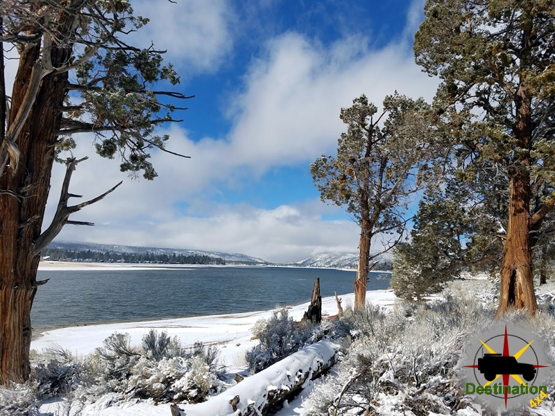
Big Bear, CA
I quiet mountain community full of back country adventure.
The Journey is the destination
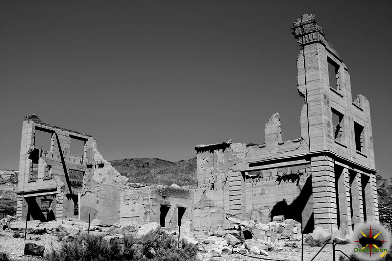

The Tonopah and Tidewater Railroad (T&T) was a standard-gauge shortline railroad that operated from 1907 to 1940, primarily serving the remote mining regions of eastern California and southwestern Nevada. Incorporated on July 19, 1904, in New Jersey by Francis Marion “Borax” Smith, president of the Pacific Coast Borax Company, the railroad was envisioned as a vital link to transport borax from Death Valley-area mines to markets, while also connecting to the booming gold and silver districts near Tonopah, Nevada, and potentially reaching “tidewater” (a Pacific port like San Diego). However, it never reached either endpoint on its own tracks, terminating instead at Ludlow, California (connecting to the Atchison, Topeka and Santa Fe Railroad) in the south and Gold Center, Nevada (near Beatty) in the north, spanning approximately 167 miles.
The T&T was constructed amid fierce competition, including obstacles from Senator William A. Clark’s Los Angeles and Salt Lake Railroad. Construction began in 1905, with the line reaching Death Valley Junction by 1907 and full operation shortly thereafter. It initially thrived on borax haulage but later diversified into other minerals, passengers, and general freight. The railroad outlasted competing lines in the Death Valley region, providing essential service to isolated desert communities until its abandonment in 1940, with rails removed during World War II for scrap.
Bradford Siding was a minor but functionally important stop on the T&T mainline, located at milepost (MP) 128.01, approximately 6 miles north of Death Valley Junction, California, in Inyo County near the Nevada border. It was classified as a siding—a short spur track allowing trains to pass or load/unload—rather than a full station. The siding featured a spur line extending to nearby clay pits, making it a key loading point for non-borax minerals.
The site was situated along the Amargosa River valley route, where the T&T paralleled modern California State Route 127. Heading north from Death Valley Junction, the line passed Bradford Siding before entering Nevada stations like Jenifer and Scranton.
Bradford Siding was named after John Bradford, a local operator involved in early clay mining and transportation in the Amargosa Valley. Around 1916–1925, large clay deposits were discovered just over the state line in Nevada by prospectors like Ralph “Dad” Fairbanks. Initial operations involved small-scale mining, with clay hauled by tractor (notably Holt caterpillar tractors operated by John Bradford) across the desert to the siding for loading onto T&T railcars. Bradford also maintained a small milling operation and boiler at the site for processing.
By the mid-1920s, clay production increased, attracting interest from oil companies that produced hundreds of tons monthly using crude mills. The siding became the primary transloading point, as direct rail access to the Nevada pits was limited.
Bradford Siding gained prominence in the late 1920s after the Pacific Coast Borax Company relocated its primary operations to Boron, California, in 1927, reducing borax traffic on the T&T. To sustain revenue, the railroad diversified, hauling alternative commodities such as lead from Tecopa, gypsum, talc, and—significantly—feldspar and clay from Bradford Siding.
In 1926, clay operations consolidated under the Death Valley Clay Company, which acquired a former borax plant in Death Valley Junction. To improve efficiency, the company extended the narrow-gauge (3-foot) Death Valley Railroad (DVRR, a separate borax-haul line from Ryan to Death Valley Junction) northward. This extension ran parallel to the T&T mainline using a third rail for dual-gauge operation, reaching Bradford Siding and then branching into Nevada to serve the clay pits directly.
This setup allowed clay to be transported via narrow-gauge from the mines to Bradford, where it was transferred to standard-gauge T&T cars for long-haul shipment. The arrangement supported growing production from pits like the Bell Pit and Associated Pit.
After the DVRR ceased operations in 1931, the T&T took over the Bradford spur, converting it to standard gauge. This ensured continued service to the clay mills through the 1930s, even as overall T&T traffic declined amid the Great Depression and waning mining activity. As late as 1931, remnants of John Bradford’s original mill and boiler remained visible at the siding, though no longer operational.
By the late 1930s, the T&T faced insurmountable challenges: declining mineral output, competition from trucks and highways, and financial strain. The railroad ceased operations in 1940. Bradford Siding, tied to the diminishing clay trade, was abandoned alongside the mainline. The site reverted to desert, with no significant structures surviving. Rails were removed in the early 1940s for wartime scrap metal.
Bradford Siding exemplifies the T&T’s adaptation from borax dependency to diversified mineral hauling, extending the railroad’s viability into the 1930s. Today, it remains a obscure historical footnote, with the former right-of-way traceable along modern roads near the California-Nevada border. Remnants of the grade and occasional artifacts can still be found by explorers, highlighting the harsh desert environment that both enabled and ultimately doomed such remote rail operations.
The T&T’s story, including stops like Bradford, is preserved through sources such as historical societies, abandoned rail databases, and accounts in works like David F. Myrick’s Railroads of Nevada and Eastern California. It underscores the transient nature of early 20th-century desert railroading in support of America’s mining frontier.
The Tonopah and Tidewater Railroad (T&T) was a significant historical railroad that operated in eastern California and southwestern Nevada from 1907 to 1940. Primarily built to transport borax from mines east of Death Valley, it also carried lead, clay, feldspar, passengers, and general goods. Shoshone Station, located in Inyo County, California, served as a crucial stop along this line, contributing to the development of the village of Shoshone and supporting mining and early tourism in the Death Valley region.

Incorporated on July 19, 1904, by Francis Marion Smith in New Jersey, the T&T aimed to connect the mining town of Tonopah, Nevada, to a tidewater port, initially planned for San Diego but never realized. Construction began in 1905 from Ludlow, California, after an initial attempt from Las Vegas was abandoned due to competition from William A. Clark’s Las Vegas and Tonopah Railroad. The route traversed harsh desert terrain, including blasting through Amargosa Canyon over three years, and reached Death Valley Junction by 1907, with a branch line to the Lila C. borax mine.
In 1908, the T&T merged with the Bullfrog Goldfield Railroad, extending service to Goldfield via Beatty and enabling connections to Tonopah. During World War I, it came under U.S. Railroad Administration control, and the competing Las Vegas and Tonopah line was abandoned in 1918. The Lila C. mine depleted by 1913, leading to the creation of the narrow-gauge Death Valley Railroad for new borax operations at Ryan. Peak operations involved up to 16 steam locomotives, mostly Baldwin models like 2-8-0 and 4-6-0, hauling freight and passengers.
Decline began in 1927 when Pacific Coast Borax shifted to Boron, California, reducing borax traffic. The line shortened with the abandonment of the Bullfrog Goldfield segment in 1928, focusing on lesser cargoes like lead from Tecopa and feldspar from Bradford Siding. In the 1930s, the T&T promoted tourism, offering Pullman sleepers from Los Angeles to Death Valley Junction for attractions like Furnace Creek Inn, but the Great Depression curtailed this. Abandonment was filed in 1938 and approved in 1940 due to $5 million in debt and flood damage. Rails were removed in 1943 for World War II scrap, and ties were repurposed for local buildings.
Shoshone Station was positioned at milepost 96.95 on the T&T line, situated between Tecopa and Death Valley Junction in the Mojave Desert section of the route. It functioned as a whistle-and-water stop, essential for locomotive maintenance and crew operations in the remote desert environment. This station played a pivotal role in facilitating reliable crossings through challenging terrain, supporting the railroad’s longevity compared to other short-lived Death Valley lines.
The establishment of Shoshone Station directly led to the growth of Shoshone village, transforming it from a mere railroad halt into a community hub for mining and tourism. Key buildings associated with the station include the Station House, originally located in Evelyn (north of Shoshone), where it served as the crew’s office and residence for track maintenance every 20 miles. It was relocated to Shoshone in the 1940s and now functions as a studio. Additionally, the T&T restaurant in Shoshone burned down in 1925 during a fire that threatened the town; it was rebuilt using adobe bricks made on-site by the railroad’s bridge gang and later served as offices for the Inyo County Sheriff.
Notable events at Shoshone include the last run of the T&T in 1940, marked by a ceremonial gathering with California State Senator Charles Brown and others accompanying Locomotive No. 8. The station’s infrastructure, including a wooden staircase and railway car, is documented in historical photographs from the early to mid-20th century.
Shoshone Station’s significance extended beyond logistics; it enabled the T&T to outlast competitors by over 30 years, bolstering mining communities and pioneering tourism in Death Valley. The railroad opened vast desert regions to economic activity, though it faced ongoing challenges from floods, competition, and shifting industries.
Today, the T&T’s rails are gone, but remnants of the trackbed serve as hiking trails in Death Valley National Park. Surviving artifacts, such as boxcar #129 and caboose #402, are preserved in museums like the Southern California Railway Museum. The Tonopah & Tidewater Railroad Historical Society, formed in 2015, promotes its history, with exhibits at the Shoshone Museum covering the railroad alongside local topics. Shoshone itself remains a small community at an elevation of 1,585 feet, preserving ties to its railroad origins through historical buildings and tours.
Shoshone Station exemplifies the T&T Railroad’s role in shaping the American Southwest’s industrial and cultural landscape. From its humble beginnings as a desert stop to its enduring legacy in historical preservation, it highlights the era’s ambitious yet precarious rail ventures. Further exploration of sites like the Shoshone Museum or Death Valley National Park can provide deeper insights into this chapter of history.
Valjean (sometimes spelled Val Jean) was a minor station and siding on the Tonopah and Tidewater Railroad (T&T) line in San Bernardino County, California, in the Mojave Desert. It was located south of the Death Valley region, between the stations of Dumont (to the north) and Riggs (to the south), near Silver Lake and the modern alignment of Interstate 15.
Valjean served primarily as a water stop, siding for passing trains, and minor freight point in an otherwise remote stretch of desert. There is little evidence of significant mining or settlement directly associated with the station, suggesting it was mainly operational for railroad maintenance and logistics. The arid location near dry lakes and playas made it a typical “whistle stop” on desert railroads.
The Tonopah and Tidewater Railroad (T&T) was a historic standard-gauge railroad that operated from 1907 to 1940 in eastern California and southwestern Nevada. Founded by Francis Marion “Borax” Smith, president of the Pacific Coast Borax Company, the railroad was originally envisioned to connect the mining boomtown of Tonopah, Nevada, to tidewater ports in San Diego, California, for efficient export of minerals, particularly borax.
Due to political and competitive pressures from Senator William A. Clark’s San Pedro, Los Angeles & Salt Lake Railroad (later part of the Union Pacific), the northern terminus was limited to Gold Center near Beatty, Nevada (later extended via acquisitions to Goldfield). The southern terminus became Ludlow, California, on the Atchison, Topeka and Santa Fe Railway. The T&T spanned approximately 230 miles through harsh desert terrain, including the Amargosa River valley and areas near Death Valley.
The railroad primarily hauled borax from Death Valley-area mines (interchanging with the narrow-gauge Death Valley Railroad at Death Valley Junction), as well as talc, clay, lead, feldspar, passengers, and general freight. It outlasted competing lines in the region but ceased operations in 1940 due to declining traffic. Rails were removed in 1942–1943 for World War II scrap metal, and the line was officially abandoned by 1946.
Much of the former right-of-way parallels California State Route 127 and is accessible for historical exploration or off-roading.
Valjean (sometimes spelled Val Jean) was a minor station and siding on the T&T line in San Bernardino County, California, in the Mojave Desert. It was located south of the Death Valley region, between the stations of Dumont (to the north) and Riggs (to the south), near Silver Lake and the modern alignment of Interstate 15.
The sequence of southern stations included:
Valjean served primarily as a water stop, siding for passing trains, and minor freight point in an otherwise remote stretch of desert. There is little evidence of significant mining or settlement directly associated with the station, suggesting it was mainly operational for railroad maintenance and logistics. The arid location near dry lakes and playas made it a typical “whistle stop” on desert railroads.
As part of the T&T, Valjean Station exemplified the challenges of desert railroading: extreme heat, water scarcity, and isolation. The line’s construction through areas like the Amargosa Canyon required massive engineering efforts, and stations like Valjean supported crew changes, water supply for steam locomotives, and train operations.
In its later years, the T&T shifted toward hauling talc and clay from regional mines, and Valjean likely facilitated some of this traffic. The station’s obscurity highlights how the T&T served sparse desert communities long after the early 20th-century mining booms faded.
Today, Valjean Station is abandoned, with no standing structures documented in available sources. The railroad grade remains visible in places, crossing the desert landscape. Explorers and railroad historians occasionally visit remnants along the T&T route, but Valjean appears to have left minimal physical traces compared to more prominent sites like Death Valley Junction or Tecopa.
The former T&T corridor is of interest to off-road enthusiasts, hikers, and those tracing abandoned railroads. Some sections fall within or near protected areas like Death Valley National Park or the Mojave National Preserve.
Valjean Station represents a small but integral part of the Tonopah and Tidewater Railroad’s legacy as a vital lifeline across the Mojave Desert. While not a major hub, it supported the operations of one of the last railroads to serve the Death Valley region. Its story reflects the rise and fall of early 20th-century desert mining and transportation, leaving behind faint traces in an unforgiving environment. For further reading, resources like David F. Myrick’s Railroads of Nevada and Eastern California or the Abandoned Rails website provide detailed maps and histories.
The Colorado River, flowing from the Rocky Mountains through the arid Southwest to the Gulf of California, was a challenging waterway—shallow, swift, and prone to sandbars, floods, and shifting channels. Despite these obstacles, steam-powered vessels played a vital role in its navigation from the mid-19th century until the early 20th century. Primarily operating on the lower Colorado River (from the Gulf of California upstream to areas near modern-day Nevada), steamboats transported military supplies, miners, settlers, and freight, fueling the development of Arizona, California, Nevada, and parts of Mexico. They were the most economical means of moving goods across the desert until railroads supplanted them.

The need for reliable transport arose after the Mexican-American War (1846–1848), when the U.S. Army established Fort Yuma at the confluence of the Gila and Colorado Rivers to protect emigrants heading to California during the Gold Rush. Supplying the isolated fort overland from San Diego cost up to $500 per ton. River transport from the Gulf of California offered a cheaper alternative.
Initial efforts used schooners and barges. In 1850–1851, the schooner Invincible and longboats reached only partway upriver. Lieutenant George Derby recommended shallow-draft sternwheel steamboats.
The first successful steamboat was the small iron-hulled Uncle Sam, a 65-foot tug with a 20-horsepower engine, assembled at the river’s mouth in 1852 by Captain James Turnbull. It reached Fort Yuma in December 1852 but later proved unreliable and sank.
In 1853–1854, George Alonzo Johnson, partnering with Benjamin M. Hartshorne and others, formed George A. Johnson & Company. They brought parts for the sidewheeler General Jesup from San Francisco, assembling it at the river mouth. The General Jesup carried 50 tons of cargo to Fort Yuma in five days, reducing costs to $75 per ton and proving commercial viability.

Johnson’s company built wood yards staffed by Cocopah Indians and added vessels like the sternwheeler Colorado (1855, captained by Isaac Polhamus) and others. By the late 1850s, steamboats regularly serviced Fort Yuma and emerging mining camps.
Exploration pushed limits:
Mormon leader Brigham Young sought a sea-to-Utah route via the Colorado. In 1864–1866, Anson Call established Callville (near modern Lake Mead) as a potential port. Steamboats like the Esmeralda reached it in 1866.
The 1862 Colorado River gold rush near La Paz (Arizona) and later discoveries in Eldorado Canyon and elsewhere created explosive demand. Ports like Ehrenberg, Hardyville, and Aubrey emerged. Steamboats hauled machinery, food, and ore, often towing barges for extra capacity.
George A. Johnson & Company dominated initially but faced rivals like Thomas Trueworthy’s Union Line in the 1860s. Competition ended when Johnson’s company absorbed opponents. In 1869, it reorganized as the Colorado Steam Navigation Company (C.S.N.Co.), expanding the fleet with vessels like Cocopah, Mohave, and larger ones like the 149-foot Mohave II (1876) and Gila.
Key captains included Isaac Polhamus (“Dean of the Colorado River”) and later Jack Mellon. Ocean steamships connected San Francisco to the river mouth at Port Isabel, feeding river traffic.

The 1870s marked the peak, with scheduled services and luxurious boats offering passenger excursions. The C.S.N.Co. monopolized trade, profiting immensely from military contracts, mining,, and Mormon supplies.
Railroads spelled doom. The Southern Pacific reached Yuma in 1877, bridging the river. That year, Johnson and partners sold the C.S.N.Co. to Southern Pacific interests for a massive profit. Steamboats continued but focused on upper reaches and local freight.
Later vessels included the Cochan (1900, the last major sternwheeler) and Searchlight (1903–1909), hauling ore from Nevada mines.
The 1909 completion of Laguna Dam (for irrigation) blocked navigation. Final operations involved limited freight and dam-related work. The last commercial steamboat, Searchlight, retired around 1916.
Attempts on the upper Colorado (e.g., Glen Canyon, Green River) were short-lived due to rapids and low water.
For over 50 years, Colorado River steamboats connected isolated frontiers, enabling settlement and extraction in a harsh desert. They carried millions in gold, supplied forts and mines, and linked the Pacific to inland territories. Though overshadowed by railroads and dams, their era transformed the Southwest, leaving behind ghost towns, historic sites like Yuma Quartermaster Depot, and a romantic chapter in Western transportation history.

| Potholes, California, From 1859 | 18 mi (29 km) |
| La Laguna, Arizona Territory, 1860-1863 | 20 mi (32 km) |
| Castle Dome Landing, Arizona Territory, 1863-1884 | 35 mi (56 km) |
| Eureka Landing, Arizona Territory, 1863-1870s | 45 mi (72 km) |
| Williamsport, Arizona Territory, 1863-1870s | 47 mi (76 km) |
| Picacho, California, 1862-1910 | 48 mi (77 km) |
| Nortons Landing, Arizona Territory, 1882-1894 | 52 mi (84 km) |
| Clip, Arizona Territory, 1882-1888 | 70 mi (110 km) |
| California Camp, California | 72 mi (116 km) |
| Camp Gaston, California, 1859-1867 | 80 mi (130 km) |
| Drift Desert, Arizona Territory | 102 mi (164 km) |
| Bradshaw’s Ferry, California, 1862-1884 | 126 mi (203 km) |
| Mineral City, Arizona Territory, 1864-1866 | 126 mi (203 km) |
| Ehrenberg, Arizona Territory, from 1866 | 126.5 mi (203.6 km) |
| Olive City, Arizona Territory, 1862-1866 | 127 mi (204 km) |
| La Paz, Arizona Territory, 1862-1870 | 131 mi (211 km) |
| Parker’s Landing, Arizona Territory, 1864-1905 Camp Colorado, Arizona, 1864-1869 | 200 mi (320 km) |
| Parker, Arizona Territory, from 1908 | 203 mi (327 km) |
| Empire Flat, Arizona Territory, 1866-1905 | 210 mi (340 km) |
| Bill Williams River, Arizona | 220 mi (350 km) |
| Aubrey City, Arizona Territory, 1862-1888 | 220 mi (350 km) |
| Chimehuevis Landing, California | 240 mi (390 km) |
| Liverpool Landing, Arizona Territory | 242 mi (389 km) |
| Grand Turn, Arizona/California | 257 mi (414 km) |
| The Needles, Mohave Mountains, Arizona | 263 mi (423 km) |
| Mellen, Arizona Territory 1890 – 1909 | 267 mi (430 km) |
| Eastbridge, Arizona Territory 1883 – 1890 | 279 mi (449 km) |
| Needles, California, from 1883 | 282 mi (454 km) |
| Iretaba City, Arizona Territory, 1864 | 298 mi (480 km) |
| Fort Mohave, Arizona Territory, 1859-1890 Beale’s Crossing 1858 – | 300 mi (480 km) |
| Mohave City, Arizona Territory, 1864-1869 | 305 mi (491 km) |
| Hardyville, Arizona Territory, 1864-1893 Low Water Head of Navigation 1864-1881 | 310 mi (500 km) |
| Camp Alexander, Arizona Territory, 1867 | 312 mi (502 km) |
| Polhamus Landing, Arizona Territory Low Water Head of Navigation 1881-1882 | 315 mi (507 km) |
| Pyramid Canyon, Arizona/Nevada | 316 mi (509 km) |
| Cottonwood Island, Nevada Cottonwood Valley | 339 mi (546 km) |
| Quartette, Nevada, 1900-1906 | 342 mi (550 km) |
| Murphyville, Arizona Territory, 1891 | 353 mi (568 km) |
| Eldorado Canyon, Nevada, 1857-1905 Colorado City, Nevada 1861-1905 | 365 mi (587 km) |
| Explorer’s Rock, Black Canyon of the Colorado, Mouth, Arizona/Nevada | 369 mi (594 km) |
| Roaring Rapids, Black Canyon of the Colorado, Arizona/Nevada | 375 mi (604 km) |
| Ringbolt Rapids, Black Canyon of the Colorado, Arizona/Nevada | 387 mi (623 km) |
| Fortification Rock, Nevada High Water Head of Navigation, 1858-1866 | 400 mi (640 km) |
| Las Vegas Wash, Nevada | 402 mi (647 km) |
| Callville, Nevada, 1864-1869 High Water Head of Navigation 1866-78 | 408 mi (657 km) |
| Boulder Canyon, Mouth, Arizona/Nevada | 409 mi (658 km) |
| Stone’s Ferry, Nevada 1866-1876 | 438 mi (705 km) |
| Virgin River, Nevada | 440 mi (710 km) |
| Bonelli’s Ferry, 1876-1935 Rioville, Nevada 1869-1906 High Water Head of Navigation from 1879 to 1887 | 440 mi (710 km |

| Name | Type | Tons | Length | Beam | Launched | Disposition |
| Black Eagle | Screw | 40 feet | 6 feet | Green River, Utah June 1907 | Exploded 1907 | |
| Charles H. Spencer | Stern | 92.5 feet | 25 feet | Warm Creek, Arizona February 1912 | Abandoned Spring 1912 | |
| Cliff Dweller | Stern | 70 feet | 20 feet | Halverson’s Utah November 1905 | To Salt Lake April 1907 | |
| Cochan | Stern | 234 | 135 feet | 31 feet | Yuma, Arizona November 1899 | Dismantled Spring 1910 |
| Cocopah I | Stern | 140 feet | 29 feet | Gridiron, Mexico August 1859 | Dismantled 1867 | |
| Cocopah II | Stern | 231 | 147.5 feet | 28 feet | Yuma, Arizona March 1867 | Dismantled 1881 |
| Colorado I | Stern | 120 feet | Estuary, Mexico December 1855 | Dismantled August 1862 | ||
| Colorado II | Stern | 179 | 145 feet | 29 feet | Yuma, Arizona May 1862 | Dismantled August 1882 |
| Comet | Stern | 60 feet | 20 feet | Green River, Wyoming July 1908 | Abandoned 1908 | |
| Esmeralda | Stern | 93 feet | 13 feet | Robinson’s, Mexico December 1857 | Dismantled 1868 | |
| General Jesup | Side | 104 feet | 17 feet | Estuary, Mexico January, 1864 | Engine Removed 1858 | |
| General Rosales | Stern | Yuma, Arizona July 1878 | Dismantled 1859 | |||
| Gila | Stern | 236 | 149 feet | 31 feet | Port Isabel, Mexico January 1873 | Rebuilt as Cochan 1889 |
| Major Powell | Screw | 35 feet | 8 feet | Green River, Utah August 1891 | Dismantled 1894 | |
| Mohave I | Stern | 193 | 135 feet | 28 feet | Estuary, Mexico May 1864 | Dismantled 1875 |
| Mohave II | Stern | 188 | 149.5 feet | 31.5 feet | Port Isabel, Mexico February 1876 | Dismantled Jan 1900 |
| Nina Tilden | Stern | 120 | 97 feet | 22 feet | San Francisco, California July 1864 | Wrecked September 1874 |
| Retta | Stern | 36 feet | 6 feet | Yuma, Arizona 1900 | Sunk Feburary, 1905 | |
| St. Vallier | Stern | 92 | 74 feet | 17 feet | Needles, California Early 1899 | Sunk March 1909 |
| San Jorge | Screw | 38 feet | 9 feet | Yuma, Arizona June 1901 | To Gulf July 1901 | |
| Searchlight | Stern | 98 | 91 feet | 18feet | Needles, California December 1902 | Lost October 1916 |
| Uncle Sam | Side | 40 | 65 feet | 16 feet | Estuary, Mexico November 1852 | Sunk May 1853 |
| Undine | Stern | 60 feet | 10 feet | Green River, Utah November 1901 | Wrecked May 1902 |
Gerstley Station (also referred to simply as Gerstley) was a siding and minor stop on the Tonopah and Tidewater Railraod T&T mainline in Inyo County, California, at milepost 101.26. Located approximately 4 miles north of Shoshone along the Amargosa River valley (near present-day California State Route 127), it served as a key transfer point rather than a major settlement or passenger station.
The station was established around 1921–1924 and named in honor of James Gerstley Sr., a business associate of Francis Marion Smith and a key figure in the Pacific Coast Borax Company (later U.S. Borax). The naming reflected the close ties between the railroad and borax mining interests.
The Tonopah and Tidewater Railroad (T&T) was a historic narrow-gauge railroad incorporated in 1904 by Francis Marion “Borax” Smith, a prominent mining entrepreneur known for his borax operations in Death Valley. The railroad aimed to connect mining districts in Nevada (including the booming gold towns of Tonopah and Goldfield) to tidewater ports in California, but it never reached either endpoint—terminating at Ludlow, California (connecting to the Atchison, Topeka and Santa Fe Railroad), and extending north to Gold Center, Nevada (near Beatty), with joint operations to Goldfield via the Bullfrog Goldfield Railroad.
Spanning approximately 168 miles through the harsh Mojave and Amargosa Deserts, the T&T primarily transported borax, minerals, and supplies, supporting mining booms and early tourism in the Death Valley region. It operated from 1907 to 1940, outlasting other Death Valley railroads by decades. Operations ceased due to declining mining activity, and the tracks were dismantled in 1942–1943 for World War II scrap metal.
Gerstley Station’s primary significance stemmed from its link to the Gerstley Mine (also known as the State Lease Mine), a colemanite (calcium borate) deposit discovered in 1922 by prospector Johnny Sheridan. The mine was sold to Clarence Rasor (a Pacific Coast Borax engineer) and then to the company in 1924.
To transport ore efficiently, the Pacific Coast Borax Company constructed a 3-mile narrow-gauge (“baby gauge”) railroad from the mine to the T&T siding at Gerstley. This short line featured:
The operation allowed borax ore to be shipped via the mainline T&T to processing facilities. Mining ceased in October 1927 due to exhaustion of viable deposits or shifting priorities, and the narrow-gauge equipment was relocated to the company’s new mine at Boron, California.
With the closure of the Gerstley Mine in 1927, the station lost its primary purpose. The T&T continued limited operations until 1940, but Gerstley remained a minor point on the line. Today, the entire T&T right-of-way is abandoned, with much of the grade visible along modern highways. Remnants of tracks, roadbed, and ruins can still be traced in the Death Valley area, though little specific to Gerstley Station survives beyond historical records and possible faint traces of the narrow-gauge spur.
Gerstley Station exemplifies the symbiotic relationship between the T&T and the borax industry in the early 20th century. While not as famous as stops like Death Valley Junction or Ryan, it highlights how short branch lines supported remote mining operations in the desert. The T&T as a whole played a vital role in developing the region, outlasting competitors and leaving a legacy in abandoned rail grades that attract historians and off-road enthusiasts today.
Sources: Historical accounts from Pacific Narrow Gauge, Abandoned Rails, Wikipedia, and regional mining records (e.g., David Myrick’s Railroads of Nevada and Eastern California).