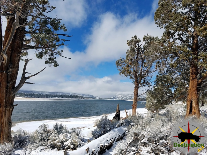
Big Bear, CA
I quiet mountain community full of back country adventure.
The Journey is the destination
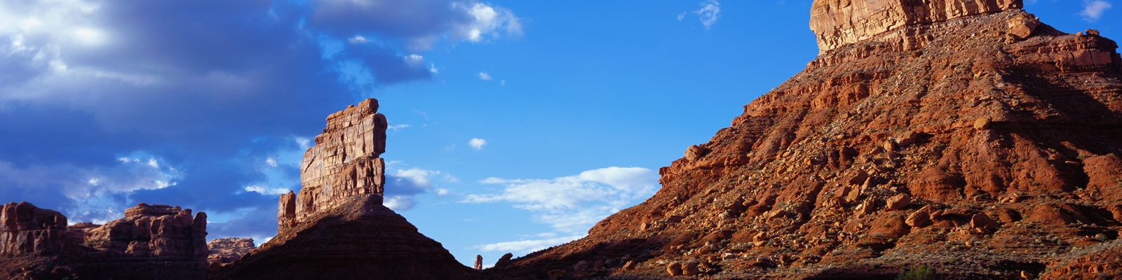
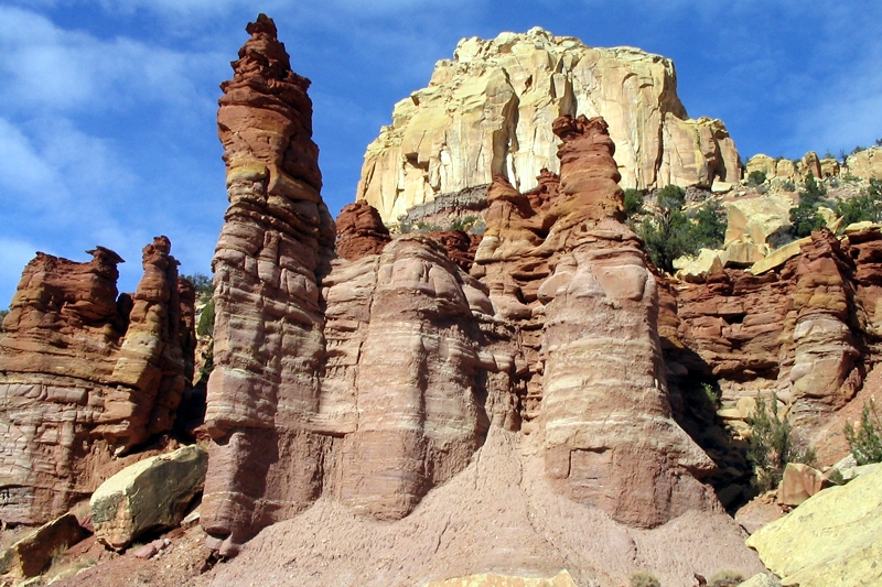

Pine Nut Road is a 6-mile long, bumpy dirt road on the east side of the Sheep Range that runs north from the Mormon Well Road to a traditional primitive camping area. This camping area offers several campsites with one which overlooks the valley below and would be a nice place to cool down on a hot summer trail ride.
Pine Nut is just inside the Pinyon-Juniper Woodland zone, which means the campsites are shaded by Single-leaf Pinyon and Utah Juniper.
The road usually requires only a high-clearance vehicle, but it can get troublesome crossing the first large wash; call the refuge headquarters for current conditions.

The primitive campsite offers no services and although the area is under Junpiter Trees, firewood should be brought to the site for campfires. There are a few fire pits outlined with rock and offer nice small clearing to keep the fire hazard down. The campsites are separated from each other with Jupiter trees.


The Mormon Well Road is a long, rough, dirt road that runs across the Desert National Wildlife Range from Corn Creek to Highway 93. The road runs across the desert and over the mountains through some spectacular country, including towering limestone cliffs; broad, flat valleys; and narrow, winding canyons. The road runs through several desert vegetation life zones, starting in the very dry (stunted) Mojave Desert Scrub Zone and climbing to the Yellow Pine (Ponderosa Pine) Zone.

There are primitive campsites at the top of the Pine Nut Road. This location offers a wonder view of the valley, and there are three distinct large camping spots and perhaps one smaller site which is probably only used as an overflow.

The variety of life zones provides many different habitats for birds and other wildlife.
The Wildlife Refuge used to maintain their roads, but in recent years, funding for maintenance has been directed towards other things (for example, building an unnecessary and expensive new visitor center). As a result, all roads on the DNWR are deteriorating, and during the summer of 2010, the north end of the Mormon Well Road suffered flooding. From the campground north, the road is quite rough, but passable in a 4WD vehicle.

The road takes its name from the broader Mormon presence in southern Nevada beginning in the 1850s. In 1855, Mormon missionaries led by William Bringhurst established the Las Vegas Mission in the Las Vegas Valley (now part of Clark County), building an adobe fort near the Las Vegas Springs as a waystation along the main Mormon Road (also called the Los Angeles–Salt Lake Road). This major wagon route, an evolution of the earlier Old Spanish Trail, connected Salt Lake City to southern California and supported Mormon colonization, mail service, and freight across the arid Southwest.
While the main Mormon Road followed a different alignment (roughly paralleling modern I-15), the name “Mormon” became associated with many trails, springs, and features in the region due to early Mormon settlers and missionaries. By the late 19th century, as ranching and mining expanded in Clark County, the specific Mormon Wells Road emerged on the east side of the Sheep Mountains.
Two parallel pioneer wagon trails were developed around the turn of the 20th century (circa 1900):
These roads provided essential overland connections for ranchers and prospectors traveling between the Las Vegas Valley and the more remote Pahranagat Valley to the north.
At the heart of the road is Mormon Well Spring (sometimes referred to in plural as Mormon Wells), a natural spring in the high-desert terrain. In the early 1900s, Mormon ranchers developed the site as a summer pasture and watering stop for cattle. They built a crude livestock corral, a water tank, and other basic improvements to support grazing in the cooler elevations of the Sheep Range during hot summers. The spring was critical in this arid climate, where reliable water sources were rare.
The site saw active use for ranching from roughly 1900 to 1924. It continued in limited use until about 1966 before being largely abandoned. Nearby Corn Creek Ranch (established earlier and later incorporated into the refuge) also used the area as a stagecoach stop and cattle operation. In 1974, Mormon Well Spring and its associated corral were listed on the National Register of Historic Places (NRHP #1974001143) for their role in early 20th-century ranching history.
The primary purpose of Mormon Wells Road was practical and economic:
The Desert National Wildlife Refuge (originally the Desert Game Range) was established in 1936 primarily to protect desert bighorn sheep habitat, eventually encompassing the road and well. This preserved the historic route while shifting its use from ranching to recreation and conservation.
In summary, Mormon Wells Road is a tangible remnant of southern Nevada’s pioneer era — born from the Mormon settlement wave of the 1850s and shaped by early 20th-century ranching and prospecting needs. It highlights the perseverance required to navigate and utilize the arid landscapes of Clark County long before Las Vegas became a modern metropolis. Remnants like the historic corral and spring (now often dry) can still be visited along the road, offering a direct link to that rugged past.
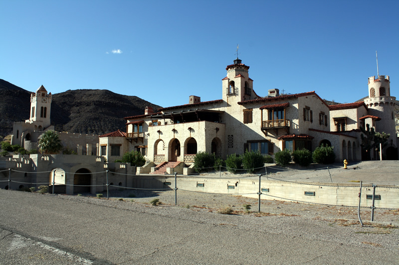
A short side trip from the Saline Valley Road to the Saline Valley Warm Springs in Death Valley National Park, California. The road is used to access the Warm Springs Hot Springs of the Saline Valley. The region and its hot springs became very popular in the 1960’s

The hot springs were improved before the National Park was formed in 1994. As such; showers, bathtubs concrete pools and three bathrooms. these bathrooms are replaced by the Park Service. Palm trees were planted to create am oasis. Additionally, there is a small airport known as the “Chicken Strip”, which is a 1400 foot dirt runway cleared near the hot springs. The “Chicken Strip” landing strip is about a 10 minute walk from the oasis.
There are three distinct springs and camping locations. The warm springs oasis existed as its own four some 40 years prior to the national park service taking over. The location became quite popular and nudity was common. There was quite a bit of controversy when the national park service took over due to the decades long existence of the improvements conflicting with the governments tendency to (over)regulate.

A “clothing optional” policy is still permitted at the springs, but nudity is frowned upon elsewhere at the site.
The road is maintained for the most part and should be accessible to most 2WD vehicles.
It is said that Charles Manson visited the Warm Springs looking for entrance to the bottomless pit. Manson believed the bottomless pit was an entrance to an underground world, which would protect him from the race war he tried to start as part of his plan to start “Helter Skelter.”
| Name | Warm Springs Road |
| Location | Saline Valley, Death Valley National Park, California |
| Length | 7.5 Miles |
| Difficulty | Easy |
White Top Mountain road is located off of Hunter Mountain Road, in Death Valley National Park, California. A hilly and mountainous road connecting the Hidden Valley road to the White Top mining area district.

The road is approximately 11 miles in length and has an elevation gain from 4800 feet above sea level to 7000 feet. High clearance 4WD is recommended when wheeling this trail. The route is passable to high clearance 2WD in the first 5 miles. Beyond that distance, the NPS recommends high clearance 4WD because of 3 relatively small dry falls, 12-24″.
Travel beyond Burro Spring Junction is not recommended when wet or snow covered during winter months.
Once near the top of the trai, the Huntley Mining operations are visible.
The Lawrence Asbestos and Fluorspar claims located on the north slope of White Top Mountain two miles northeast of Burro Spring have been explored by several lessees over the years, but have produced only a few hundred tons of asbestos and fluorspar. Much scarring in the area has resulted from dozer prospecting and road building. The property consisted of three fluorspar claims, thirty-two asbestos claims, and a millsite under, location by R.H. Lawrence of Mojave. In 1970s the lessees proposed to develop the fluorspar deposits and ship the ore to Barstow via truck. Today the area consists of bulldozed prospects and a miner’s shack. Wright H. Huntley, pres., Huntley Industrial Minerals, Inc., to T.R. Goodwin,
Death Valley – Historic Resource Study – A History of Mining
Homestake Dry Camp is a remote, primitive camping area at the southern end of Racetrack Road in the northern part of Death Valley National Park. It sits at roughly 3,760–3,785 feet elevation amid open desert terrain and wilderness, offering solitude and stark scenery for self-sufficient campers willing to handle rough access roads.

The camp occupies a few graded pullouts and dispersed spots along a turnaround loop at the end of the unpaved Racetrack Road, deep in the park and bordered by the Death Valley Wilderness. The landscape is classic high-desert Death Valley: sparse vegetation, hard-packed earth, distant mountains and ridges, and expansive views under intensely clear skies. It is the closest legal camping to the famous Racetrack Playa (about 2 miles north) and lies past the south end of the playa. The site feels isolated—crowds are minimal precisely because of the long, rough approach. Night skies here rank among the darkest in the park, with excellent stargazing and Milky Way views on moonless nights.
Access is via Racetrack Road (high-clearance vehicle strongly recommended; 4WD helpful, especially after rain or on washboard sections). From near Ubehebe Crater, it is roughly 20 miles on Racetrack Road to Teakettle Junction, then about 9–10 miles farther past the playa. An alternate route via Lippincott Pass from Saline Valley Road is more technical and recommended only for experienced 4WD drivers. Always check current road conditions with the park, as flash floods or washouts can close or severely degrade the route.

This is true dry camping with almost no facilities:
Come fully prepared with water, food, shade, and waste management. The remoteness is the main amenity for those seeking quiet.

Late fall through spring (roughly October–April) offers the most comfortable conditions. Daytime temperatures at this elevation are milder than on the valley floor, though nights can be cold in winter. Spring may bring wildflowers after wet winters. Summer is best avoided due to extreme heat (even at elevation the desert is punishing), and road access can be more hazardous with monsoon storms. Winter provides outstanding clear skies and solitude but requires cold-weather gear. Always monitor weather and road reports—rain can make the approach impassable.
Homestake rewards prepared, experienced desert travelers with genuine remoteness, proximity to one of Death Valley’s most iconic features, and outstanding night skies. It is not a place for casual car camping or those needing services—treat it as backcountry and leave no trace. Check the National Park Service Death Valley site for the latest road, weather, and regulation updates before heading out.
The campground is located at the southern end of the Race Track Valley Road.
| Camp Ground Name | Homestake Dry Camp |
| Latitude, Longitude | 36.6372892,-117.5745213 |
| Sites | 4 |
| Elevation | 3780 |
| Amenities | No Water, No Fires, No tables |