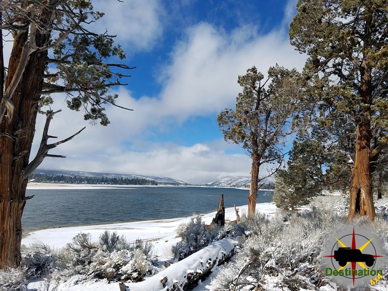
Big Bear, CA
I quiet mountain community full of back country adventure.
The Journey is the destination
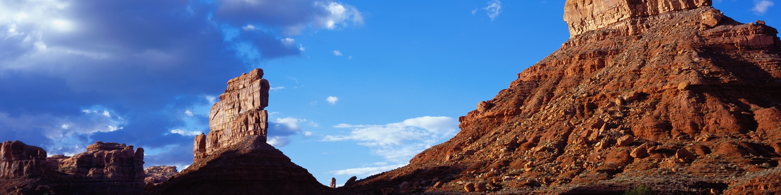
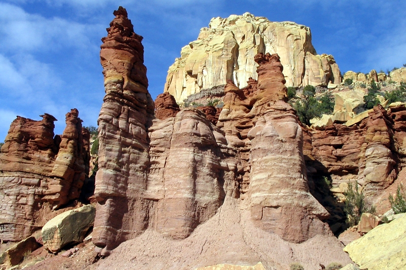
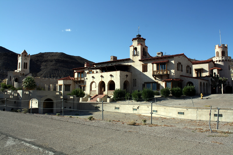

As the name implies, the California Poppy is that state flower of California. However, this little flower is extremely wide spread and flourishes throughout most of the United States. The flower was first described by a Germain naturalist and poet, Adelbert von Chamisso. Chamisso was travelling on the Russian exploring ship “Rurick”. The “Rurick” was travelling around in the world in 1815, when the ship sailed in the San Francisco Bar Area.
This species of flowering plant with an international pedigree is a perennial and can range in height from 5 – 60 inches. The four petals of the flower are about two inches in size and range in colors from a vibrant orange to yellow, red and in some cases pink. They typically flower between February and September depending upon location.

When in full display, the California Poppy can carpet the landscape in a sea of color as happens in the Antelope Valley California Poppy Reserve. Such an event is spectacular to witness and will make the local news outlets in Southern California.
The flowers have four petals, which will close each night or when windy and or cloudy. The delicate little flowers will open again each morning to once again showcase this little plant.
Frank “Shorty” Harris (1857–1934) was one of the most colorful and enduring figures of the American desert West—a short-statured, hard-drinking, single-blanket jackass prospector whose 1904 discovery of the Bullfrog Mine in Nevada’s Bullfrog Hills triggered one of the last great gold rushes of the early 20th century and gave birth to the boomtown of Rhyolite in Nye County. Though he never grew rich from his strikes and cheerfully sold or gambled away most of his claims, Harris became a living legend in the Death Valley region. His later 1905 gold find with Pete Aguereberry at Harrisburg in the Panamint Mountains further cemented his reputation as a man who could “smell gold.” For more than three decades he wandered the harsh terrain of Death Valley (California) and adjacent Nye County, Nevada, embodying the romantic, footloose desert rat long after the major booms had faded.

Early Life and Wanderings
Born Frank Harris on July 21, 1857 (some accounts say 1856), near Providence, Rhode Island, he was orphaned at age seven when both parents died. Raised by an aunt who treated him harshly, he ran away at nine to work in textile mills. In the late 1870s, at about age twenty, he rode the rails west seeking fortune in the mines. Standing only five feet four inches tall, he earned the nickname “Shorty” early on.
Harris chased every major rush of the era: Leadville, Colorado; Tombstone, Arizona; the Coeur d’Alene district in Idaho; and others. He reached the Death Valley country in the 1880s–1890s, prospecting around Ballarat, California, and later the great Nevada booms at Tonopah and Goldfield. Like most old-time prospectors, he arrived too late for the richest ground and never accumulated lasting wealth. What he did accumulate was an encyclopedic knowledge of the desert, a gift for tall tales, and a reputation for generosity mixed with wild exaggeration.
Harris’s most famous strike came on August 9, 1904, in the Bullfrog Hills of southern Nye County, Nevada, just east of Death Valley. Traveling with partner Ernest “Ed” Cross, he was camped at Buck Springs (near present-day Beatty) after leaving the Keane Wonder Mine. While chasing stray burros one morning, Shorty stubbed his toe on a rock, looked down, and saw a greenish quartz ledge speckled with visible gold—“jewelry stone” so rich it assayed at up to $3,000 per ton. The pair named their claim the Bullfrog Mine because the ore’s color reminded them of a frog’s back.
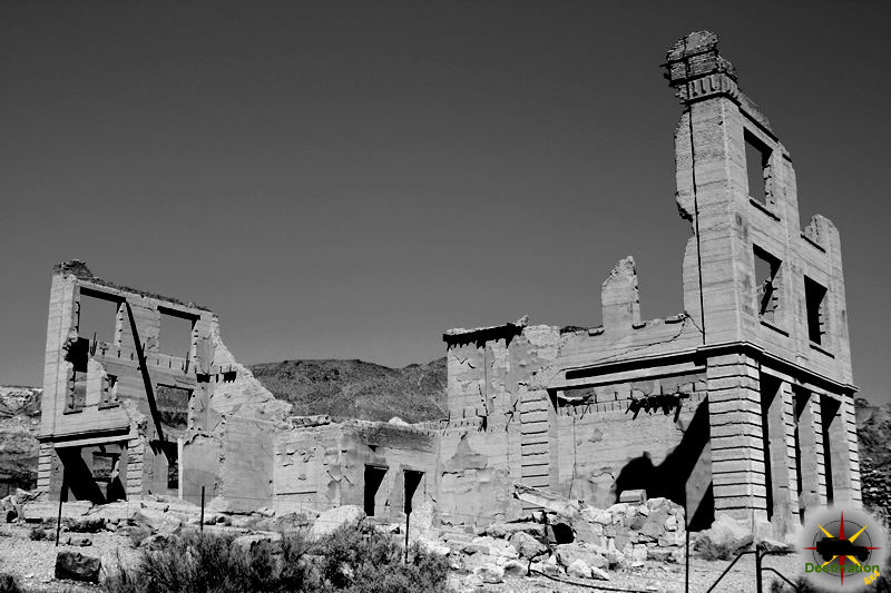
Word spread like wildfire. Within days a stampede erupted from Goldfield and Tonopah; newspapers called it one of the wildest rushes in Western history. New towns sprang up almost overnight—Rhyolite, Bullfrog, Amargosa City, and others. Rhyolite, founded in 1905 on the slopes below the discovery, quickly became Nye County’s premier mining metropolis. At its peak (1906–1908) it boasted 5,000–10,000 residents, three railroads, a stock exchange, opera house, ice plant, and concrete buildings that still stand today as ghostly ruins. The Bullfrog Mining District produced nearly $1.7 million in gold between 1907 and 1910, though production declined sharply afterward.
Characteristically, Harris and Cross sold their interests early and cheaply. Shorty reportedly gambled or drank away much of his share (one account says he traded it for $1,000 and a mule). He never profited from the district he helped create, yet he remained proud of the strike that “made Rhyolite grow like a mushroom.” His role in Nye County mining history is foundational: the Bullfrog rush revived interest in the Amargosa-Death Valley borderlands and briefly turned a remote corner of Nye County into a symbol of Nevada’s final great mining boom.
One night, when I was pretty well lit up, a man by the name of Bryan took me to his room and put me to bed. The next morning, when I woke up, I had a bad headache and wanted more liquor. Bryan had left several bottles of whiskey on a chair beside the bed and locked the door. I helped myself and went back to sleep. That was the start of the longest jag I ever went on; it lasted six days. When I came to, Bryan showed me a bill of sale for the Bullfrog, and the price was only $25,000. I got plenty sore, but it didn’t do any good. There was my signature on the paper and beside it, the signatures of seven witnesses and the notary’s seal. And I felt a lot worse when I found out that Ed had been paid a hundred and twenty-five thousand for his half, and had lit right out for Lone Pine, where he got married.
Frank “Shorty” Harris
Touring Topics: Magazine of the American Automobile Association of Southern California
October 1930

In June 1905, still riding the wave of his Bullfrog fame, Harris teamed with French-Basque prospector Pete Aguereberry. While crossing the Panamint Mountains toward Ballarat for the Fourth of July, they found free gold on a ridge in what became known as Harrisburg Flats. Pete staked the north side (Eureka Mine) and Shorty the south. A tent camp of several hundred people briefly flourished before fading; the site was first called “Harrisberry” in Shorty’s honor, then Harrisburg. Aguereberry eventually won legal control of the Eureka and worked it alone for decades, while Harris moved on.
Harris continued roaming the Death Valley region for the rest of his life—prospecting, guiding occasional visitors, and living the minimalist existence of a “single blanket jackass prospector.” He preferred the freedom of the desert to the comforts of town, often traveling with a string of burros and little else.
Shorty was famous for his wit, storytelling, and love of saloons. He claimed to have attended every major rush since the 1880s and delighted in recounting (and embellishing) his adventures. Despite his rough edges, he was well-liked and generous. In his final years he lived quietly in a cabin near Big Pine, California.
Ill for some time, Frank “Shorty” Harris died in his sleep on November 10, 1934, at age 77. True to his wishes, he was buried in Death Valley near the grave of his friend James Dayton. His simple marker carries the epitaph he requested:
“Here lies Shorty Harris, a single blanket jackass prospector.”
Though he left no fortune, Shorty Harris’s discoveries shaped the historical landscape of both regions. In Nye County, the ruins of Rhyolite and the scattered remnants of Bullfrog stand as monuments to the rush he ignited. In Death Valley National Park, the Harrisburg site and Aguereberry Camp preserve the memory of his partnership with Pete Aguereberry. His name appears in trail guides, park literature, and countless desert histories. More than any bank account, Shorty valued the freedom of the open desert and the camaraderie of fellow prospectors. In an era of corporate mining, he represented the last generation of lone wanderers who opened the final frontiers of the American West.
“I hear that Frisco is a ghost town now—abandoned and the buildings falling to ruin. That is what happened to many of the towns where I worked in the early days, but nobody then would have thought it was possible. Even now, it’s hard for me to believe that owls are roosting over those old bars where we lined up for drinks, and sagebrush is growing in the streets.”
Frank Shorty Harris
“almost as hell-roaring a place as Leadville. The boys were all decorated with six-guns and believe me, they knew how to use them. The handiest on the draw stayed in town, but those that were too slow made a one-way trip to Boot-Hill
Frank Shorty Harris – On Tombstone in 1885
 Bullfrog Nevada – Nye County Ghost TownIn the scorching summer of 1904, amid the rugged Bullfrog Hills at the northern edge of the Amargosa Desert in Nye County, Nevada, two prospectors… |
 Goldbelt SpringsA discovery by the famous prospector "Shorty Harris", led to the founding on the Goldbelt Springs mining district off Hunter Mountain Road in Death Valley… |
 Harrisburg California – Inyo County Ghost TownHarrisburg, California, a now-abandoned ghost town in Inyo County, was a fleeting but significant mining camp in Death Valley’s history. Established in 1905 following a… |
 Pete Aguereberry – A Panamint Valley MinerJean Pierre “Pete” Aguereberry (1874–1945), universally known as Pete Aguereberry, was a Basque-born prospector and miner whose four-decade solitary vigil at the Eureka Mine in… |
 Rhyolite Nevada – Nye County Ghost TownRhyolite is a ghost town location just outside of the Eastern edge of Death Valley National monument in Nye country, Nevada. Founded in 1904 by… |

Now it was the time to get serious on a Utah Trip. I am been all over California, and have had a bit of success but have yet to capture the jaw dropping color and composition that I have been working towards. I have taken several images that were interesting, but nothing that I have really been happy about.
In October, I took two weeks off, and spent one week on a house boat at Lake Powell with friends. Each afternoon I would hike out into the country looking for the right light. However, I was never able to find the images I was looking for. I found that I had some problems being on the wrong side of the lake, when the sun light began to soften.
After a week on the lake, I was finally able to relax from the office, and wind down. The second week of my trip was spent with my good friend John and his wife. John has been taking photographs for several years, but only began after I stopped. So this is the first time we have ever taken pictures together. A truly fine photographer, John has taught me much in the last year and has been instrumental in helping me develop my technique and style.
The Slot Canyons

Our first day was spent around page Arizona, We got ourselves organized, and headed off to Antelope Canyon. Each toting two cameras, several lenses, tripods, multiple rolls of film, we jumped on a Native American truck and drove up the road to Upper Antelope Canyon. Upper Antelope is a truly amazing place, and I consider myself fortunate to have visited this place.
The light at midday was inspiring and I found it difficult to shoot as I was just content to look. However, after a quick walk through the canyon we went to work with the cameras with some good results. The only negative thing that I could say about Upper Antelope Canyon, was that it has become quick popular, and was rather crowded. There was only 25 people or so in the canyon, and this may not seem like many, but when you are in a canyon that is only 3 feet wide, you are constantly moving and relocating to let someone pass.
Lower Antelope canyon is just across the road from Upper Antelope, but could not have been more different. Upper Antelope is known for it’s Grandeur, Lower Antelope Canyon is a much more intermit place to visit. The whole time that we were there, we only saw two other people. I could not have planned it better. Lower Antelope canyon starts literally as a small crack in a river bed. It opens up into one of the prettiest places on earth. Words can not do it justice, and the images that can be capture are beyond description. Hours past in an instant
Escalante & Bryce
After leaving Page Arizona, we head North West on our Utah trip, and took a dirt shortcut up to Bryce. We spent the next day exploring Escalante Canyon. We got a late start, and we did not really have a good plan of attack for Escalante Canyon. I took some good shots of around Calf Creek Falls.
Zion
I had not been to Zion in many years. It had been so long, that I was not too sure what to expect. However, John knew exactly where to go, and had previously obtained all the back country permits. Our Utah trip was made when we discovered that we would be in the same valley as one of our mutual influences. We hiked down into the small river canyon that contain our goal. A tubular structure carved into the canyon wall known as the subway. The nine mile hike into the subway is strewn with a lot of boulder hoping along a “trail” that is missing most the time. It was rough going, but was truly worth the effort. Leading up to the subway itself is a series of cascades. It was on these cascades that John and I met the man who has so influenced our work.
After a quick lunch we started shooting the water falls, and let the other photographer work further up the valley unimpeded. Although careful, I quickly was completely soaked with water from the knees down. Continuing up the canyon, we found our goal, the subway itself. Standing in near freezing water, for hours at a time had its toll, but the time continued to fly by. However, the longer we waited the better the light became.
After just four short hours we had to leave. The climb out of the canyon is steep up a heavily eroded trail that is best navigated with some remaining light.
The next two days were spent relaxing a bit. On the hike out of the subway, I aggravated an old knee injury, and my knee had quickly swollen and became painful. It was worth it though. I captured some good photographs, and met one of my influences out in the field, doing what we both love. Truly a great Utah trip.

Located within 45 minutes to the Las Vegas strip, Boulder Beach Campground offers a camping opportunity near the shore of beautiful Lake Mead. The campground is located on a bluff overlooking the shoreline and Lake Mead. The campground offers views of the lake and amazing sailing, boating, fishing, swimming, fishing and hiking trails.
This is a year round campground which offers group camps, tent and RV Accommodations. During the summer moths the desert heat can be a factor, so be sure to plan ahead. Each site is equipped with fire rings and tables and palm trees may offer a break from the sun. Due to the location of the campground and the lower lake levels, the beach is located a bit further than normal.
Boulder Beach provides quick access to Hoover Damn, the Hoover Damn Bypass Bridge, the Visitor Center. The River Mountains Loop Trail and the Historic Railroad Trail provide are quick hikes which are also located near by.
The weather can vary from freezing temperatures in the winter months with summer heat the temperature of easily capable of over 110 degrees Fahrenheit. This is a first come first serve campground
| Name | Boulder Beach Campground |
| Location | Lead Mead, Clark County, Nevada |
| Latitude, Longitude | 36.036901,-114.802604 |
| Elevation | 1,280 feet |
| Sites | 154 |
| Ammenities | Tables, Fire Rings, Water, Bathrooms, |
Marietta is a historic ghost town in Mineral County, Nevada, located in the Excelsior Mountains at approximately 38°14′36″N 118°20′19″W and an elevation of about 4,947 feet (1,508 meters). Situated southeast of Hawthorne near the alkali flats of Teel’s Marsh (also spelled Teel’s Marsh), it was never a typical Nevada boomtown fueled primarily by gold or silver. Instead, its economy centered on non-metallic minerals—first salt and then borax—extracted from the nearby dry lakebed. Founded in the late 1870s, Marietta grew rapidly as a supply and processing hub but declined sharply in the 1890s when richer deposits were found elsewhere. Today, it stands as a near-abandoned site of stone and adobe ruins, including remnants of F.M. “Borax” Smith’s company store. Since 1991, the surrounding 68,000-acre area has been designated the nation’s only federally managed Wild Burro Range by the Bureau of Land Management (BLM), home to roughly 78–104 wild burros descended from those used by 19th-century miners.
The town’s story reflects broader patterns of Nevada’s mining history: rapid boom driven by resource extraction, isolation-fueled lawlessness, economic vulnerability to distant market shifts, and a lingering legacy in the form of feral animals and occasional modern exploration.
Prospecting in the Marietta Mining District (sometimes called the Silver Star District) began in the 1860s, making it the third-oldest mining district in Mineral County. Initial activity focused on small-scale silver, lead, copper, and gold claims in the surrounding ranges, though these yielded limited results compared to neighboring camps like Candelaria and Belleville.
By around 1867, attention shifted to the vast alkali deposits at Teel’s Marsh, a seasonal dry lake about two miles south of the future townsite (roughly 5 miles long, 1–2 miles wide, and covering about 6 square miles). Salt (sodium chloride) was scraped from the surface and transported—primarily by mule teams, though some accounts (disputed by historians) mention camel trains—to chlorination mills in Virginia City, Aurora (Nevada), Bodie (California), and other Comstock-era operations. Salt was essential for processing silver and gold ore at the time. These early operations supplied distant mills but did not yet support a permanent settlement.

The pivotal event came in 1872 when Francis Marion “Borax” Smith (often called F.M. Smith) and his brother J.P. Smith, while working salt fields in nearby Columbus, identified rich borate deposits (including ulexite) in Teel’s Marsh. They staked claims across much of the marsh and began large-scale scraping and processing. Crude borax was hauled roughly 115–130 miles north to railheads like Wadsworth by large freight teams (in 1875, 28 teams of 16 horses each were reportedly engaged). The Smith brothers formed the Teels Marsh Borax Company, a precursor to larger entities that eventually controlled much of the world’s borax market. Borax, previously a niche pharmaceutical import from Europe, was marketed by Smith as an abrasive cleaner, expanding demand dramatically.
Marietta was formally established as a town in 1877 (some sources note informal settlement as early as 1872). It quickly grew into a functional community with a post office (established July 1877), a newspaper, a company store owned by the Smith brothers, general mercantiles, and other businesses. Population peaked around 1880 at several hundred residents (exact counts are uncertain due to untracked Chinese laborers who worked the marsh and plants). At its height, the town boasted 13 saloons, stone and adobe structures, a stamp mill (erected early on), and supported intermittent metal mining in the hills above. Borax plants on the southeast edge of Teel’s Marsh produced up to six tons daily at times, operating seasonally for about eight months a year.
Marietta was notably isolated and lawless, even by Old West standards. As a mostly male camp, it suffered frequent robberies—the stage line was reportedly held up 30 times in 1880 alone, including four times in one week. A notorious 1880s gunfight between rival factions (involving figures like Tom McLaughlin and the Brophy brothers) left four men dead in a domestic dispute that escalated into street violence. Despite the chaos, the borax and salt operations proved lucrative, tying Marietta into the regional economy alongside nearby boomtowns.
Marietta’s prosperity lasted roughly 15–20 years but proved unsustainable. By the late 1880s, borax prices fell, operations slowed, and Chinese laborers (who had leased some works) abandoned the site amid illness in 1891. The decisive blow came in 1892 when vastly richer colemanite deposits were discovered in Death Valley, California. F.M. Smith relocated his operations southward, closing the Teel’s Marsh plants. With the primary industry gone, businesses shuttered, the post office closed (around 1881 in some records, though the town lingered longer), and most residents departed. By the early 1900s, Marietta was largely a ghost town, its wooden structures decaying and stone ruins left behind.
Metal mining in the surrounding district continued sporadically. The Endowment Mine (also known as part of the Marietta operations) produced significant silver-lead ore, contributing roughly $1.5 million (with some estimates higher) from the late 1800s into the early 1900s. District-wide output reached about $2 million by 1939, with over half from tungsten mined during World War I price spikes.
Brief revivals occurred in the 1930s with silver and gold prospecting (e.g., shipments from the Joe Rutty Mine and development at the Endowment property, plus a short-lived “Cloudburst” district claim in 1940). Small uranium discoveries in the 1950s–1960s sparked minor interest but never scaled up. Large-scale activity largely ended by 1956, though exploration persisted into the 1980s. A few caretakers and later industrial buildings reflect ongoing (mostly private) mineral work, but these did not revive the town.
Today, Marietta consists of scattered ruins—most prominently the stone walls of Borax Smith’s general store, mill foundations, and debris from wooden structures—amid the arid landscape. A handful of modern dwellings and mobile homes house caretakers or private interests. The site is accessible via dirt roads off U.S. Highway 95 (part of the Free-Range Art Highway), but visitors are advised to use 4×4 vehicles, carry supplies, and avoid entering old mines or private property due to hazards.
The area’s most distinctive modern feature is its status as the Marietta Wild Burro Range, dedicated in 1991 (the 20th anniversary of the 1971 Wild Free-Roaming Horses and Burros Act). The burros, descendants of those brought by miners for hauling, roam freely among the ruins and marsh, numbering around 85–100. This makes Marietta a unique cultural and ecological site blending Nevada’s mining past with wild horse/burro preservation.
Marietta’s history underscores the fragility of resource-dependent towns in the American West. From salt and borax booms tied to F.M. Smith’s empire to its quiet endurance as a burro sanctuary, it remains a tangible link to Nevada’s 19th-century mining frontier. Sporadic modern exploration continues, but the town endures primarily as a ghost of its former self.
 Francis Marion Smith – “Borax Smith”Francis Marion "Borax" Smith Francis Marion Smith, also known as "Borax" Smith was a miner and business man who made a fortune in the hostile… |