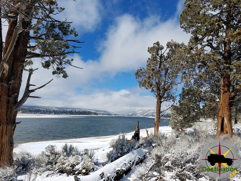
Big Bear, CA
I quiet mountain community full of back country adventure.
The Journey is the destination

George Alexander Grant (March 4, 1891 – 1964) was an American photographer who served as the first official staff photographer and later the first Chief Photographer of the U.S. National Park Service (NPS). Over a 25-year career (1929–1954), he produced an estimated 30,000–40,000 images documenting national parks, monuments, historic sites, battlefields, landscapes, architecture, staff, Civilian Conservation Corps (CCC) work, and public use of the parks. Though millions of people have seen his photographs, they were almost always credited only to the National Park Service rather than to him by name, leaving him relatively obscure compared with contemporaries such as Ansel Adams.
Grant was born in Milton, Pennsylvania, and grew up in nearby Sunbury. After high school he worked a series of manufacturing and factory jobs. In 1912 he became a master craftsman and metalsmith at the Roycroft Community in East Aurora, New York, a center of the Arts and Crafts movement known for high-quality furnishings and architectural pieces.
With U.S. entry into World War I in 1917, he enlisted in the Army and was stationed at Fort D.A. Russell in Cheyenne, Wyoming, for artillery training. The western landscapes made a lasting impression. After his discharge in 1918 he returned to Pennsylvania and took construction and factory work, while writing to Yellowstone National Park about ranger positions. His persistence paid off in 1922 when Yellowstone Superintendent Horace M. Albright (impressed by Grant’s military background and Wyoming experience) offered him a seasonal ranger job at $80 per month.
That summer, at age 31, Grant taught himself photography (it is unclear whether he brought a camera or acquired one at the park). He photographed park scenes in his spare time; Albright encouraged the work. At season’s end Grant was offered a permanent ranger position, but a horseback accident had shaken his confidence in the physical demands of backcountry work, and winter photographic opportunities were limited. He declined the full-time ranger role and instead pursued photography training.
In early 1923 he took photography courses in New York City, then worked for four years as a photographer (and photography instructor) at Pennsylvania State College (now Penn State University). Throughout this period he maintained correspondence with Albright and other NPS officials, advocating for the creation of a dedicated photographer position.
In 1927 a photography position was approved in principle; Grant resigned from Penn State, bought equipment, and traveled west, photographing parks such as Yosemite and Sequoia and offering images free of charge. Funding did not materialize for the 1928 budget. In early 1929, after Albright became NPS Director (succeeding the ailing Stephen Mather) and outside funding was secured for 18 months by Chief Naturalist Ansel Hall, Grant was hired on April 8, 1929, as the NPS’s first staff photographer. He was based at the Educational Division headquarters at the University of California, Berkeley.
His first field season involved extensive travel across the West and Southwest, photographing more than a dozen parks. In November 1929 he presented on the value of photography at the first Park Naturalists Conference in Berkeley. In 1931 he was promoted to Chief Photographer and transferred to Washington, D.C.
Grant’s workload expanded dramatically after Franklin D. Roosevelt’s inauguration and the 1933 executive order that transferred numerous national monuments, historic sites, and battlefields to the NPS, nearly doubling the system. He extensively documented CCC projects in the parks (roads, trails, buildings, and daily camp life) as well as surveys for proposed parks and parkways, including the Great Smoky Mountains (1931), the Natchez Trace Parkway route (1934), southern Arizona and Sonora, Mexico (1935), Big Bend in Texas (1936), and the North Cascades in Washington (1937). He used large-format cameras (including 5×7 and 8×10 view cameras) and traveled roughly 140,000 miles over his career, often in a Park Service vehicle he called the “hearse,” on roads that were frequently unpaved.
His subjects ranged from dramatic landscapes and geological features to flora, fauna, cultural resources, architecture, staff and visitor activities, and historic artifacts. Later major work included documentation for the Missouri River Basin Project (Pick–Sloan Missouri Basin Program) in the late 1940s–early 1950s, recording sites and artifacts threatened by reservoir inundation.
Grant remained a lifelong bachelor. He spent holidays and vacations visiting family in Pennsylvania and his younger brother’s family in Snow Hill, Maryland.


Budget constraints ended the chief photographer position in 1954; Grant retired after 25 years. He received the NPS Meritorious Service Award. After his death in 1964 he was designated an “Eminent Photographer” by the National Park Service—a recognition given to those who created substantial bodies of work documenting the parks and the agency.
Only about 10% of his images were published during his lifetime, yet they appeared widely in magazines, newspapers, textbooks, guidebooks, exhibits, brochures, and government offices, helping introduce many Americans to distant parks and supporting the NPS mission of education, promotion, and preservation. His photographs are preserved in the National Park Service Historic Photograph Collection and continue to be used for research, interpretation, and public information. A major modern reassessment came with Ren and Helen Davis’s 2015 book Landscapes for the People: George Alexander Grant, First Chief Photographer of the National Park Service (University of Georgia Press), which brought renewed attention to his skill in composition, lighting, and patient fieldwork, and to his role as an “unknown elder” of American landscape photography.
Grant’s quiet persistence, technical mastery, and vast documentary record made him a foundational visual chronicler of the National Park System during its period of major expansion and institutional maturation.

Chapman Duncan (July 1, 1812 – December 22, 1900) was an early Latter-day Saint pioneer, missionary, and colonizer whose brief settlement attempt in southern Utah gave the name to the ghost town of Duncan’s Retreat in Washington County.
Duncan was born in Bath, Grafton County, New Hampshire, to John Duncan and Betsey Taylor Putnam. His family later lived in Barnet, Vermont. In 1830, at about age 18 and suffering from poor health (he later recalled consumption), he left home intending to travel to South America for recovery. While on the Ohio River, he experienced what he described as a spiritual impression directing him instead toward the gathering place of the Latter-day Saints. He arrived in Independence, Missouri, in late 1831 and was baptized into the Church of Jesus Christ of Latter-day Saints in December 1833 (some accounts say late 1831) by Titus Billings and confirmed by Bishop Edward Partridge.
He lived through the Missouri persecutions, including events in Jackson County and at Far West and Adam-ondi-Ahman. He worked various jobs (farming, clerking, teaching school, hat-making), was ordained a teacher and later an elder, and participated in the Kirtland Temple endowment. He also served in Joseph Smith’s 1844 presidential campaign mission in Virginia.
Duncan married Rebecca Rose on May 21 (or the first Monday in May), 1838, in the Far West area of Missouri. She and two young children died in the Montrose, Iowa, area in the mid-1840s. He then married Lockey (or Lauratha/Lorthy/Martha) Jones on March 12, 1846, in Burke’s Garden, Tazewell County, Virginia. They had children including Emily Deseret Duncan (born in Utah Territory). Secondary sources also record a later marriage to Rosanna Taylor on August 23, 1862, with children Taylor and Becky (or Rosilla). He reportedly adopted a Native American boy named Charles Litt.
Duncan crossed the plains to the Salt Lake Valley in 1848 with the Willard Richards / Amasa Lyman / Barney Adams company (arriving around October 16–17), serving as captain of a ten. He and his brother Homer initially lived in the Big Cottonwood area. He helped colonize Iron County (appearing in the 1850 census in Parowan/Cedar City area as a farmer) and was involved in early Iron Mission efforts. Some secondary accounts list him as a Mormon Battalion member, though primary muster rolls do not clearly confirm this.
Duncan served missions in Vermont, Virginia, and China. In late 1852 he was called with Hosea Stout and James Lewis to open missionary work in China. They sailed from San Francisco in March 1853 and arrived in Hong Kong on April 28. Civil unrest (the Taiping Rebellion), language barriers, limited funds, and local resistance restricted their efforts largely to Hong Kong. They left in June 1853 after less than two months. He returned to the United States by August 1853. In 1857 he traveled again as company chaplain with the Chester Loveland company.
In 1861, as part of Brigham Young’s “Utah’s Dixie” cotton-growing initiative, Duncan settled with Alma Minnerly and a few others on Mukuntuweap Creek (a Virgin River tributary) about three miles east of present-day Virgin, Washington County, near what is now Zion National Park. The Great Flood of 1862 destroyed much of the farmland and settlement (as it did nearby Grafton). Duncan and most original settlers left early that year, selling claims to later arrivals including William Theobald, Joseph Wright, and others. Remaining residents named the place Duncan’s Retreat.
A local legend claims Duncan’s departure was hastened by a surveying error: he allegedly laid out a canal from the Virgin River that ran uphill when dug, prompting his “retreat.” Versions place the botched survey at Virgin or Rockville. The settlement later grew to about 70 people by the end of 1862, with a post office (1863), schoolhouse (1864), and LDS meetinghouse. It produced cotton, corn, wheat, and sorghum in good years but suffered repeated floods and was evacuated during the Black Hawk War (1866). It was largely abandoned by 1891–1895 and is now a ghost town with scant remains (a few graves, including that of Nancy Ferguson Ott, an old ditch, and dead fruit trees) along Utah State Route 9.
Duncan continued pioneering and community work in southern and central Utah (including areas around Cedar City, St. George/Washington County, and later Wayne County). Contemporary accounts describe him as generous—giving away livestock to those in need—and steadfast in his faith despite hardships, mob violence, and frontier challenges. He died December 22, 1900, in Loa (or nearby Cainsville), Utah, at age 88 and is buried in Lyman Cemetery, Wayne County.
Duncan left an autobiography/reminiscences covering much of his early life (to the mid-1840s/early Utah period), preserved in Church and university collections. His descendants lived primarily in Utah. He is remembered mainly for his role in the short-lived Duncan’s Retreat settlement and as a representative early Utah pioneer and missionary.

DEATH VALLEY, Calif. — A 68-year-old French visitor died Monday, Aug. 17, after he and a traveling companion became stranded on a remote road in Death Valley National Park.
Pierre Michel Formosa, 68, and his travel companion, both from France, were traveling on West Side Road when their vehicle became stuck in mud near Queen of Sheba Mine Road. With no other vehicles in the area, the men began walking across the salt flats toward Badwater Road to seek assistance. Temperatures reached 116°F that day. After about 1.3 miles, the man was unable to continue. His companion continued toward Badwater Road, where he eventually received assistance from a passing motorist and reported the incident at the Furnace Creek Visitor Center shortly after 2 p.m.
National Park Service rangers and an Inyo County deputy began a search and rescue operation about 2:13 p.m. A California Highway Patrol helicopter joined the search and located the man later that afternoon, approximately 1.5 miles from Badwater Road. He was pronounced dead at the scene. The Inyo County coroner will determine the cause and manner of death.
“Our deepest condolences are with the family and friends of the visitor who died,” said Death Valley National Park Superintendent Mike Reynolds. “This is a heartbreaking reminder of how quickly conditions here can turn dangerous. Death Valley is an extraordinary place, but its heat, distances, and remoteness can be dangerous, regardless of experience. We’re grateful to everyone who took part in the search, and our thoughts are with his loved ones.”
Planning Ahead in Death Valley
Death Valley National Park covers vast, remote terrain where cell service is limited or nonexistent, and emergency help can be hours away. The park encourages all visitors to prepare for that reality before they set out:
The National Park Service urges all visitors to arrive prepared with the knowledge, equipment, and supplies to keep themselves safe until help arrives.
-nps.gov-

Adventure (sometimes called Aventure) was a short-lived early Mormon pioneer settlement and is now a ghost town site in Washington County, Utah, along the upper Virgin River.
It formed part of Brigham Young’s Cotton Mission (or “Utah’s Dixie”), an effort to grow cotton and other warm-climate crops for self-sufficiency amid the U.S. Civil War and limited imports. Settlements clustered along the Virgin River where flat land and water allowed farming: Virgin (1857), Grafton (1859), Adventure (1860), Duncan’s Retreat and Northup (1861), and later Shunesburg, Rockville, and Springdale (1862).
In 1860, Philip Klingensmith (also spelled Phillip or related variants) and five other people from Iron County established a small farming community a couple of miles upriver from Grafton, on the south side of the Virgin River, just west of what is now the center of Rockville and east of Grafton.
The settlers aimed to cultivate cotton and support the broader Mormon colonization of the region. The name “Adventure” reflected the pioneers’ sense that attempting to tame this primitive desert area was truly an adventure.
Like neighboring communities, residents dug irrigation ditches, planted crops, and built basic structures (including a blacksmith shop noted in some accounts of flood damage). The settlement remained small and faced the same challenges as others along the river: scarce arable land, silt-heavy irrigation water, unpredictable flooding, and the need for constant maintenance of ditches and dams.
Adventure lasted only about two years. In January–February 1862, after roughly 40–44 days of rain, the Great Flood of 1862 devastated the upper Virgin River valley. The flood destroyed or heavily damaged Adventure along with much of Grafton (the original downstream site), Duncan’s Retreat, Northup, and other settlements. Homes, crops, a blacksmith shop, and other property were swept away.
Survivors relocated to higher ground with more space for growth and better protection from floods. Many moved to the area that became the center of Rockville (founded/settled in 1862 partly by people displaced from Adventure and nearby sites). Rockville’s modern legal boundaries now encompass the former sites of both Adventure and Grafton.
Adventure was never substantially rebuilt as an independent community. Its brief existence is tied to the broader pattern of pioneer resilience and hardship in southern Utah: repeated floods, limited farmland, irrigation struggles, occasional tensions with Native peoples (notably during the later Black Hawk War period that temporarily emptied nearby towns), and the eventual shift of families toward more viable locations such as Rockville, Hurricane (after the canal opened), and other areas.
Today, little or nothing visible remains at the original site. It is a true ghost-town location rather than a preserved historic district with standing buildings (unlike better-known nearby Grafton, which retains several structures and a cemetery and has been used in films). The site lies just west of Rockville center on the south side of the Virgin River. Visitors exploring the area typically focus on Grafton (a few miles away), which is more accessible and photogenic, or other Washington County historic sites such as Silver Reef.
Adventure’s history is documented primarily through local and regional sources, including Washington County Historical Society materials, Daughters of Utah Pioneers publications (e.g., Under Dixie Sun), place-name references, and accounts of the Cotton Mission settlements. It exemplifies the temporary, experimental nature of many early Dixie-era outposts that were abandoned after natural disasters forced relocation to more sustainable spots.
In short, Adventure was a small, short-lived 1860–1862 cotton-mission farming settlement that vanished in the Great Flood of 1862, with its people helping found or expand Rockville. It remains a footnote in the rich but challenging pioneer history of Washington County and the Zion region.
Fort Harmony was an early Mormon pioneer settlement and adobe fort in Harmony Valley, on the northern edge of Washington County, Utah (near present-day New Harmony and Interstate 15 Exit 42). It existed primarily from 1854 to 1862 and is now a ghost town site listed on the National Register of Historic Places.
After Mormon pioneers arrived in the Salt Lake Valley in 1847, exploring parties assessed southern Utah’s resources, including potential iron deposits. In late 1849, a party led by Parley P. Pratt explored the region and identified promising areas. John D. Lee, a prominent early settler and member of the Church’s Council of Fifty, played a key role in southern colonization efforts aimed at supporting an anticipated iron industry and establishing agricultural outposts.
In December 1852 (some accounts reference early 1853 activity), a small group including John D. Lee and Elisha H. Groves established an initial settlement called Harmony along Ash Creek (near the site of today’s Ash Creek Reservoir). They built a wooden fort with a few houses. The name honored Harmony, Pennsylvania, associated with the translation of the Book of Mormon. This site proved inadequate—too small, too close to the river (flood risk), and distant from sufficient farmland—so it was largely abandoned.
Washington County was created by the Utah Territorial Legislature in March 1852, with the Harmony area designated as the county seat (though permanent structures came later). The settlement also became linked to the Church of Jesus Christ of Latter-day Saints’ Southern Indian Mission (sometimes called the mission to the Lamanites), focused on relations with Southern Paiute and other Native peoples. Missionaries taught farming and other skills while seeking conversions.
In 1854, Brigham Young visited and directed relocation about four miles north to a better site in the middle of the valley. On or around May 9–20, 1854 (sources vary slightly; diaries such as T.D. Brown’s support May 20), Young personally turned the first sod for the southeast corner. Construction proceeded under John D. Lee’s supervision (with input from others, including possibly Truman O. Angell on design aspects) and was largely completed by February 1855.
It was the first fort in the Utah Territory built primarily of adobe brick (following Spanish-influenced suggestions), set on stone footings roughly 3 feet thick. Dimensions are reported variously as about 200 feet or 300 feet square (contemporary accounts and markers lean toward 200–300 feet). Walls were thick (outer walls around 3 feet; interior partitions thinner). The east side had one-story houses against a lower wall (about 10–11 feet high); the west side had two-story houses against a taller wall (about 16 feet high) for better oversight. Gates stood on the north and south sides. A deep well (reports of 86–100 feet) provided culinary water in the center; irrigation came from Kanarra and Harmony Creeks. Corrals for animals were to the south. Houses backed against the walls for defense and efficiency.
The fort housed dozens of families (estimates of population in the hundreds over time, with one mid-1850s report noting about 40 families and 260 people). It served as a hub for colonization south of the Great Basin, a way station for travelers on routes toward California (feeding and sheltering many), headquarters for the Southern Indian Mission, and the Washington County seat from 1856 until 1859 (when the seat shifted as other settlements grew). John D. Lee held local offices including probate judge, clerk, and assessor. Agriculture focused on wheat and other crops; an Indian farm was also established nearby.
Daily life centered on farming, missionary work with local Native groups, community governance, religious activities, and defense preparations amid frontier conditions and the Utah War tensions of 1857. The fort was a key outpost for the Iron Mission region and a resting place for thousands of travelers.
John D. Lee lived there with family members during this period. In September 1857, the Mountain Meadows Massacre occurred roughly 35–40 miles away, in which a wagon train of emigrants (primarily from Arkansas) was attacked, resulting in the deaths of about 120 people. Local militia and some Native allies were involved; Lee was later the only person convicted and executed for his role (in 1877). The fort itself was not the massacre site, but it was Lee’s residence at the time and part of the regional context of high tensions.
An earthquake in 1860 cracked some walls, requiring repairs. Overall, the settlement was a productive agricultural and missionary center for several years.
The Great Flood of 1862 (part of a broader regional storm event that devastated other southern Utah settlements) brought nearly continuous heavy rain and snow for about 28 days in January–February 1862. The adobe bricks—made without sufficient binding materials such as straw or horsehair—dissolved and crumbled. Walls and buildings collapsed progressively. Families moved into wagons for safety.
By mid-to-late January, most residents had left. On or around February 7, 1862, while John D. Lee’s wife Sarah and some children remained, a gust of wind toppled a wall that crashed through to the lower floor, killing two of their young children: George Albert (about age 6) and Margarett Ann (about age 5). The fort was fully abandoned shortly thereafter (around mid-to-late February). It was never rebuilt.
Survivors relocated: many moved a short distance west to higher ground and founded New Harmony (the modern town); others went east/north to establish Kanarraville (in what is now Iron County). These towns share founding connections and family names from the fort era. New Harmony later developed its own infrastructure (including a schoolhouse by 1863).
The site passed into private hands (including the Schmutz family) and was used for ranching/agriculture. In 1936, the Utah Pioneer Trails and Landmarks Association (with local stake members) erected corner markers of stacked rock/concrete and a monument. The Daughters of Utah Pioneers also placed a marker. The Fort Harmony Site was listed on the National Register of Historic Places on November 16, 1979 (reference #79003493). In 2006, land was donated to Washington County with stipulations for protection; limited archaeological work has uncovered foundations, artifacts (pottery, nails, household items, etc.), and features such as rooms and ovens.
Today, little remains above ground beyond foundation traces (visible in places amid sagebrush), the 1930s corner markers, monuments, and interpretive signs. The site lies near the New Harmony Branch of the Washington County Library, just off the road from I-15 Exit 42 toward New Harmony, with views toward the Kolob Canyons section of Zion National Park. It is a quiet historic landmark rather than a developed tourist attraction, preserving the story of early southern Utah colonization, the challenges of adobe construction in a harsh climate, and the transition to lasting towns like New Harmony.
Sources for this account include contemporary diaries and records, National Register documentation, local historical society materials (e.g., Washington County Historical Society), and secondary historical summaries. Minor discrepancies exist in exact measurements, founding dates, and details across accounts, which is typical for 19th-century frontier records.