The Pony Express operated for a very brief period of time from April 3, 1860, to October 26, 1861. The mail service allowed quick delivery of mail, messages and newspapers between California and Missouri. The pony express was built and operated around one hundred and eighty six stations, which enabled a rider to change horses frequently and quickly traverse the county.
The Pony Express only operated for a brief 18 months. Yet, the lore of its riders racing the mail across the country maintains a special place in history. The service was not a financial success and heavily subsidized. Despite this influx of capital, the service was doomed on October 24, 1861 with the success of the transcontinental telegraph.
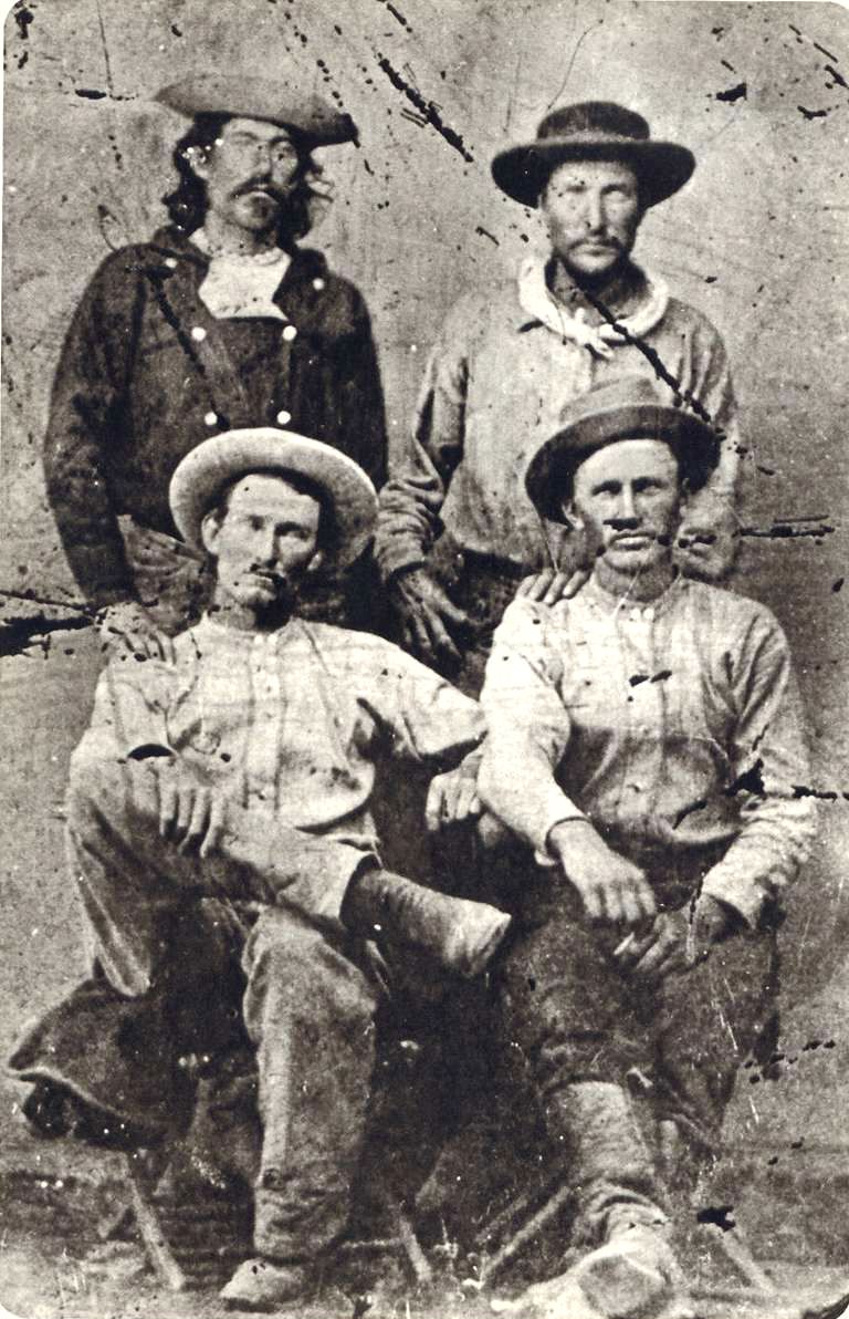
A Brief History
The Pony Express started to fill a need caused by the growing populations of California. After the discovery of Gold in 1848, thousands streaked to the golden state to seek their fortune in the ground. Additional demand for mail service was caused from migration along the infamous Oregon Trail and the Utah Mormon exodus in 1847. Stage Service was used to transfer correspondence across the Western United States.

The service was built and organized by three men, William Russell, Alexander Majors, and William B. Waddell. These men formed the company Russell, Majors & Waddell and in just two months in the winter of 1860 organized 184 stations, 80 riders and 400 hundred horse to race mail from St. Joseph, Missouri to Sacramento, California. Some of the stations were existing stage stops while others were purpose built humble buildings deep in the Nevada territory. They hoped with a 10 day delivery time they could secure government contracts. The costs of the expedited service was 25000% greater that the slower stage service and a 1/2 package would cost $5 at the time.
“Men Wanted”
The undersigned wishes to hire ten or a dozen men, familiar with the management of horses, as hostlers, or riders on the Overland Express Route via Salt Lake City. Wages $50 per month and found.
Ad in the Sacramento Union, March 19, 1860
The riders would received their delivery and store them in a special mail pouch or mochila. The rider would travel from station to station and changed horses at each station about every 10 miles. Every third station, or so, is designated as a home station, where extra horses, firearms, men and provision are kept. Weight was an important factor. Riders, horses, letters, and gear were all chosen with this in mind. The horses averaged about 14 1/2 hands high and weighed less than 900 pounds. The riders would be changed every 75 to 100 miles and road 24 hours a day. A pony express rider earned $125 / month which was a good salary for the time
The last day of the pony express was October 26, 1861. On this day, the transcontinental telegraph completed the first direct communication between san Francisco and New York. On that day, the pony express officially became too slow, too expensive and ceased operations.

Nevada Pony Express Stations
- Alpine Ranch Station
- Antelope Spring Station
- Buckland’s Station ( Lyon County ) Home Station
- Butte Station
- Carson City
- Carson Sink Station ( Carson City ) Home Station
- Cold Springs Station – Home Station
- Dayton Station ( Lyon County )
- Deep Creek Station
- Diamond Springs Station ( Eureka County )
- Dry Creek Station – Home Station
- Dry Wells Station
- Edwards Creek Station
- Egan Station
- Eightmile
- Fort Churchill ( Lyon County ) Home Station
- Friday’s Station ( Douglas County ) Home Station
- Genoa ( Douglas County )
- Grubb’s Well
- Hooten Well Station
- Jacob’s Well Station
- Jacobsville Station
- Middlegate Station
- Miller’s Station ( Churchill County )
- Mountain Spring Station
- Prairie Gate
- Ragtown Station ( Churchill County )
- Robert’s Creek Station – Home Station
- Ruby Valley Station ( White Pine County )
- Sand Springs Station
- Scheel Creek Station – Home Station
- Simpson Park Station
- Smith Creek Station – Home Station
- Spring Valley Station
- Sulpher Springs Station
- Van Sickle’s Station ( Douglas County )
Pony Express Rider Oath
I, … , do hereby swear, before the Great and Living God, that during my engagement, and while I am an employee of Russell, Majors, and Waddell, I will, under no circumstances, use profane language, that I will drink no intoxicating liquors, that I will not quarrel or fight with any other employee of the firm, and that in every respect I will conduct myself honestly, be faithful to my duties, and so direct all my acts as to win the confidence of my employers, so help me God.”
Oath sworn by Pony Express Rider
Pony Express Trail Map
 Buckland’s StationBuckland Station is a pony express station, stage stop, boarding house and supplier near Fort Churchill in Lyon County, Nevada. The station is designated as… |
 Carson City Station – Pony Express StationCarson City Station was a pony express station located between on Carson Street between Forth and Fifth Street in Carson City, Nevada. Founded in 1858,… |
 Cold Springs Station – Churchill CountyChurchill County, Nevada Cold Springs Station, located in Churchill County, Nevada, along U.S. Highway 50 (known as the "Loneliest Road in America"), played a key… |
 Dayton Station – Pony ExpressDayton, Nevada is a small unincorporated community, and the location of the Dayton Station Pony Express stop in Lyon County, Nevada. The little town of… |
 Diamond Springs StationDiamond Springs Station is a Pony Express Station number 133 and located in a meadow in Eureka County, Nevada. Today the station is on private… |
 Eightmile, Nevada – White Pine County Ghost TownGhost Towns of White Pine County, Nevada Eightmile (also known as Eight Mile or Eight Mile Station) is a historic locale and ghost town site… |
 Fairview, Nevada – Churchill County Ghost TownLocated against the stark western flanks of Fairview Peak in southeastern Churchill County, Nevada, the ghost town of Fairview stands as a weathered echo of… |
 Fort Churchill NevadaFort Churchill is a Civil War era United States Army Fort, Pony Express Station and overland stage stop located in Lyon County, Nevada just West… |
 Friday’s Station – Pony ExpressFriday's Station is Union Army Military Post and Pony Express Station located near Lake Tahoe, in Douglas County, Nevada. The two story building is originally… |
 Genoa Station – Pony ExpressOriginally part of the Utah Territory, Genoa is a former Pony Express Station and unincorporated community in Douglas County, Nevada. The settlement was first founded… |
 Miller’s Station – Pony ExpressMiller's station, also known as Reed's Station is a pony express station located in Churchill County, Nevada. Winchester Firearms adopted the image of a Pony… |
 Ragtown, Nevada – Churchill County Ghost TownRagtown Nevada is ghost town and Nevada State Historical Marker number nineteen. The town and Nevada State Historic Marker are located in the Churchill County,… |
 Ruby Valley Stationn was started in 1859 as part of George Chorpenning's mail route. Later the station served the Pony Express and Overland Mail Company line in… |
Sand Springs Station, Nevada – Churchill County Ghost TownChurchill County, Nevada Sand Springs Station, located in Churchill County, Nevada, is a historic site best known as a relay station on the Pony Express… |
 The Pony Express Trails and Stations In NevadaThe Pony Express operated for a very brief period of time from April 3, 1860, to October 26, 1861. The mail service allowed quick delivery… |
 Van Sickle’s Station – Pony ExpressThe Van Sickle's Station is the second Pony Express Station encountered when traveling east from Friday’s Station at the California/Nevada State Line. The Van Sickle… |


