Old Spanish Trail

The Old Spanish Trail was a historic trade route that linked Santa Fe, New Mexico to Los Angeles, California. The trail was established in the early 19th century and was primarily used for the transportation of goods, such as furs, horses, and mules.

The Told Spanish Trail BLM Sign

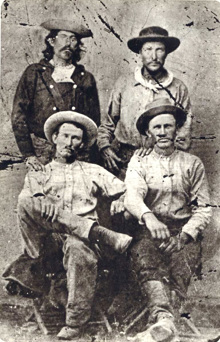
The trail began as a network of routes used by Native American tribes, who traded goods such as salt, obsidian, and turquoise. In the late 18th century, Spanish traders began to use these routes to transport goods between Santa Fe and California. These traders were known as the “Comancheros” and were primarily focused on trading with the Ute and Navajo tribes in the area.

The route became known as the Old Spanish Trail in the early 19th century, when American traders began using the trail to transport furs and other goods to California. The trail was difficult to traverse, with harsh deserts, steep mountains, and treacherous canyons, but it was a vital link between the Southwest and the West Coast.

The trail was not a single route, but rather a network of different paths that crossed the desert and mountains of the Southwest. The most popular route followed the Virgin River in Utah, crossed the Colorado River at the mouth of the Virgin River, and then passed through the Mojave Desert to Los Angeles. Another route followed the Gila River in Arizona and crossed the Sonoran Desert to California.

The Old Spanish Trail played an important role in the development of the American West, as it provided a direct link between the remote and isolated communities of the Southwest and the growing cities of California. The trail was also a source of conflict, as American traders often clashed with Native American tribes over access to resources and trading rights.

In the mid-19th century, the discovery of gold in California brought thousands of settlers to the West Coast, and the Old Spanish Trail became a major thoroughfare for travelers and goods. The trail was also used by the Mormon pioneers, who traveled to California in the late 1840s and early 1850s.

In the late 19th century, the construction of railroads and highways made the Old Spanish Trail less important as a trade route. However, the trail remained an important part of the cultural history of the American Southwest, and efforts were made to preserve the trail and its landmarks.

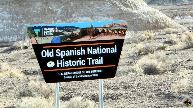
Today, several sections of the Old Spanish Trail have been designated as National Historic Trails by the National Park Service, including sections in Utah, Colorado, New Mexico, and California. These trails allow visitors to experience the beauty and history of the Old Spanish Trail and to appreciate the legacy of the traders, Native Americans, and settlers who traveled its rugged terrain.

Old Spanish Trail Routes

All routes came together at Fork of Roads, east of present-day Barstow in the Mojave desert, and then crossed Cajon Pass between the San Gabriel and San Bernadino Mountains to Coastal California. After negotiating the pass, traders had an easy two to three days travel to the San Gabriel Mission and beyond to Los Angeles.

Armijo Route

Exterior, south facade of Mission San Gabriel Arcangel - 1878
Exterior, south facade of Mission San Gabriel Arcangel – 1878

The first complete trip across the trail began in Abiquiú, northwest of Santa Fe. The Armijo party followed well-known trails northwest to the San Juan River, then nearly due west to the Virgin River. They used the Crossing of the Fathers, cut into rock canyon wall some 75 years earlier by the Domínguez-Escalante party. Armijo’s caravan went down the Muddy River and across
the Mojave Desert to the Amargosa and Mojave Rivers, through Cajon Pass and down to Mission San Gabriel.

The Armijo and Northern Route diverge from each other on the east bound trail near the town of Tecopa, California.

Main Northern Route

First blazed by William Wolfskill and George C. Yount in 1831, this route veered northwest from Abiquiú through Southern Colorado and central Utah. It avoided the rugged canyons of the Colorado River that the Armijo party had encountered and took advantage of the better water and pasture resources across central Utah before returning to the Colorado River and Armijo’s route not far from Las Vegas.

Northern Branch

This route followed well-known trapper and trade routes north through the Rio Grande gorge to Taos and into southern Colorado. It then went west through Cochetopa Pass, largely open during the winter when other passes were snowed in and up the Gunnison River valley, rejoining the Northern Route near present-day Green River, Utah.

Mojave Road

Afton Canyon in the Mojave National Preserve.

The Mojave Road is a 188-mile crossing of the Mojave Desert long used by area Indians and by Spanish explorers and missionaries, it was first traveled by Jedediah Smith, an American trapper, in 1826.

Old Spanish Trail Locations

Government Holes in the central section of the Old Mojave Road.

Old Mojave Road

The Old Mojave Road (Government Road) is an east-west route that enters the Mojave National Preserve off the highway 95 in Nevada, and Afton Canyon…
The Old Spanish Trail BLM Sign

Old Spanish Trail

The Old Spanish Trail was a historic trade route that linked Santa Fe, New Mexico to Los Angeles, California. The trail was established in the…
Francisco Hermenegildo Tomás Garcés O.F.M. (April 12, 1738 – July 18, 1781)

Old Spanish Trail (Garces Expedition)

Old Spanish Trail (Garces Expedition) is a Nevada State Historic Marker Number 140 located in Clark County, Nevada. This marker is one of several which…
Captain John C. Frémont, explorer first mapped Diamond Valley Nevada

Old Spanish Trail (Journey of the Dead Man)

Old Spanish Trail (Journey of the Dead Man) is a Nevada State Historic Marker Number 139 located in Clark County, Nevada. This marker is one…

Old Spanish Trail Mountain Springs Pass – Nevada State Historic Marker

Old Spanish Trail Mountain Springs Pass is located along highway 160 and Nevada State Historic Marker No. 142 in Clark County, Nevada. The Old Spanish…
Old Tecopa house at smelter on Willow Creek, Amargosa Valley. Dr. Noble, Mrs. Noble. Inyo County, CA. 1922 - Photo from Herbert E. Gregory Book 8: 1915 - 1924.

Tecopa Inyo County

Nestled in the stark, sun-scorched expanse of the Mojave Desert in southeastern Inyo County, California, Tecopa stands as a resilient outpost shaped by ancient indigenous…
The Old Spanish Trail 1829-1850 - Nevada State Historic Marker 33

The Old Spanish Trail 1829-1850 – Nevada State Historic Marker 33

Old Spanish Trail 1829-1850 is Nevada State Historic Marker Number 33, located in the town of Blue Diamond, in Clark County, Nevada. The Old Spanish…
Old Spanish Trail 1829-1850 - Nevada State Historic Marker #34 located in Mountain Springs, Nevada

The Old Spanish Trail 1829-1850 – Nevada State Historic Marker 34

Old Spanish Trail 1829-1850 is Nevada State Historic Marker Number 33, located in the town of Mountain Springs, in Clark County, Nevada. Old Spanish Trail…

References

The Pony Express Trails and Stations In Nevada

The Pony Express operated for a very brief period of time from April 3, 1860, to October 26, 1861. The mail service allowed quick delivery of mail, messages and newspapers between California and Missouri. The pony express was built and operated around one hundred and eighty six stations, which enabled a rider to change horses frequently and quickly traverse the county.

Pony Express Riders "Billy" Richardson, Johnny Fry, Charles Cliff, Gus Cliff - Ernest and Elaine Hartnagle (original tintype from the Martin E. Ismert Collection - Kansas City, Missouri) - http://www.historybuff.com/library/refrichardson.html
Pony Express Riders “Billy” Richardson, Johnny Fry, Charles Cliff, Gus Cliff – Ernest and Elaine Hartnagle (original tintype from the Martin E. Ismert Collection – Kansas City, Missouri) – http://www.historybuff.com/library/refrichardson.html

The Pony Express only operated for a brief 18 months. Yet, the lore of its riders racing the mail across the country maintains a special place in history. The service was not a financial success and heavily subsidized. Despite this influx of capital, the service was doomed on October 24, 1861 with the success of the transcontinental telegraph.

A Brief History

The Pony Express started to fill a need caused by the growing populations of California. After the discovery of Gold in 1848, thousands streaked to the golden state to seek their fortune in the ground. Additional demand for mail service was caused from migration along the infamous Oregon Trail and the Utah Mormon exodus in 1847. Stage Service was used to transfer correspondence across the Western United States.

Pony express route April 3, 1860 - October 24, 1861 - Jackson, William Henry, 1843-1942.
Pony express route April 3, 1860 – October 24, 1861 – Jackson, William Henry, 1843-1942.

The service was built and organized by three men, William Russell, Alexander Majors, and William B. Waddell. These men formed the company Russell, Majors & Waddell and in just two months in the winter of 1860 organized 184 stations, 80 riders and 400 hundred horse to race mail from St. Joseph, Missouri to Sacramento, California. Some of the stations were existing stage stops while others were purpose built humble buildings deep in the Nevada territory. They hoped with a 10 day delivery time they could secure government contracts. The costs of the expedited service was 25000% greater that the slower stage service and a 1/2 package would cost $5 at the time.

“Men Wanted”

The undersigned wishes to hire ten or a dozen men, familiar with the management of horses, as hostlers, or riders on the Overland Express Route via Salt Lake City. Wages $50 per month and found.

Ad in the Sacramento Union, March 19, 1860

The riders would received their delivery and store them in a special mail pouch or mochila. The rider would travel from station to station and changed horses at each station about every 10 miles. Every third station, or so, is designated as a home station, where extra horses, firearms, men and provision are kept. Weight was an important factor. Riders, horses, letters, and gear were all chosen with this in mind. The horses averaged about 14 1/2 hands high and weighed less than 900 pounds. The riders would be changed every 75 to 100 miles and road 24 hours a day. A pony express rider earned $125 / month which was a good salary for the time

The last day of the pony express was October 26, 1861. On this day, the transcontinental telegraph completed the first direct communication between san Francisco and New York. On that day, the pony express officially became too slow, too expensive and ceased operations.

Illustrated Map of Pony Express Route in 1860 by William Henry Jackson ~ Courtesy the Library of Congress ~ The Pony Express mail route, April 3, 1860 – October 24, 1861; reproduction of Jackson illustration issued to commemorate the 100th anniversary of Pony Express founding on April 3, 1960. Reproduction of Jackson's map issued by the Union Pacific Railroad Company.
Illustrated Map of Pony Express Route in 1860 by William Henry Jackson ~ Courtesy the Library of Congress ~ The Pony Express mail route, April 3, 1860 – October 24, 1861; reproduction of Jackson illustration issued to commemorate the 100th anniversary of Pony Express founding on April 3, 1960. Reproduction of Jackson’s map issued by the Union Pacific Railroad Company.

Nevada Pony Express Stations

Pony Express Rider Oath

I, … , do hereby swear, before the Great and Living God, that during my engagement, and while I am an employee of Russell, Majors, and Waddell, I will, under no circumstances, use profane language, that I will drink no intoxicating liquors, that I will not quarrel or fight with any other employee of the firm, and that in every respect I will conduct myself honestly, be faithful to my duties, and so direct all my acts as to win the confidence of my employers, so help me God.”

Oath sworn by Pony Express Rider

Pony Express Trail Map

Buckland Station early 1900s

Buckland’s Station

Buckland Station is a pony express station, stage stop, boarding house and supplier near Fort Churchill in Lyon County, Nevada. The station is designated as…
King Street, General View, 1880, Carson City, Carson City, NV

Carson City Station – Pony Express Station

Carson City Station was a pony express station located between on Carson Street between Forth and Fifth Street in Carson City, Nevada. Founded in 1858,…
Churchill County, Nevada

Cold Springs Station – Churchill County

Churchill County, Nevada Cold Springs Station, located in Churchill County, Nevada, along U.S. Highway 50 (known as the "Loneliest Road in America"), played a key…
Union Hotel, Dayton, built in the early 1870s - Chester Barton collection

Dayton Station – Pony Express

Dayton, Nevada is a small unincorporated community, and the location of the Dayton Station Pony Express stop in Lyon County, Nevada. The little town of…
Diamond Springs Station

Diamond Springs Station

Diamond Springs Station is a Pony Express Station number 133 and located in a meadow in Eureka County, Nevada. Today the station is on private…
Ghost Towns of White Pine County, Nevada

Eightmile, Nevada – White Pine County Ghost Town

Ghost Towns of White Pine County, Nevada Eightmile (also known as Eight Mile or Eight Mile Station) is a historic locale and ghost town site…
Nevada Hills Gold Mine, Fairview, Nevada

Fairview, Nevada – Churchill County Ghost Town

Located against the stark western flanks of Fairview Peak in southeastern Churchill County, Nevada, the ghost town of Fairview stands as a weathered echo of…
A lithograph drawing of Fort Chuchill, Nevada Territory created by Grafton Tyler Brown in 1862

Fort Churchill Nevada

Fort Churchill is a Civil War era United States Army Fort, Pony Express Station and overland stage stop located in Lyon County, Nevada just West…
Friday's Station was a Pony Express station at Lake Tahoe - (Nevada Historical Society

Friday’s Station – Pony Express

Friday's Station is Union Army Military Post and Pony Express Station located near Lake Tahoe, in Douglas County, Nevada. The two story building is originally…
Simpson expedition, Genoa, Nevada, 1859

Genoa Station – Pony Express

Originally part of the Utah Territory, Genoa is a former Pony Express Station and unincorporated community in Douglas County, Nevada. The settlement was first founded…
Winchester Firearms adopted the image of a Pony Express Rider.

Miller’s Station – Pony Express

Miller's station, also known as Reed's Station is a pony express station located in Churchill County, Nevada. Winchester Firearms adopted the image of a Pony…
Ragtown, Nevada

Ragtown, Nevada – Churchill County Ghost Town

Ragtown Nevada is ghost town and Nevada State Historical Marker number nineteen. The town and Nevada State Historic Marker are located in the Churchill County,…
Ruby Valley, White Pine County, Nevada - Ruby Valley Pony Express Station - photo taken in 1944

Ruby Valley Station

n was started in 1859 as part of George Chorpenning's mail route. Later the station served the Pony Express and Overland Mail Company line in…
Churchill County, Nevada

Sand Springs Station, Nevada – Churchill County Ghost Town

Churchill County, Nevada Sand Springs Station, located in Churchill County, Nevada, is a historic site best known as a relay station on the Pony Express…
Pony Express Riders "Billy" Richardson, Johnny Fry, Charles Cliff, Gus Cliff - Ernest and Elaine Hartnagle (original tintype from the Martin E. Ismert Collection - Kansas City, Missouri) - http://www.historybuff.com/library/refrichardson.html

The Pony Express Trails and Stations In Nevada

The Pony Express operated for a very brief period of time from April 3, 1860, to October 26, 1861. The mail service allowed quick delivery…
Van Sickle's Station 1870

Van Sickle’s Station – Pony Express

The Van Sickle's Station is the second Pony Express Station encountered when traveling east from Friday’s Station at the California/Nevada State Line. The Van Sickle…

References

Cerro Gordo California – Inyo County Ghost Town

Located in the Inyo Mountains on the eastern side of Owens Valley, Cerro Gordo California is a currently a ghost town after almost 100 years in operation from 1866 to 1957.  Several buildings still survive, including the general store, assay offices and hoist house. Cerro Gordo, spanish for “Fat Hill” is located on private land and permission to visit must should be obtained.

Cerro Gordo overlooking the then full Owens Lake.

The town site is currently on the ridge of the mountain range, and accessible from either the western side in Owens Valley, or from the East from the Saline Valley Road.  Founding of the site is credited to Pablo Flores who began mining near Buena Vista Peak.  Initial development of the area was hindered by Native American activity in the area.  The establishment of Fort Indepence helped “control” this activity and the amount of activity in Cerro Gordo increased.  Early efforts were primitive with most mines being open pits or trenches and smelting was done in adobe ovens.

Mortimer Belshaw
Mortimer Belshaw

The location began to develop with the foundation of the first store at Cerro Gordo by Independence businessman Victor Beaudry.  He soon acquired several claims in exchange for payment of debt at his store and soon built two smelters.  

In 1868, Mortimer Belshaw established a partnership with another stakeholder the Union Mine.  He secured financing from Los Angeles, and built the first road, a toll road known as the “Yellow Road”, which gave him a lot of control over shipments coming down the mountain.

Cerro Gordo was famously a rough and tumble town and claims that a murder a week was commonplace. Water is not available at the townsite and several attempts were made from bring the life sustaining liquid to the town. For a time, water was piped in from several springs many miles away. The springs dried up when the Owens Lake was drained by Los Angeles in the 1920’s. Water was brought up by burro and for a time it was pumped up from 600 feet down the Union Mine. The ore was delivered down hill to Keeler utilizing an aerial tramway. From Keeler, the ore was transported some 275 miles to the small port city of Los Angeles.

The townsite was place for sale and the ghost town was sold for $1.4 million dollars along with some 360 acres surrounding and 22 structures remaining. The development group which features Brent Underwood is hoping to turn the town into a destination of sorts. While undergoing renovations, the American Hotel burnt down on June 15th, 2020 along with the ice house and a nearby residence. Brent Underwood is currently living full time in the town and uploads videos about once per week on a YouTube channel.

It is clear from his videos that Mr. Underwood has a passion for the area, the town, the history and some point, I would love to pay him a visit.

Town Summary

NameCerro Gordo
LocationInyo County, California
Latitude, Longitude36.53771, -117.795031
GNIS220862
Elevation8500 feet
Population4000

Cerro Gordo Trail Map

Resources

Cerro Gordo Books

Cerro Gordo (Images of America) written by Cecile Page Vargo, Roger W. Vargo

Cerro Gordo (Images of America)

Cerro Gordo (Images of America) written by Cecile Page Vargo, Roger W. Vargo High in the Inyo Mountains, between Owens Valley and Death Valley National…
Ghost Town Living: Mining for Purpose and Chasing Dreams at the Edge of Death Valley written by Brent Underwood

Ghost Town Living: Mining for Purpose and Chasing Dreams at the Edge of Death Valley

Ghost Town Living: Mining for Purpose and Chasing Dreams at the Edge of Death Valley written by Brent Underwood The siren song of Cerro Gordo,…

Anniversary Mine and Narrows

The narrows near the Anniversary Mine are a fun place to hike and keep cool.  Lake Mead National Recreation Area, Nevada
The narrows near the Anniversary Mine are a fun place to hike and keep cool. Lake Mead National Recreation Area, Nevada

The Anniversary Mine and Narrows trail is truly a fun place to go and the location has a little bit of everything. This is a very short side trail found off the northern shore of Lake Mead and suitable for almost any vehicle.

Located in the Muddy Mountain Wilderness of the Lake Mead National Recreation Area, the Anniversary Mine was founded in 1921.  The colomanite mine operated at seven years until 1928 and produced an estimation 200,000 tons of ore.  The mine is located a short ways off North Shore Road (167).  There exist some foundations, and tunnels along with some minor infrastructure of the operation.

The narrows near the Anniversary Mine are a fun place to hike and keep cool.  Lake Mead National Recreation Area, Nevada
The narrows near the Anniversary Mine are a fun place to hike and keep cool. Lake Mead National Recreation Area, Nevada

Should you drive down into the wash you have the opportunity to continue on to the left, or you can turn right and drive towards the mine narrows located at the end of the canyon.  The only obstacle is right at the beginning and and easy to get past with some clearance. Once past the trail is just a wash, but do yourself a favor.  Park the 4×4 and take the time to walk it. Just past the beginning obstacle, there are some tunnels about 20 feet up on the side of the canyon wall, which are fun hike up to and explore.

Leaving the side trail from the Anniversary Mine, Lake Mead National Recreation Area.

There are things to explore all along the route to the narrows and it is a great excuse the get out of the truck.  The slot canyon is about 1/4 of a mile in length and a bit tight in the few places. This is a nice place to hike on a hot day.

Anniversary Mine 4×4 Trail and Destination

Hunter Mountain Road

Hunter Mountain Road is a lightly used moderately difficult road which delivers you to one of the most remote and beautiful parts of Death Valley National Park, California. Starting at Teakettle Junction, the twenty four mile route climbs up over 7,128 feet about sea level over a high mountain pass. 4×4 is recommended and you will encounter loose rock, sand, washes and wash boards.

Hunter Mountain Road start at Teakettle Junction in Death Valley National Park

Racetrack valley is one of the most remove portions of Death Valley, and Hunter Mountain Road is empty compared to it. It is likely that you will not encounter another vehicle while in this area. The route is technically not difficult, however it is possible to find deep sand in a few places. There are no services in this route, so be sure to plan accordingly. Cell phones will probably not work in the area, so you are on your own.

The trail is an excellent route to see some beautiful back county. There are many places of historical interest such as mines shafts and mining camps. This is an excellent area for nature lovers, bird watching and just a great scenic drive.

The Lost Burrow Mine is located off Hunter Mountain Road in Death Valley National Park, CA

From the Hunter Mountain trail, you can visit other fun destinations to explore, including:

A sorting screen at the Calmet Mine in the Goldbelt Springs Mining District, Death Valley National Park, California

Our last trip to up the trail was cut short by thunderstorms. We did an overnight at Home Stake Dry Camp and watched lightening strikes all night. When we drove the trail, it was a bit muddy and the sand was saturated with water. We had no issues from the overnight showers, but when it started to rain on us again at Goldbelt Springs, we opted to be cautious and turned around. I really would like to spend more time exploring this area.

I need a Go Pro…

Trail Summary

NameHunter Mountain Road
LocationDeath Valley National Park
Distance24.7 miles
DifficultyEasy to Moderate

Continue Reading →